One hundred years of flooding and landslides on Shore Road in Remuera
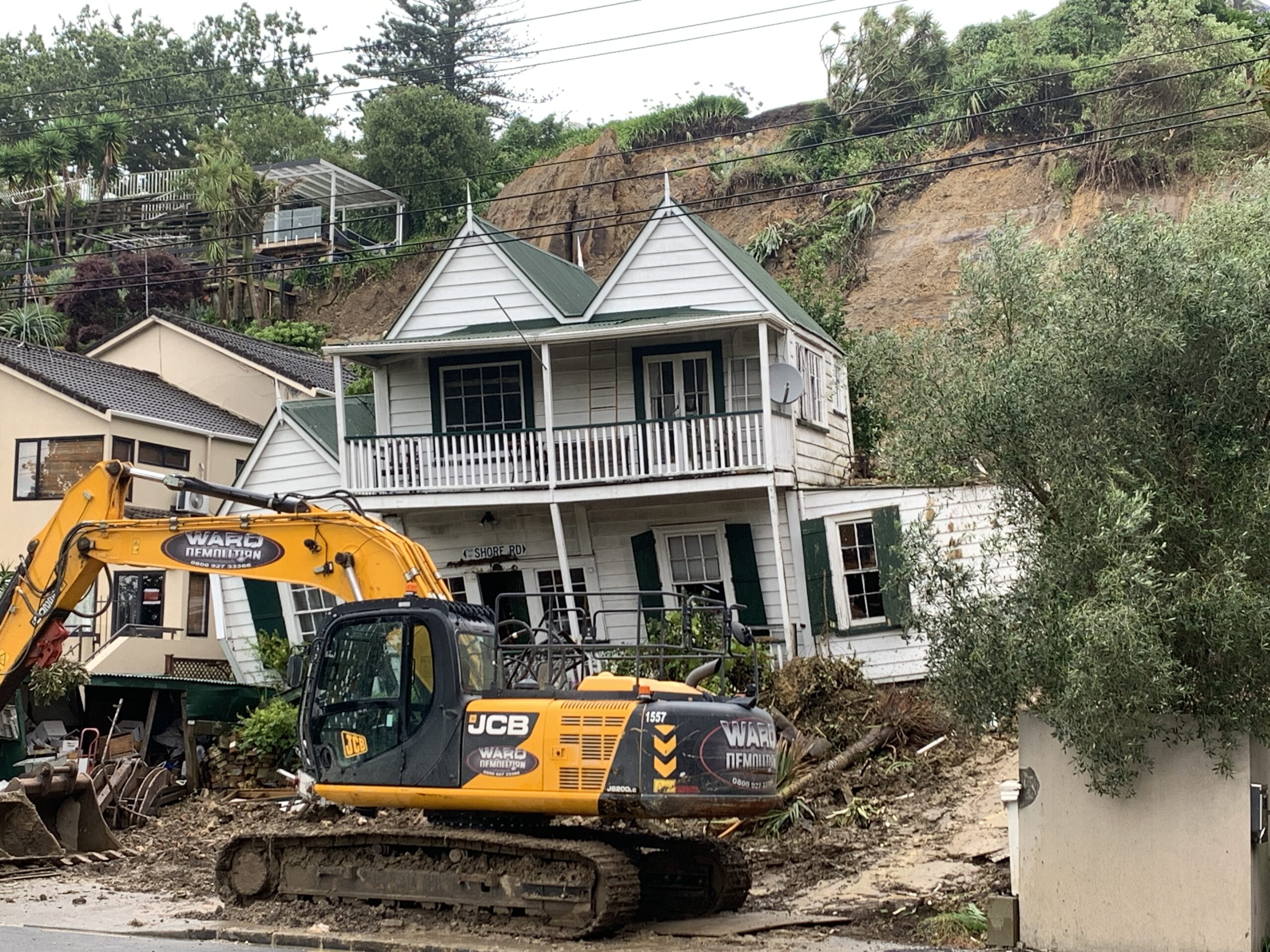
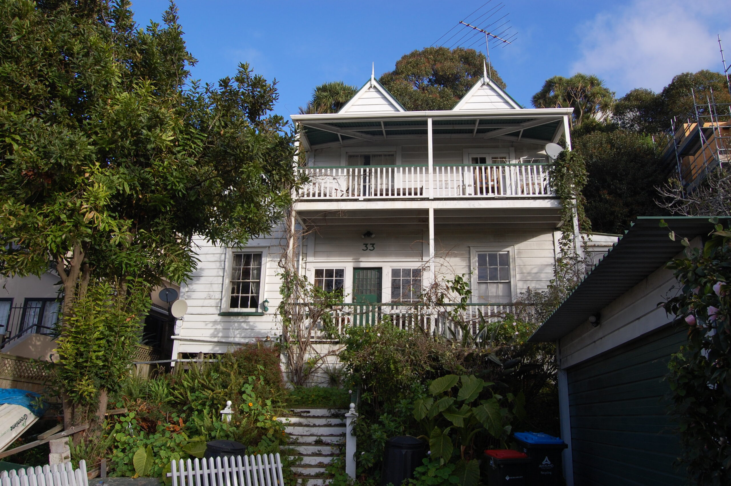
33 Shore Rd ready for demolition. Terry Sutcliffe March 2023
The storm that struck Auckland city on Anniversary Weekend 27 January 2023 broke all previous rainfall records with flooding and landslides causing widespread damage. It was not the first time that landslides had occurred on Shore Road, Remuera.
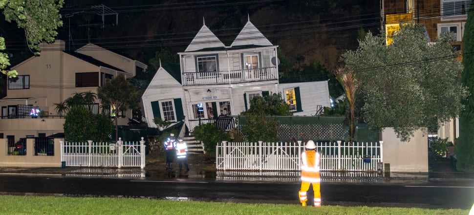
33 Shore Rd at night of landslip 27-28 Jan 2023
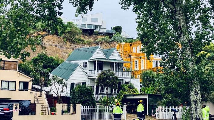
33 Shore Rd morning after landslide 28 Jan 2023
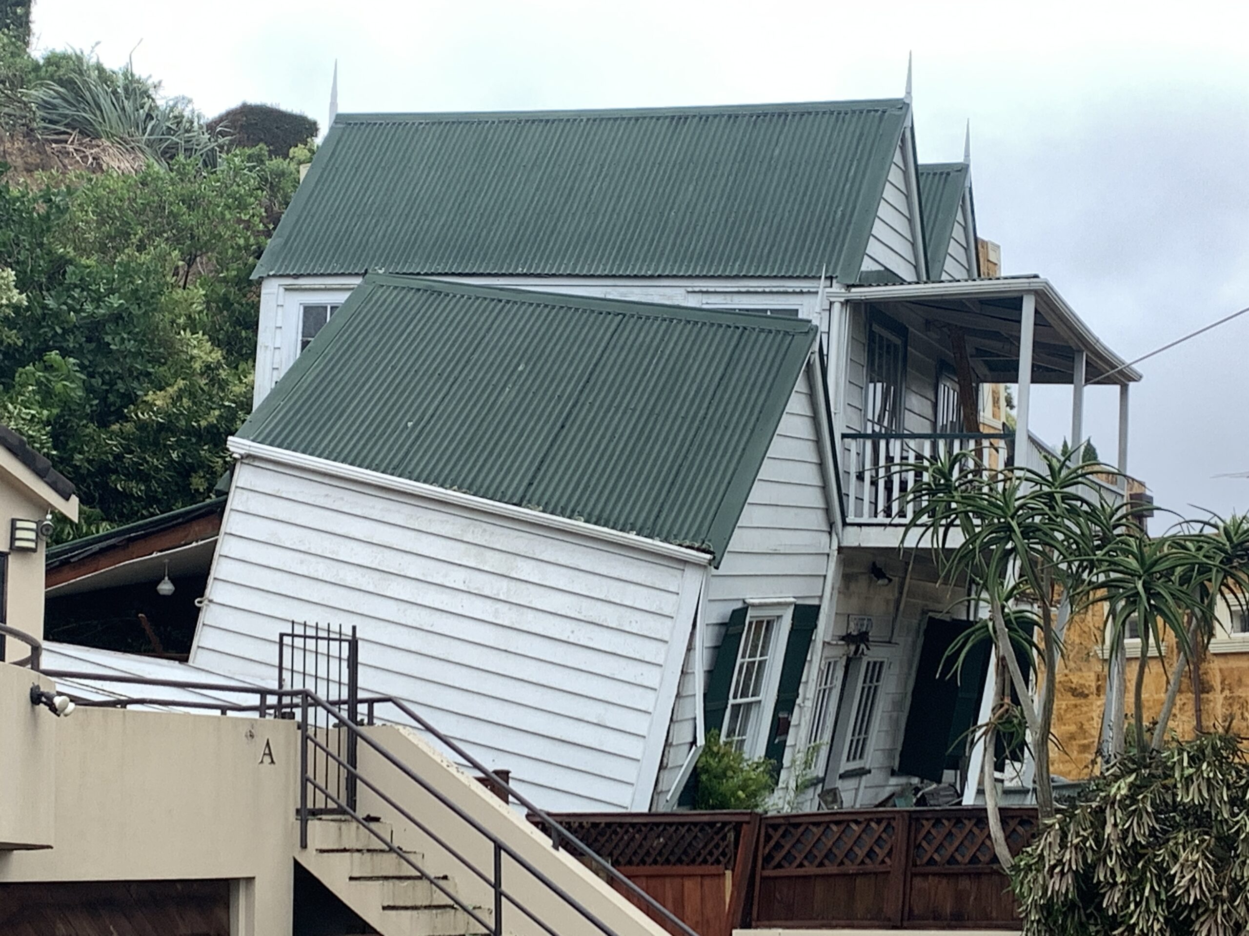
33 Shore Rd ready for demolition. Terry Sutcliffe March 2023 -5
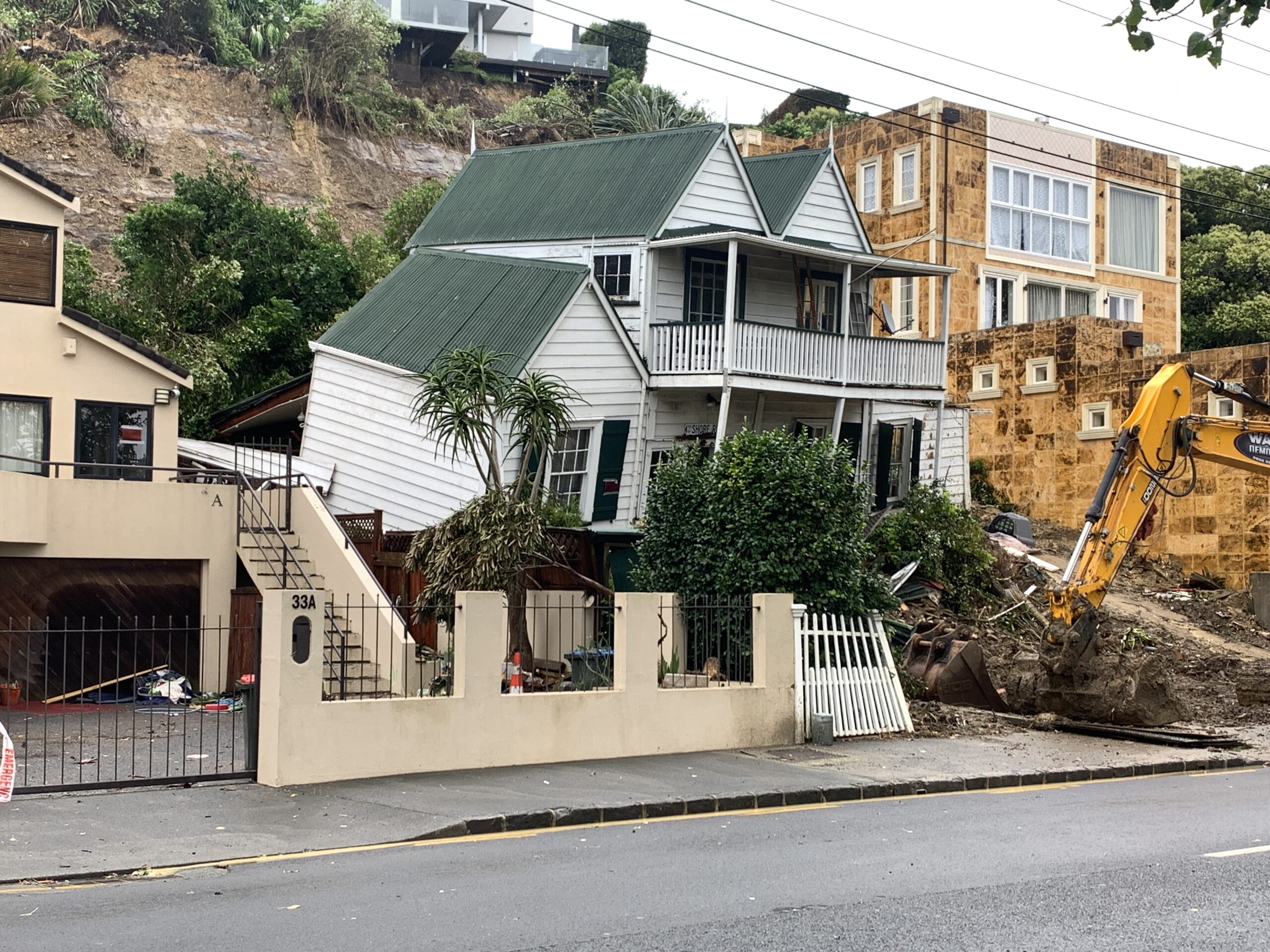
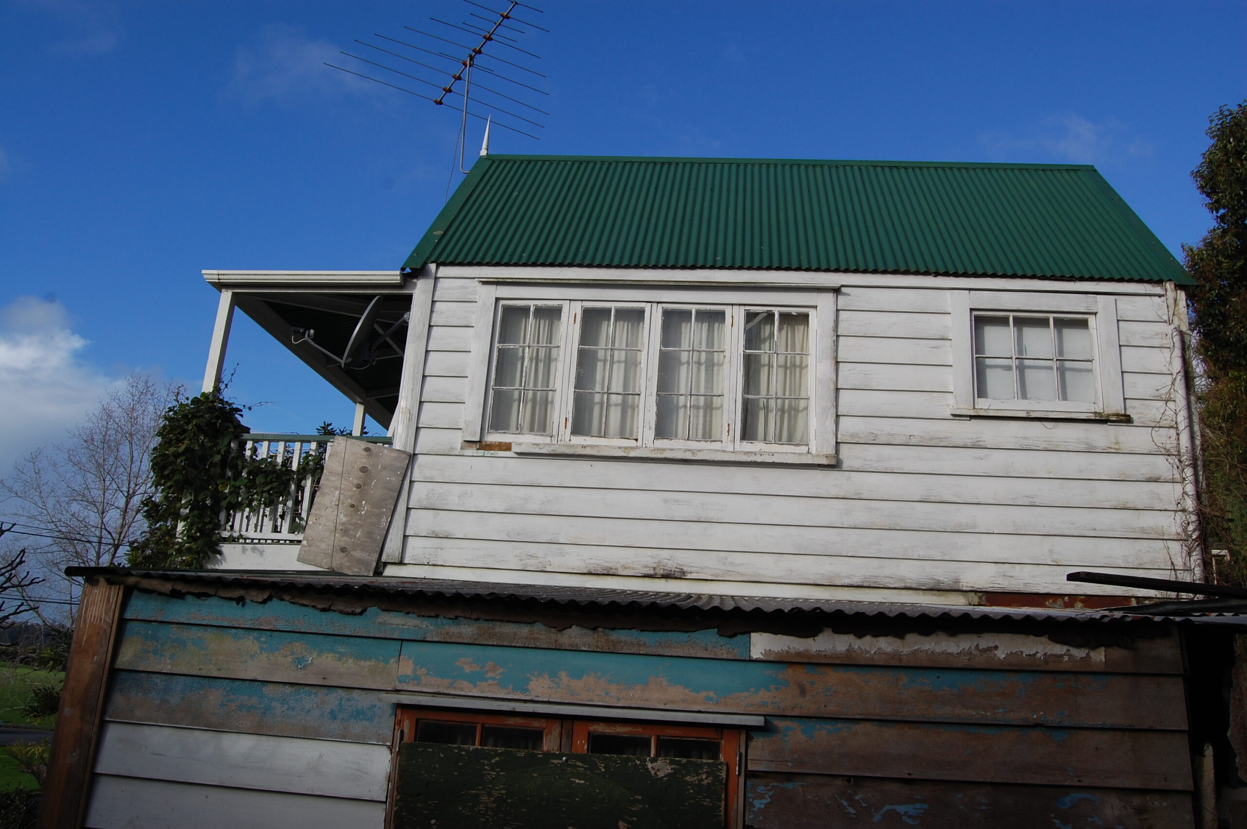
33 Shore Rd ready for demolition. Terry Sutcliffe March 2023
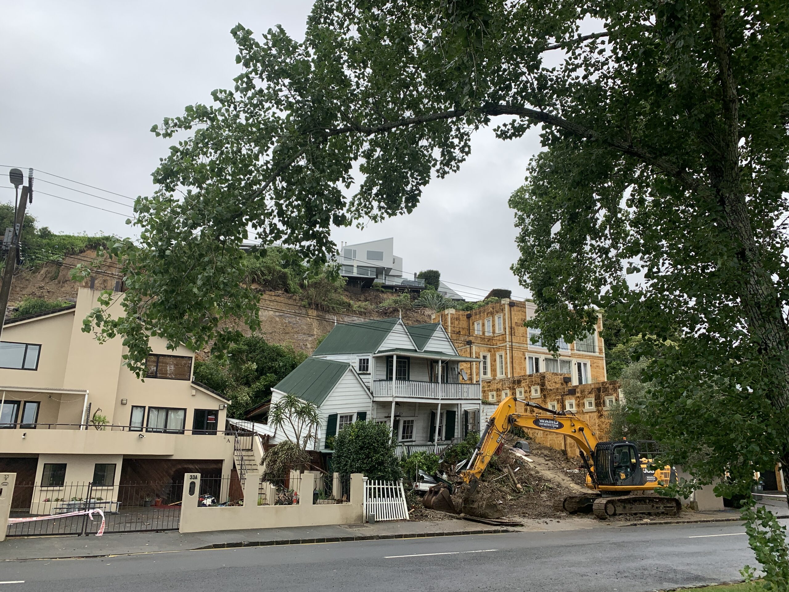
33 Shore Rd ready for demolition. Terry Sutcliffe March 2023
A landslide on an Arney Rd property in Remuera saw plantings at the rear of the property slip down the cliff and a gaping chasm appear underneath the multimillion-dollar houses. The impact on Shore Road below was devastating, resulting in the death of David Lennard when the landslide hit his house. [1]
It was not the first time that landslides had occurred on Shore Road.
20th Century
On 27th September 1997 heavy rain caused a landslide to destroy Chris Grove’s hillside house at 35a Shore Road, sending it crashing into Robyn Mackay’s house below at 35b Shore Road. Ms Mackay said the slip was caused by mainly water being forced into the ground via an Arney Road garden drain. However, the Earthquake Commission decided to redevelop the Grove property with retaining walls and drainage in place, as well as the Mackay property. [2]
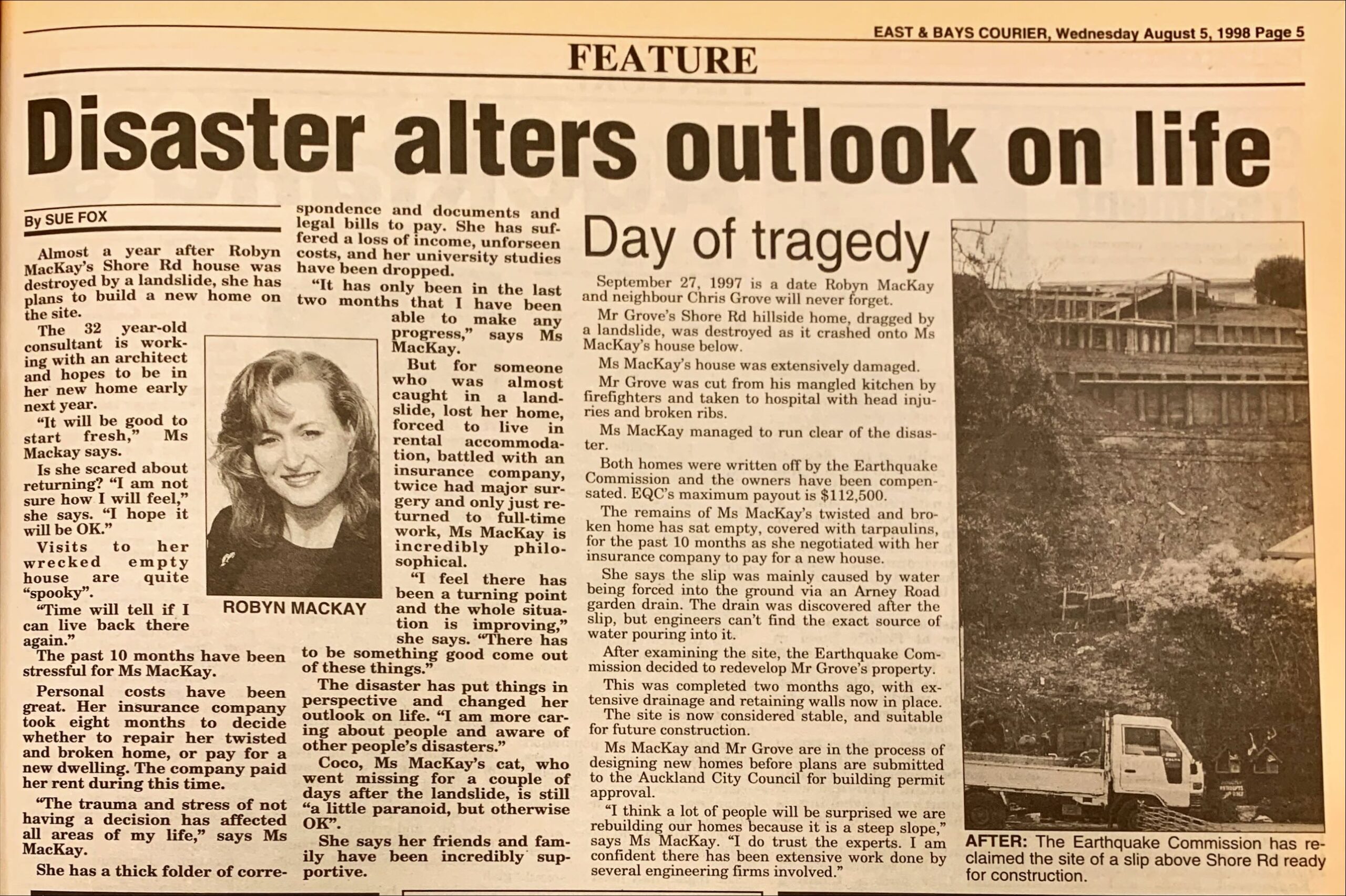
1998 East & Bays Courier 1998 Aug 05 p5 - Disaster Alters Outlook on Life & Day of Tragedy
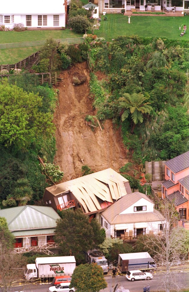
35 a and b Shore Rd after landslide in 1997. Jane Phare in NZ Herald
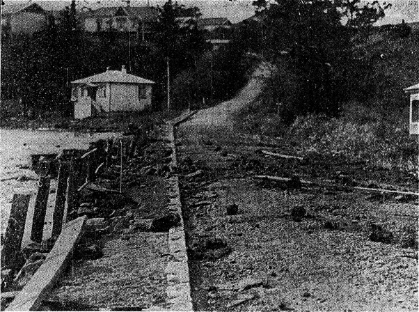
Shore Rd littered with debris from waves on the Victoria Ave-Brighton Rd busroute. N Z Herald 13 July 1926
Further back than 1997 though, the same problem had occurred 50 years previously in 1947.
The Remuera Round newspaper reported in 1947:
“Storm Sidelights-
A heavy slip crashed down Mt Hobson and crushed a tram waiting shed. The down railway line near the traffic bridge in Remuera Road, Newmarket was blocked for 18 hours following a washout. A group of houses in Shore Road. Remuera, below Arney Road, were in danger during the height of the storm when the soil slipped over the papa rock on the cliff behind and fell into their backyards. Most of the yards were filled with mud and at least one house suffered structurally.” [3]
Papa rock has been described as:
The terms papa or papa-rock are used for the widespread soft, blue-grey mudstone or muddy sandstone. Although the word papa is of Māori derivation (meaning earth), by the mid-19th century it was being used by Pākehā writers referring to mudstone, and in 1905 it was nicely summed up: ‘The Papa Rock, of which many of the cliffs in the bush country of New Zealand are formed, is really a very hard, blue clay … It lies in distinct strata, and when the wet penetrates to one beneath, the surface of this latter becomes as slippery as glass’. [4]
In May 1947 the Remuera Round reported that Auckland City Council recommended that the Council give financial relief to those residents in Shore Road whose properties were damaged by the recent slips. The recommendation included the cost of freeing the cliff, from which the slips came, of unstable material and also of other measures to give greater security. The council suggested that the necessary grant should come from the Earthquake and War Damage Fund.
The Round recently detailed the actual damage. To clear the slips alone involves over £150, there is the heavy structural damage to Mr. and Mrs. C. Taylor’s property, and in the opinion of the City Engineer, the approximate cost of making the cliff safe would be £1,800. In the last figure is included £950 for interceptor pipe drains and field tiles at the top of, the cliff, £550 for clearing the face of unstable material, £300 for walls and drainage at base. The City Engineer also considers that there are three other houses in the vicinity threatened by unstable earth on the cliff face. [5]
Needless to say, the Government refused to give financial assistance to the residents in Shore Road whose properties were damaged by slips which occurred on a cliff during torrential rain on April 19 and 20 1947. Without statutory power itself to help residents who suffered crippling losses, the City Council suggested, that the Government, should make a payment from the Earthquake and War Drainage Fund. In replying to the council’s suggestion, the Acting-Minister of Finance wrote that he was unable to agree that the fund was an appropriate source from which to grant relief to property owners for damage outlined in a report by the City Engineer.
The Statute under which the Earthquake and War Damage Fund was established specifically restricted claims to losses, caused by earthquake and war damage to property insured against fire under policies to which the Act applied, the commission administering the fund had authority under the Act to compensate owners of property for damage caused by landslide, or rainwater. Although there appeared to have been some minor damage to buildings which may be insured under fire policies, the major damage seemed to have occurred to the cliff face which would not be insured under a fire policy, and even if so insured would be excluded, from the cover given under the Earthquake and War Damage Act by reason of regulation of the regulations made under the Act. The Acting-Minister regretted that a favourable reply to the council’s suggestion could not be given but as the fund was established for the purposes laid down in the Act, it would be appreciated that the use of the fund for other purposes was not permissible. [6]
A photo from 1926 also shows Shore Road littered with debris from the waves. [7]
The 1954 creation of Bloodworth Park on Shore Road on reclaimed land gave protection from the waves in Hobson Bay but not from the landslips from Arney Road.
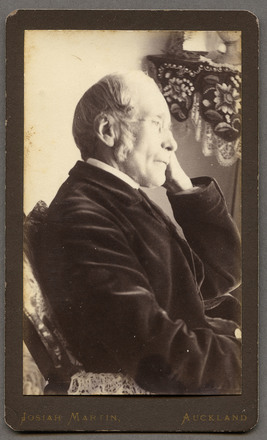
Hon. W. N. Swainson, Attorney General, Martin, Josiah, 1843-1916, photographer,Auckland Museum. PH-PR-191
William Swainson's house in Judges Bay, Parnell, 1887 by James Richardson. Auckland Libraries Heritage Collections
19th Century
Shore Road and no. 33 have had a very historical series of owners plus events which over the years have resulted in landslides.
Mr George Cutler, author of the Old Remuera column in the Remuera Round 28th August 1947, wrote: When the City Council sets to work to reclaim the swamp at the corner of Portland and Shore Roads for a recreation ground, it will be repeating history. In Remuera’s early days, an attempt was made to establish a cricket ground by draining the swamp. Private enterprise made the effort. To hold the creek back, a mud retaining wall, which still exists, was made, and a drain dug around the swamp on the back part of which there has been a flourishing Chinese garden. Floods in the creek, drainage from the back hill at times of heavy rain, defeated the enterprise, and no cricket pitch was ever laid.
Shore Road on Hobson Bay was made by Reuben Scarborough cutting through Morrin’s Hill which went from Portland Road to the bottom of Victoria Avenue. A track was built using spoil to make up the road on the flat, with a timber facing on the seaward side. However, heavy rain in winter caused clay mud to wash down Morrin’s Hill to form mud four feet deep on the track. Once a man coming home at night “blundered into the clay and when found next morning, he was stuck to his shoulders and exhausted.” [8]
The property at 33 Shore Road which was demolished in 2023 by a landslide was part of an interesting history from the 19th century. William Swainson (1809-1884) was New Zealand’s first Attorney General who left England in 1841 and brought his pre-fabricated frame house out with him which he constructed on about 6 acres he owned at the end of Gladstone Road on Taurarua, Judges Bay. [9]
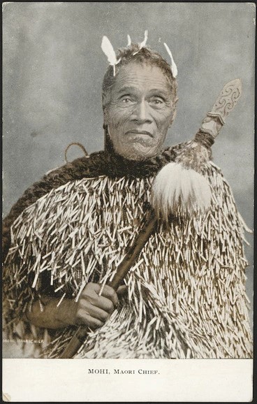
Mohi H&B Postcard 1910 Turnbull Library

Mohi Horowhenua by James Corbett photographer active 1873-1883 PA2-0548 Record 22664175 Alexander Turnbull Library
Mohi Horowhenua by Sam Stuart 1855-1920 International Art Centre 2013-11-084-H
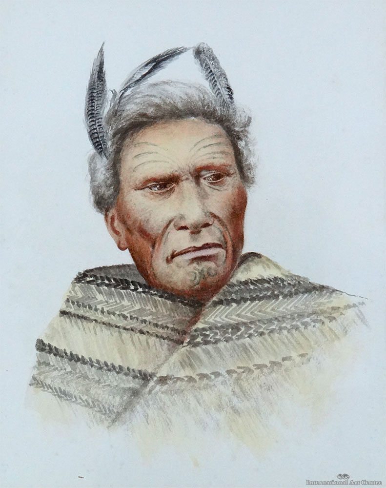
When Sir George Grey left Kawau Island for the first time in 1868, his boatman Mohi (Moses) Horowhenua moved back to Auckland and a small cottage was found for him on Shore Road in Hobson Bay where he became the boatman for William Swainson. So, it may well be correct, as suggested by heritage architect John Stacpoole, that what is now 33 Shore Rd was Mohi’s home. [12]
A hospital that treated Māori had been built nearby and Mohi Horowhenua te Puatau, was a patient there. Mohi’s wife and child had died, and Mohi was then employed by Swainson as a boatman and handyman. Mohi would row Swainson into ‘town’ on the tide dressed in spotless white with blue facings. [10]
Mohi was to accompany Swainson from then on for the rest of Swainson’s life, including at Wellington synod meetings [11] and in a canoe trip around Waiheke Island, where Mohi’s hapū was and his wife was buried. In 1880 Mohi lived in a whare 30 yards (27 m) east of Swainson’s house. Swainson described Mohi in his will as his “old friend”. When Mohi was on his deathbed in 1890 Governor Grey visited Mohi daily during his last days and Grey led Mohi’s funeral procession. In the words of Swainson’s biographer, John Stacpoole, Mohi was buried “no more than a leap away from Swainson’s grave.”
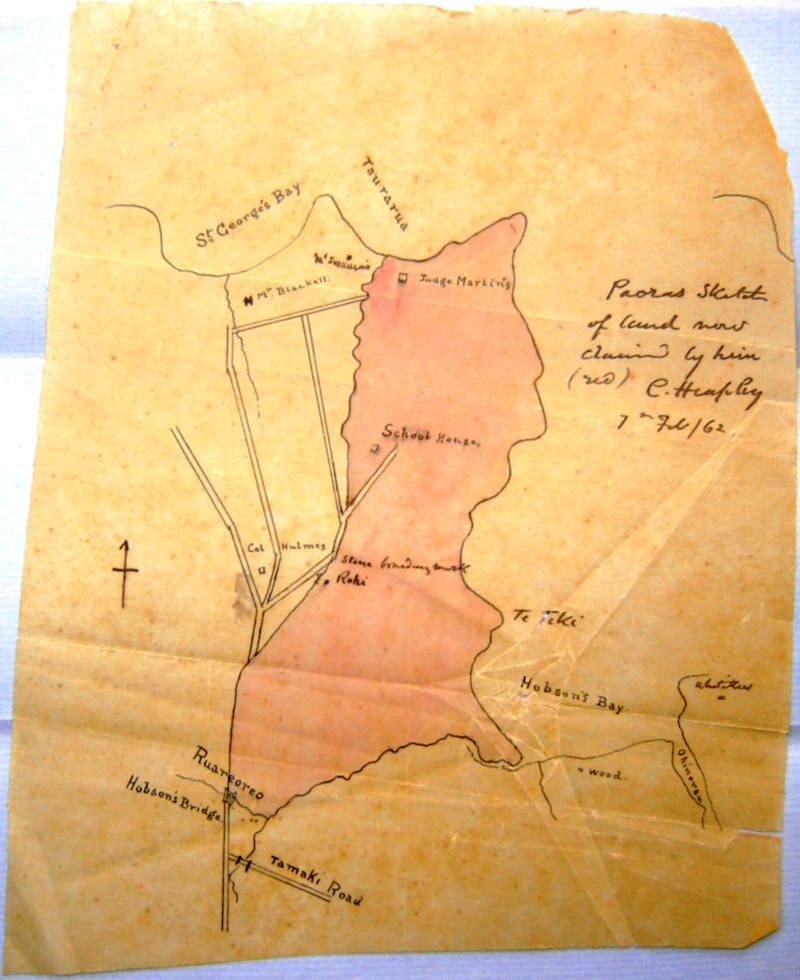
Hobson Bay 1862 - Charles Heaphy's Map owned by Dave Lennard 33 Shore Rd
A map by Charles Heaphy (1820-1881) from 1862 shows Swainson’s house at Taurarua on Judges Bay, and a spot marked Wood on Hobson Bay. [13] This is likely to refer to Reader Gillson Wood, 1821-1895, an early Auckland architect in the 1840s who designed and built cottages for settlers.
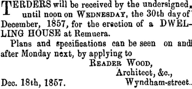
He also designed the General Assembly House, colloquially called “Shedifice” by the members of Parliament, which was the first building to house the New Zealand Parliament in Auckland. It was in use by Parliament from 1854 until 1864 during the time that Auckland was the capital of New Zealand. On 18 January 1854, Parliament was first summoned to meet in Auckland on 24 May of that year and Reader Wood, who was deputy surveyor-general, was tasked with designing a suitable meeting house that could be used by the survey department during the parliamentary recess. Reader Wood went on to become the Member of Parliament for Parnell and then Waitemata, holding the ministerial positions of Colonial Treasurer and Minister of Colonial Defence. [14]
Wood likely designed and built the cottage on Shore Road about 1858 where Mohi lived and which became 33 Shore Road. [15]
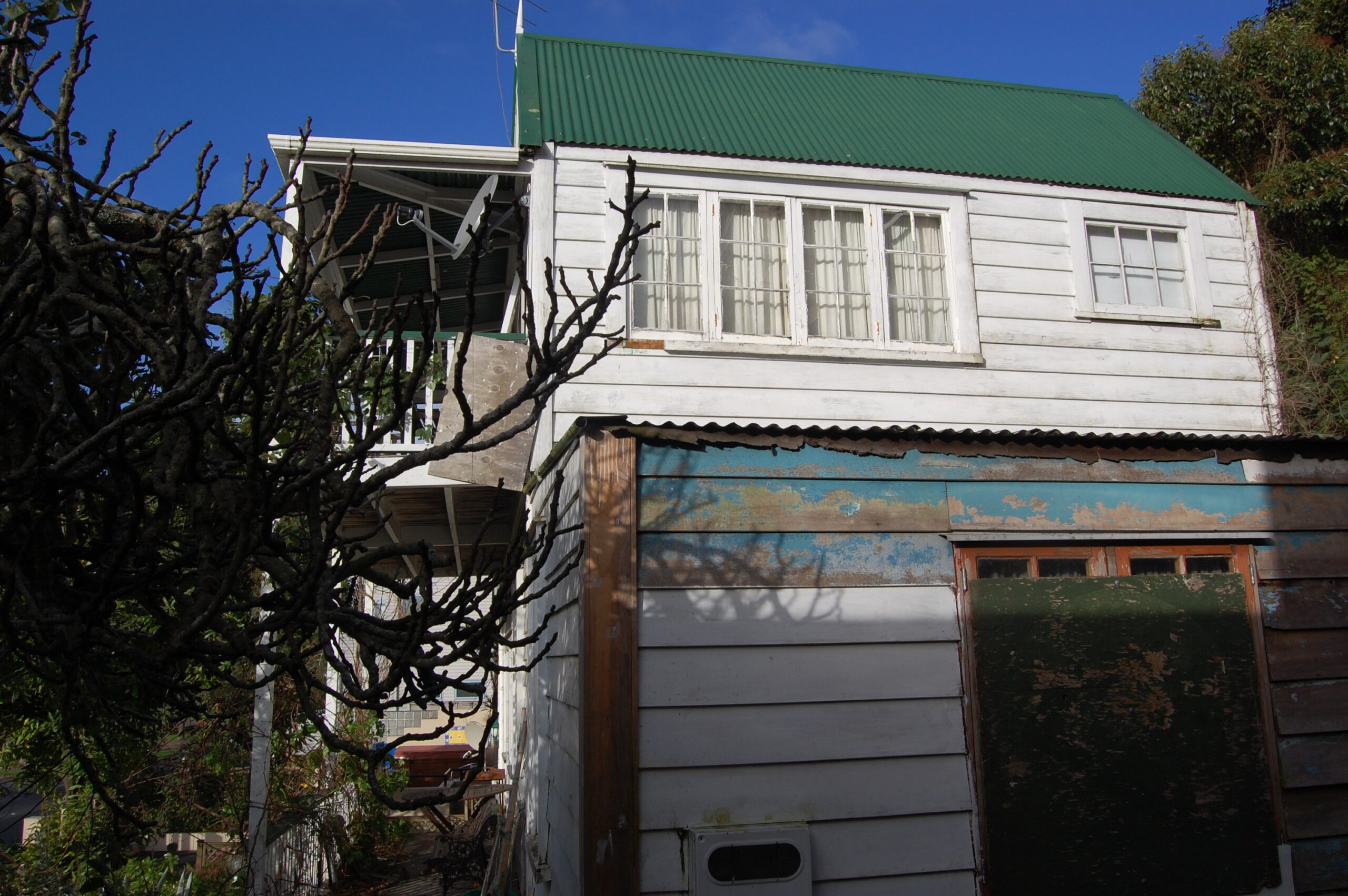
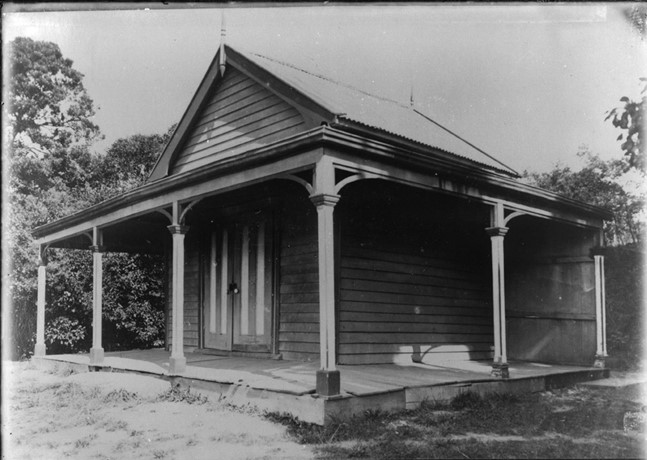
33 Shore Rd 2008 photos by Terry Sutcliffe
33 Shore Rd 2008 photos by Terry Sutcliffe
33 Shore Rd 2008 photos by Terry Sutcliffe
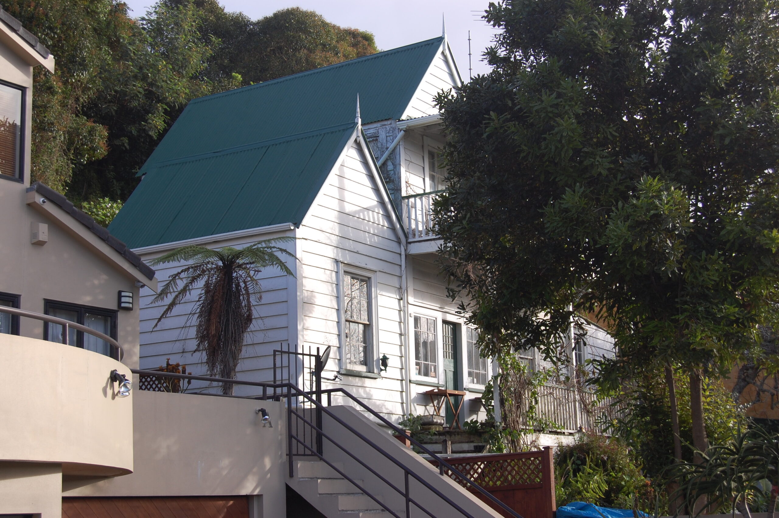
33 Shore Rd 2008 photos by Terry Sutcliffe
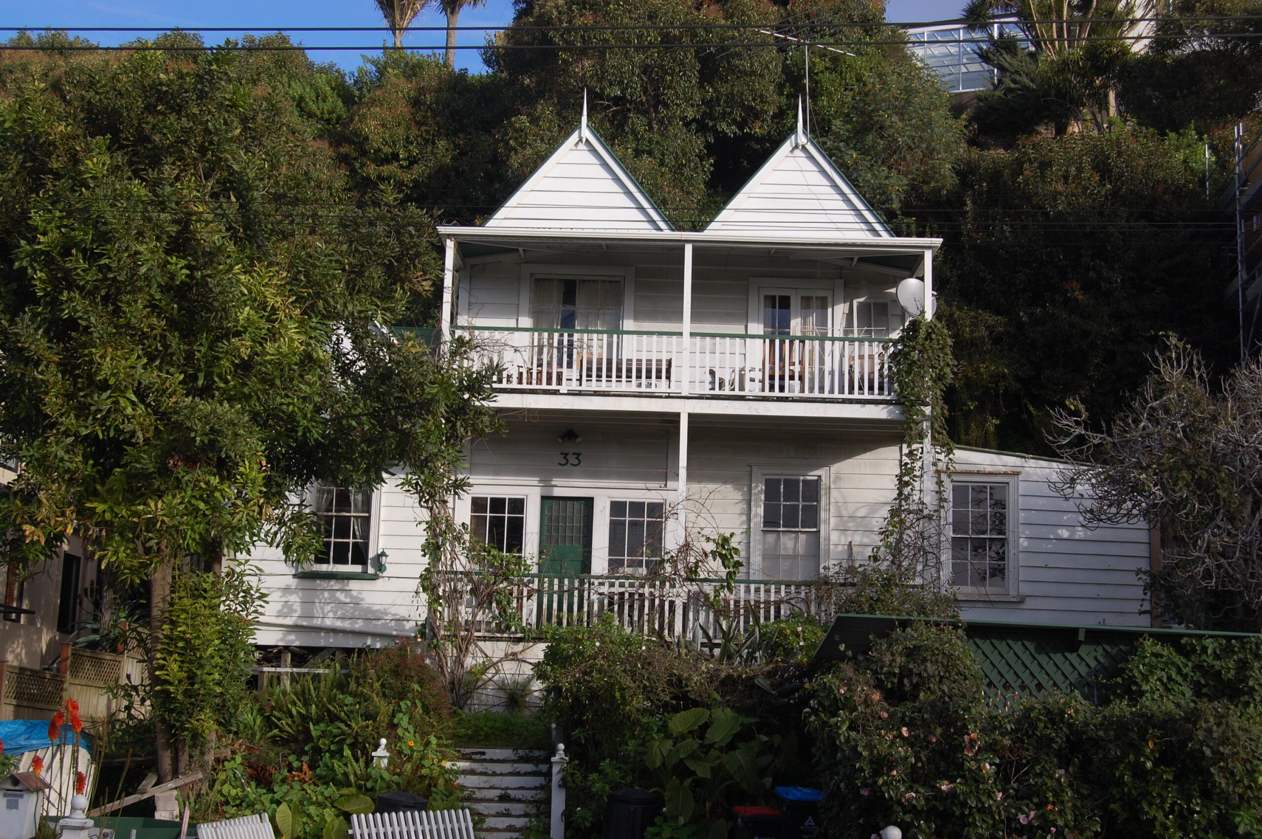
33 Shore Rd 2008 photos by Terry Sutcliffe
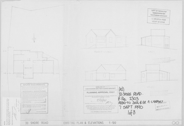
Auckland Council. Addition to dwelling and erection of carport. 33 Shore Rd. 7 Sept 1990
The house sat on a 601sq.m. section right underneath a high cliff face. Prior to the 2023 storm, the cliff face was covered with vegetation. The two-storey double-gabled cottage was weatherboard with a corrugated iron roof and sat on concrete blocks. The exact date of the cottage is unknown. The front verandah and upper verandah would have been later additions as were the gabled single-storey lean-to with carport below on the eastern side, built in 1990, and the single-storey lean-to on the western side with a flat roof date unknown. Permission for an internal toilet was granted by the council in 1970, and site retaining walls were consented in 1991. The original floor area of the house was 86sqm with an additional 38sqm added in 1990 for the carport and second storey. The verandah was 11sqm and carport 18sqm. Decorative finials sat above the three gables and the three Shore Road double hung windows had shutters either side.
Entry into the house was through a centralised front door off the verandah, into a lobby with a stairwell to the two bed-sitting rooms above with French doors opening onto the upper verandah. The living room was off to the right of the entrance lobby and a bedroom off this, and another bedroom to the left of the lobby, all with double hung sash windows. At the rear of the house was the kitchen, dining, laundry and bathrooms facing the cliff face. Most of the external doors and windows were replaced in the 1990 renovation and house extension. [16]

David Lennard 1945-2023
Back to the future 21st Century
So, what has been learnt from these frequent earlier weather-related landslides when the land under the houses on Arney Road fell down the cliff face below onto Shore Road causing death and devastation?
Jane Phare of the N Z Herald has asked the question: “So why are lessons not learned? Why do Aucklanders keep building on the edge of unstable cliffs, or at the bottom of cliffs that could one day bury them in their houses? And why does Auckland Council let them? The reasons, it seems, are complex. They include Aucklanders’ obsession with property and sea views, greed, legislation that allows them to build pretty much anywhere, a desperate need for homes, infill housing, pressure from developers, and lack of accountability.” [17]
Auckland of University geologist Martin Brook points a finger at the 1981 Local Government Amendment Act, specifically section 641A. That section effectively allows councils to permit building or rebuilding on unstable land but absolves councils from any civil responsibility. That get-out-of-jail-free card was introduced after the 1979 Abbotsford landslide in Dunedin. Miraculously, no one died when 18ha slid 48m down a hill in just 15 minutes, although some residents were injured. The tonnes of rubble, sand and earth took with it 68 houses, sparking a Commission of Inquiry. But rather than banning the rebuilding of housing on unstable land, section 641A acts to protect councils from claims”.[18]
Martin Brook also said: Repetitive slips like Remuera’s Shore Rd and those at Muriwai are a legacy of that 1980s legislation, he says. After this year’s floods, a drone won’t have to fly too far to find the angry yellow-brown scars down Auckland’s cliff faces. And there’s a lot of coastline, and cliffs, to consider – 3200km of it that includes the Waitematā, Manukau and Kaipara harbours. Those cliffs are part of the East Coast Bays Formation which underlies much of the Auckland region, stretching all the way to Whangaparāoa. It’s renowned for its deep residual soil that forms, over time, on top of the layers of sedimentary rock.
That deep soil is often what people build on and that’s what slides down cliffs, with some loose rocks mixed in, once it becomes saturated, taking people’s houses, retaining walls and swimming pools with it. Memories are short and the cliff gashes are soon covered with undergrowth. But researchers don’t have to delve too deep into Auckland’s files to uncover similar stories. [18]
In March 2023, Mayor Wayne Brown believed the flood and infrastructure damage after the Auckland Anniversary Weekend storm and Cyclone Gabrielle floods made it imperative the council rethink building more houses in areas prone to flooding.
Brown told a planning committee hearing that rushed decisions under the current planning timeframe could lead to problems.
“It’s just unfortunate the Plan Change 78 process has got itself underway – the legislation has been foisted upon us, legislation I’m not at all happy with but that’s what governments do when you let them sit in a room in Wellington.”
“This could involve a variation to PC78 or a wider plan change to the Auckland Unitary Plan.”
Plan Change 78 arises from a cross-party law from late 2021 when National joined Labour in pushing for sweeping changes to existing plans for the country’s major urban areas – and effectively overrode the Auckland Unitary Plan. Agreed in 2016, that plan had in itself made radical provisions for higher building zones and more housing density in the city to cope with 20 to 30 years of growth. It stands criticised for allowing building in flood plains. [19]
In an opinion piece in the Herald, the Mayor of Auckland, Wayne Brown, blamed bad decisions in the past, including by the Environment Court, poor building technique choices, lack of investment in stormwater. Brown said the council needs to be able to say “no” to building applications in at-risk areas, and for the decision to stick.
“I am determined that the council and everyone involved will learn the lessons from these floods, and not have another flood report that goes ignored. We need to stop making the same mistakes and having to do the same recovery work over and over.” [20]
Auckland Council Healthy Waters have prepared a Flood Viewer where properties can be checked for different types of flooding e.g. flood plains, flood prone areas, overland flow paths and coastal inundation. 33 Shore Road is identified as a flood prone area, subject to coastal inundation and as an overland flow path from Arney Road. It’s a start.
However, Radio NZ has reported that 1415 were new homes consented on Auckland flood plains in the year since the flooding disaster.
Auckland councillor Richard Hills, head of the council’s Planning, Environment and Parks committee, agreed with Noy that local authorities were “hamstrung” by current planning laws that allowed applicants to go ahead if they could show they had taken reasonable steps to reduce the risk.
“Essentially, when consent holders can prove through their engineers, lawyers, whoever, that they can mitigate the risk and they believe that lifting the floor level, or only putting structures that won’t have people living, sleeping – so garages or basements – and that’s a level of risk they’re willing to take, then those things will get consent.”
Since the floods,the council had been taking a second look at some greenfields sites that had been zoned for residential development, Hills said.”We will be looking to down-zone some areas but that will be controversial … and it’s not just something we can do overnight.”
However, the council could not do that until it implemented a previous planning change that required councils around the country to allow for more intensive development. Hills said it would make more sense to combine the two processes and both councillors and staff were hoping to get permission from the new government to do just that. [22]
Here’s hoping Auckland Council, the Environment Court, residents, ratepayers and developers can act responsibly and place restrictions on building in known dangerous places and make land information reports available to all.
We owe it to the memory of Dave Lennard. [21]
Subscribe to our newsletter to keep up to date.
[1] Auckland floods: Luxury $10 million cliff-top mansion red-stickered in Remuera (149a Arney Road). By Akula Sharma, NZ Herald 8 Feb, 2023
[2] I could hear it coming after me, by Jane Phare. N Z Herald 4 March 2023; pA6-7.
[3] Storm sidelights https://paperspast.natlib.govt.nz/newspapers/NA19470421.2.19. Northern Advocate, 21 April 1947, Page 2
[4] Simon Nathan, ‘Rock and mineral names – Local names’, Te Ara – the Encyclopedia of New Zealand, http://www.TeAra.govt.nz/en/rock-and-mineral-names/page-1 (accessed 7 November 2023)
[5] shore road slips request to government. Remuera Round, Wednesday May 21, 1947, in Kura Heritage Collections Auckland Libraries
[6] Shore Road slips – no financial help reply by government. Remuera Round Thursday, July 17, 1947. In Kura Heritage Collections Auckland Libraries.
[7] Shore Road, Remuera, Littered with debris by the waves. Shore Road is on the Victoria Avenue-Brighton Road bus route. New Zealand Herald, 13 July 1926
[8] Old Remuera. Remuera Round 28th August 1947
[9] Graeme Reid. ‘Swainson, William’, Dictionary of New Zealand Biography, first published in 1990. Te Ara – the Encyclopedia of New Zealand, https://teara.govt.nz/en/biographies/1s29/swainson-william (accessed 11 January 2024)
[10] https://paperspast.natlib.govt.nz/newspapers/NZH19230707.2.166.22. New Zealand Herald, Volume LX, Issue 18445, 7 July 1923, Page 4 (Supplement)
[11] https://paperspast.natlib.govt.nz/newspapers/NZH19230707.2.166.22. New Zealand Herald, Volume LX, Issue 18445, 7 July 1923, Page 4 (Supplement)
[12] Sailing to Bohemia: A Life of the Honourable William Swainson, by John Stacpoole. Puriri Press, 2007. p169.
[13] Hobson Bay1862 – C Heaphy’s Map owned by Dave Lennard 33 Shore Rd
[14] Death of Sir Reader Wood. A veteran colonist. https://paperspast.natlib.govt.nz/newspapers/AS18950821.2.7. Auckland Star, 21 August 1895, Page 2
[15] Interview with Dave Lennard by Terry Sutcliffe Dec 2016
[16] Auckland Council. 33 Shore Road. P. No. 2303. Addition to dwelling and erect a carport. 7 Sept 1990.
[17] I could hear it coming after me, by Jane Phare. N Z Herald 4 March 2023; pA6-7.
[18] Jane Phare, I could hear it coming after me, by Jane Phare. N Z Herald 4 March 2023; pA6-7.
[19] Minister weighs Auckland housing density delay. Tim Murphy, Newsroom. March 28 2023.
https://www.newsroom.co.nz/pro/minister-weighs-auckland-housing-density-delay
[20] Auckland flooding. Wayne Brown – how did homes get built in risk-prone places? NZ Herald 1 March 2023
[21] https://remueraheritage.org.nz/news/in-memory-of-david-lennard/
[22] 1415 new homes consented on Auckland flood plains in the year since flooding disaster. RNZ Kate Newton 26 Jan 2024 https://www.rnz.co.nz/news/in-depth/507562/1415-new-homes-consented-on-auckland-flood-plains-in-the-year-since-flooding-disaster