History of Waitaramoa – past and present
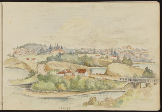
Watercolour looking from Orakei towards Remuera with Orakei Basin (left) and Hobson Bay (right). Baradene Girls School is seen on the hill (left of centre) with the grounds of St Kentigerns School (centre) and the Auckland War Memorial Museum (right, distance). 1940s by Frank Stevens 1871-1965 Auckland Libraries Heritage Collections
Waitaramoa was the original Māori name of the land around Hobson Bay from Taurarua/ Point Resolution to the Orakei Basin. This includes Hobson Bay, Shore Road, Shore Road Reserve, Thomas Bloodworth Park, the Remuera or Ōhinerau or Portland Streams, Waitaramoa Reserve and Portland Reserve in Remuera.
Waitaramoa is the traditional name for the area now commonly referred to as Hobson Bay. The meaning of the name is “the bay of the first rays of sun” or “Speargrass water” [waitaramoa is commonly known today as ‘bush lawyer’] and is “also applied to a creek at headwaters of the bay, near Hay’s Gardens.” Hay’s Nursery Montpellier was on the corner of Shore Road and Seaview Road. (1)
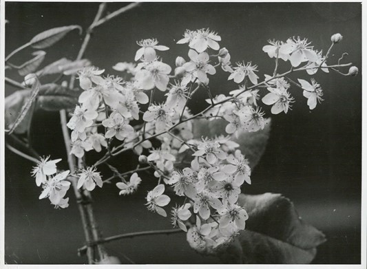
Bush lawyer flowers or "Spear grass water"
Hay Nursery - Montpellier - was on the corner of Shore Road and Seaview Road.
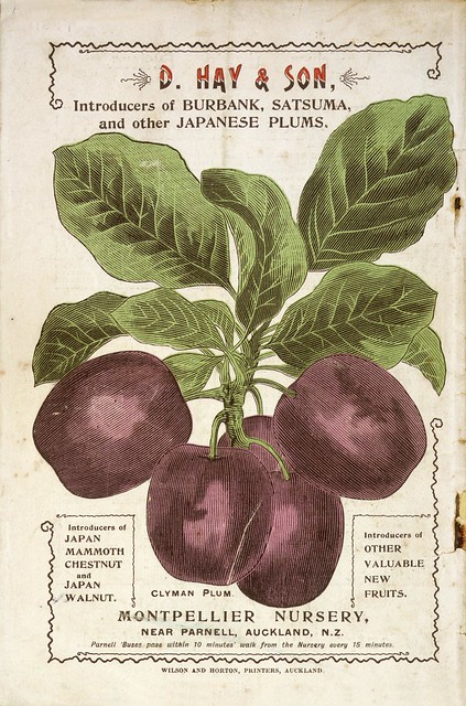
David Hay was responsible for the first commercial importation of Pinus Radiata into New Zealand. And the first tree tomato or tamarillo seeds from India.
The Ngāti Whātua o Ōrākei rangatira Te Tinana had a kāinga or settlement in that vicinity in the late 1830s which Professor Russell Stone places “on the lower slopes of Little Rangitoto, on or near the narrow neck of land between the western shore of Waitaramoa (Hobson Bay) and the drowned tidal crater known today as Ōrākei Basin”. Tinana’s pā (named ‘Waitararoa’) was included in the Ōhinerau Block offered to the Crown in 1851 by Apihai Te Kawau, Tinana, Te Keene and Te Hira. The boundaries of this block were “north by the sea, northeast by the stream Ōhinerau [which would seem to have run through what are now Waiata and Martyn Wilson Field Reserves]; on the west by Tiki (I and II) [land blocks named for a stream which could be compatible with the canal now seen in Waitaramoa Reserve] after sold to the Crown; south by the road [Remuera Road] and on the east by Native Land.”
Point Resolution Taurarua had been purchased at the time the Russian Scare in 1885 and fortifications were established for a fort which led to the destruction of the Taurarua Pa site in 1885. The Parnell Baths and Reserve were built in 1913-14 from fill from the excavations of the fort. (2)
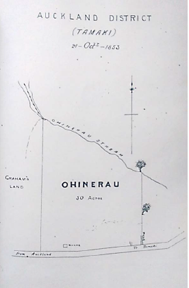
Plan showing Ohinerau Block. In J. H. Rose, Some Houses in Ohinerau, n.d. 29
Tinana of Ngati Whatua signed the Treaty of Waitangi in 1840. Tinana’s pā (named as ‘Waitararoa’) was included in the Ōhinerau Block offered to the Crown in 1851 by Apihai Te Kawau, Tinana, Te Keene and Te Hira.
The boundaries of this block were –
- “north by the sea, (Hobson Bay)
- northeast by the stream Ōhinerau [which would seem to have run through what are now Waiata and Martyn Wilson Field Reserves]; (bottom of Orakei Road)
- on the west by Tiki (I and II) [land blocks named for a stream which could be compatible with the canal now seen in Waitaramoa Reserve] after sold to the Crown; (Remuera or Waitaramoa Stream)
- south by the road [Remuera Road] and on the east by Native Land.” (Upland Road)
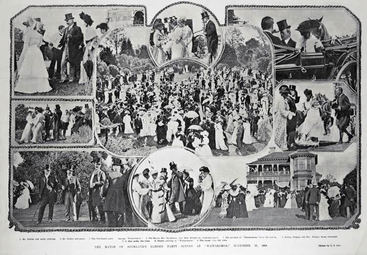
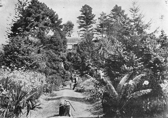
Mayor of Auckland garden party Waitaramoa Dec 17 1904, Auck Weekly News C F Bell Photographer Auckland Libraries Heritage Collections AWNS-19041222-05-01
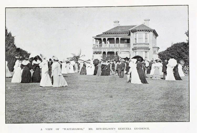
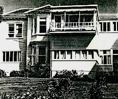
Waitaramoa Mr Mitchelson's residence NZ Graphic & Ladies Journal 24 Dec 1904. Auckland Libraries Heritage Collections NZG-19041225-0028-01
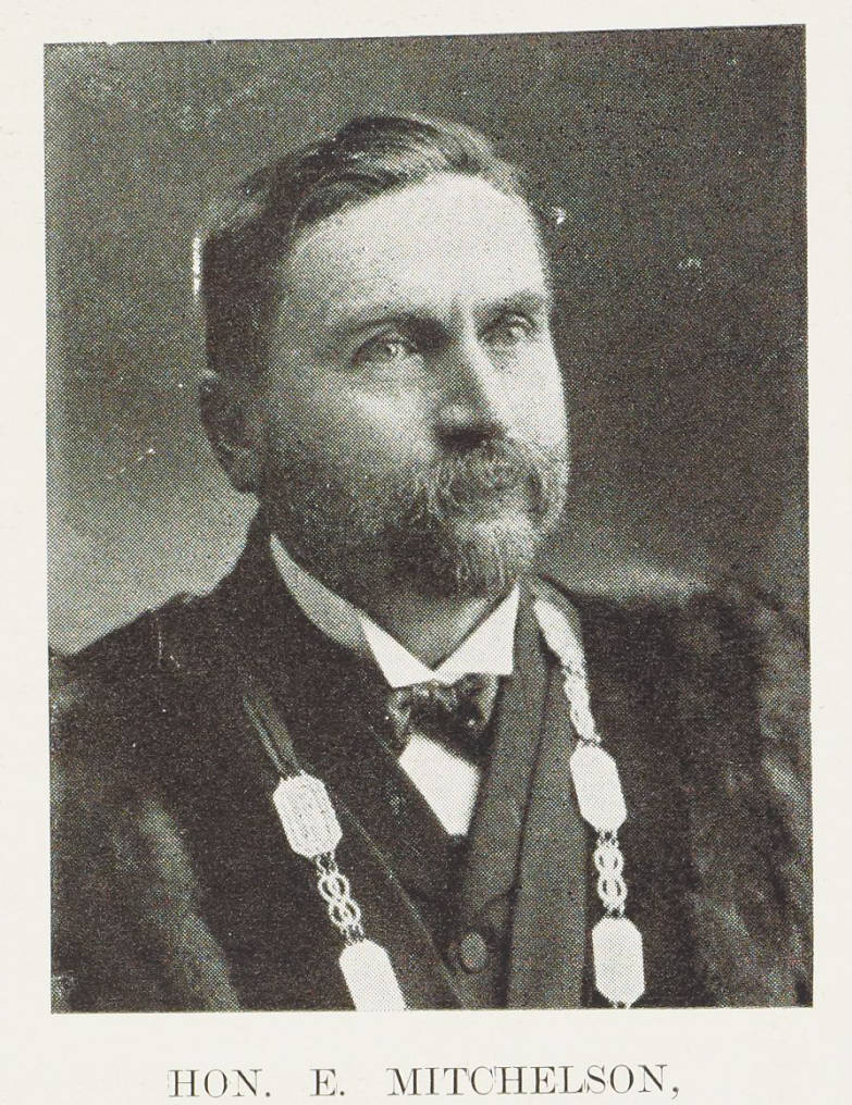
Sir Edwin Mitchelson Mayor of Auckland NZ Graphic 1908-11-04 Auckland Libraries Heritage Collections
Sir Edwin Mitchelson (1846-1934) was a successful businessman in the timber and kauri gum industries. In the government of Sir Harry Atkinson, he held the posts of Minister of Public Works, Native Affairs and Postmaster General. He was chairman of the Remuera Road Board, and mayor of Auckland from 1903 to 1905. He was a founder and long-serving chairman of the Diocesan School for Girls. He was also associated with the Auckland University College Council, Auckland Grammar School, Auckland Harbour Board, Auckland Savings Bank, and the Auckland Institute and Museum. (4)
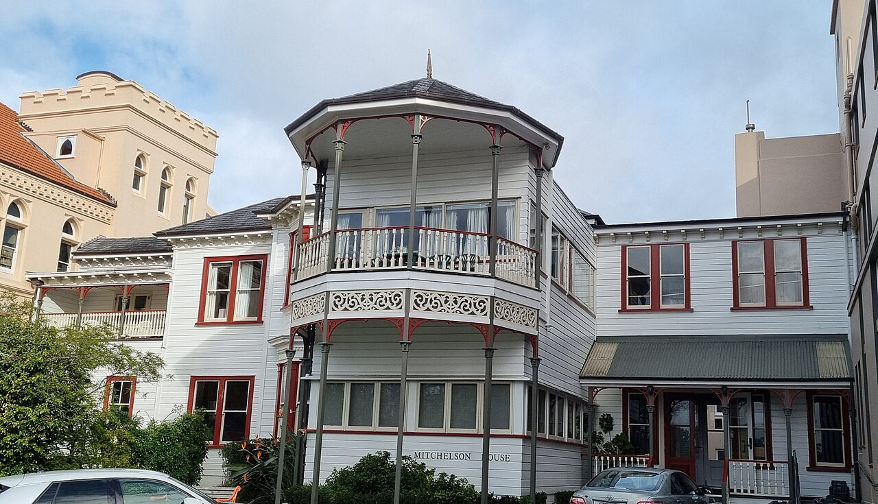
Mitchelson House at Baradene School. Wikimedia July 2023
Mitchelson House Heritage NZ
In 1909 the Evening Post newspaper reported:
The Hon. E. Mitchelson’s residence, “Waitaramoa,” at Remuera, has been purchased by the Roman Catholic order of the Sisters of the Sacred Heart, who are establishing a convent in Auckland attached to the residence, which is a two-story wooden building. There are forty acres of land, beautifully laid out and planted with choice native trees and shrubs. There are also two large vineyards, a keeper’s cottage, together with stables and other outbuildings. The property is situated at the foot of Victoria Avenue, with frontages to the Avenue and Beach-road, and commands a splendid view of the harbour. The purchase price was £12,000. (5)
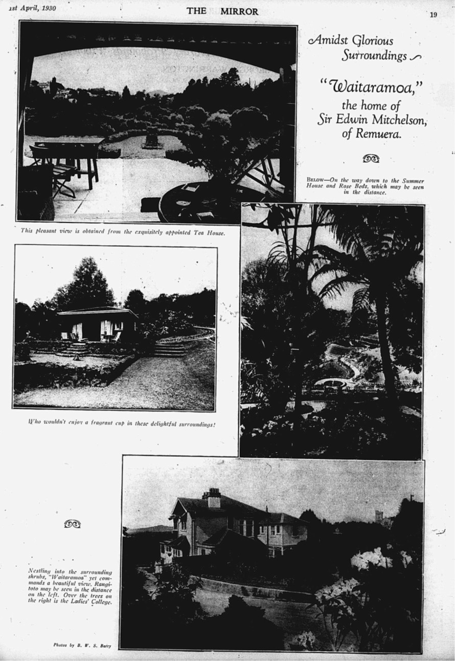
Waitaramoa Remuera Rd 1 April 1930 The Mirror
Edwin Mitchelson moved to 108, now 286, Remuera Rd and bought 18 acres of land which ran down from Remuera Road to what is now Kings School. This land he called Waitaramoa, until it was sold in the 1980s. Sir Edwin gave approx. 15 acres to Kings School and kept the rest for his family.
At the bottom of the garden there were several springs which formed a large stream called Waitaramoa. This stream ran right down the property through the bush and again reappeared at the bottom of Portland Road. This can still be seen on the right-hand side at the bottom of Aldred Road. Many years ago, this was piped and went across the road and formed a large stream running down Portland Rd and into Hobson Bay. The beginning of this stream was very visible at the bottom of Waitaramoa and below King’s School Number 3 field.
There have also been the names Remuera Stream, Ōhinerau Stream and Portland Stream.
The Portland Road Reserve was renamed Waitaramoa by the Council in 1997 but the current website still refers to a Portland Road Reserve.
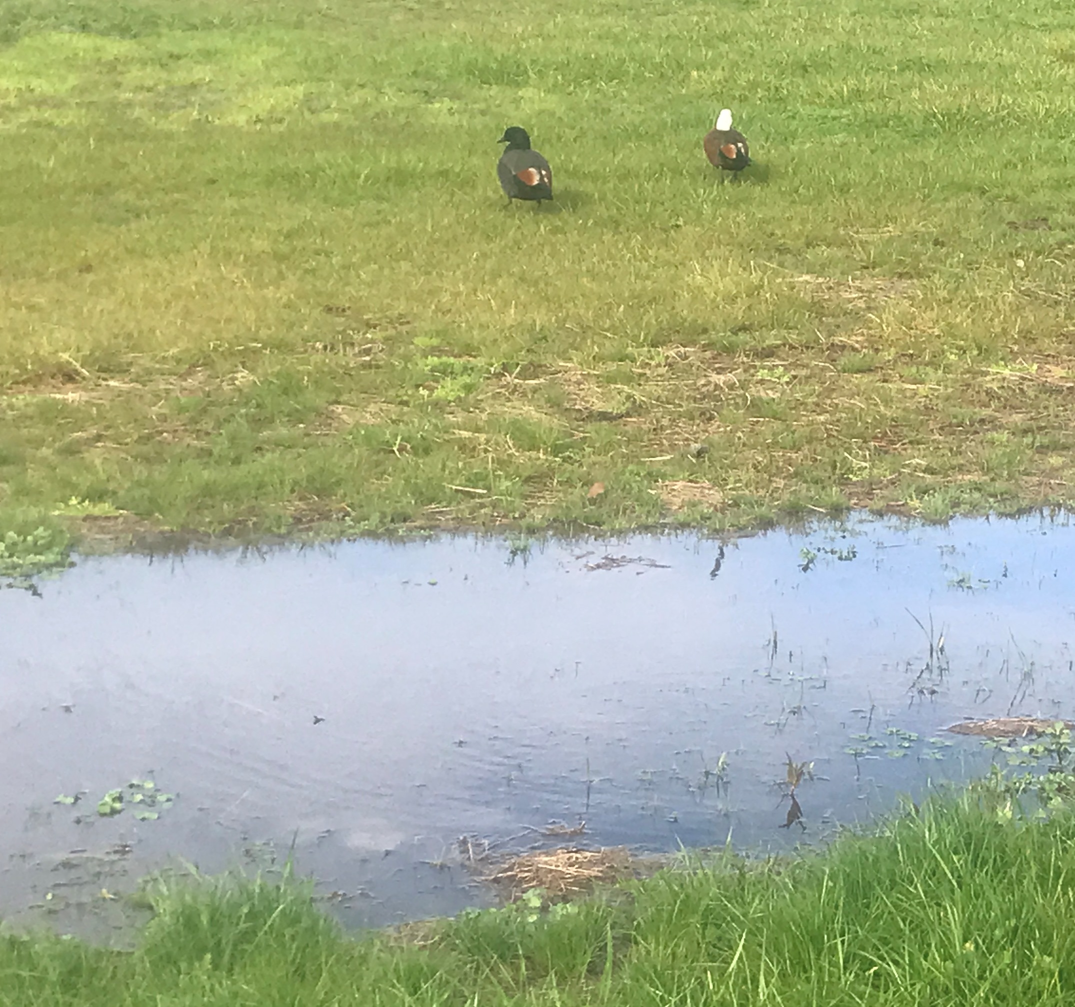
Paradise ducks enjoying the water
Remuera Stream
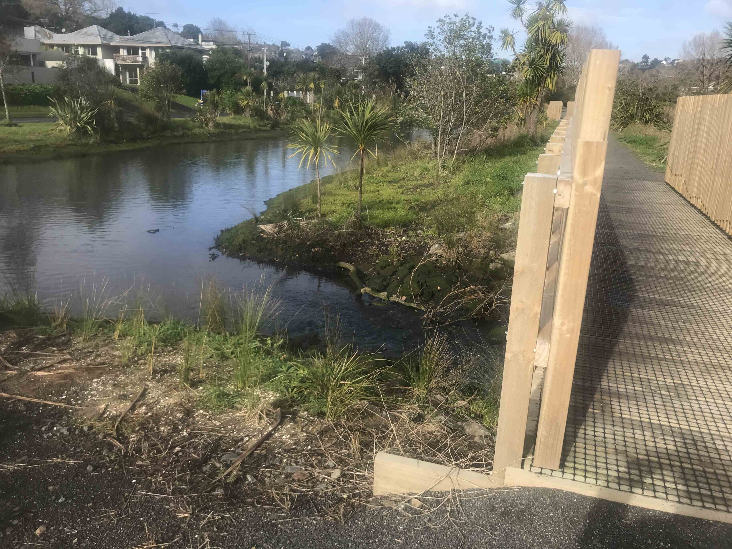
Remuera-Stream-with-planting
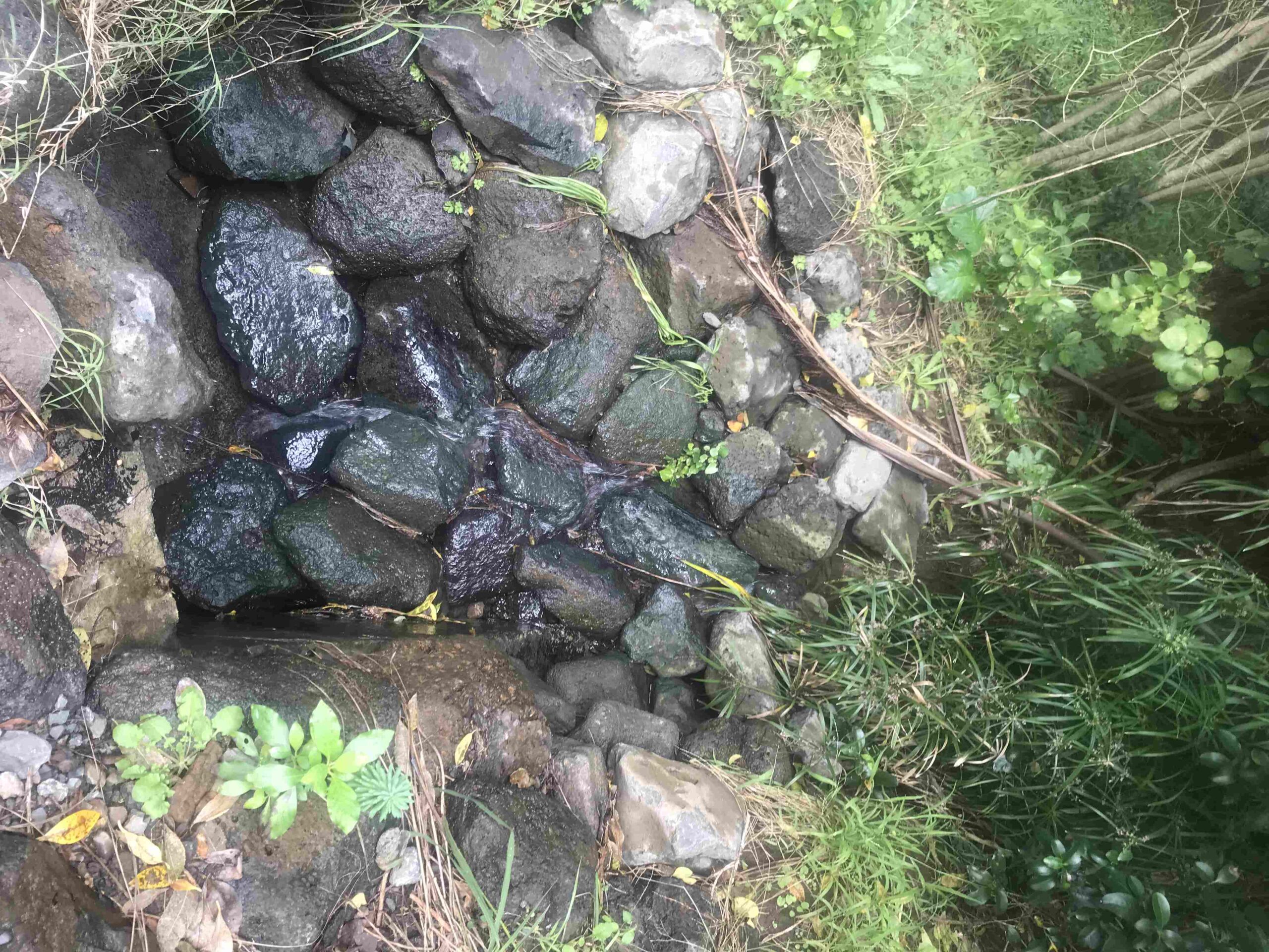
Swale with water runoff near Standen Ave
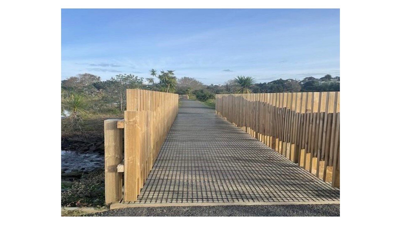
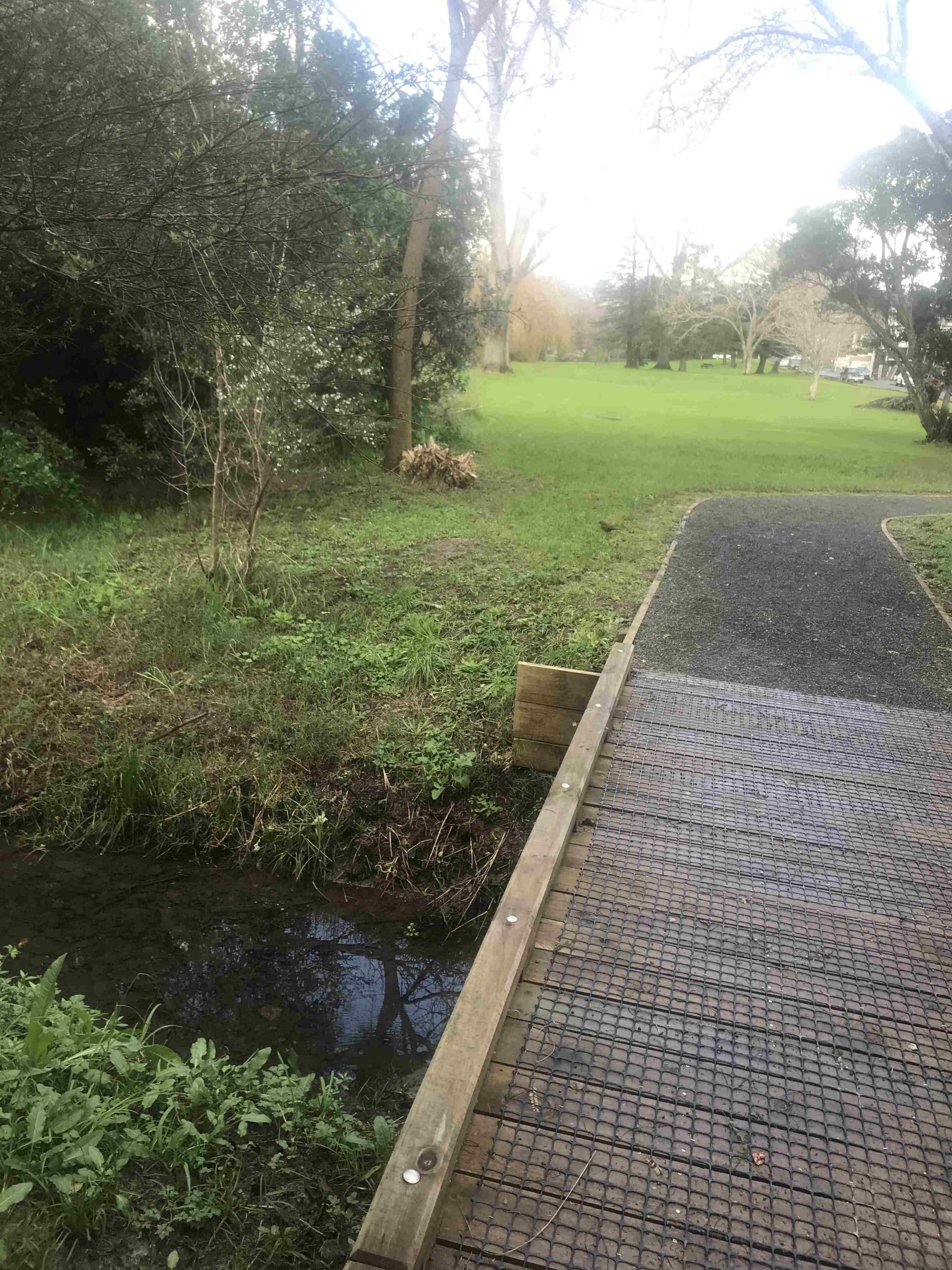
Waitaramoa bridge
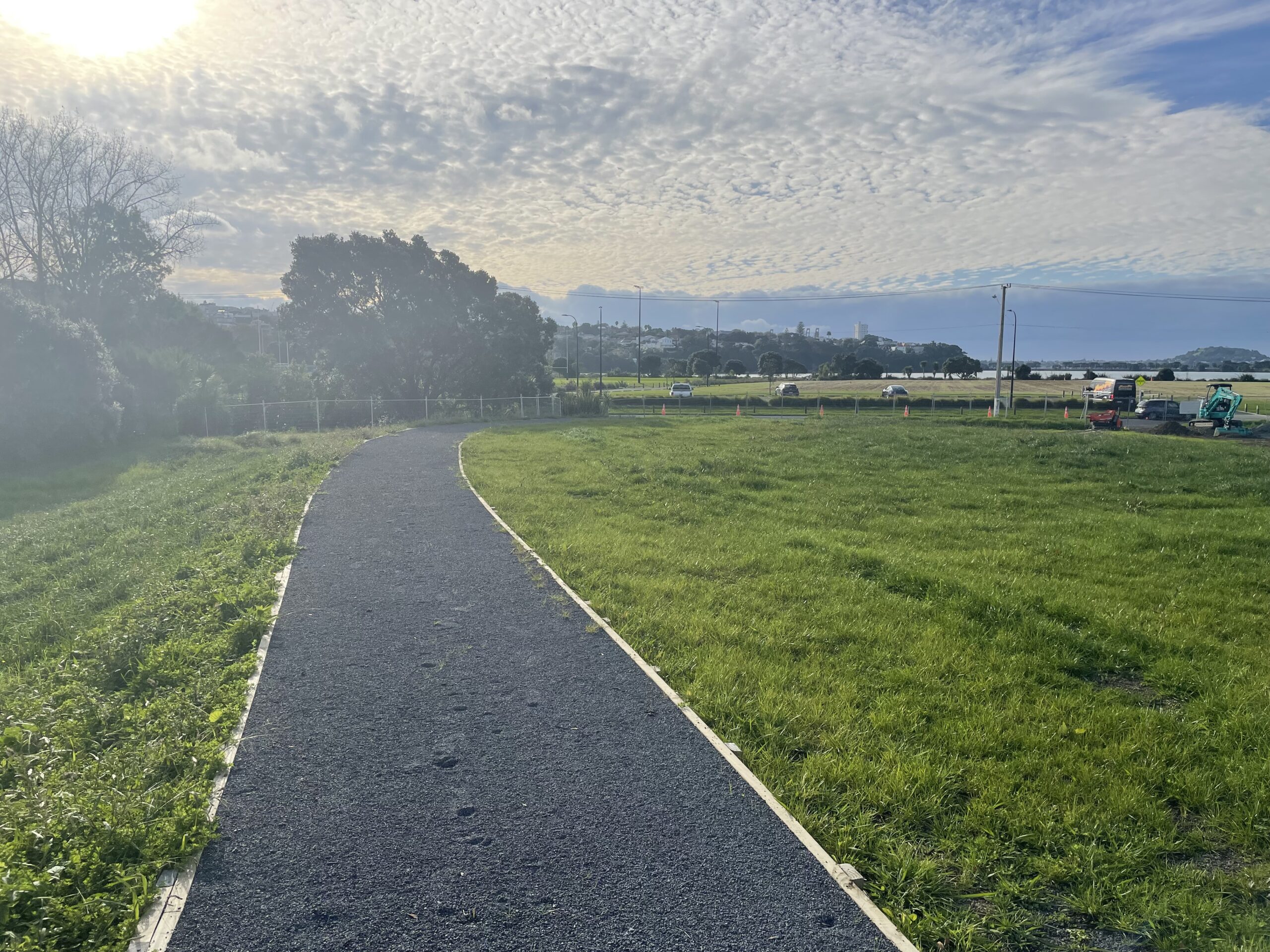
Walkway on Waitaramoa Reserve
The Waitaramoa Wetland Enhancement project started in 2021. Auckland Council’s comments:
The first step in the process was vegetation removal, which included the removal of 2000m2 of mangroves from the stream, 10 large crack willow trees and three Brazilian pepper trees, whose roots restricted stream flow. 7000m³ of silt was removed from the stream and reused to build a landform, or mound, on the Hobson Bay side of Waitaramoa Reserve. This mound will represent future flood levels over the next 100 years. At the same time, walking tracks and footbridges are being upgraded to enhance access and enjoyment of the area.
The final part of flooding mitigation involves raising the bottom section of Portland Rd, led by Auckland Transport. Auckland Council has worked “to reduce flooding in the area by removing silt and vegetation from the Portland Stream. This project will also enhance the Waitaramoa and Portland Reserves.”
The vegetation blocking the stream has been successfully removed. We have removed the trees that were blocking the stream flow. No native nesting birds were identified in any of the trees that were removed. Two native birds’ nests were found in other trees in the project area.
Our lizard survey team successfully captured and relocated nine copper skinks, three ornate skinks and a small number of plague skinks to other areas of the reserve outside of the works area.
Exclusion zones were established around the trees to minimise disruptions and the birds have now hatched. A 50m section of the stream was secured with nets to prevent fish and eels entering the operational zone. Approximately 170 fish, including shortfin eel, longfin eel and inanga were relocated outside of the netted area to allow us to safely remove silt from the stream.
The Council was on track to complete the project in July 2022 and to reinstate the area by planting 15,000 native plants and trees in April / May 2022. [i] It is unclear whether this has been achieved. (6) The latest report as of 20 May 2024 is that the project has been completed with construction finished in July 2023 and phase two planting in September 2023. Ngati Whatua will complete harakeke planting in 2024.
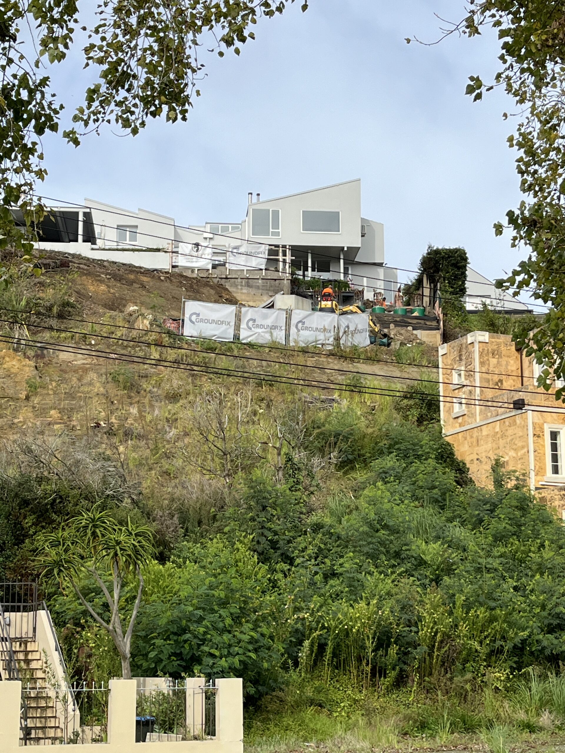
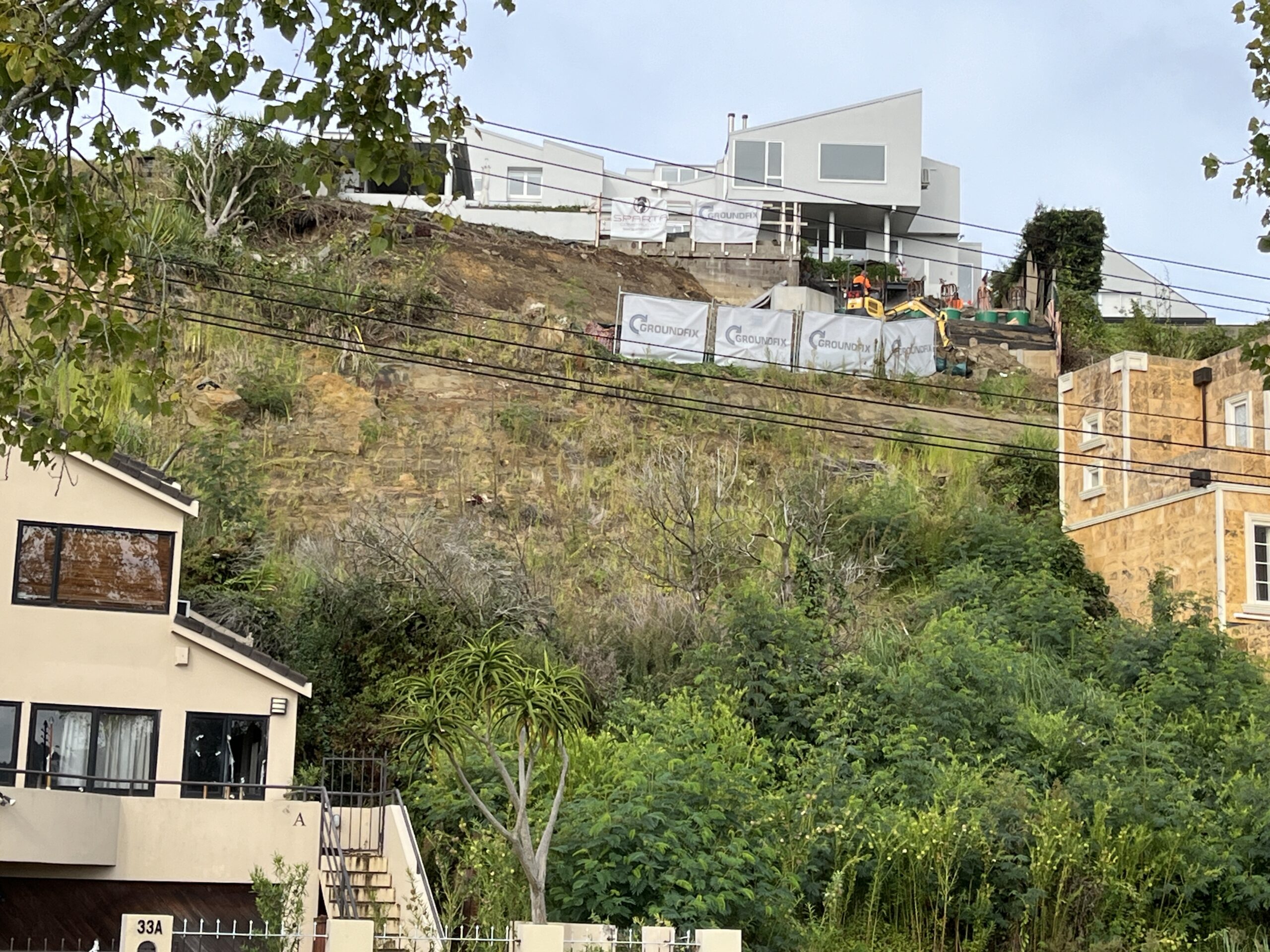
Shore Rd 33 demolition by T Sutcliffe

Shore Rd 33 demolition by T Sutcliffe
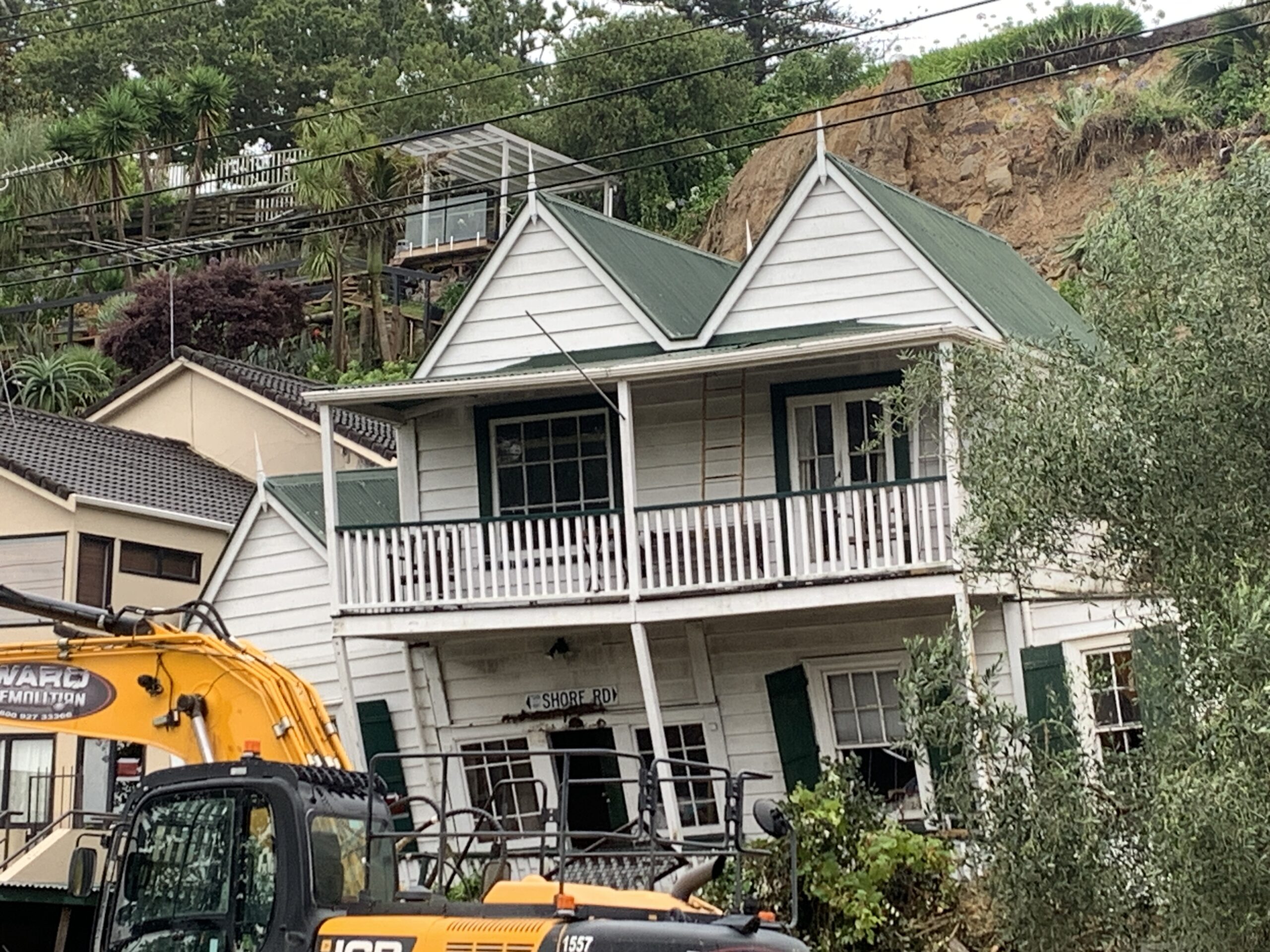
Shore Rd 33 demolition by T Sutcliffe
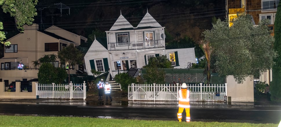
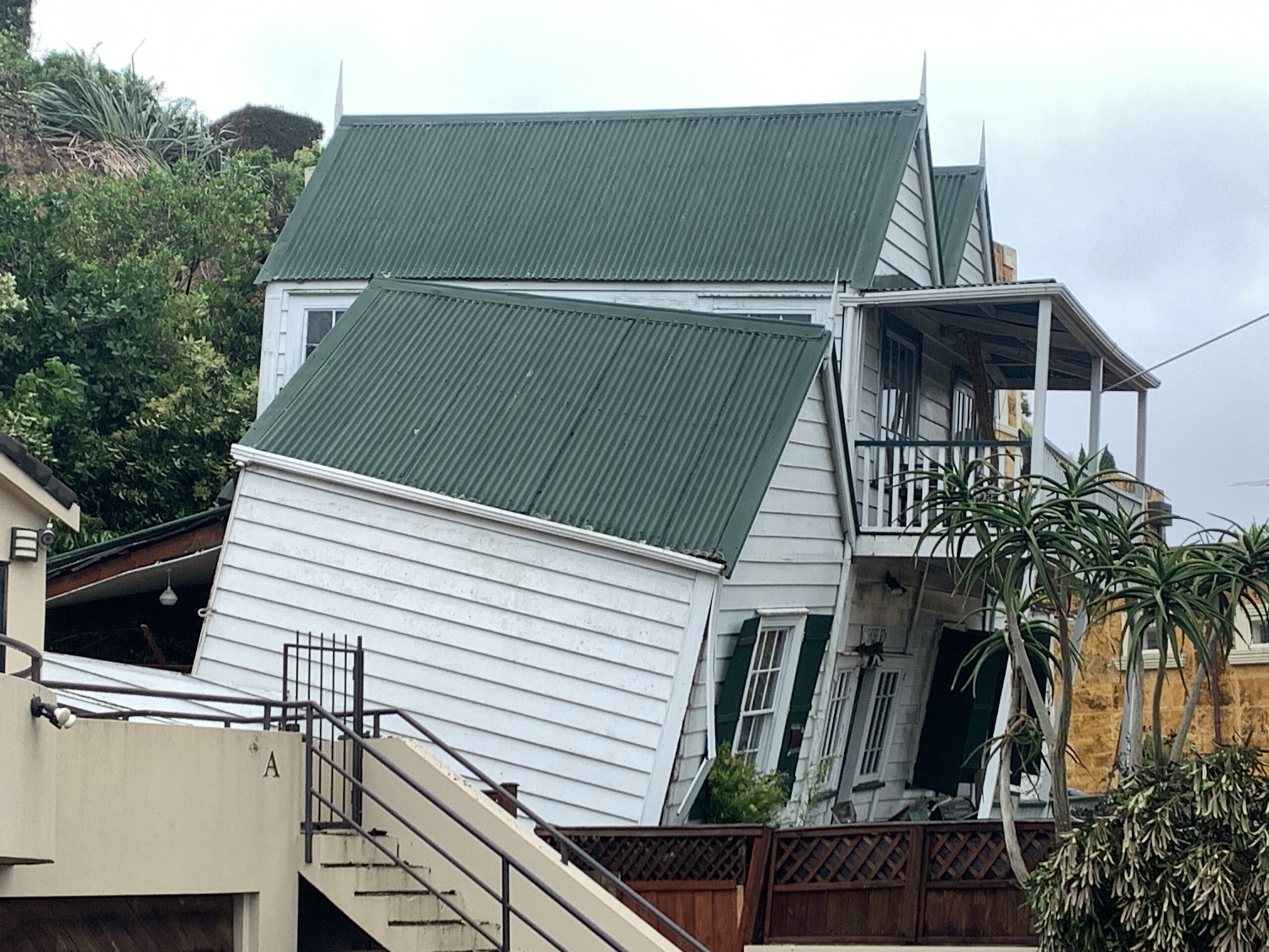
33 Shore Rd at night of landslip 27-28 Jan 2023
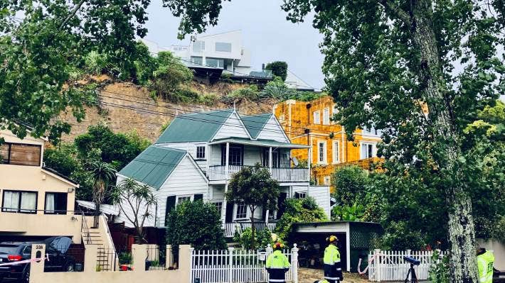
33 Shore Rd morning after landslide 28 Jan 2023
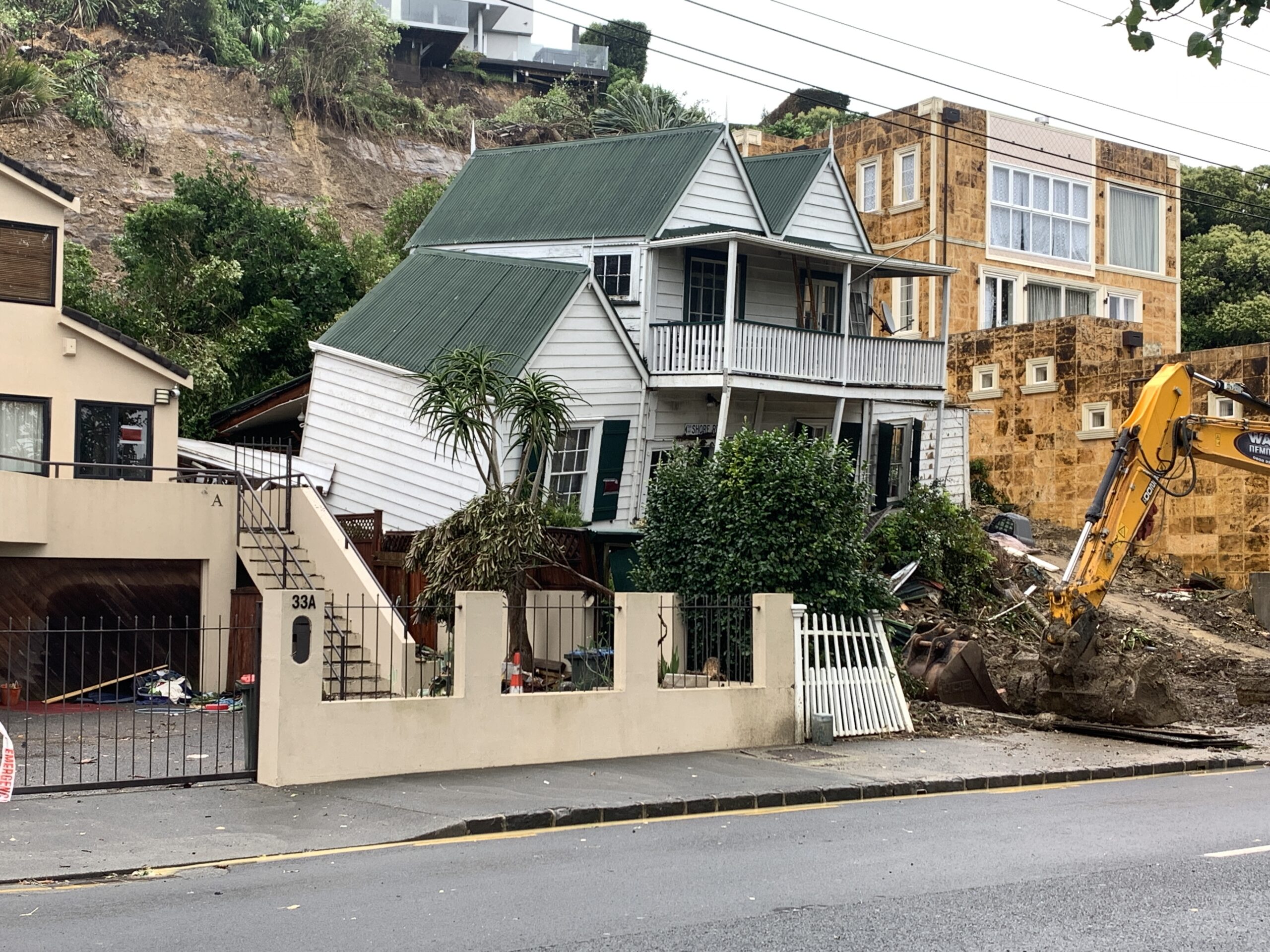
Shore Rd 33 demolition by T Sutcliffe
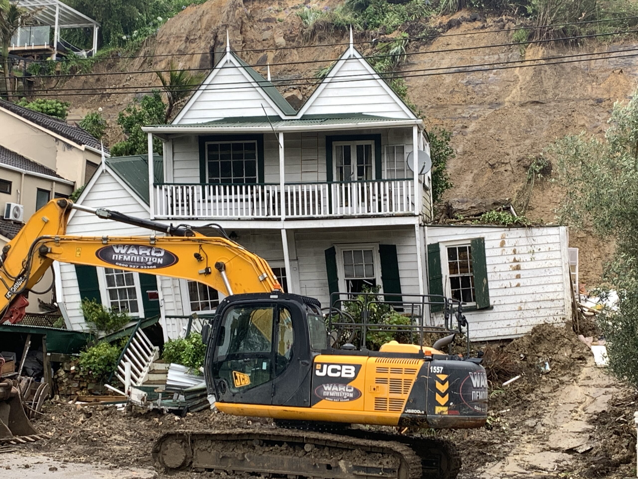
Shore Rd 33 demolition by T Sutcliffe
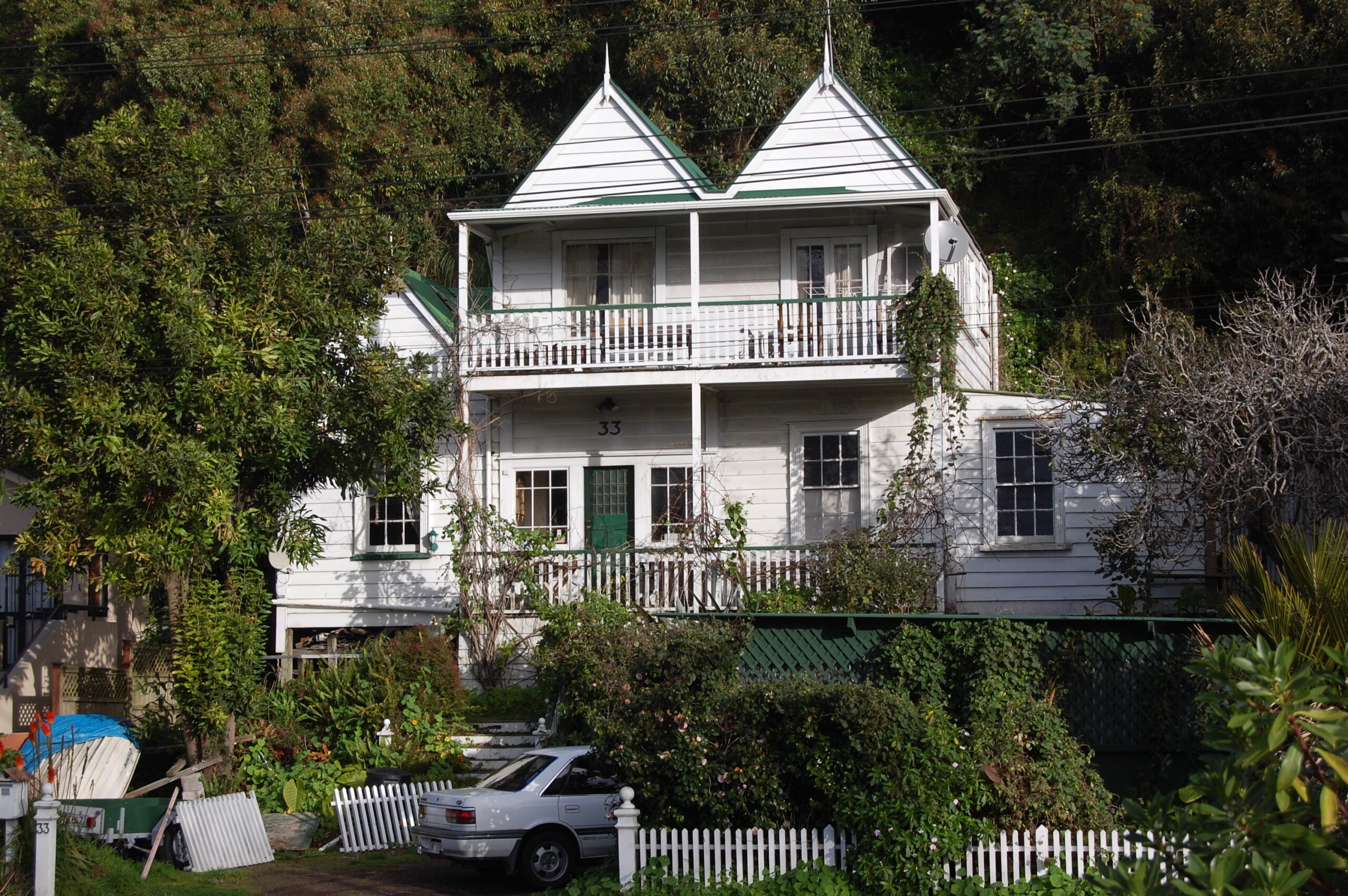
33 Shore Rd 2008 T Sutcliffe
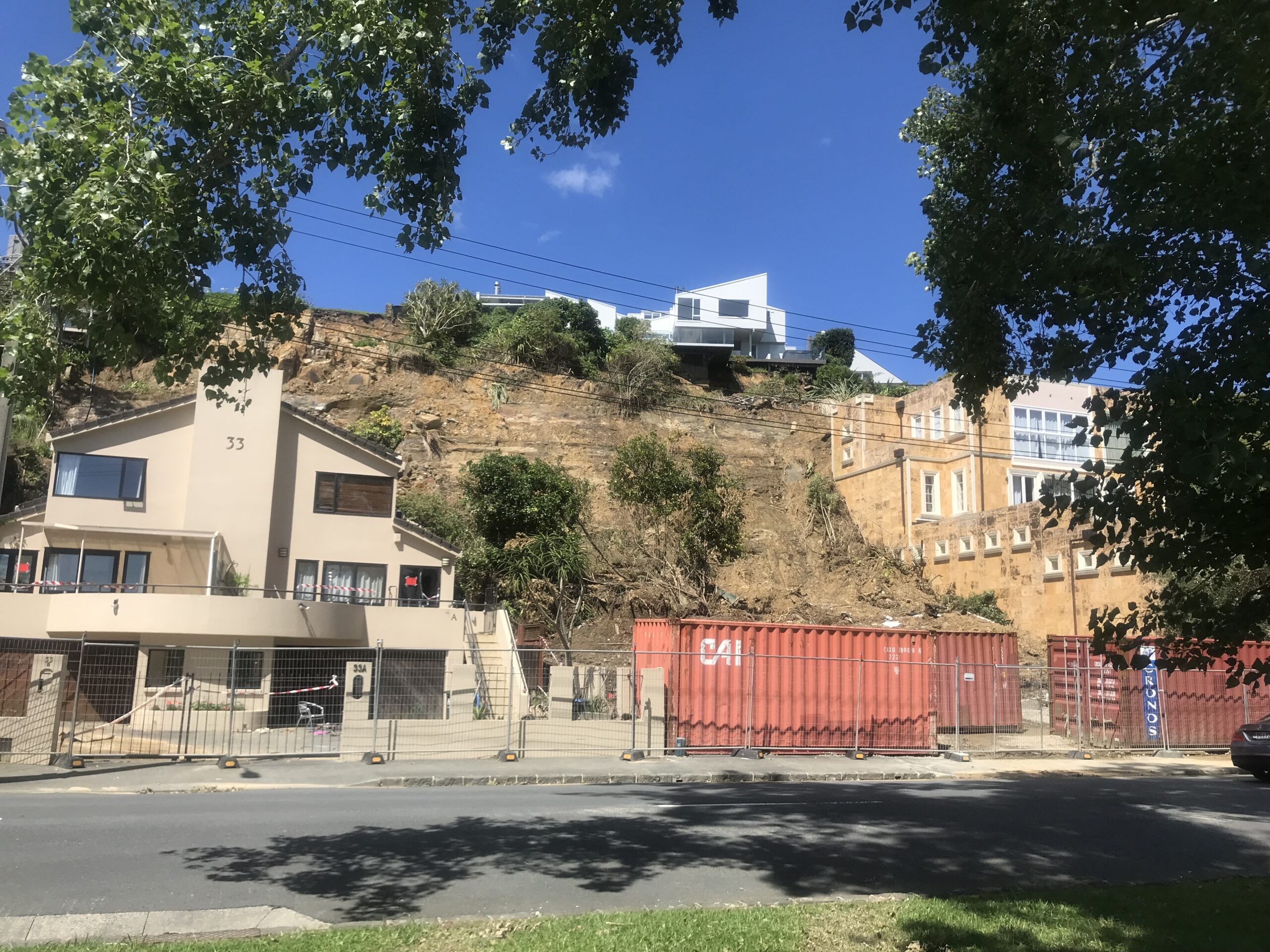
33 Shore Rd post demolition 17 Feb 2023 showing clifftop house designed by Claude Megson 1970s.
Apart from the flooding at the bottom of Portland Road, there has been a long history of flooding on Shore Road not too far away, resulting in the death of David Lennard in the Auckland Anniversary floods of 2023 when a landslide from above his house off Arney Road washed down and wiped the house out. These photos by Terry Sutcliffe show the damage done and the subsequent demolition.
The 1970s house in Remuera at 149a Arney Road, designed by architect Claude Megson, was renovated only in 2022 and sold thereafter.
But this was not the first time. In 1997, a similar landslide occurred when the house next door at 31 Shore Road owned by Robyn Mackay was badly damaged when the house immediately next door above slid down the hill and collapsed onto her house after torrential weekend rain.
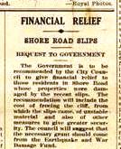
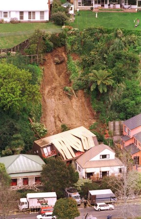
Shore Road Slips. Remuera Round 21 May 1947 Auckland Libraries Heritage Collections
Shore Road Slips. Remuera Round 21 May 1947 Auckland Libraries Heritage Collections
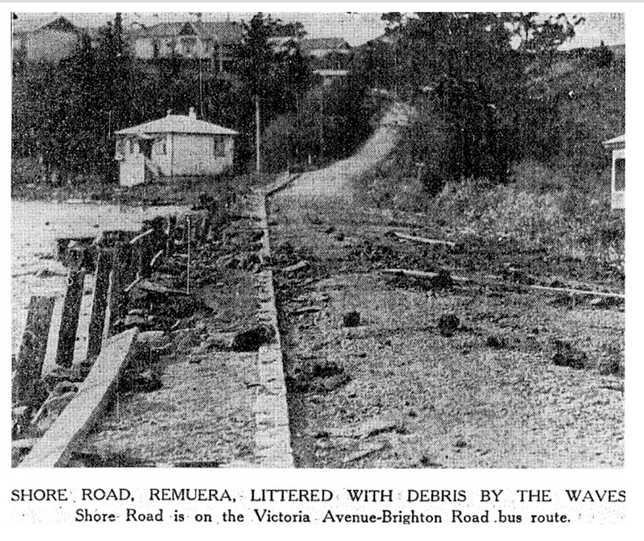
Shore Rd littered with debris by waves. NZ Herald 13 July 1926
And the same thing happened in 1947.
A group of houses in Shore Road. Remuera, below Arney Road, were in danger during the height of the storm when the soil slipped over the papa rock on the cliff behind and fell into their backyards. Most of the yards were filled with mud and at least one house suffered structurally. The week-end storm had brought a cavalcade of clay which poured into back gardens, walling up the exits. The householders carted clay through their places to the road frontage. [i]
Neither the Council nor central government accepted any responsibility under the Earthquake and War Damage Act.
The Remuera Round reported –
When the City Council sets to work to reclaim the swamp at the corner of Portland and Shore Roads for a recreation ground, it will be repeating history. In Remuera’s early days, says Mr George Cutler, an attempt was made to establish a cricket ground by draining the swamp. Private enterprise made the effort. To hold the creek back, a mud retaining wall, which still exists, was made, and a drain dug round the swamp on the back part of which there has been a flourishing Chinese garden. Floods in the creek, drainage from the back hill at times of heavy rain, defeated the enterprise, and no cricket pitch was ever laid. As has previously been described, that part of Shore Road skirting Hobson Bay was made by Reuben Scarborough under contract. He cut the start of the road through Morrin’s Hill, used the spoil to make up the road on the flat, faced the road on the seaward side with timber. Previously, Mr Cutler now explains, there had been a track, but as clay in winter washed down from Morrin’s Hill, its use was often a venturesome business. At time there would be clay mud four feet deep. That nearly caused a tragedy. Coming home one night, a man blundered into the clay, and when found next morning, he was stuck to his shoulders and exhausted. [ii]
When the City Council sets to work to reclaim the swamp at the corner of Portland and Shore Roads for a recreation ground, it will be repeating history. In Remuera’s early days, says Mr George Cutler, an attempt was made to establish a cricket ground by draining the swamp. Private enterprise made the effort. To hold the creek back, a mud retaining wall, which still exists, was made, and a drain dug round the swamp on the back part of which there has been a flourishing Chinese garden. Floods in the creek, drainage from the back hill at times of heavy rain, defeated the enterprise, and no cricket pitch was ever laid. As has previously been described, that part of Shore Road skirting Hobson Bay was made by Reuben Scarborough under contract. He cut the start of the road through Morrin’s Hill, used the spoil to make up the road on the flat, faced the road on the seaward side with timber.
In 2023 Geologist Martin Brook (Associate Professor and director of the Master of Engineering Geology degree at the University of Auckland) points a finger at the 1981 Local Government Amendment Act, specifically section 641A. That section effectively allows councils to permit building or rebuilding on unstable land but absolves councils from any civil responsibility. That get-out-of-jail-free card was introduced after the 1979 Abbotsford landslide in Dunedin. Miraculously, no one died when 18ha slid 48m down a hill in just 15 minutes, although some residents were injured. The tonnes of rubble, sand and earth took with it 68 houses, sparking a Commission of Inquiry. But rather than banning the rebuilding of housing on unstable land, section 641A acts to protect councils from claims. (7, 8)
Shore Rd houses 19 April 2024
Shore Rd houses 19 April 2024
In April 2024 a retaining wall is being built on the clifftop and 33 Shore Road is covered in vegetation.
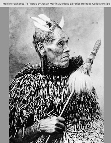
Mohi from John Stacpoole's Sailing to Bohemia. Puriri Press, 2007
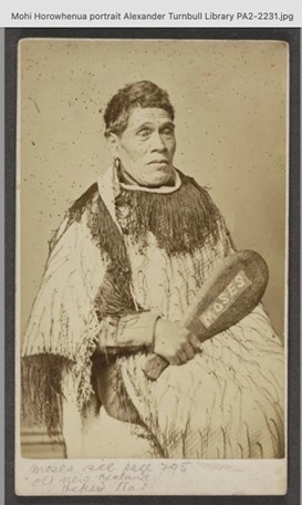
Mohi from John Stacpoole's Sailing to Bohemia. Puriri Press, 2007
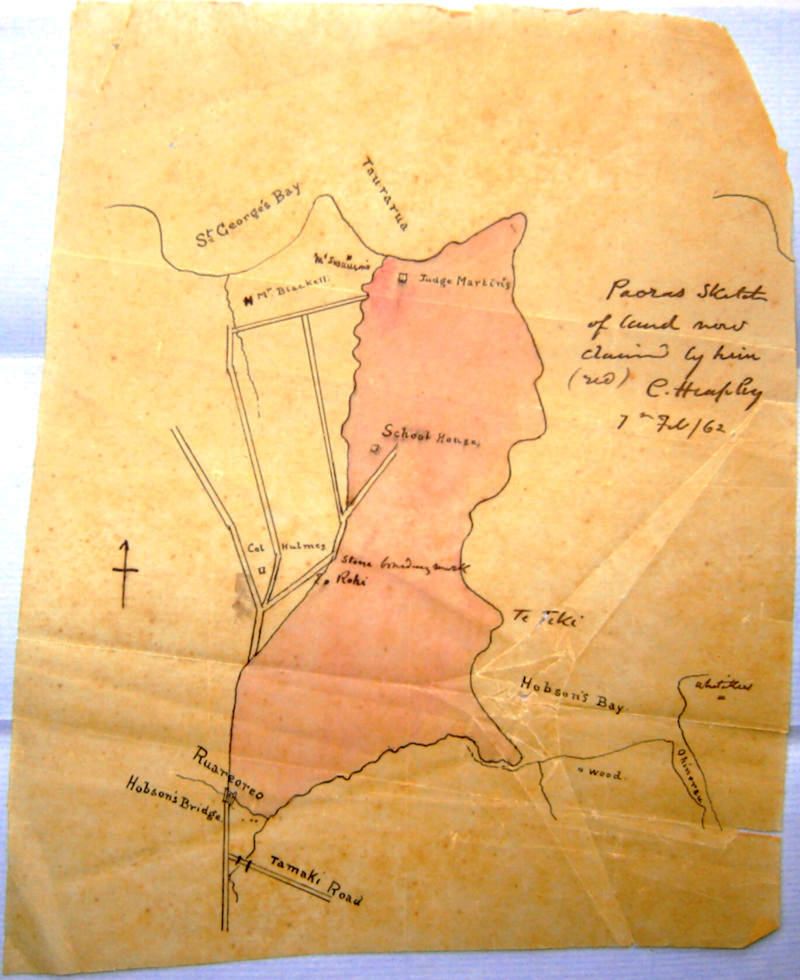
Hobson Bay1862 - C Heaphy's Map owned by Dave Lennard 33 Shore Rd
Tenders for dwelling in Remuera by Reader Wood Daily Southern Cross 22 Dec 1857
Before the reclamation of Shore Road from the 1950s to today, there was an interesting history about Shore Road in the 19th century.
William Swainson was a lawyer and the second Attorney General in New Zealand in 1841. He had a house which he brought out from England and established on Taurarua, the headland overlooking Judges Bay. He is remembered from the fact that when the tide suited, he used to come up to “town” by “pulling boat”, his boatman named Mohi.
Mohi was described as having charming manners— “quite an institution of the time. Mr Swainson used to go to town by pulling boat when the tide suited, and Mohi, dressed in spotless white with blue facings, was his trusty boatman.” (9)
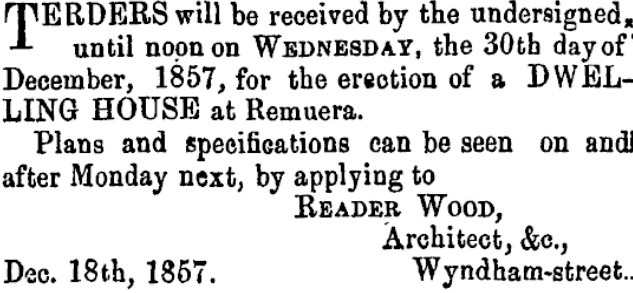
A cottage on Shore Road was Mohi’s home and may well have been on the site at 33 Shore Road built by architect Reader Wood in the late 1850s.(10)
The map by Charles Heaphy shows Taurarua with the site of the home of Judge Martin and at the bottom near Hobson Bay a marker that says Wood. This is the site of the cottage built by architect Reader Wood in the late 1850s.
Auckland Domain 1877-1914
Hobson Bay with Mt Hobson, Mt Eden far right, Shore Rd. J Richardson 1931. Auckland Libraries Heritage Collections
Hobson Park on Market Road Remuera
Hobson Park Waitaramoa
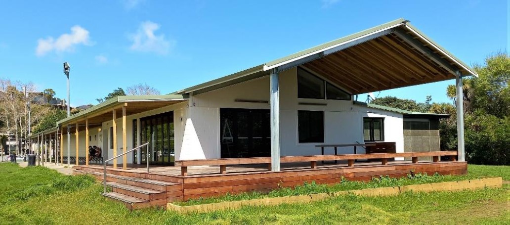
PCC Clubhouse with new extension
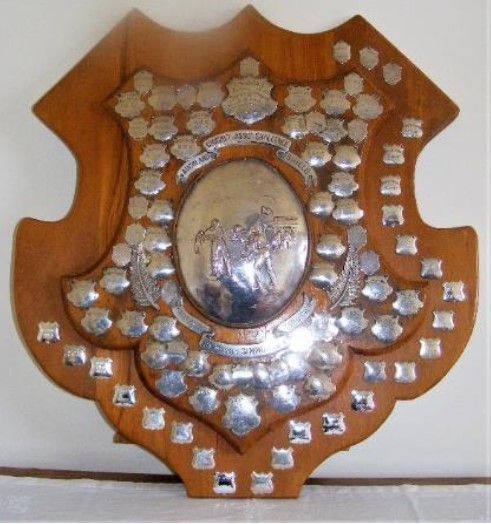
Simmons & Osborne Trophy - Auckland Cricket's Club of the Year
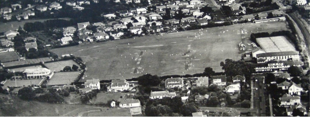
Established in 1858, the Parnell Cricket Club is the oldest in New Zealand. The PCC had several homes – Albert Barracks, Auckland Domain, Eden Park, Hobson Hockey Park, and Orakei Domain.
The Remuera Parnell Sports Club was created in 1948 and based at Thomas Bloodworth Park – on just a pocket of grassed reclamation on Shore Road, at the bottom of Ayr St and Brighton Road. Through the 1960/70s, a considerable amount of soil was dumped but, apart from the formation of a rugby practice field, no effort was made to form other sports fields or landscape the eyesore.
In 1999 Auckland City Council announced that a partial reclamation of Hobson Bay was about to commence, that sports fields would be prepared, and would Parnell CC like to be the principal summer user of this new park – Shore Road Reserve? Auckland City Council did an excellent job of extending the reclamation, landscaping it, building a changing room block and formed a sports field that would accommodate two cricket fields for summer use and three rugby fields for winters. By the 2001/02 season, these fields were ready for cricket and Parnell played its first game against Papatoetoe Cricket Club.
In 2015 Auckland Council renovated – ie leveled and sand-carpeted 2/3rd of the outfield surface. More recently, the further 1/3 of the outfield has been sand-carpeted.
Parnell Cricket Club today is a premier men’s and women’s club, and for the third time in 5 years, Parnell CC was awarded the Simmons and Osbourne Trophy – Auckland’s Cricket’s Club of the Year: 10 times now in the 98 years since the trophy was inaugurated.
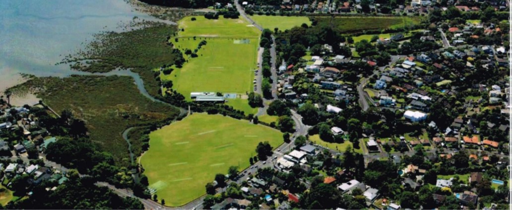
The 3 sports fields, Thomas Bloodworth Park, Shore Road Reserve, and Shore Road (still to be renovated) plus the passive Waitaramoa Reserve deserve an overall name to save confusion.
Currently, there is a proposal to change the name of the multiple parks on Waitaramoa Hobson Bay – including on Hobson Bay, Shore Road, Shore Road Reserve, Shore Road East, Thomas Bloodworth Park, the Remuera or Ōhinerau or Portland Streams and Waitaramoa Reserve and Portland Reserve in Remuera. The proposed name is Hobson Park Waitaramoa. This would align with the name of Waitaramoa Hobson Bay which consolidated the different named parts of the coastline.
The name of HOBSON PARK / WAITARAMOA has been proposed to the Orakei Local Board and is under consideration.
Special thanks to Bryan Haggitt for the story on Parnell Cricket Club.
Subscribe to our newsletter to keep up to date.
[1] “George Graham’s Maori Place Names of Auckland”. Records of the Auckland Institute and Museum. 16: 11–39. ISSN 0067-0464. JSTOR 42906272.
[2] https://www.pourewa.nz/wp-content/uploads/2022/10/Ch-1-The-Pourewa-Valley-Story.pdf (John La Roche)
3 https://remueraheritage.org.nz/story/2013-visit-to-baradene-college/
4 https://teara.govt.nz/en/biographies/2m52/mitchelson-edwin
5. Evening Post, Issue 20, 23 July 1909, Page 3
7. https://paperspast.natlib.govt.nz/newspapers/NA19470421.2.19. Northern Advocate, 21 April 1947, Page 2
8. Remuera Round August 28, 1947. Kura. Auckland Libraries Heritage Collections
9.https://paperspast.natlib.govt.nz/newspapers/NZH19230707.2.166.22
10. New Zealand Herald, Volume LX, Issue 18445, 7 July 1923, Page 4 (Supplement)
