The Great Māori Feast at Remuera
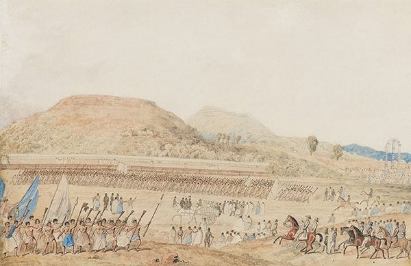

Joseph Jenner Merrett, 1816-1854, Native feast held at Remuera, Auckland, New Zealand. May 11, 1844.
In May 1844, an exceptionally large gathering of Māori took place at Remuera for a great feast, known as a hākari. In attendance were manuhiri (guests) from Tāmaki-Makaurau, the Waikato, and Bay of Plenty, along with the Governor of New Zealand and his officials. In the 19th century, there were many spectacular feasts or hākari, which drew the attention of colonial observers, commentators, and artists.
Williams’s Māori dictionary defined hākari as:
- Gift, present
- Entertainment, feast
- High wooden framework on which food was placed at a feast.
The Remuera hākari in May 1844 was variously described as:
- Hākari – feast or structure for a feast [http://www.TeAra.govt.nz/en/artwork/24539/hakari-stage]
- Paremata – repayment; parliament or a formal conference for the discussion of public affairs. [Stone R C J. From Tamaki-Makau-Rau to Auckland. Paremata]
- The Māori Feast at Remuera. [Merrett, Joseph Jenner, 1815-1854; Maori feast at Remuera. Star Steam Printing Company lithograph, 1890]
- The Great Feast of Remuera. [The Great Native Feast of Remuera. Advertisement for Brett’s Auckland Almanac for 1890]
- The New Zealand festival. [Day & Haghe, Lithographers to the Queen, London]
- The Native feast held at Remuera. [J.J. Merrett, (Joseph Jenner), 1816-1854, Native feast held at Remuera, Auckland, New Zealand. May 11, 1844]
There has been some debate as to whether it was the Waikato tribe or Ngāti Whātua who hosted the feast. Whereas an original painting of the feast from 1844 shows Ngāti Whātua as welcoming the guest of honour, Governor Fitzroy, an 1890 lithograph states that the feast was given by Te Wherowhero of Waikato. But it may well have been a demonstration of agreed mutual cooperation and collaboration between the two key iwi of Tāmaki Makau Rau.
The Remuera hākari was the subject of a well-known watercolour by artist Joseph Jenner Merrett who observed the feast on the day of 11th May 1844.
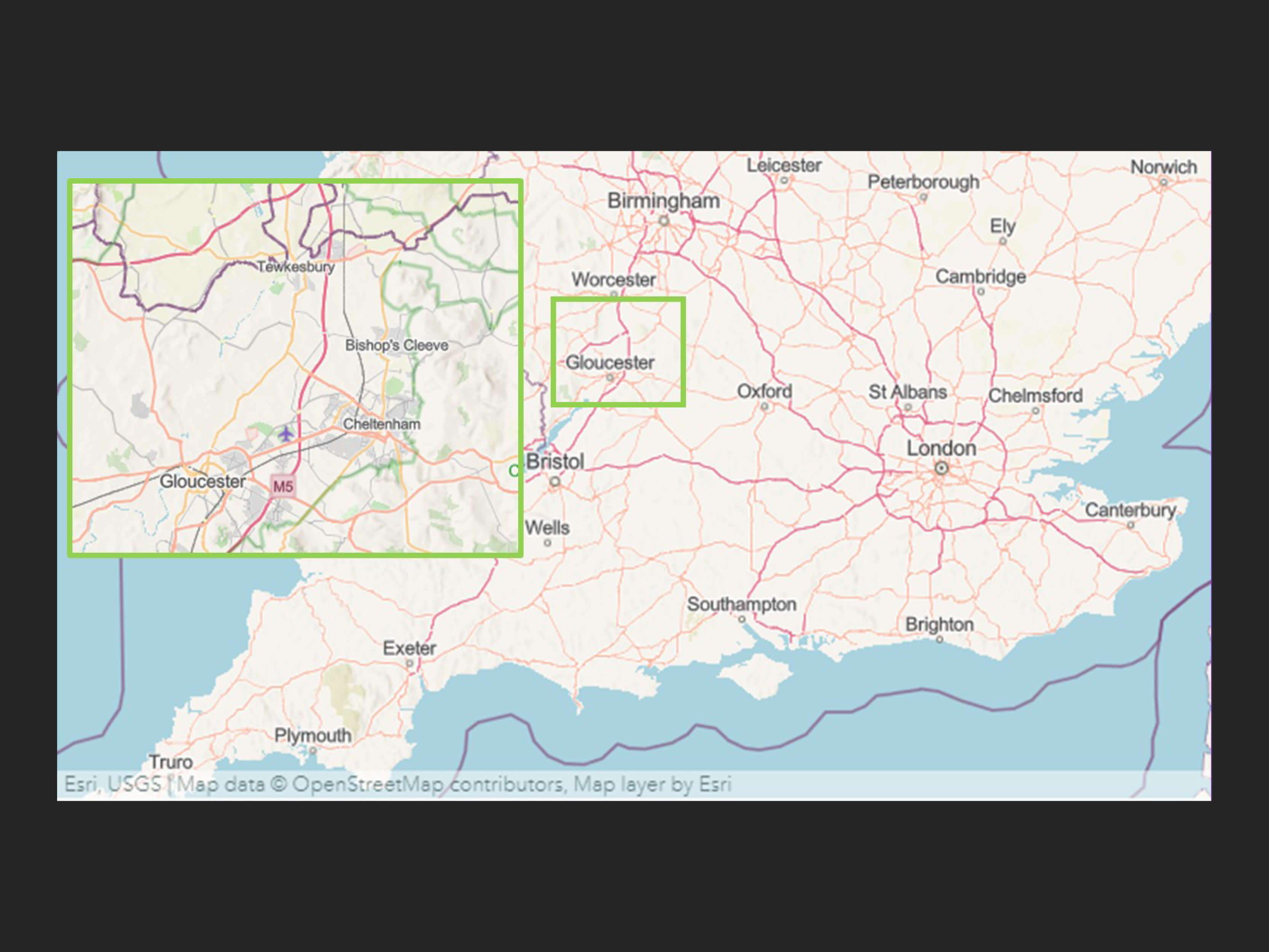
Tewkesbury, Gloucester, England
Joseph Jenner Merrett
Merrett was born in Tewkesbury, Gloucester, England, 18 December 1815, to William, a grocer, and Elizabeth Merrett. He was resident in Australia, and then Auckland by 1841. In 1841 he travelled in the central North Island with Captain William Symonds, Chief Magistrate and Assistant Surveyor General, the German naturalist Ernst Dieffenbach and Ensign Abel Dottin Best, to make sketches of places visited, people and things encountered and notable events and experiences, both for personal record and for possible use in publications.
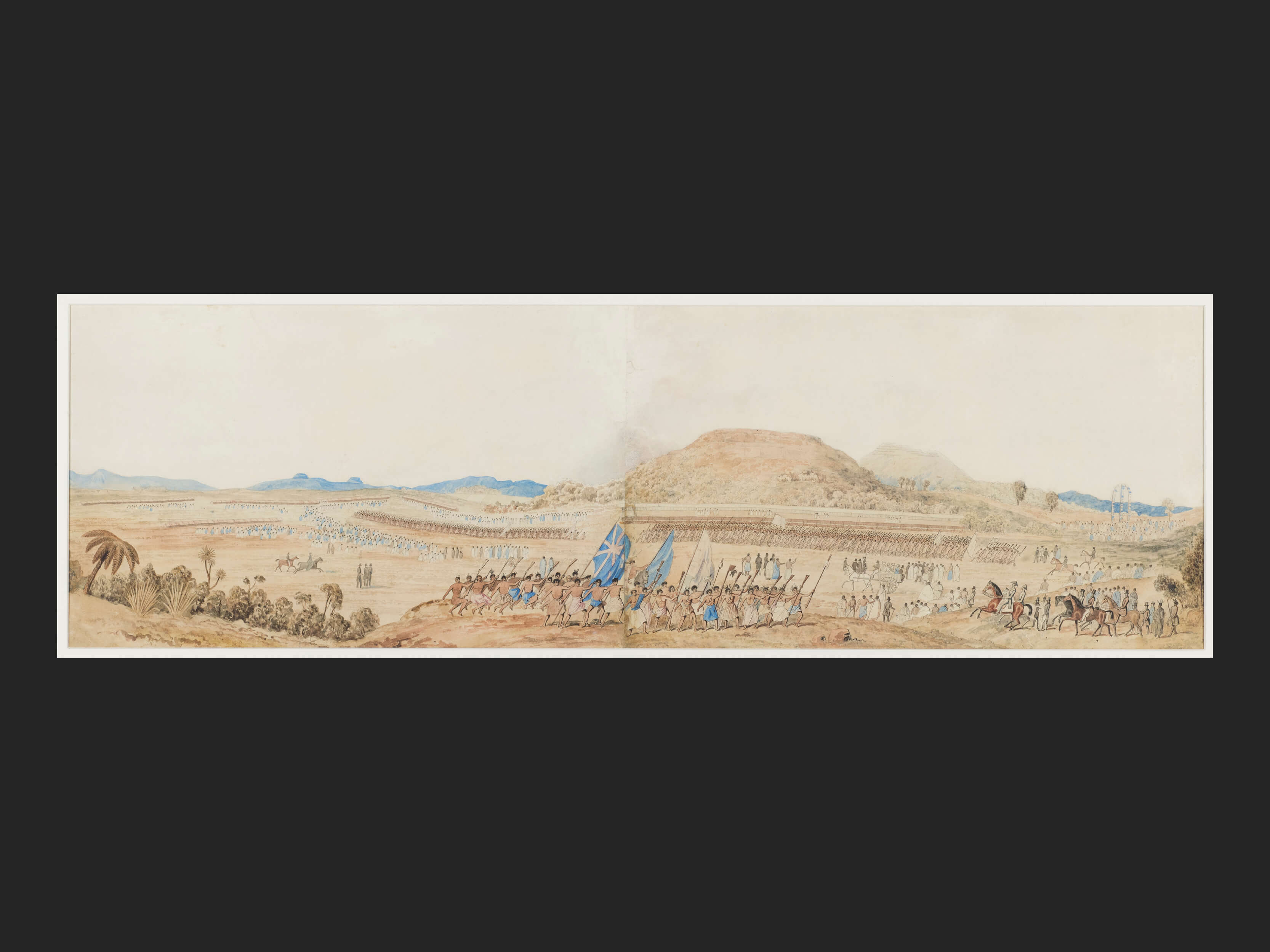
Joseph Jenner Merrett, 1816-1854, Native feast held at Remuera, Auckland, New Zealand. May 11, 1844. Hocken Collections, University of Otago Uare Taoka o Hākena
His best-known work is the painting called “Native Feast held at Remuera, Auckland. New Zealand. May 11th 1844.” He was present on the historic occasion of the hākari feast and resided at Auckland until l847. He documented not just the scale of the event but also its political importance between Māori and pākeha.
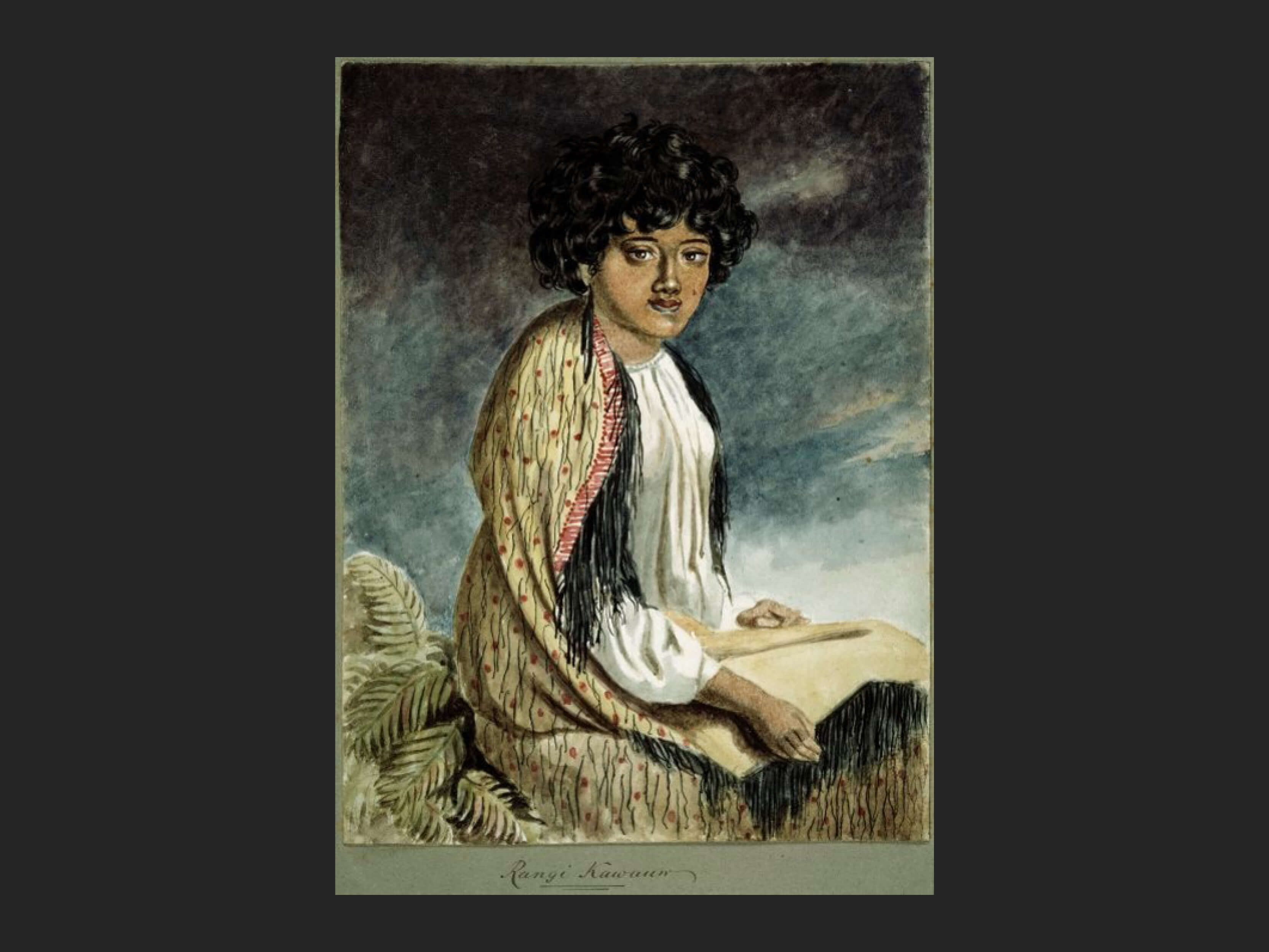
J J Merrett. Rangi Kawauw. c.1842. The Hobson Album. Alexander Turnbull Library.
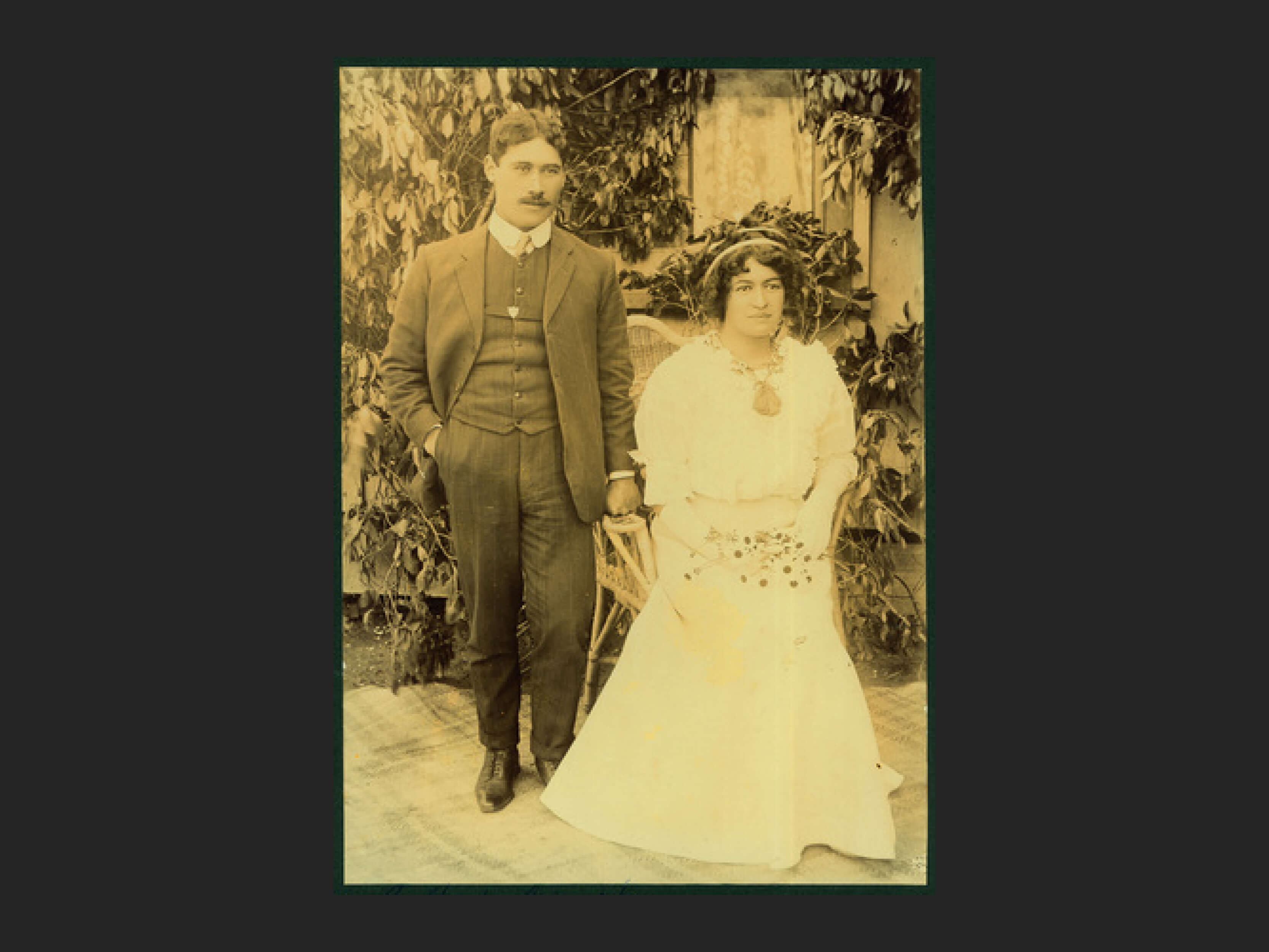
Gilbert and Ngahuia
Joseph Jenner Merrett married Maria Rangitetaea Koa in 1842 when he was 27 years old and she was 22. She was born about 1820, died in 1912 and was a descendant of Koura of the hapū Ngati Koura located at Kihikihi and Whatawhata. There are indications that Rangitetaea lived, married, and had a family in the Waikato, and came from land at Te Akau north of Raglan Harbour. Joseph and Rangitetaea had 3 children: Ani (Annie) Gage (born Merritt), Joseph Hohepa Merrett and Henare Mereti Merritt.
Source:
- First pictorial records of Waipa – J J Merrett. Footprints of history. Mary H Hurst. Journal of the Te Awamutu Historical Society, P193-198.
- But who was Rangi Kawauw? Dorothy Pilkington. The Manawatu Journal of History, Issue 15, 2019.
While there don’t seem to be any photographs of Joseph Merrett and Rangitetaea, this one of their grandchildren Gilbert and Ngahuia was found in the Auckland Museum through a search of DigitalNZ.
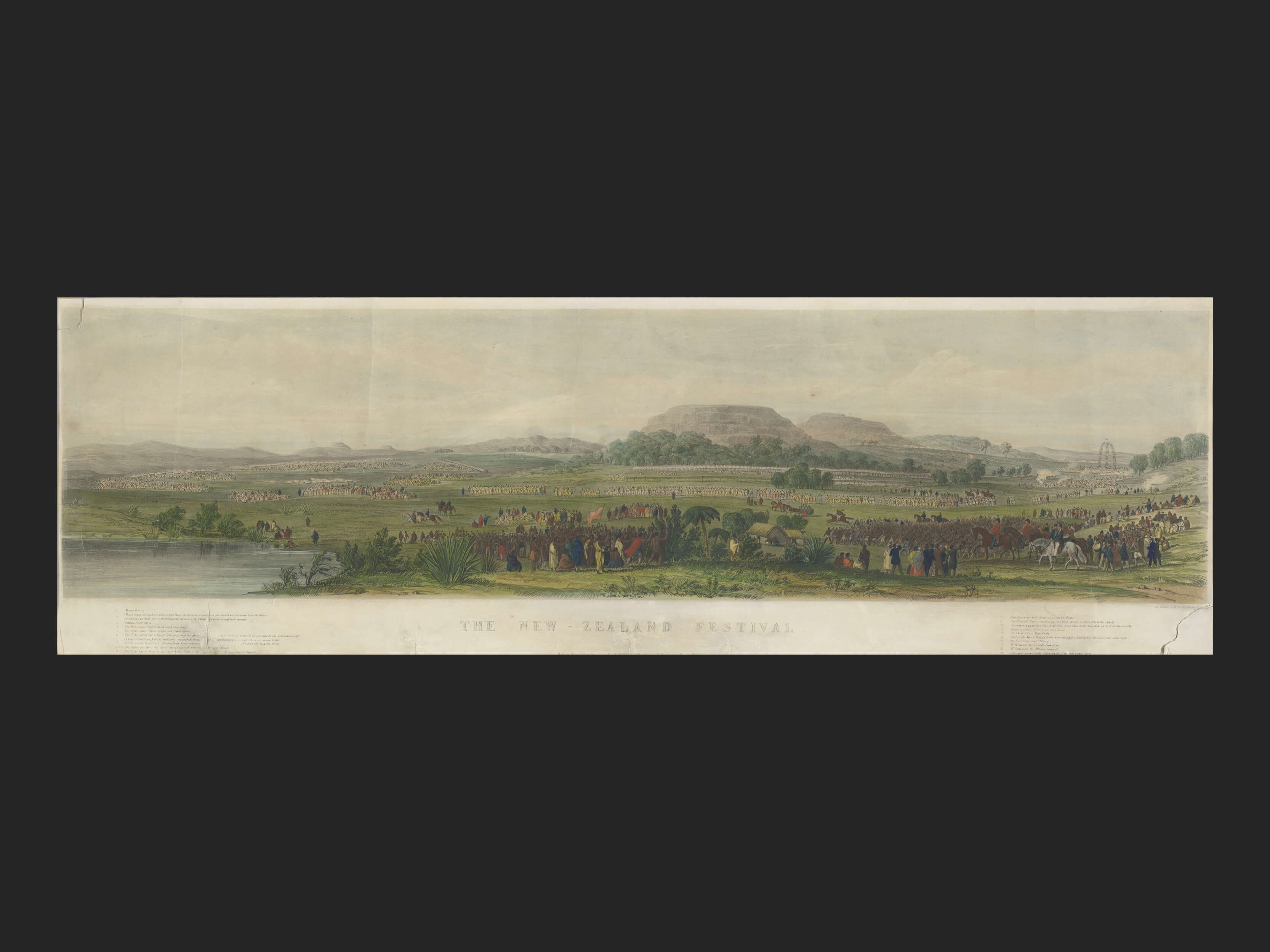
Lithograph of the Merrett watercolour. The New Zealand Festival, by Day & Hague, Samuel Tegg. Hobart, 1845.
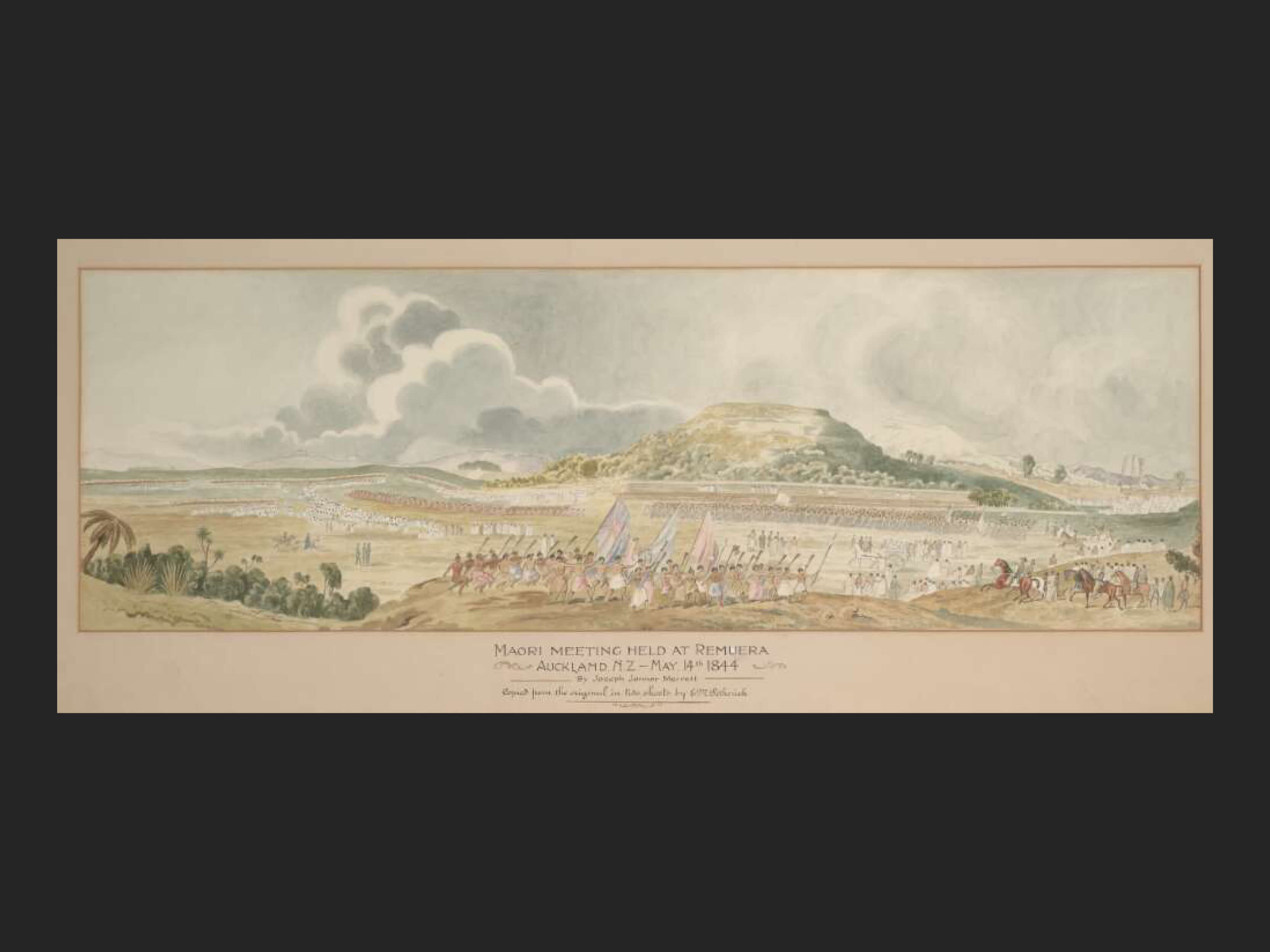
The E M Petherick copy of the original Merrett painting
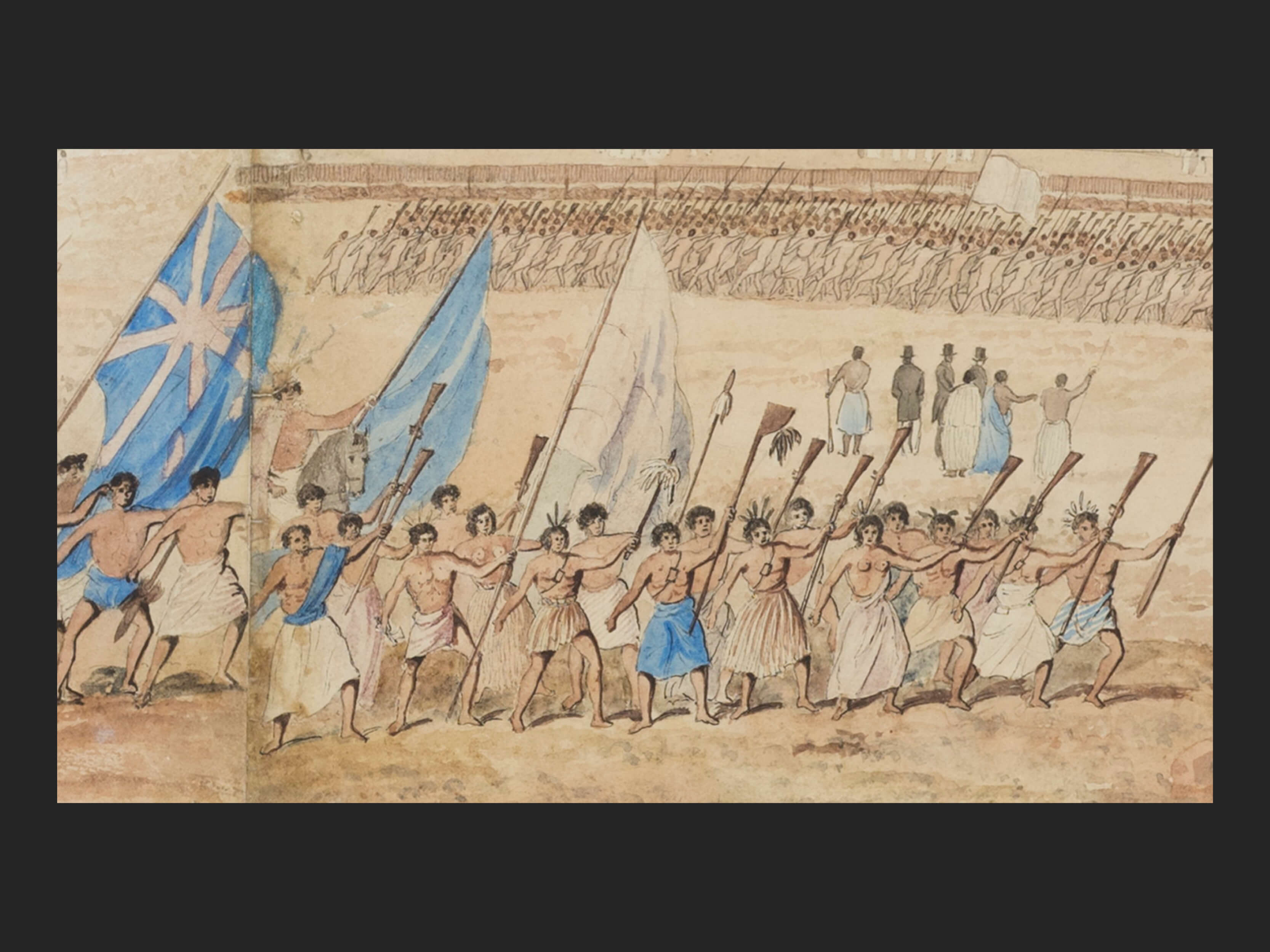
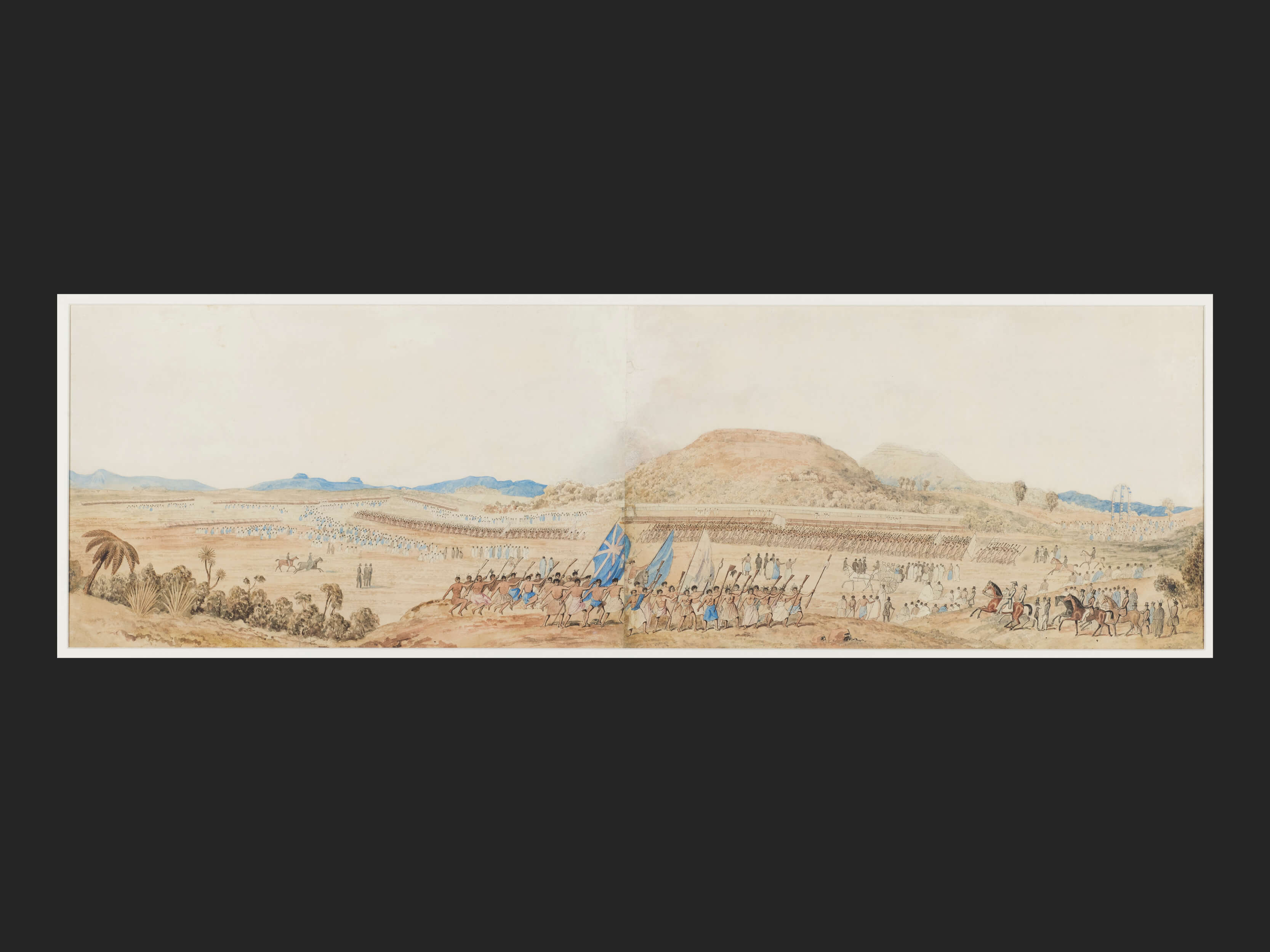
Extract from original watercolour by Joseph Merrett 1844.
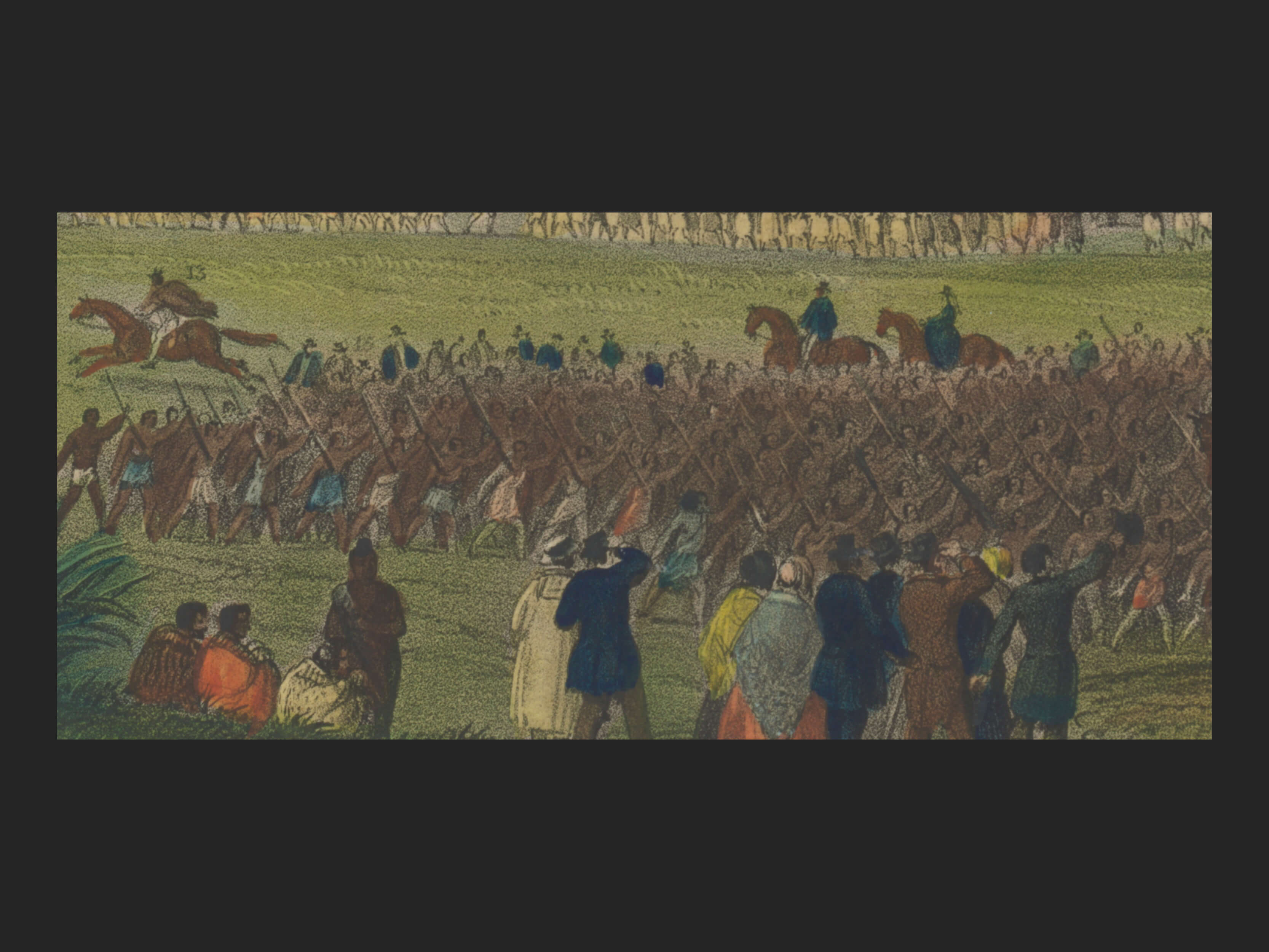
Extract from the lithograph by Day and Hague 1845
The Merrett Artwork
At some point in 1845, Joseph Merrett shipped his painting to Hobart, Tasmania to Samuel Tegg who then took it to London to be lithographed by Day and Haghe. Louis Haghe and William Day specialised in lithography of architectural and topographical views and scenes. They pioneered chromolithography as well as hand-tinted lithographs. Their work was so technically superior that in 1838, they were appointed ‘Lithographers to the Queen’ (Victoria).
Also in the National Library of Australia is a rather prettified watercolour copy of the original Merrett painting. This was done by E M Petherick (undated but record says 19-?) and was titled – Māori meeting held at Remuera, Auckland n.z. May, 14th 1844 By Joseph Jenner Merrett, Copied from the original in two sheets by E. M. Petherick.
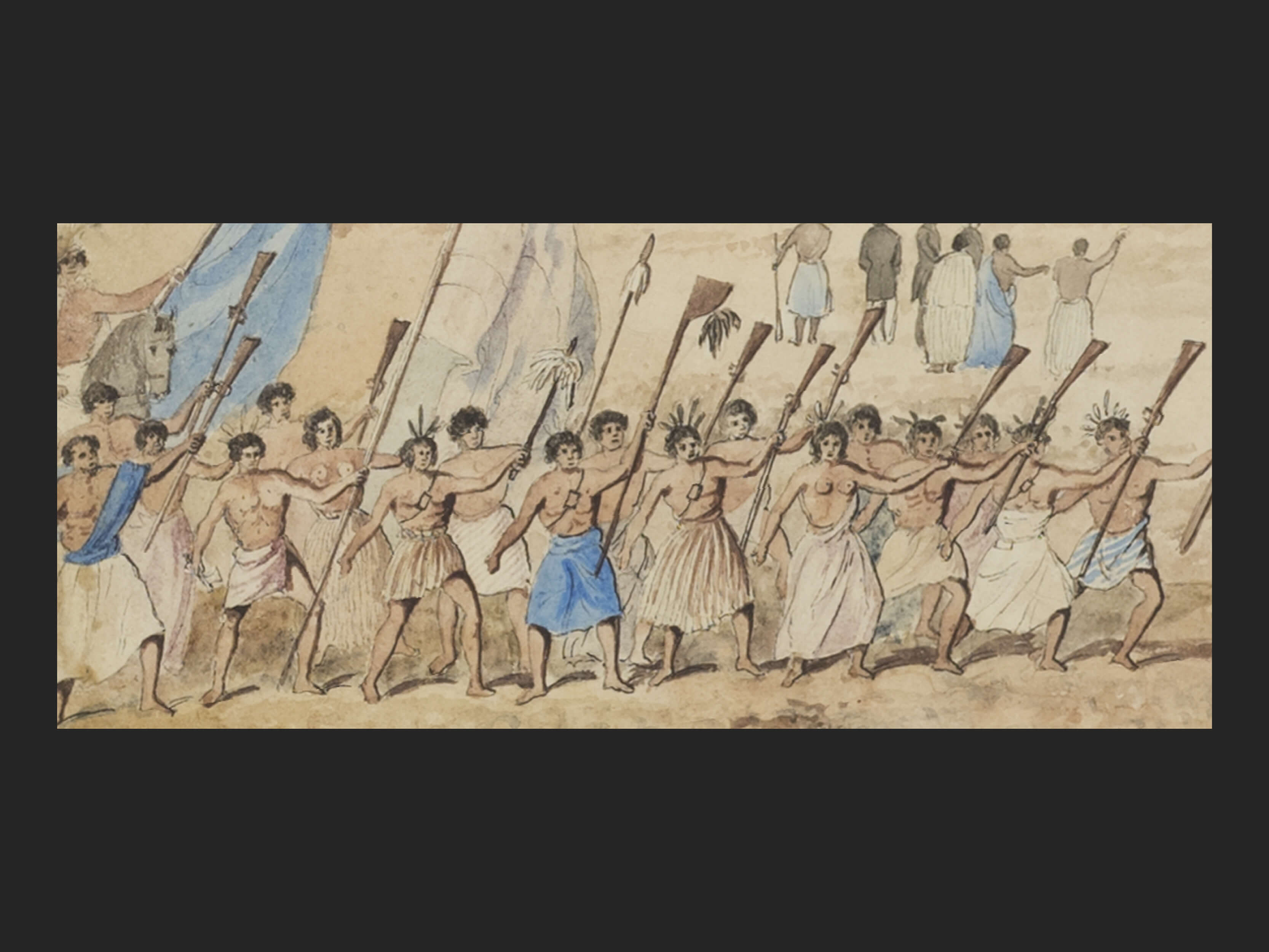
There are differences between the original watercolour by Merrett and the lithograph. In the watercolour the welcoming haka party and the crowd of armed Māori loom much larger in the composition (the haka in the centre foreground rather than the right mid-ground), and Fitzroy’s horse rears up. The watercolour has a very lively looking group of about thirty-five Māori with muskets doing a haka – three are holding large blue and/or white flags and two appear to be women.
The crowd behind them appear to be holding up muskets also. The lithographer has downplayed the sense of animation of the Māori figures in favour of a more orderly and calmer scene, in which attention is directed towards Fitzroy, as if he were presiding over the event.
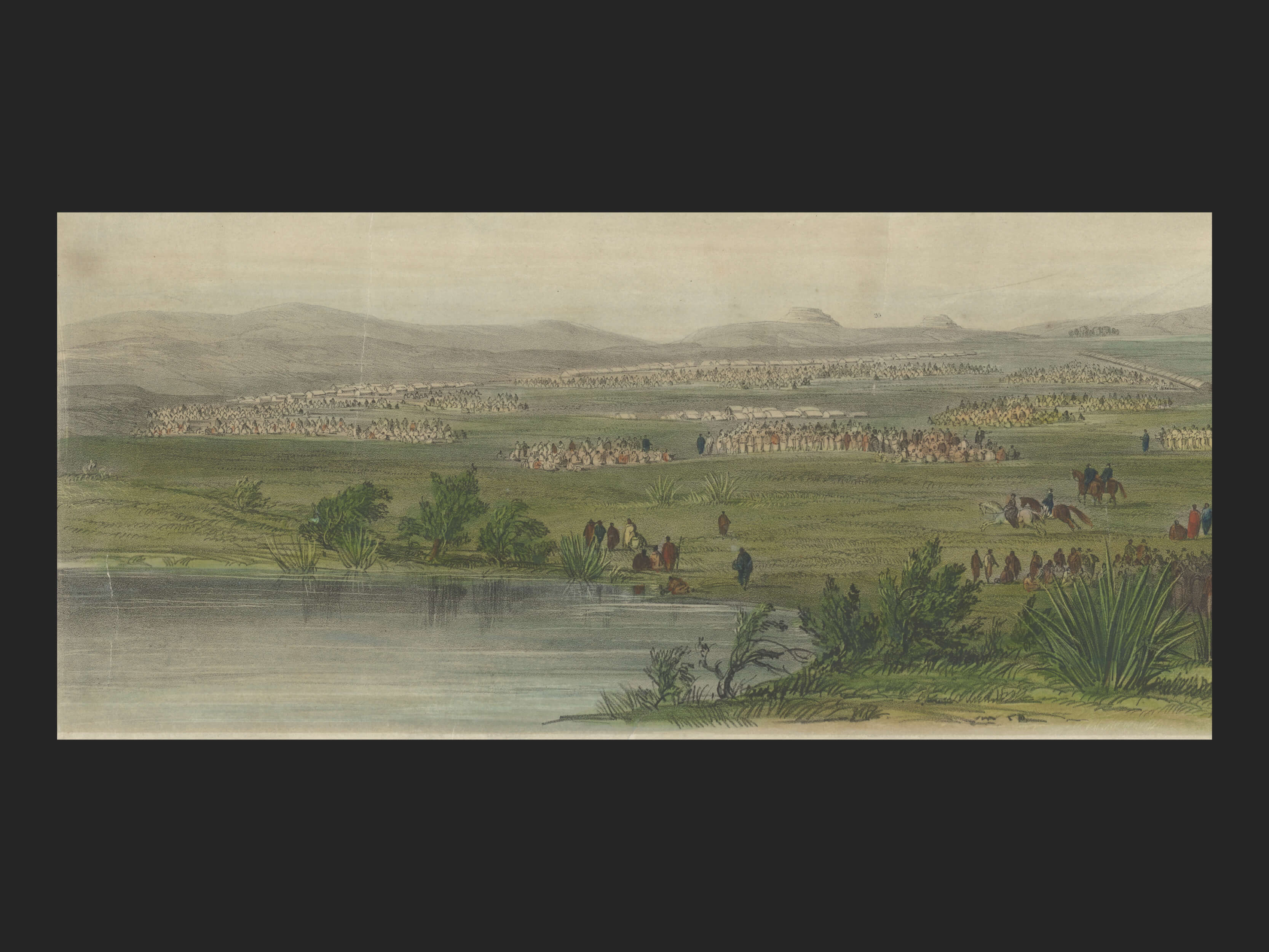
The lithograph also has a lake or lagoon on the left forefront and a cottage in the foreground. There is recorded a spring being near Little Rangitoto. It is interesting to note that Bruce Hayward’s contention that the site of the great feast was near the current Dilworth College grounds. He mentions a wetland nearby where an old ice cream factory was located.
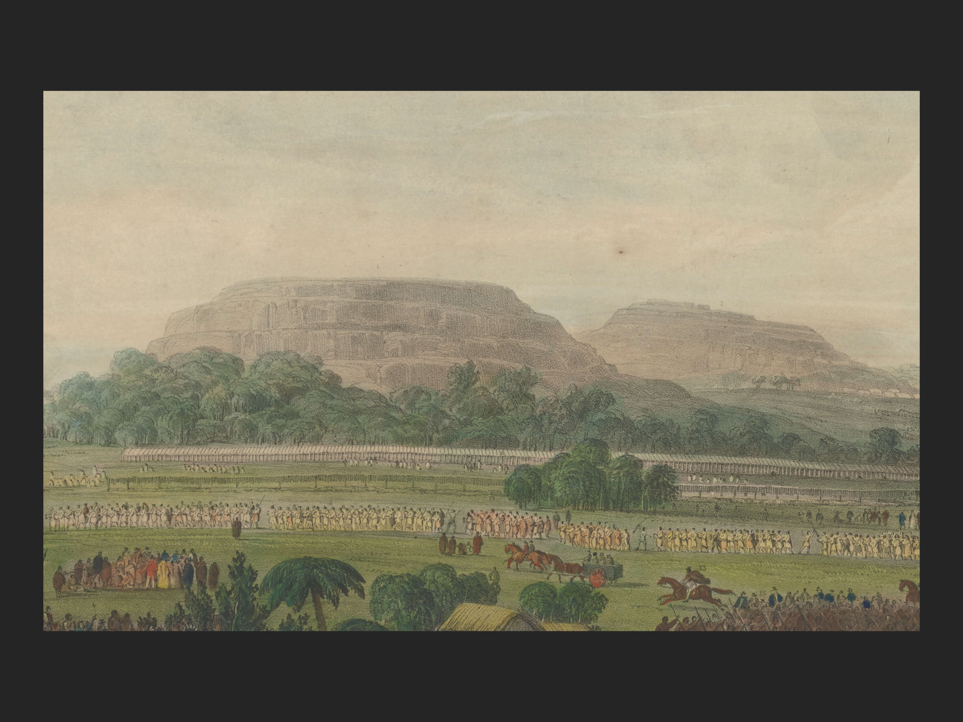
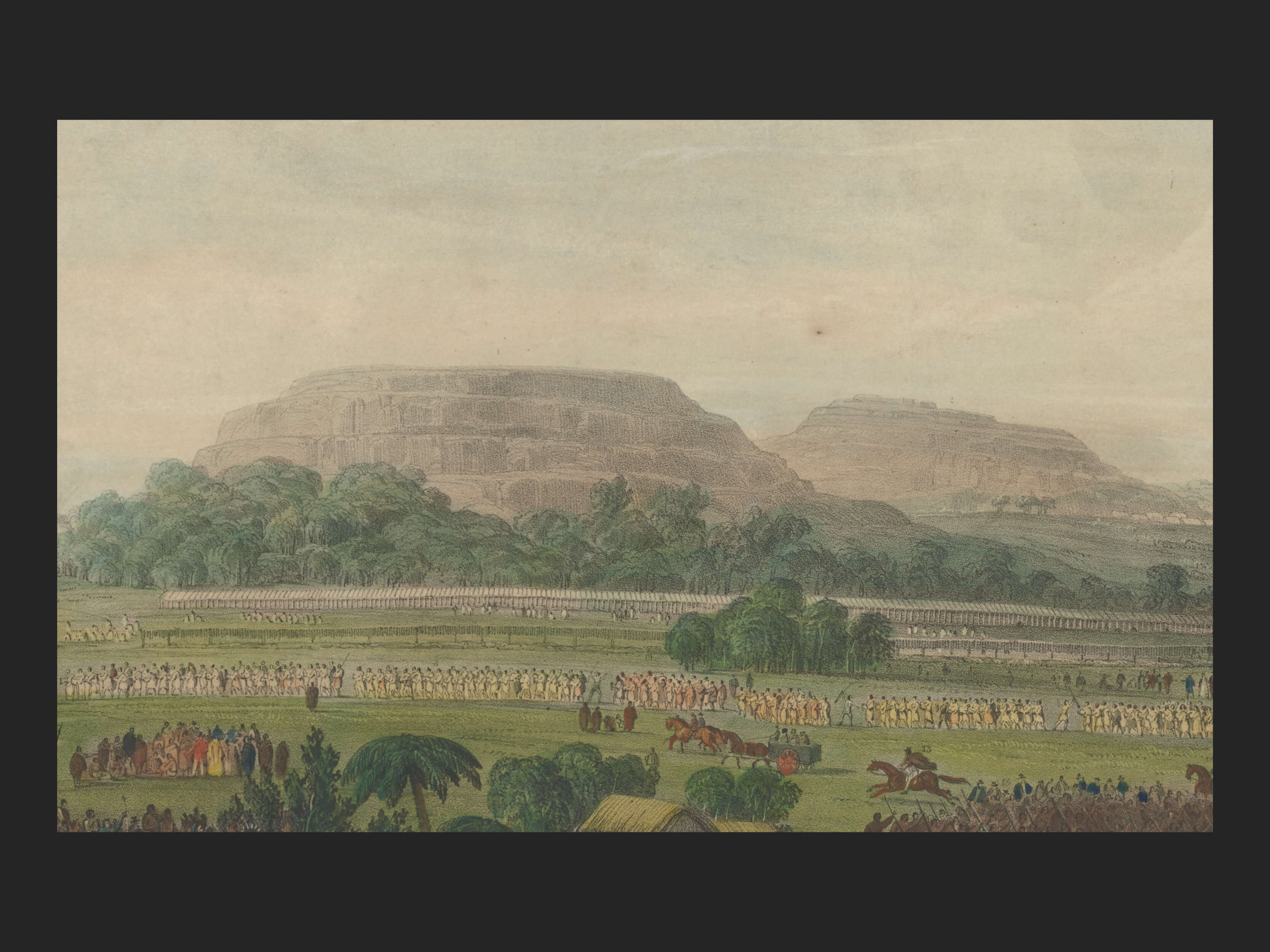
The key on the lithograph has the mountain or maunga at the front to be Ōhinerau Mt Hobson with Maungawhau Mt Eden behind it. Some historians and geologists have questioned this.
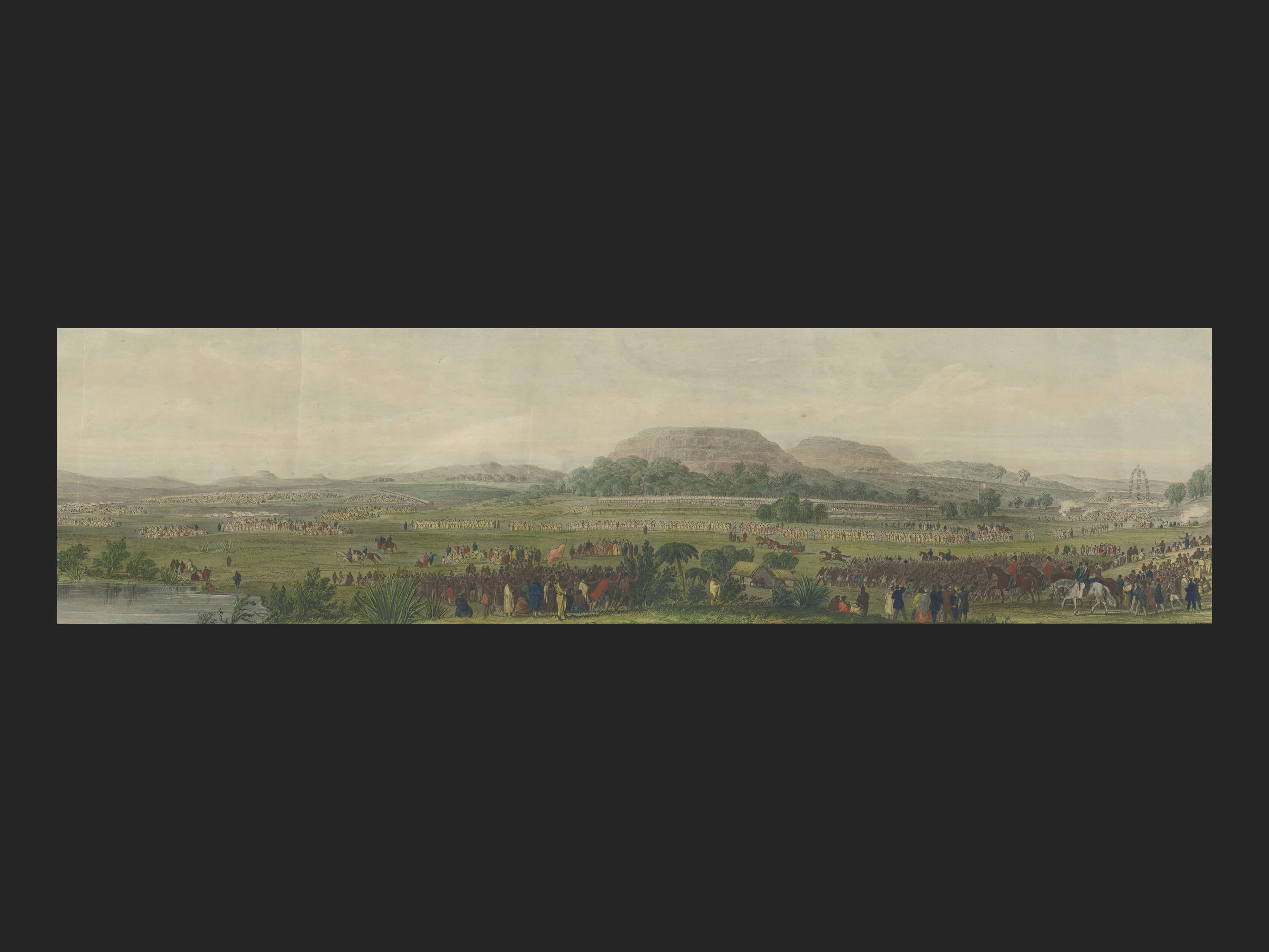
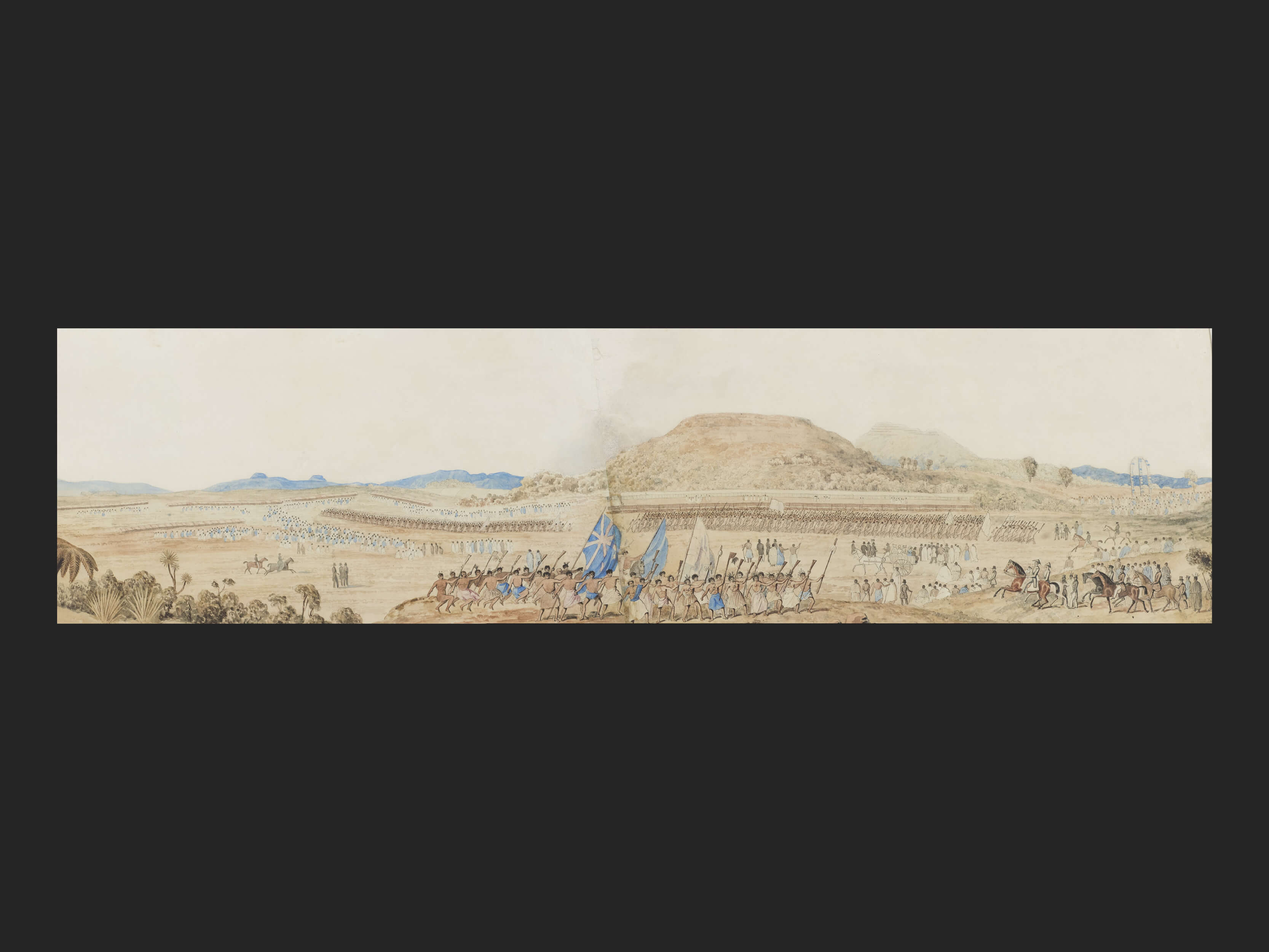
Below is a StoryMap Swipe composed of the Merrett original and the lithograph. By moving the ‘arrow heads’ left or right you can see how one of the artworks compares with the other. [You can enlarge or decrease the size of this feature by clicking on the arrows at the top right]
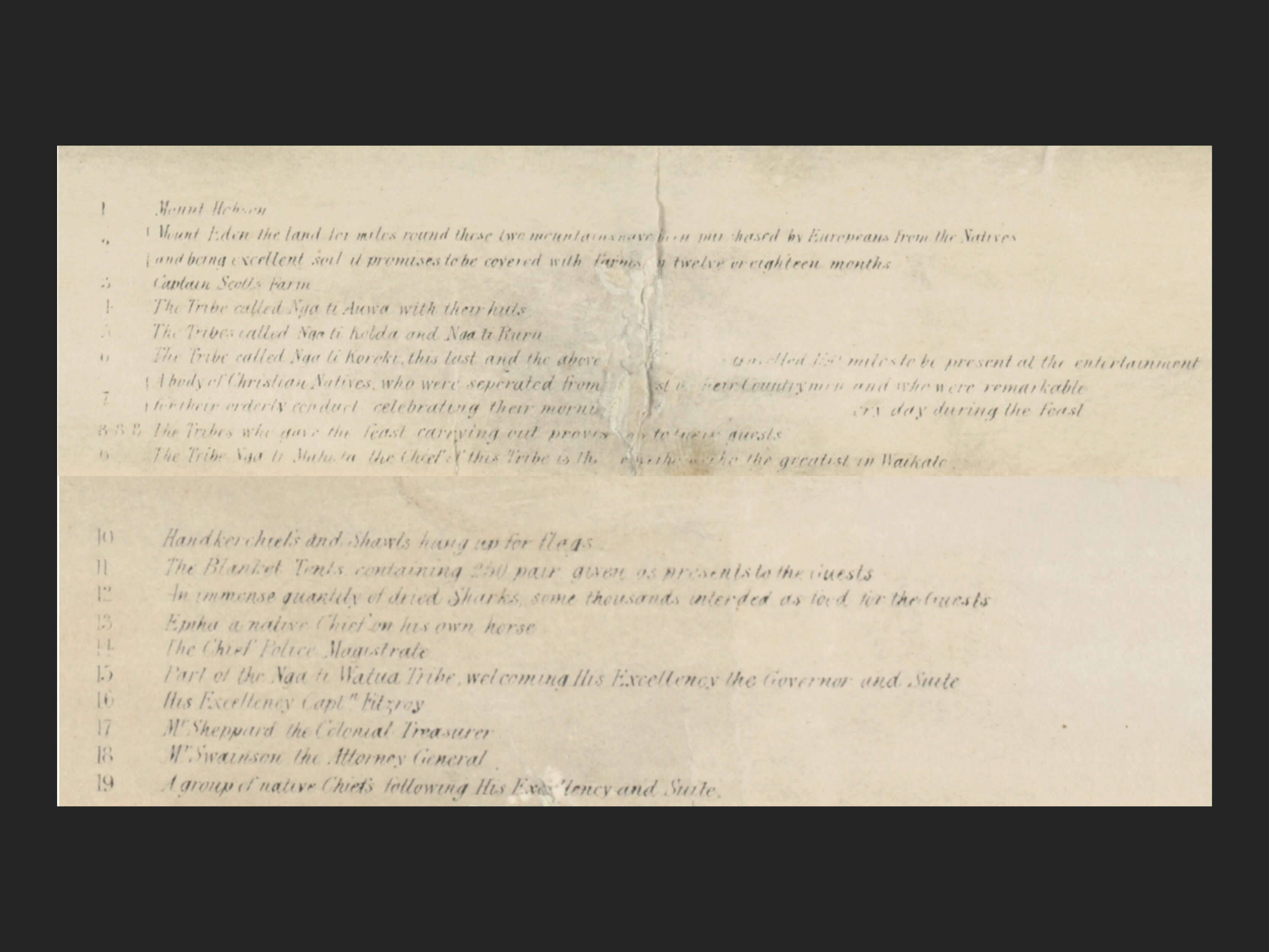
Key from the Lithograph
Both the 1845 Day & Haghe lithograph and a later Star Steam lithograph from 1890 had a description of the feast and a numbered legend at the bottom.
The image of the extract is not clear so it has been transcribed below:
- Mount Hobson
- Mount Eden
- Captain Scott’s farm
- The tribe called Ngatihaua with their huts
- The tribes called Ngatikoura and Ngatiruru
- The tribe called Ngatokoroki, this last and the above tribes travelled 150 miles to be present at the entertainment.
- A body of Christian natives who were seperated (sic) from the rest of their countrymen and who were remarkable for their orderly conduct, celebrating their morning and evening services every day during the feast
- The tribes which gave the feast carrying out provisions to their guests
- The tribe Ngati mahuta. The chief of this tribe was Te Wherowhero the greatest in Waikato
- Handkerchiefs and shawls hung up for flags
- The blanket tents containing 250 pairs given as presents for guests
- An immense quantity of dried sharks some thousands intended as food for the guests
- Epiha a native chief on his own horse
- Chief Police Magistrate Felton Mathew
- Part of the Nga ti Watua tribe welcoming His Excellency the Governor and his suite
- His Excellency Captain FitzRoy
- Mr Sheppard the Colonial Treasurer
- Mr Swainson the Attorney General
- A group of native chiefs following His Excellency and suite.
- The Three Kings
The Lithograph Legend
It is from the LEGEND that we can identify some of the key structures, personalities and features of the camp layout for the Great Feast.
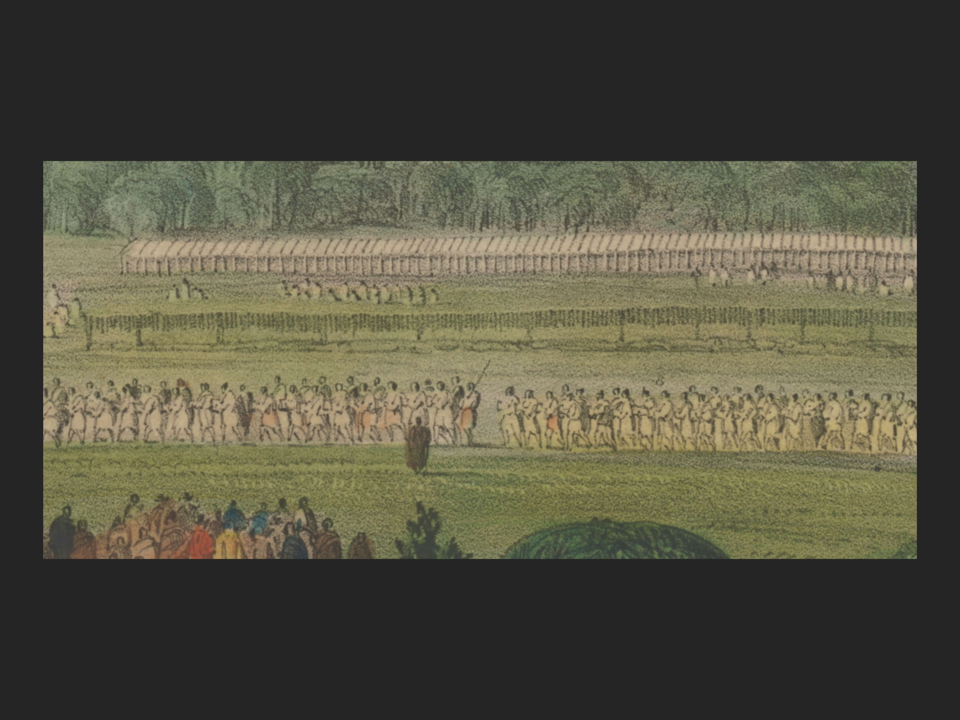
This crop from the litho shows the blanket tents that were given as presents to the attending guests (item 12) in the background. In front of them hanging on a wooden structure are the dried sharks (item 13).
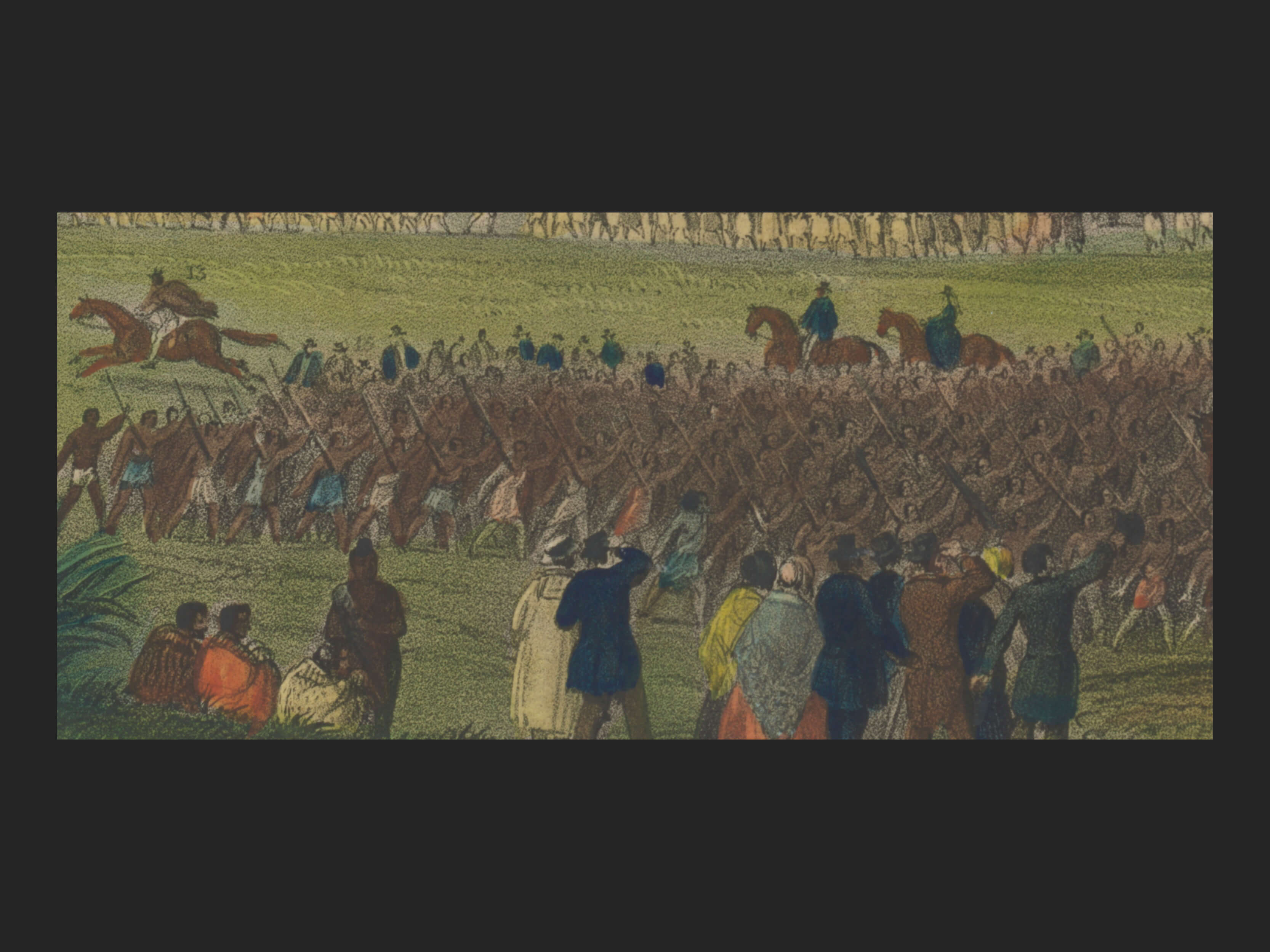
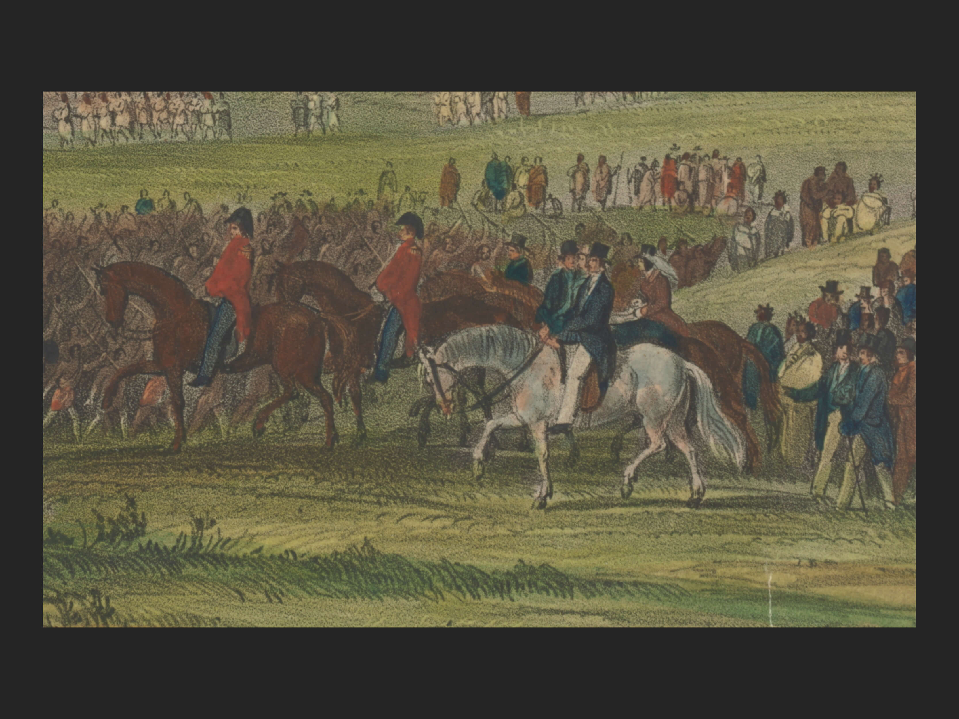
This is the welcoming party of Ngati Whatua (item 15)
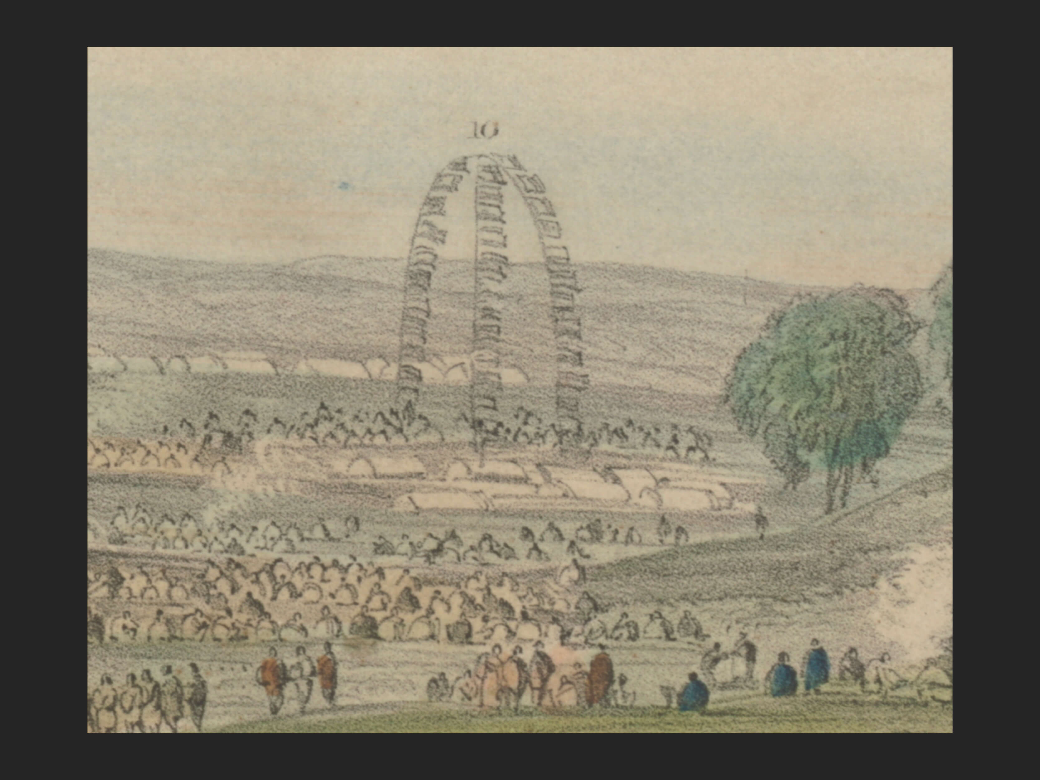
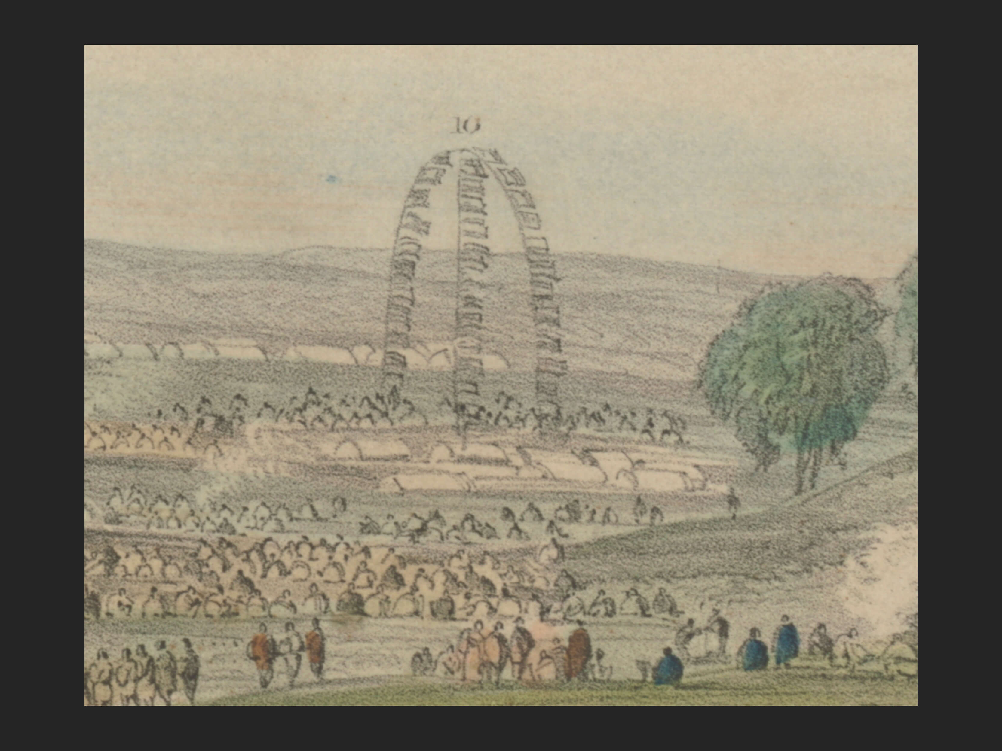
These are the Waikato flag poles and flags set up where Te Wherowhero was positioned (item 10)
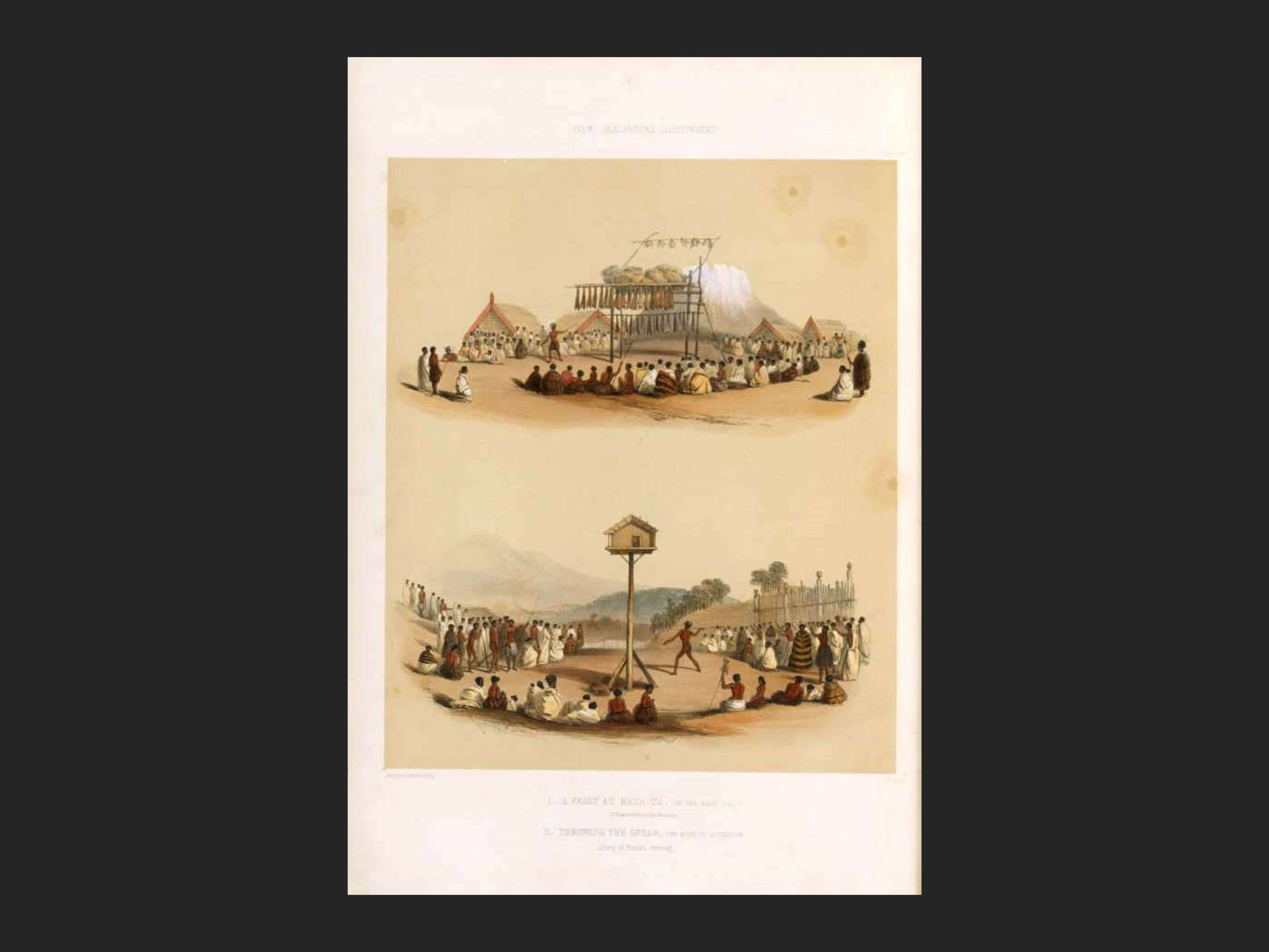
A feast at Matatā with Mt Edgecumbe in the distance. George French Angas, 1847. Auckland Libraries.
The Great Feast
The Event: What was its purpose and what brought it about?
There has been some debate as to whether it was the Waikato tribe or Ngāti Whātua who hosted the feast. Whereas an original painting of the feast from 1844 shows Ngāti Whātua as welcoming the guest of honour, Governor Fitzroy, an 1890 lithograph states that the feast was given by Te Wherowhero. But it may well have been a demonstration of agreed mutual cooperation and collaboration between the two key iwi of Tāmaki Makau Rau.
In the 19th century, there were many spectacular events or feasts, sometimes called hākari, which captured the imaginations of colonial observers, commentators and, as we have seen, artists.
The feast was an institution of great cultural importance. It represented the pinnacle of satisfaction in community life. The feast played a valuable economic and social role in providing the occasion for the meeting of different groups and promoting harmonious relations. Feasts cemented wider social alliances and facilitated the discussion of tribal policy.
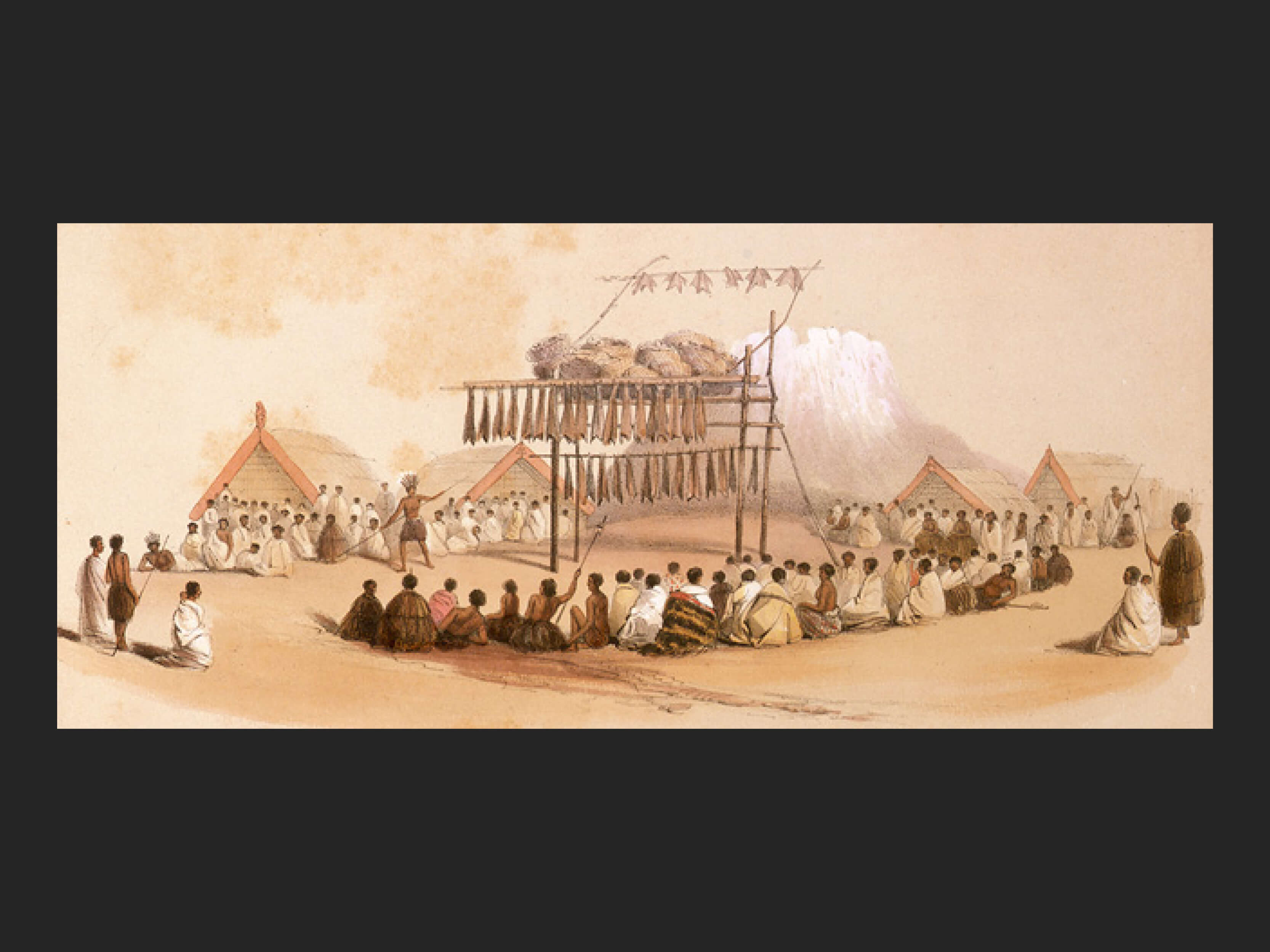
Feast at Matatā. George French Angas. 1847. Auckland Libraries Heritage Collections GNZ2157
Food was very important – it was an object of respect and its purpose was the desire to gain reputation and influence for the possessor. At hākari a chief would divide up the food. Piles would be set up and a chief would go along and note that a particular pile was for a particular iwi or hapū.
Traditionally food was set out in huge stacks or placed on whata (stages). From the mid-1800s food was presented on large hākari stages – huge pyramid- or cone-shaped structures. Hākari stages could be up to 30 metres high, and one was up to 2 miles (3.2 kilometres) long. These immense structures were part building, part scaffolding and part furnishing, using materials and artifacts from two cultures. European observers struggled to define these structures as architecture despite their size and complexity.
Colonial descriptions indicated great anxiety that the architecture used might crumble, burn or shake apart. Because the hākari stages were made of woven timber and plant structures and seen as part building, part scaffolding, and part furnishing, they challenged traditional European ideas of architecture, property, patriarchal law, stability, endurance and permanence.
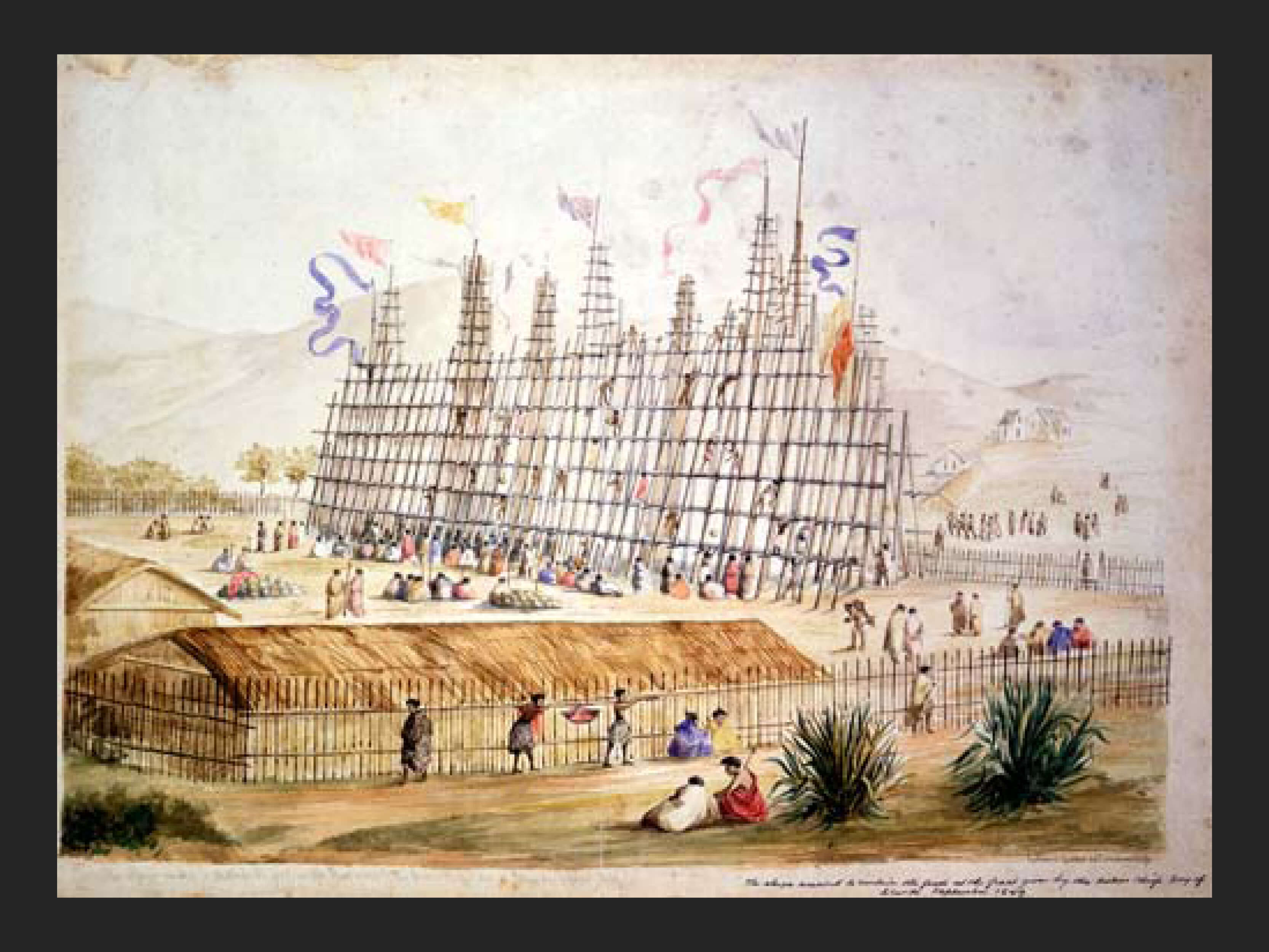
Feast at Bay of Islands. Cuthbert Charles Clarke, 1849. Alexander Turnbull Library
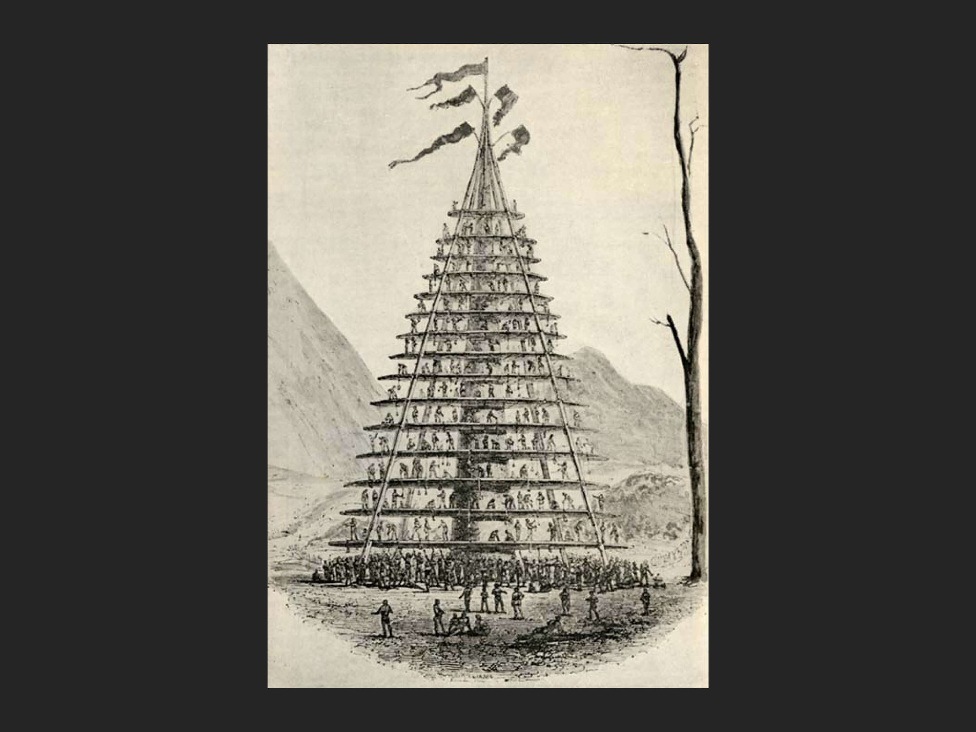
Hakari Stage. Te Ara artwork. Elsdon Best. The Maori as he was. Wellington, Dominion Museum, 1924.
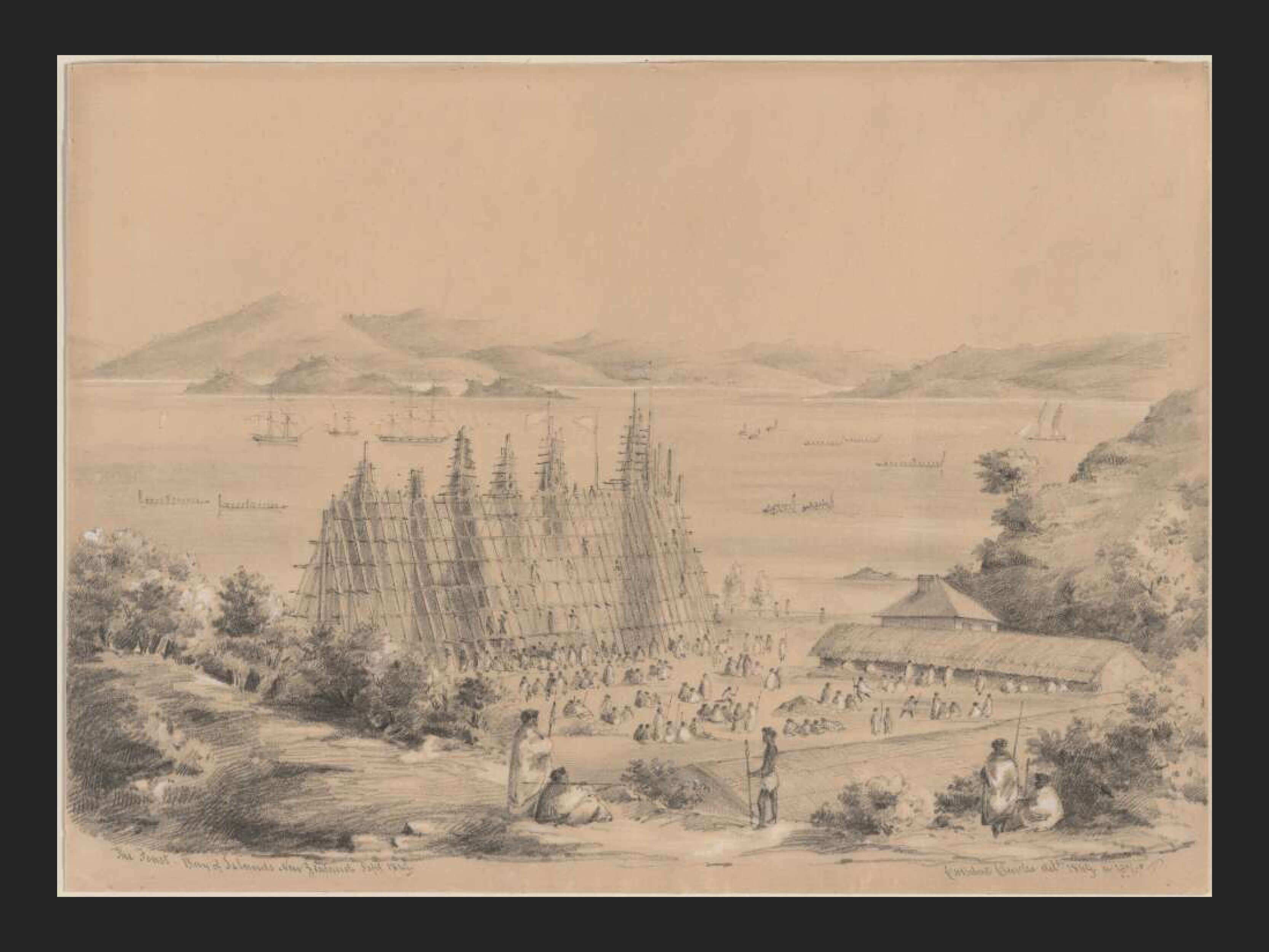
Feast at Bay of Islands. Sept 1849. Capt. Richard Oliver. Museum of N Z Te Papa Tongarewa
Images of some of the food structures that Māori created for their feasts. Many of them were extremely high and long.
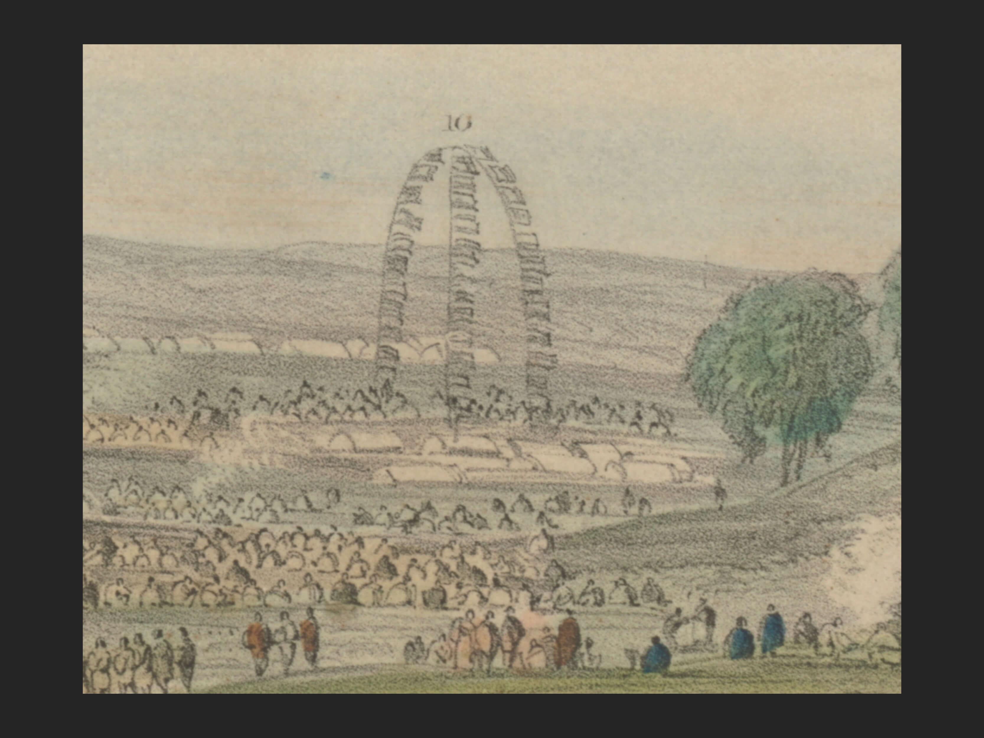
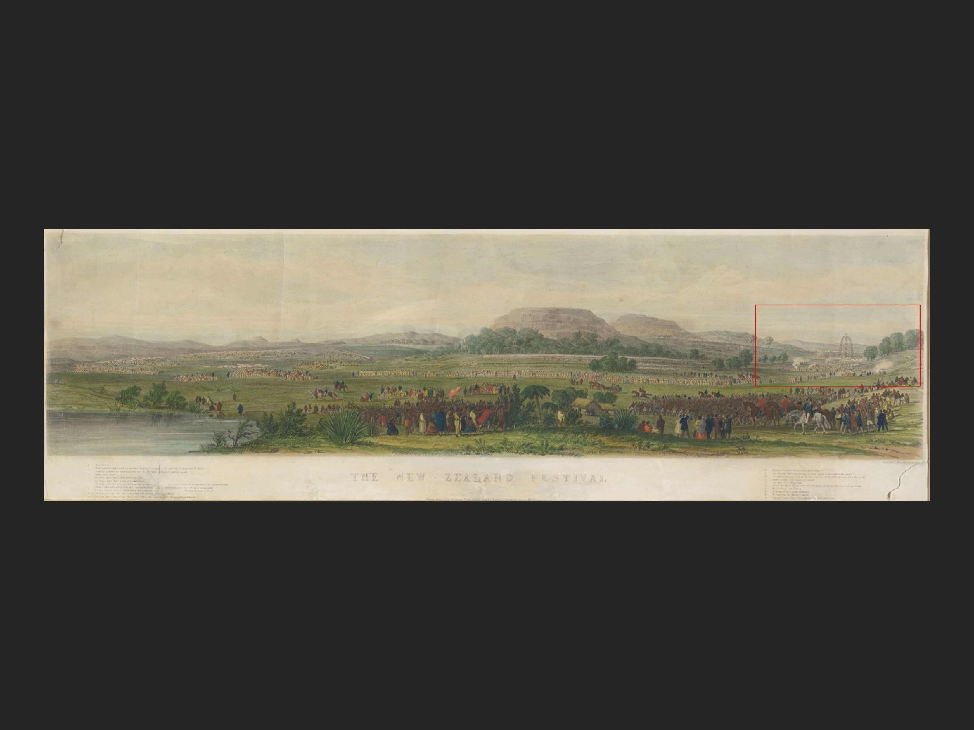
The Te WheroWhero camp site with the flagpoles as in the lithograph.
One of the interesting features of the works of the Remuera feast is that they do not show any of these types of structures. In the Merrett painting and the lithograph, the only high structure in evidence is a group of poles that the Te Wherowhero group erected which are described in the legend to the lithograph as carrying handkerchiefs and shawls hung up for flags.
This is the 1845 lithograph depiction of the Waikato tribe’s high structure.
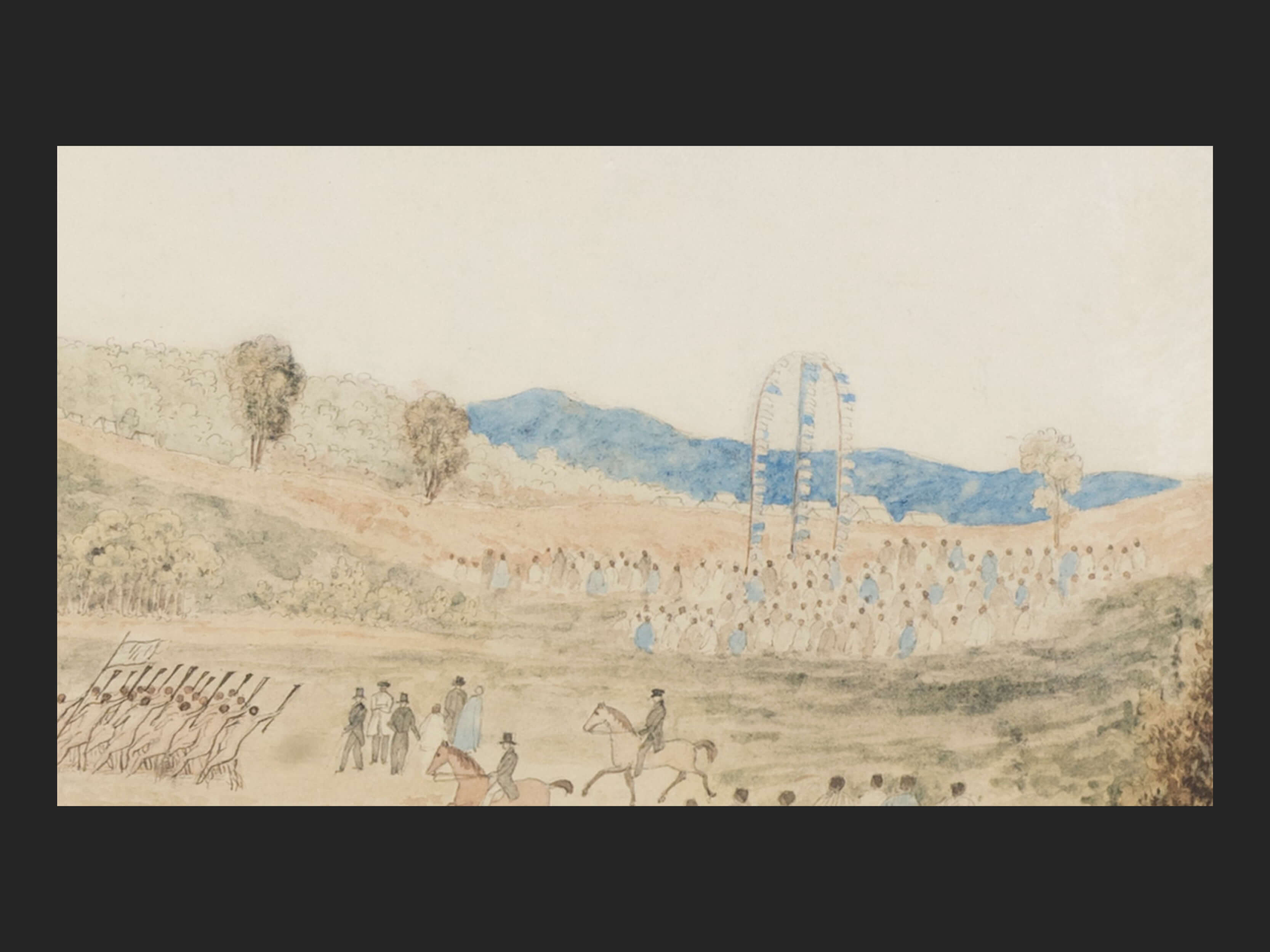
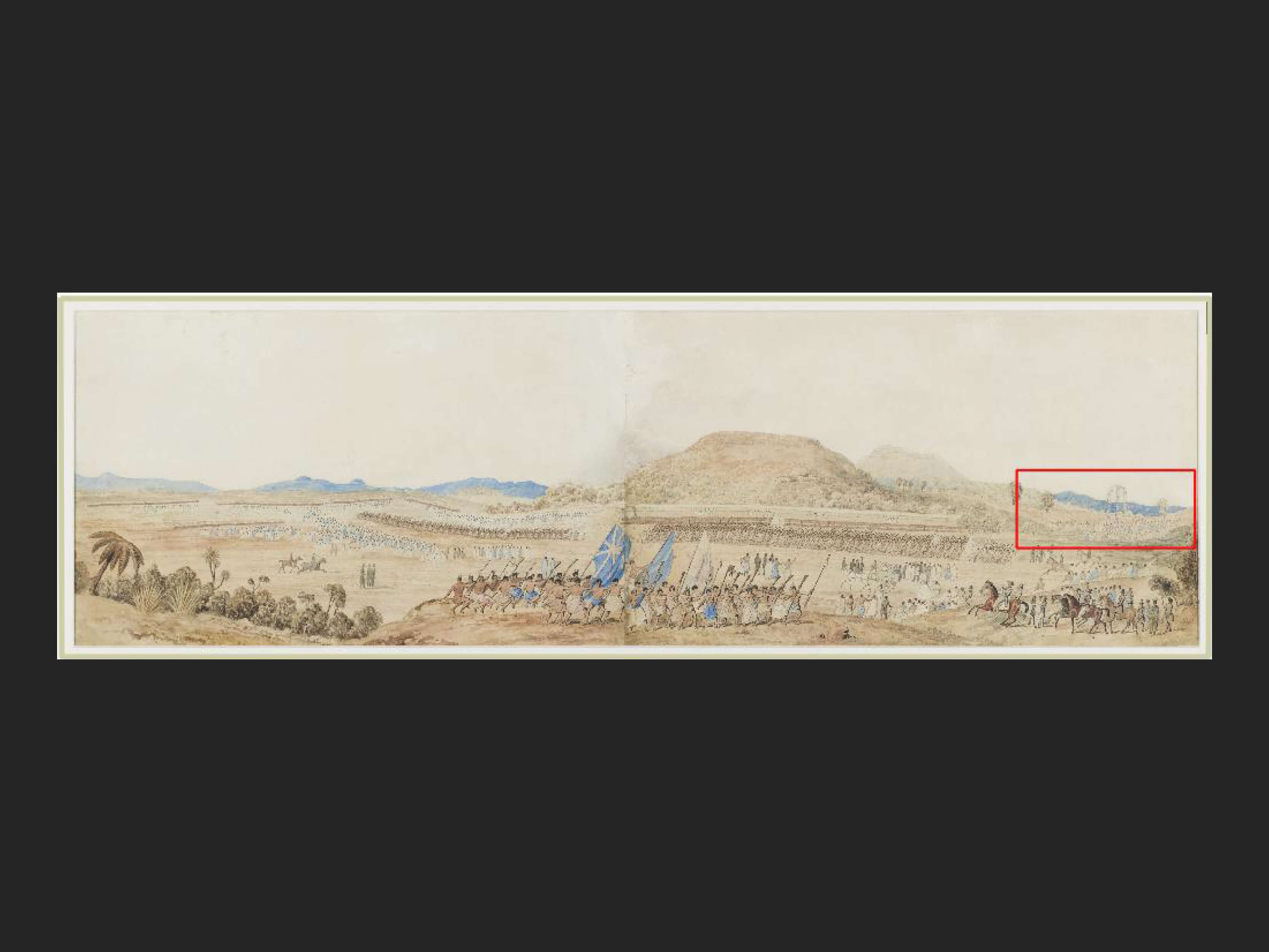
The flagpole is similarly positioned in the original Merrett painting
The original painting by Merrett shows the Waikato flagpoles as such.
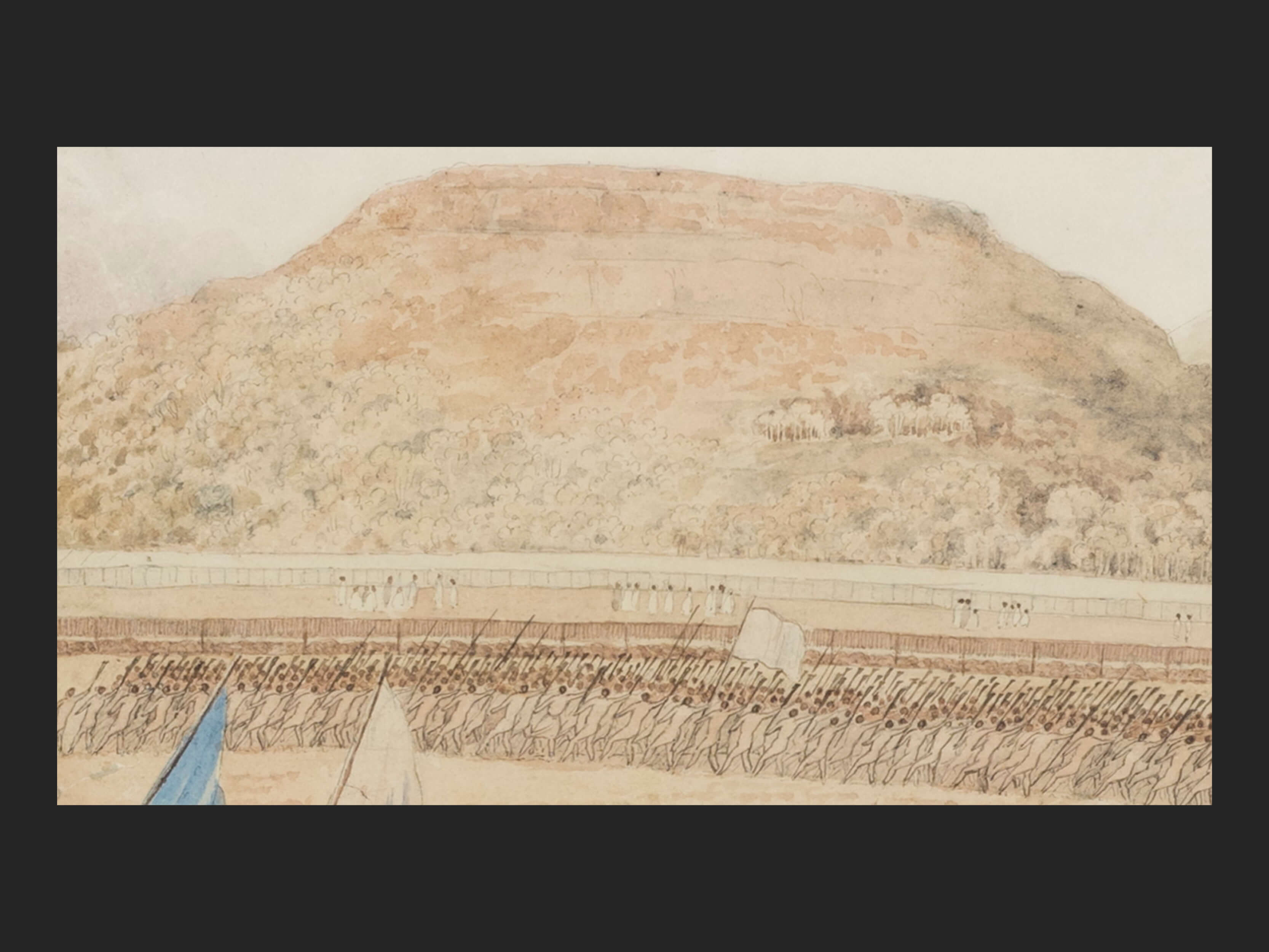
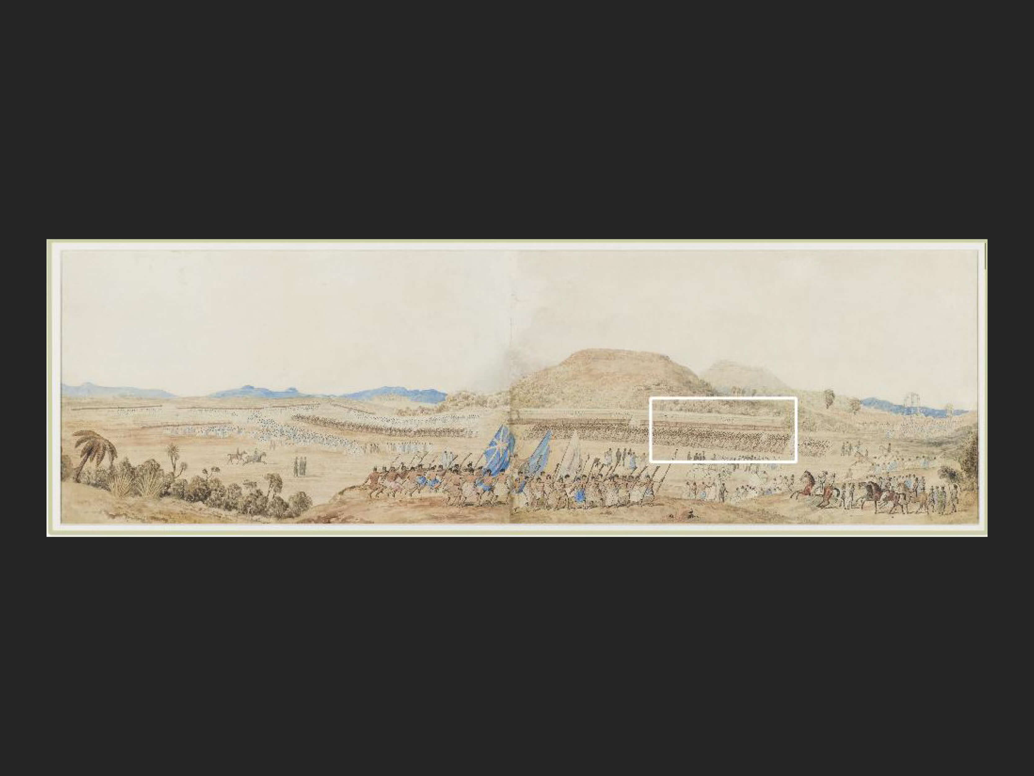
Extract is from this section of the painting
There are no other high structures in the Merrett painting. It shows long racks on which dogfish sharks were drying for the feast. They are seen directly behind the warriors carrying the muskets.
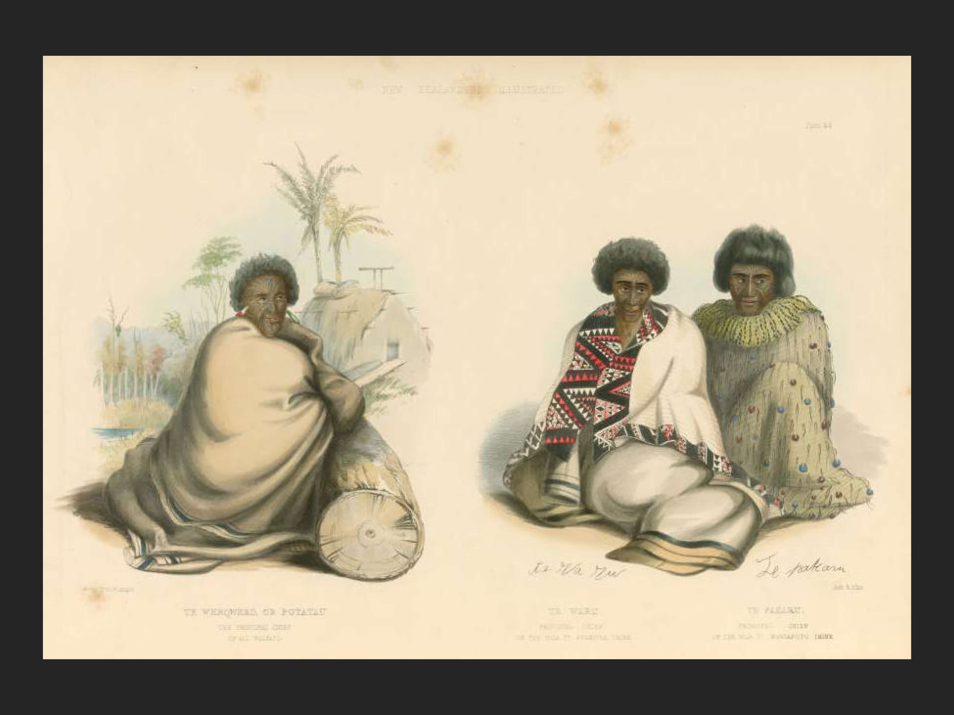
Te Wherowhero Pōtatau on left with Te Waru & Te Pakaru. G F Angas. 1847. Auckland Libraries.
The Hosts and the Guests
Ngāti Whātua were the hosts of the Great Feast
Ngāti Whātua Orakei were and are the tangata whenua of Remuera. After the arrival of the Pākehā, diseases and the use of musket guns had weakened them, their strength and hold on their lands. Northern Ngā Puhi had acquired muskets in 1820 and inflicted a huge defeat on Ngāti Whātua in the Kaipara. Tāmaki-makau-rau then became virtually uninhabited in the 1830s.
Ngāti Whātua rangatira (chief) Apihai Te Kawau sought refuge with other Ngāti Whātua kinfolk at Te Horo by the Waipā River, where they could benefit from the protection of the great Waikato rangatira Te Wherowhero. As a consequence of his becoming the protector of Ngāti Whātua, Te Wherowhero effectively became the protector of the government settlement of Auckland as well.
In 1835 Te Wherowhero supported the return of Ngāti Whātua to Tamaki where they established pā at Puponga, Mangere, Ihumātao and Ōrakei and gardens at Rangitoto-iti, Ōkahu Bay and Purewa.
Ngāti Whātua chiefs Apihai Te Kawau, Te Tinana and Te Reweti signed the Treaty of Waitangi in February 1840, in the belief that the Crown would work in partnership with them to establish peace, authority and stability.
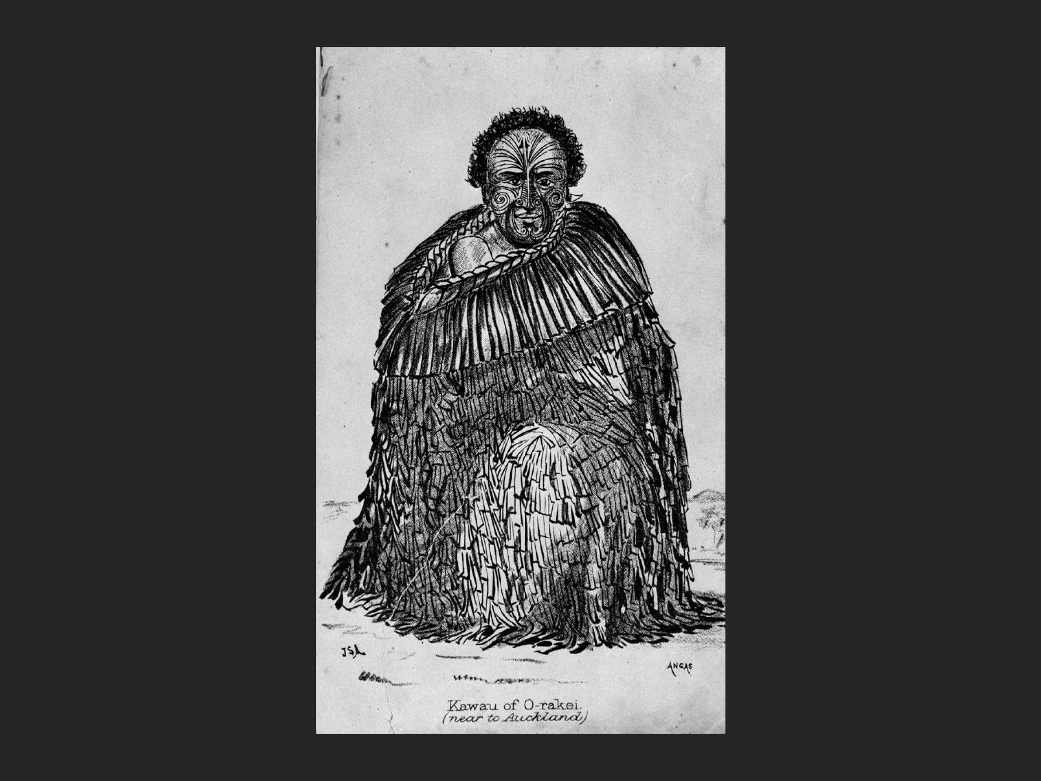
Kawau of Ōrakei. G F Angas. Jack Diamond Collection, Auckland Libraries Heritage Collections.
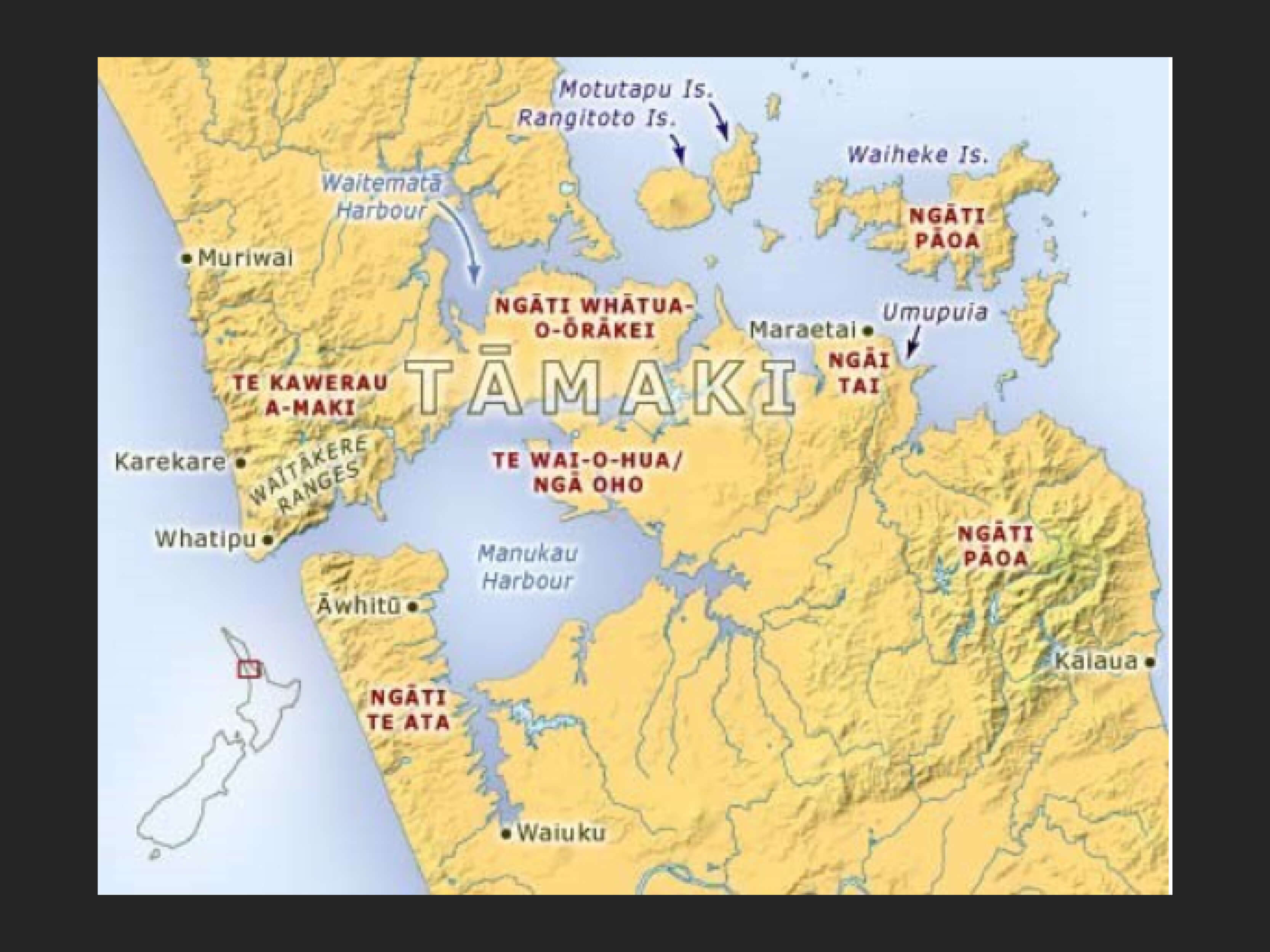
Rāwiri Taonui, Tāmaki tribes - Tāmaki tribes today. Te Ara Encyclopedia of New Zealand.Map1039enz
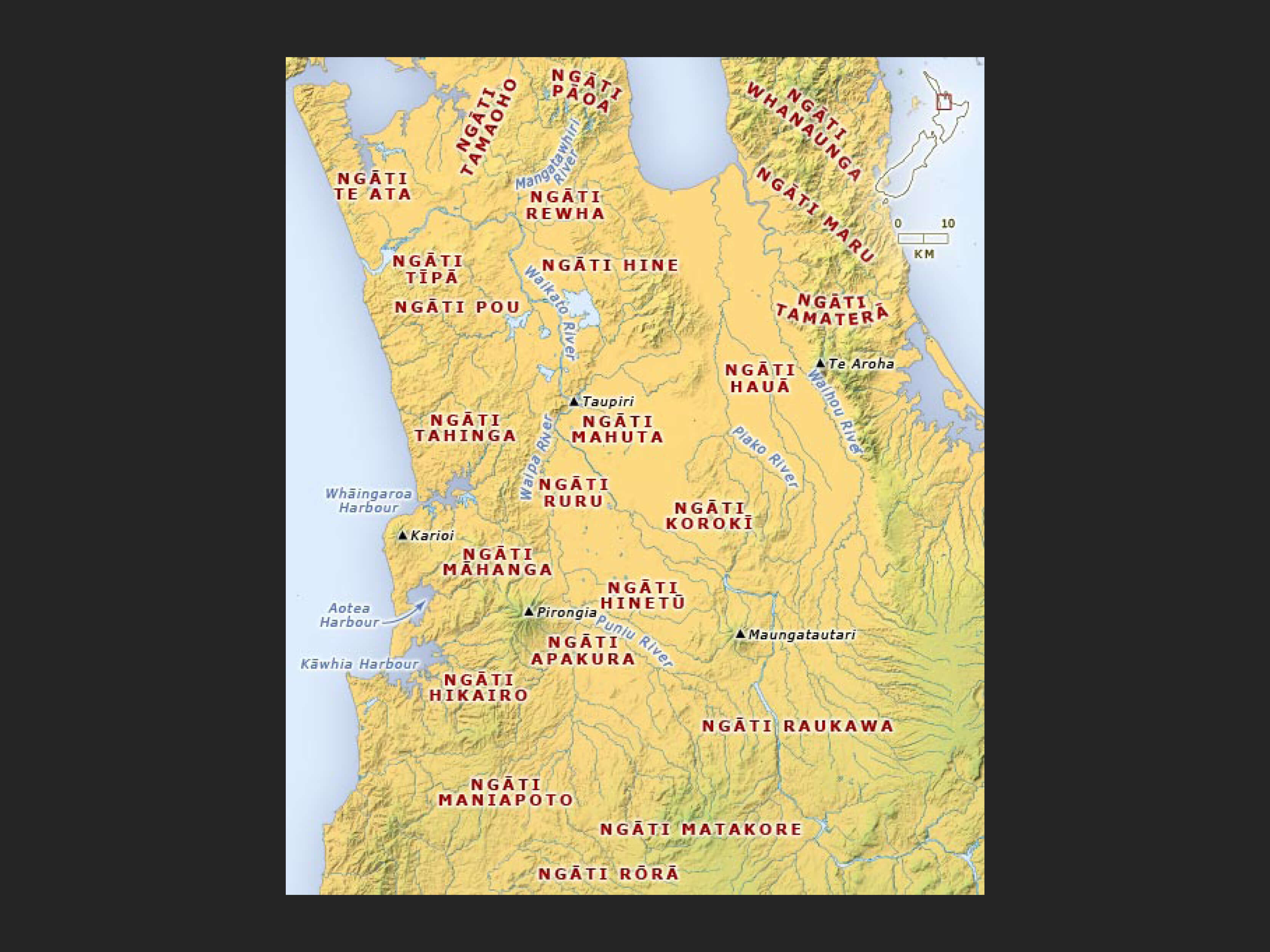
Rāwiri Taonui, Te Ara -Map
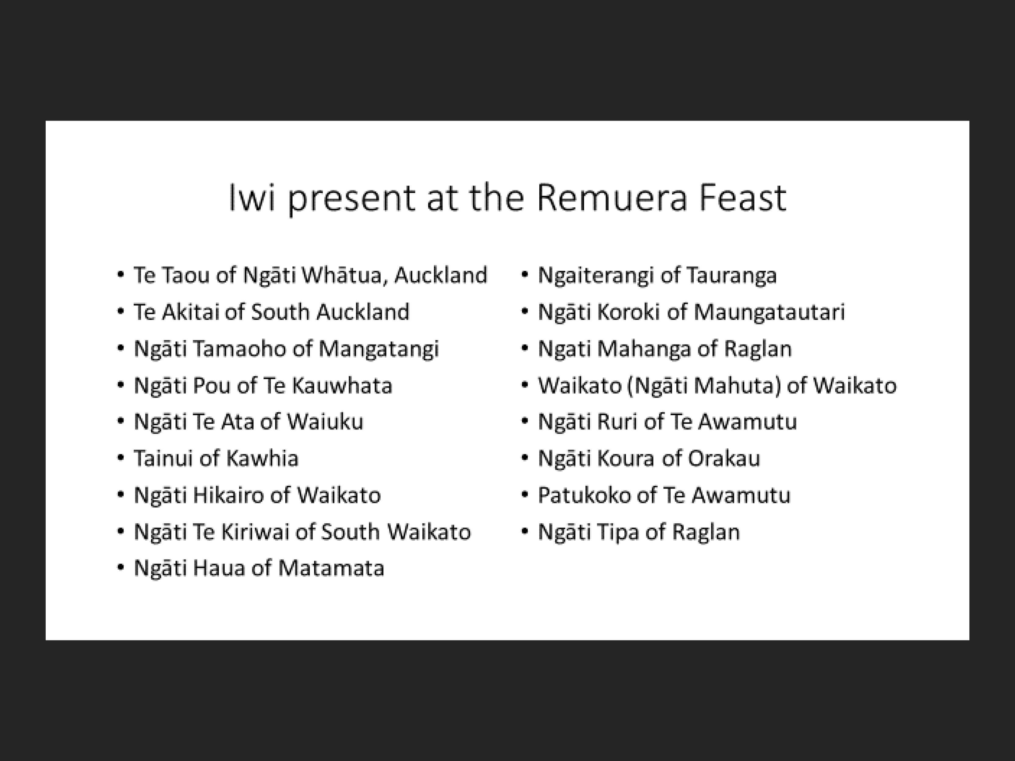
Source: David Simmons, Greater Maori Auckland.
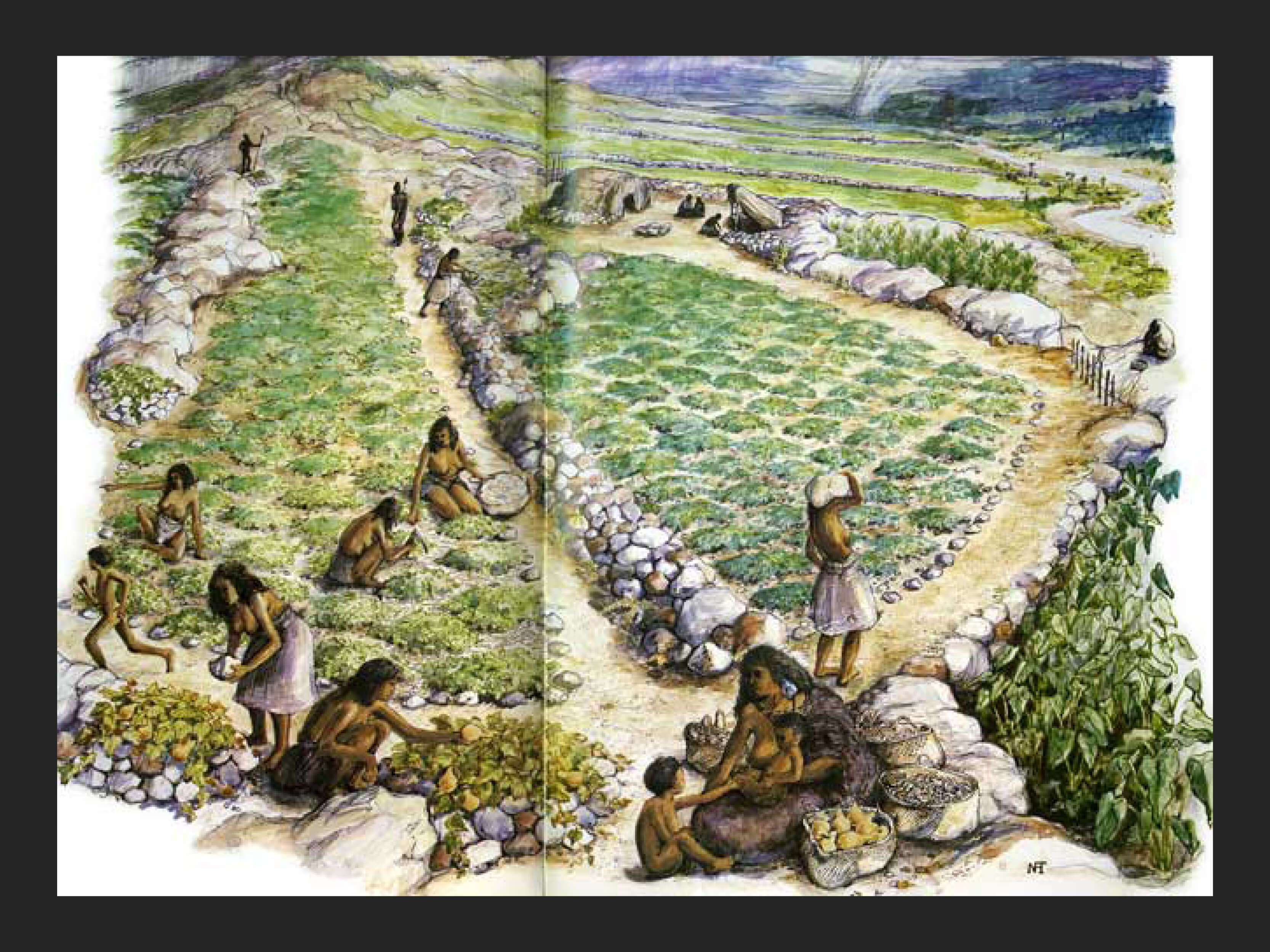
The three Ngāti Whātua chiefs, Apihai Te Kawau, Te Tinana and Te Rēweti, hosted the festivities on the land between Ōhinerau Mt Hobson and Te Kōpuke Mt St John. Earlier acres of Remuera land on the side of Ōhinerau Mt Hobson had been cleared and planted with potatoes. Weeks before the guests arrived, a wall of 11,000 flax baskets over a quarter of mile long was built, which then contained hundreds of tons of potatoes. Each basket of potatoes was about seven feet wide and four feet high. Suspended above the wall were 9,000 dried sharks, pigs and large amounts of tea, tobacco, rice, flour and sugar. The dogfish sharks were about three feet long with dividers of larger sharks of 4-5 feet long. Opposite the wall was a 400 yard long shed covered with 1,000 blankets intended as presents for the guests.
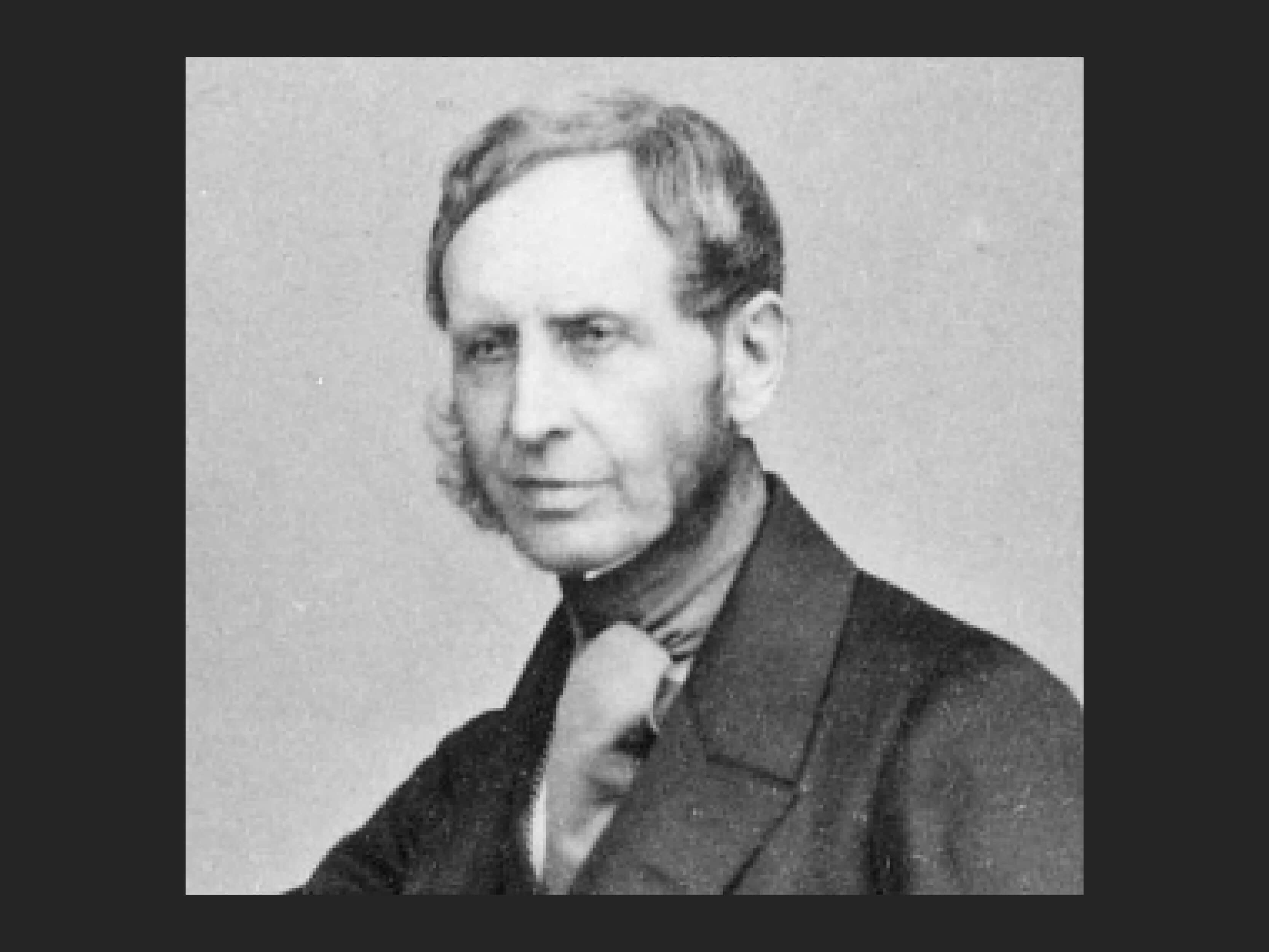
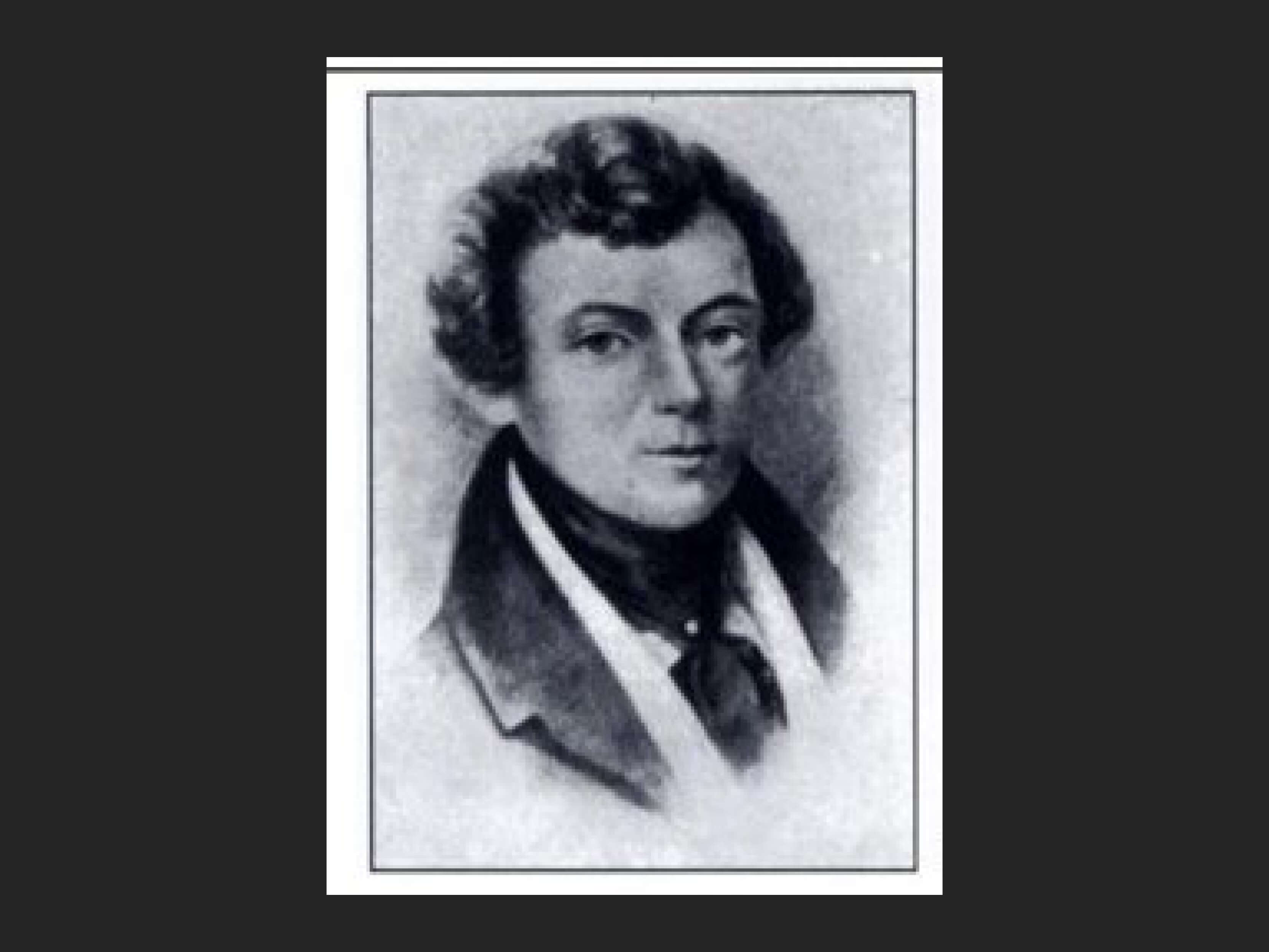
Governor Robert Fitzroy. Www.nzhistory.govt.nz. Ministry for Culture & Heritage.
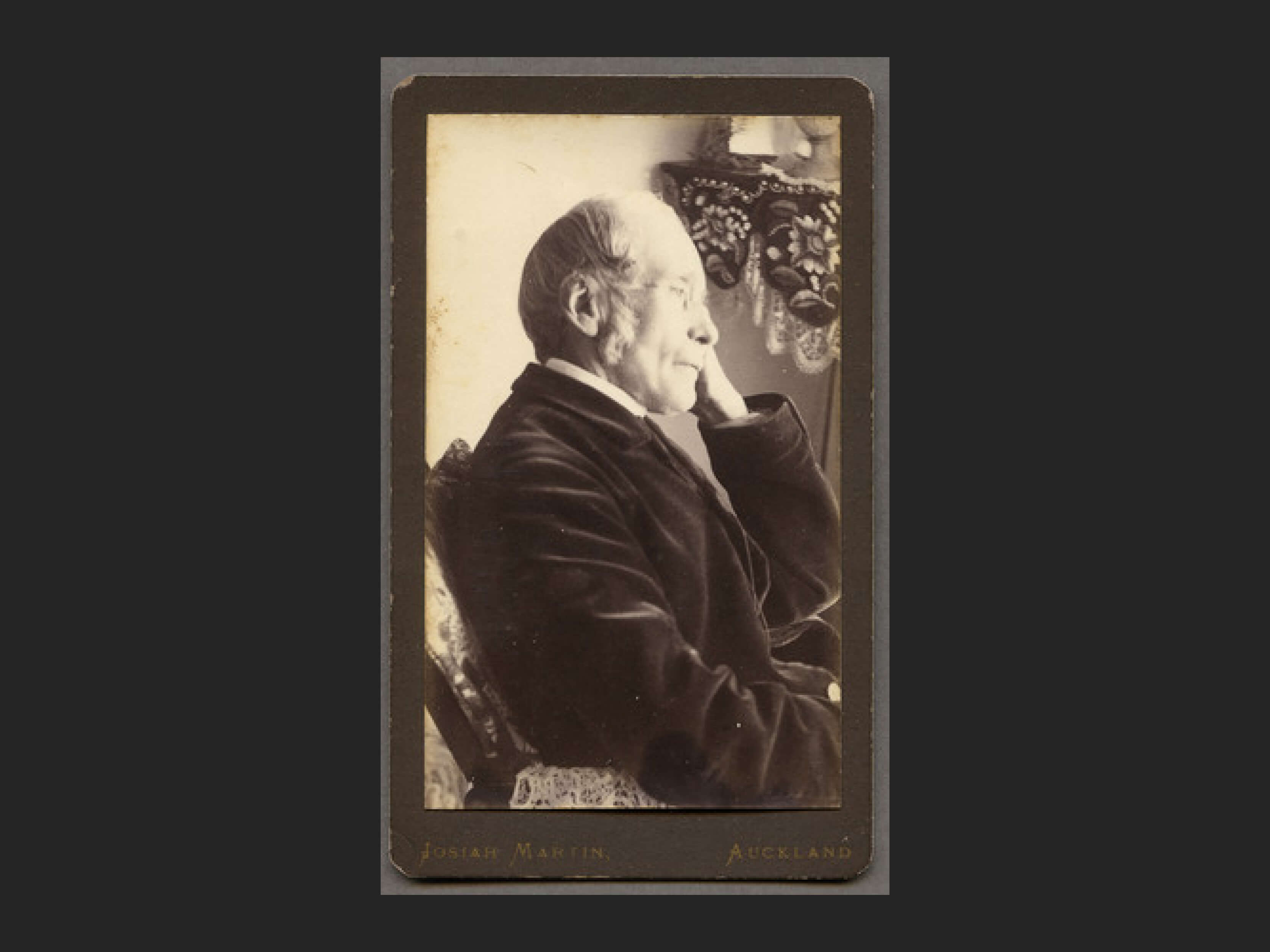
Alexander Shepherd. J W Marshall, NZETC.
Invited Guests from the Crown
A group of Pakeha settlers and government officials from the new Auckland capital also attended. Among the Crown representatives were:
- Governor Robert Fitzroy who followed Captain William Hobson in the Crown role
- William Swainson, the Attorney General
- and Alexander Shepherd, the Colonial Treasurer
They are seen in the lithograph being welcomed to the feast as they arrived on horseback to a rousing welcome by Ngāti Whātua. It is interesting that in the original painting by Merrett that women were included in the welcoming party.
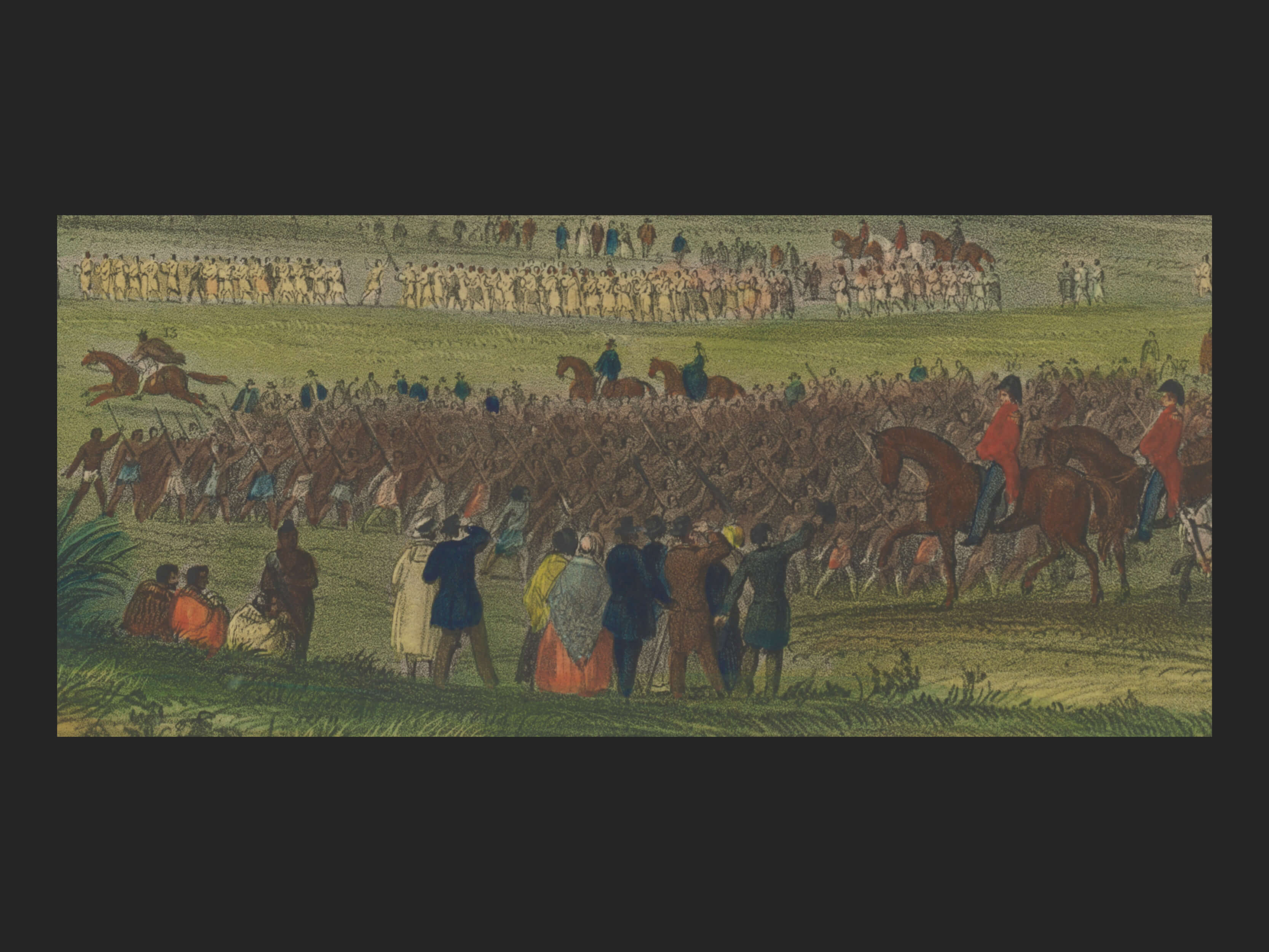
But in the Lithograph the welcoming group is not so easily discernable and the women are not in clear evidence.
The feast was not primarily intended as entertainment but as a display of power and seriousness of intent by Ngāti Whātua and Waikato. It was intended as a warning to pākeha to take the idea of partnership seriously. On the day after the feast, Governor Fitzroy received about 200 of the principal chiefs in a formal setting at Government House. The importance of the Paremata or parliament at Government House cannot be underestimated. Fitzroy listened to specific concerns and grievances concerning land and reiterated the reasons for the Treaty of Waitangi and what the British had promised: “…may we mutually assist one another by every means in our power; we are able to to assist you in a most important manner, you are also able to assist us”. This was a highly significant political summit.
A Question of Site
Where actually was the site of the feast?
As the exact site of the Remuera feast is not recorded there has been a good deal of research into where this took place. Does the geography as shown in the painting tell us that it was painted where the event took place? Or could Merrett have developed his artistic perception of the geography of the mountains near the feast from another site altogether?
What follows are merely some observations gathered from research and specialist commentaries and a suggestion of its locality based on what evidence has been thrown up ( and some geospatial logic ).
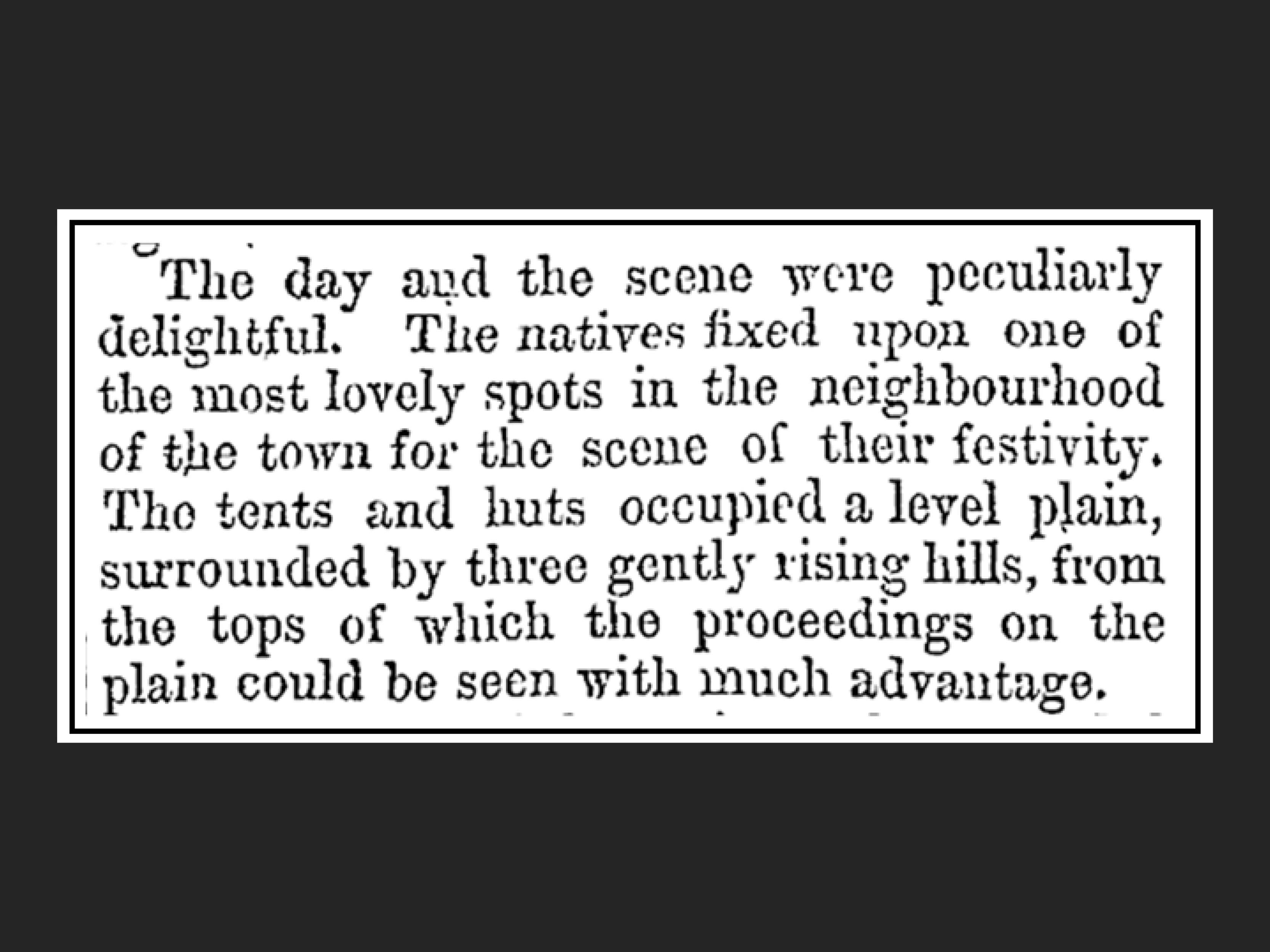
Daily Southern Cross, 18 May 1844 from Papers Past, National Library of NZ
Newspaper Articles
The newspapers of the time and following years, found in the National Library of New Zealand’s Papers Past collection, could be our best ‘contemporary’ source of information about the locality of the Great Feast at Remuera. However, while the general content is similar, there are some variations in the descriptions of events and place.
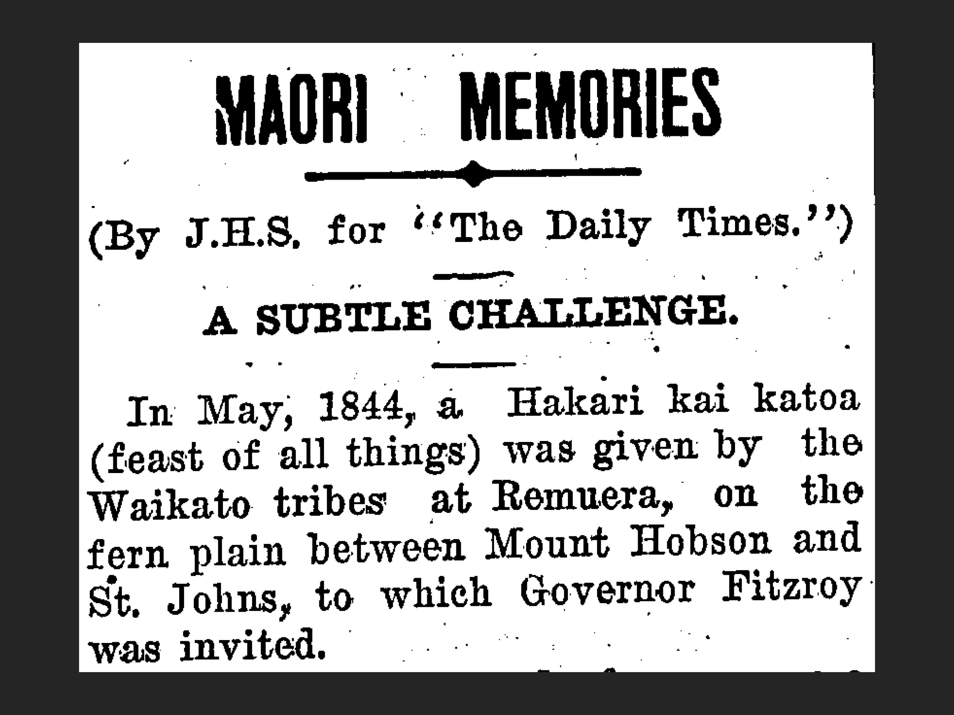
The Daily Southern Cross carries an article in its edition 18 May 1844 one week after the feast began. It gives some description of the geographic features (a level plain, three gently rising hills) of the site but doesn’t pinpoint the location.
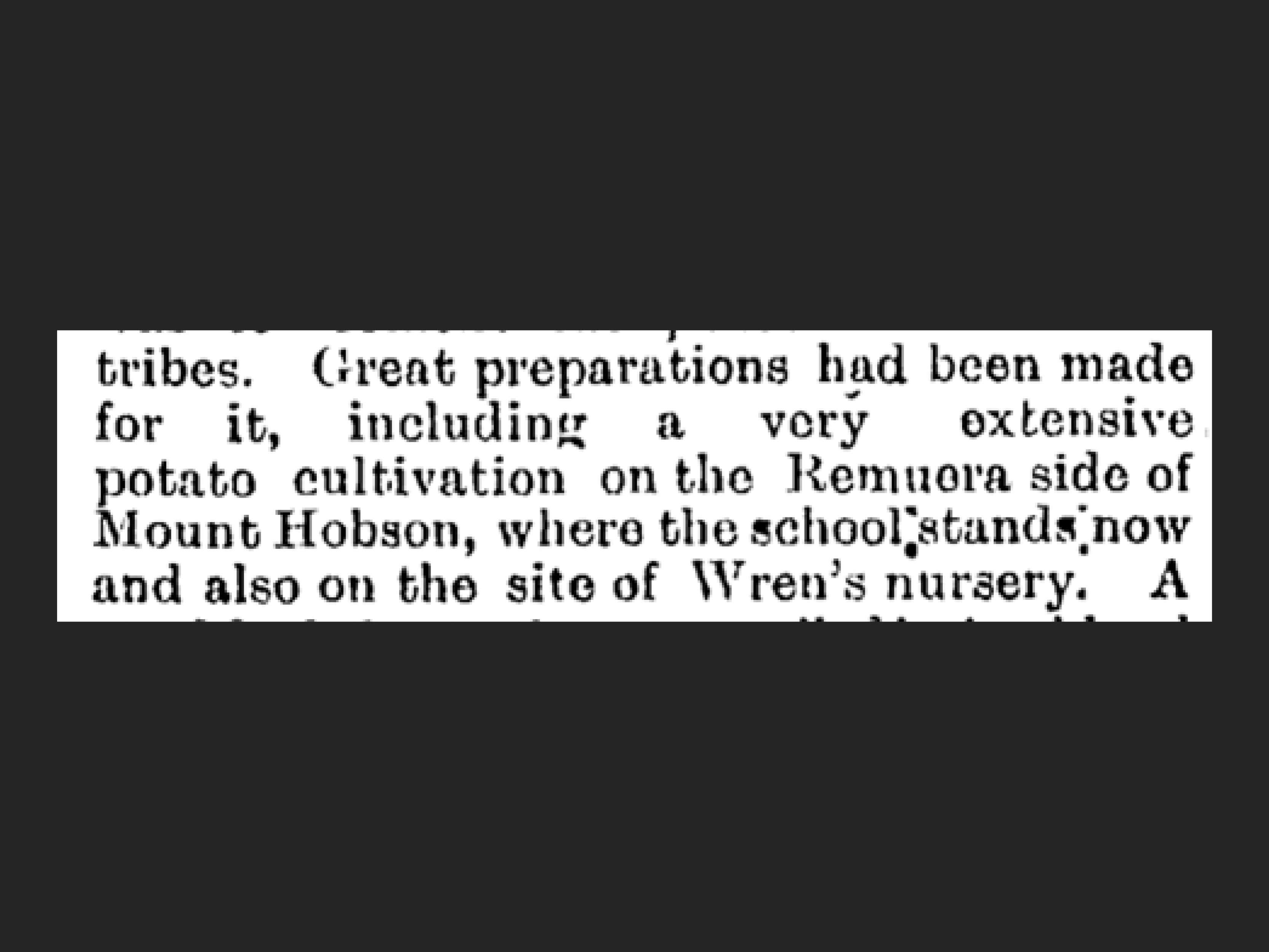
The Te Aroha News, 28 December 1889 provides some ideas as to the broad location with its reference to two localities where Māori cultivated potatoes for the feast. But that is not definitive enough as Māori could have transported the provisions long distances. Early newspapers and magazines provided text and cartoons but in the main there was very little mapping included.
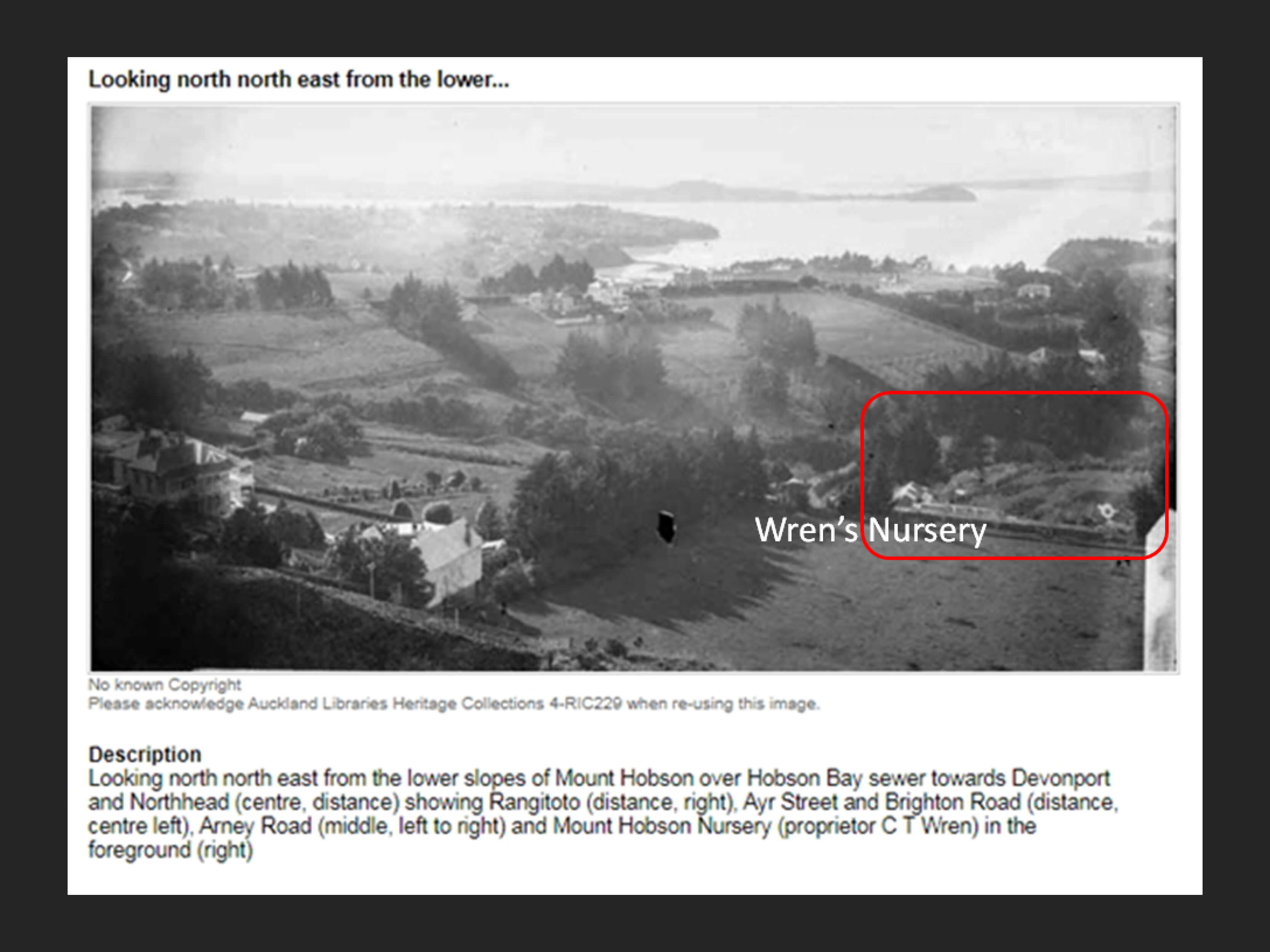
This photograph taken between 1880 and 1890 shows the position of Wren’s Mt Hobson Nursery. Mt Hobson is unseen to the left of the photo with the land falling away quite steeply in several directions from the northern side of the mountain. So as a possible site it is unlikely that the feast took place on this land. But it was important to the event as it provided large quantities of potatoes for the feast.
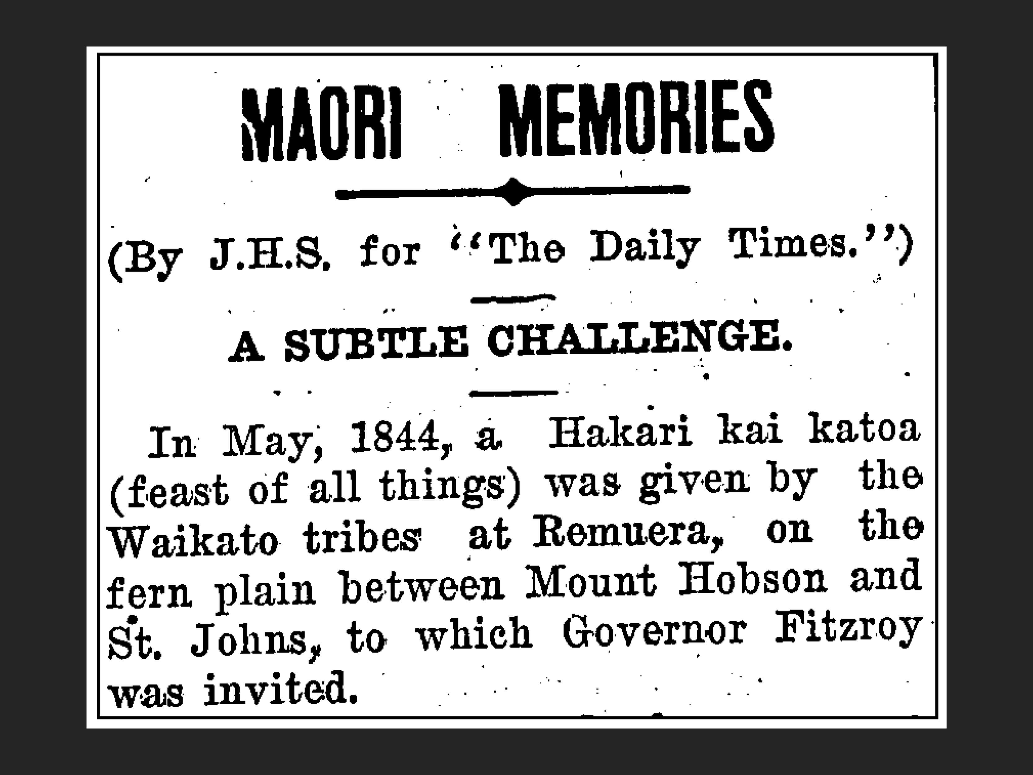
A short article in the Wairarapa Daily Times 27 June 1936 gives what appears to be an accurate locality. But this was written almost 100 years after the event and could be based on hearsay handed down. There is no source for the statement made about the site. But it does give us some clues which support the opinions of some of the researchers.
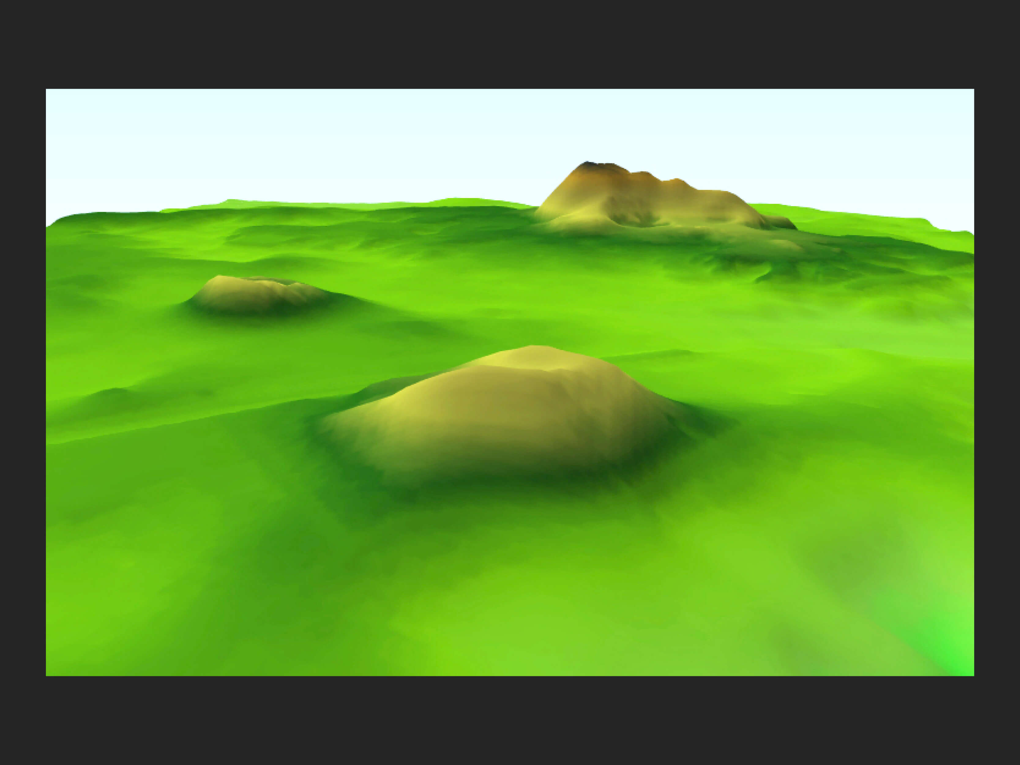
3D relief model of an ampitheatre site
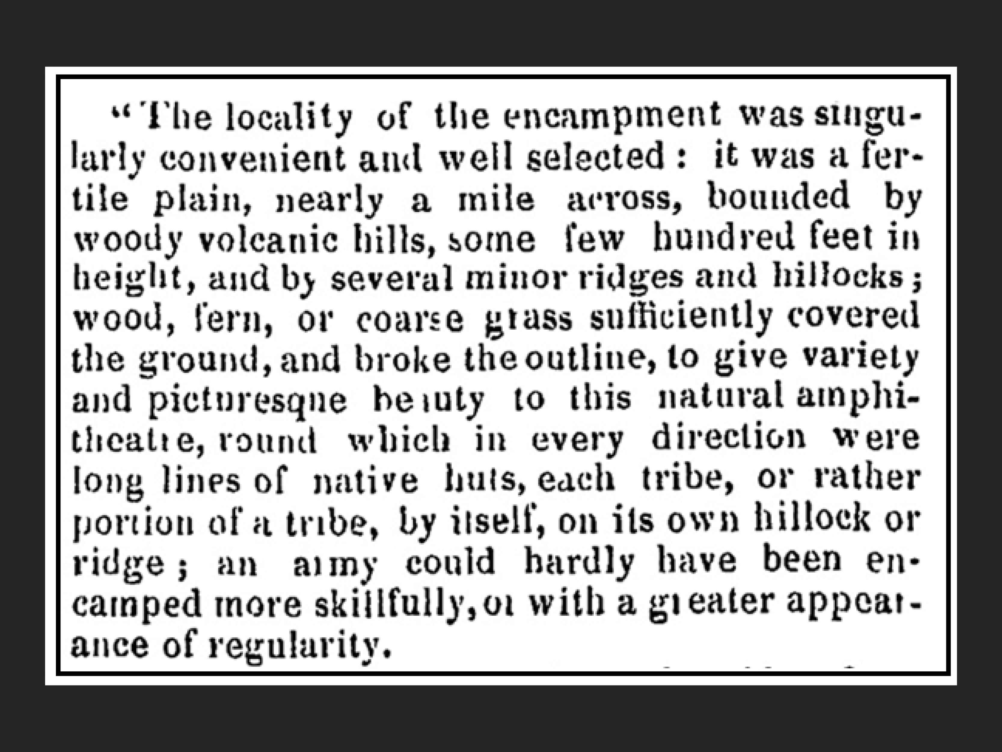
An important earlier reference comes from the New Zealander, 1845. It refers to ‘a fertile plain…bounded by woody volcanic hills’ and ‘this natural ampitheatre’. This sets us off on a trail looking for a geographic landscape similar to the 3D view below.
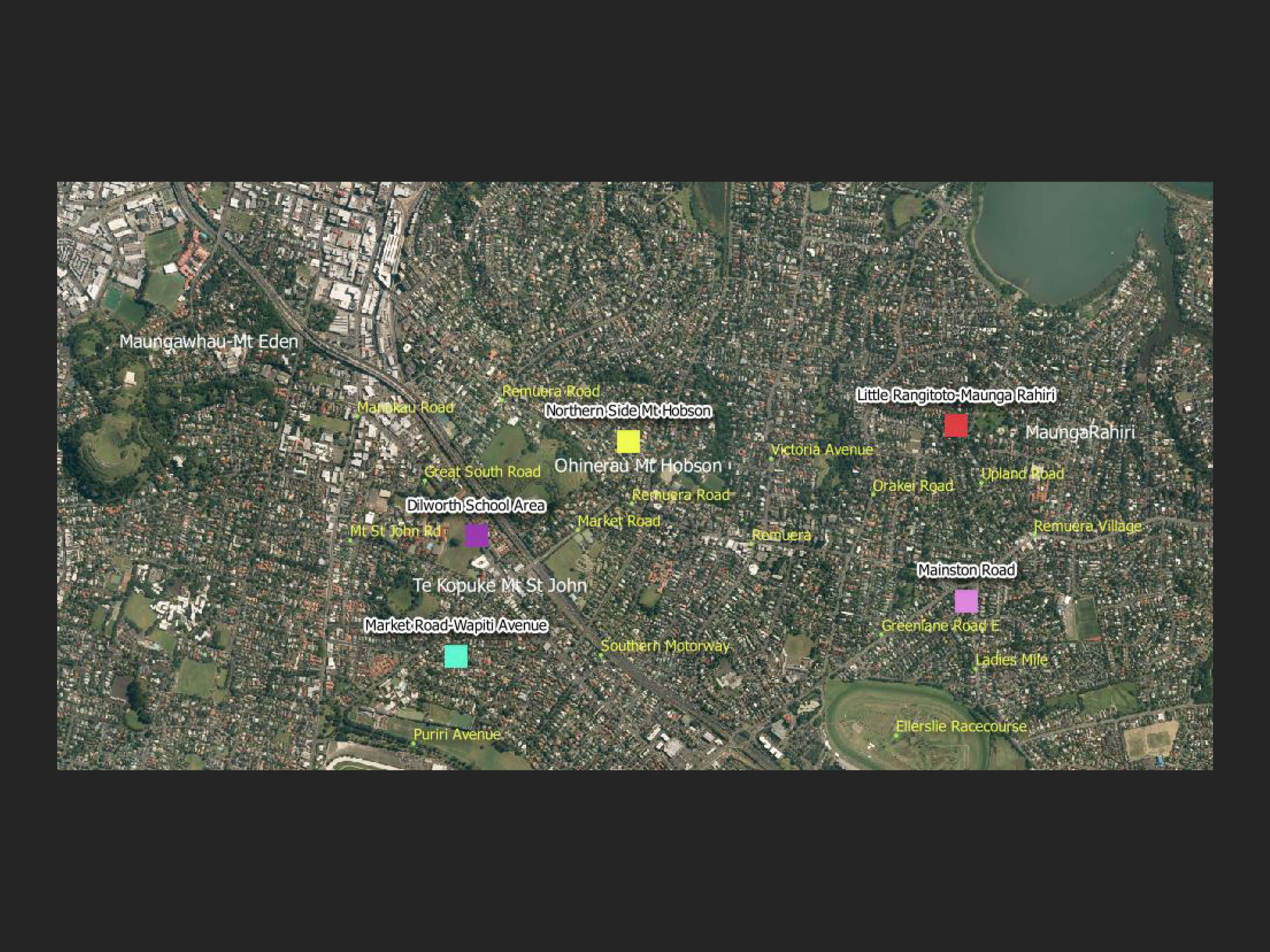
Map using 2010-2012 background imagery (Auckland Council) - possible sites in white with shadows
So where does that leave us? Still grasping for more current or at least modern interpretations from researchers. Peruse what follows and perhaps at the end of this you will have formed your own opinion.
The map image below gives you five of the locations that are mentioned regarding the Great Feast. What follows is a summary of what researchers into the site have come up with.
It’s Time for Some Geospatial Forensics
1 Little Rangitoto Maunga-Rāhiri
Dr Thomas Hocken (1836-1910) acquired the Merrett painting and wrote on the back of the frame:
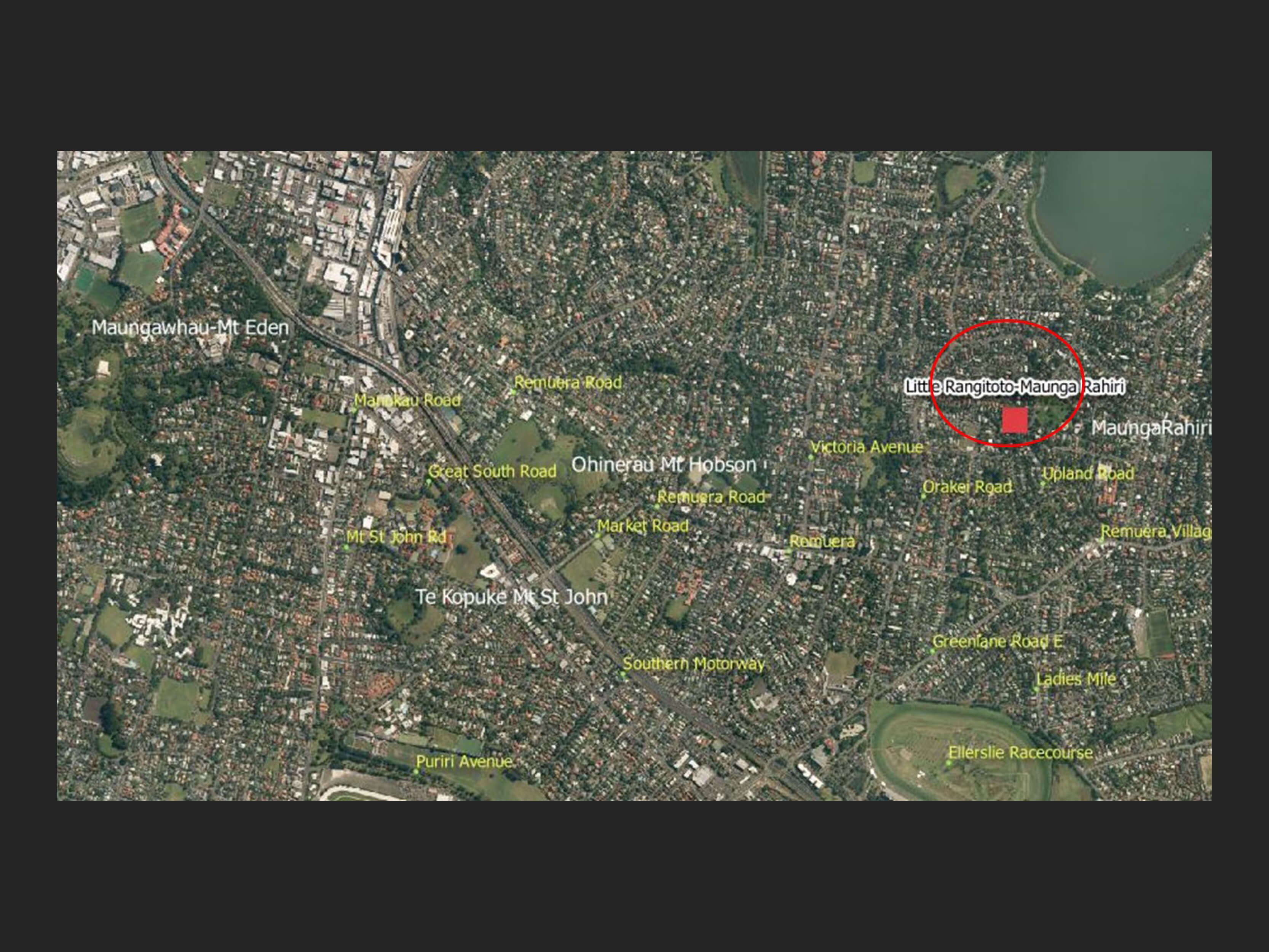
“The site of the Feast being quite forgotten & frequent inquiry failing to locate it, I devoted sometime in March 1908, aided by Mr Allom of Auckland to its discovery. The hill in the foreground of the picture is the foot of Little Rangitoto now reserved for quarry purposes. Mountain Road (now Upland Road) runs through it thus forming an additional landmark. This gives a sufficient key to the position. In early days this piece of ground had several small lagoons which have entirely disappeared.” [4].
What is fascinating about researching history is that the more you delve the more that you discover.
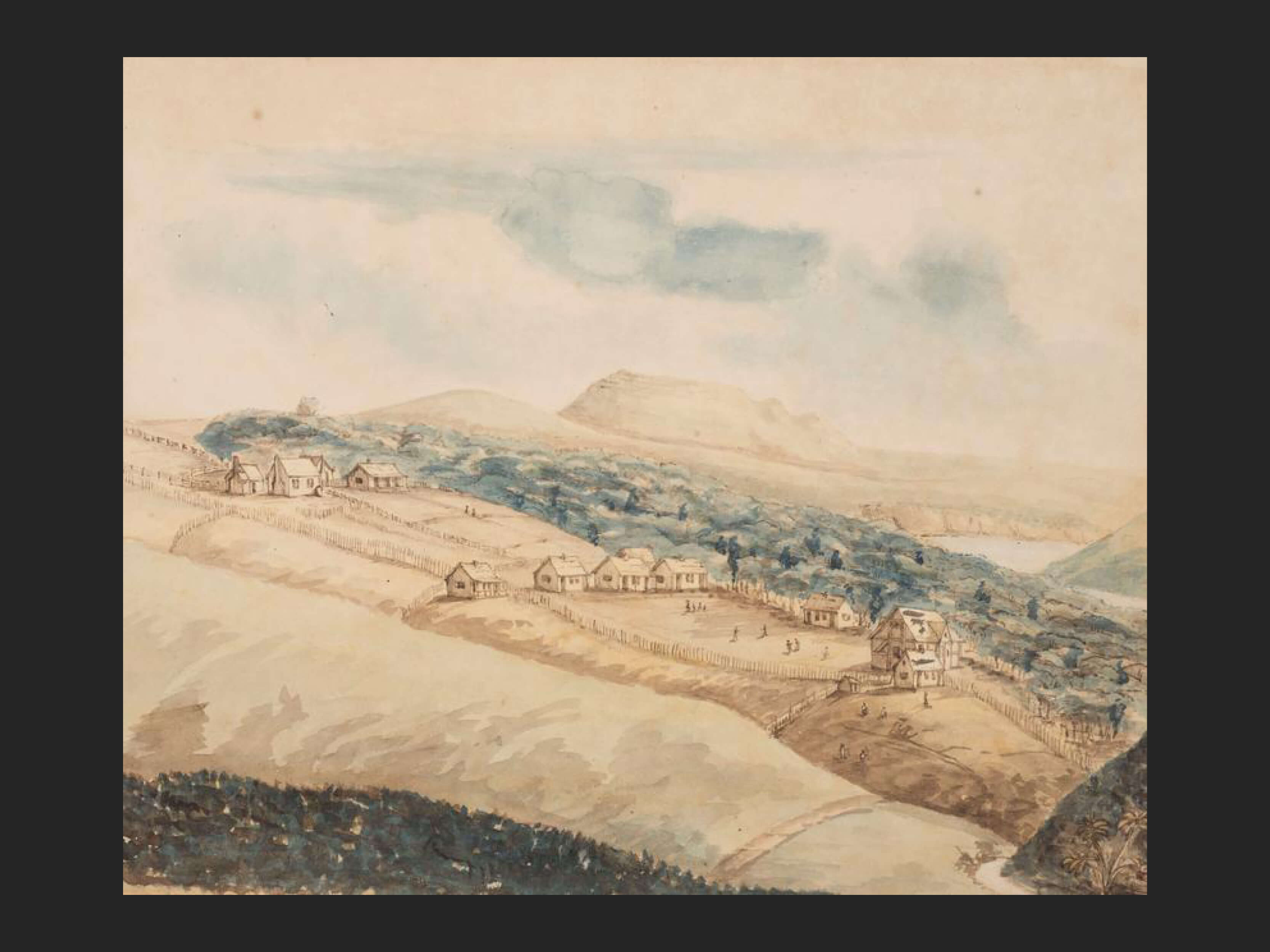
Reverend Thomas Hutton. Purewa. 19th Century. Auckland Art Gallery.
This painting drawn from where Kepa Rd is today and looking towards Ōhinerau Mt Hobson could be the only one that shows Little Rangitoto Maunga-Rāhiri on land rising from Hobson Bay before quarrying began. If Merrett began his artwork from the top of this mountain then it is quite conceiveable that a line through Ōhinerau Mt Hobson as indicated in the lithograph would show Maungawhau Mt Eden in the background and not what we can presume to be Ōhinerau Mt Hobson.
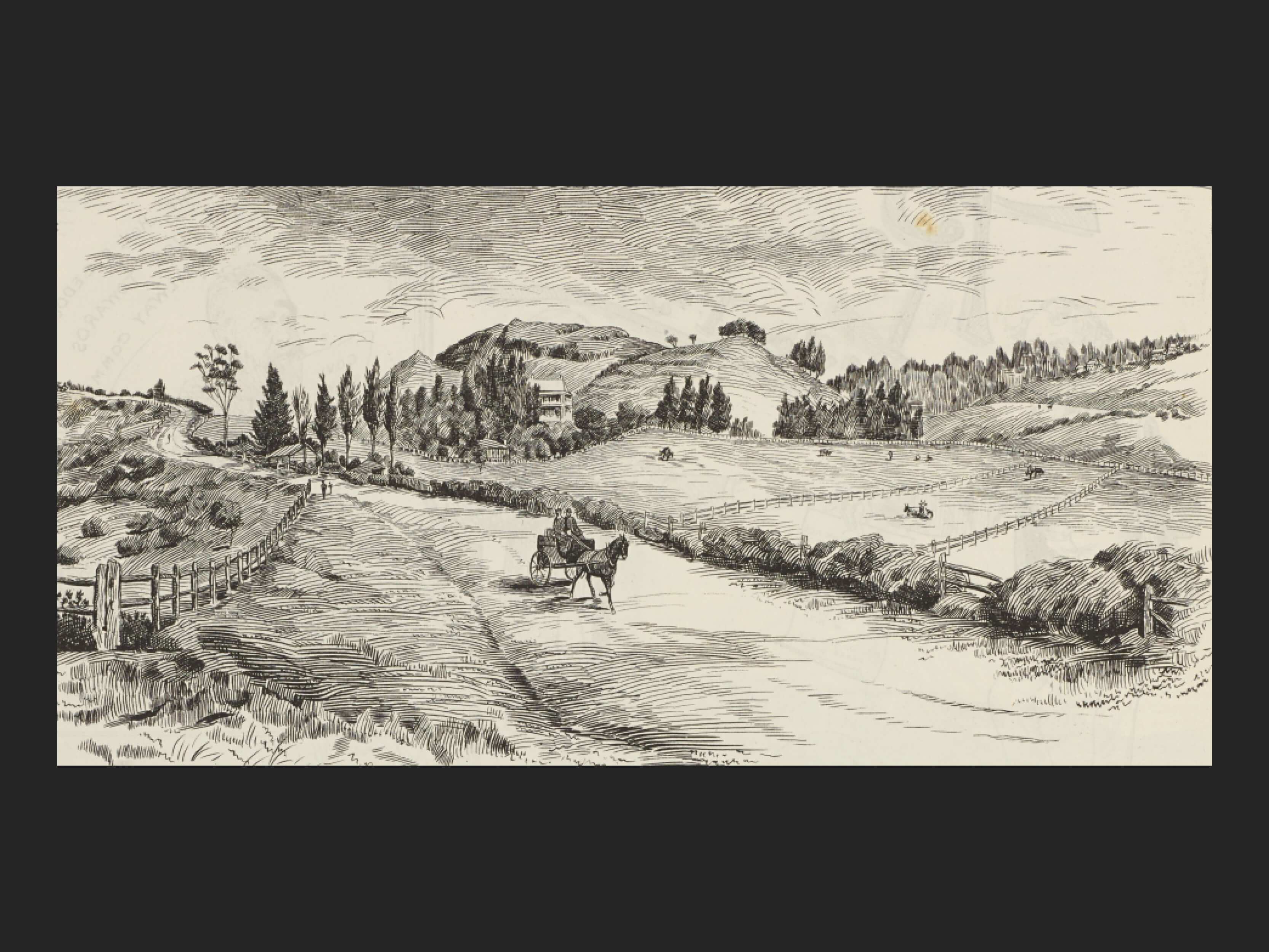
Picturesque Remuera. Auckland Libraries Heritage Collection 4 NZG_18920827 27 August 1892.
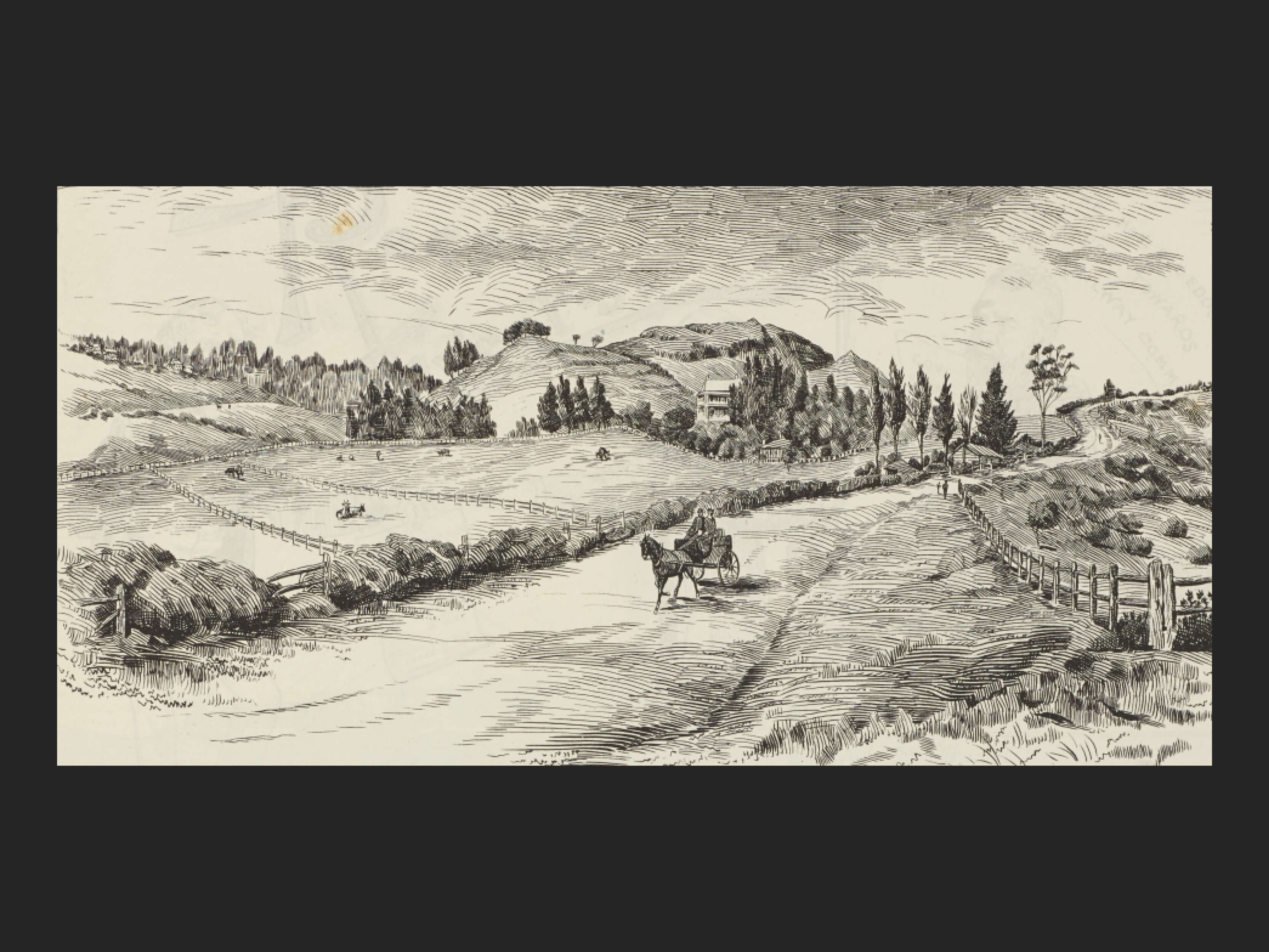
Picturesque Remuera. Auckland Libraries Heritage Collection 4 NZG_18920827 27 August 1892.
The swipe below is of pencil drawing published in the New Zealand Graphic 1892 of Upland Road. The image is sourced from Auckland Libraries Heritage Collections and does not look geographically correct with Upland Road to the east of what is Little Rangitoto-MaungaRahiri.
But draw the swipe across from right to left and what you see is the same image horizontally flipped so that Upland Road now is to the right of the mountain. It looks correct. What we have is an artwork of where Merrett may have at least envisaged his painting. The house in the drawing is probably even that referred to by xxxx as Mr Cheesman’s in Benson Road.
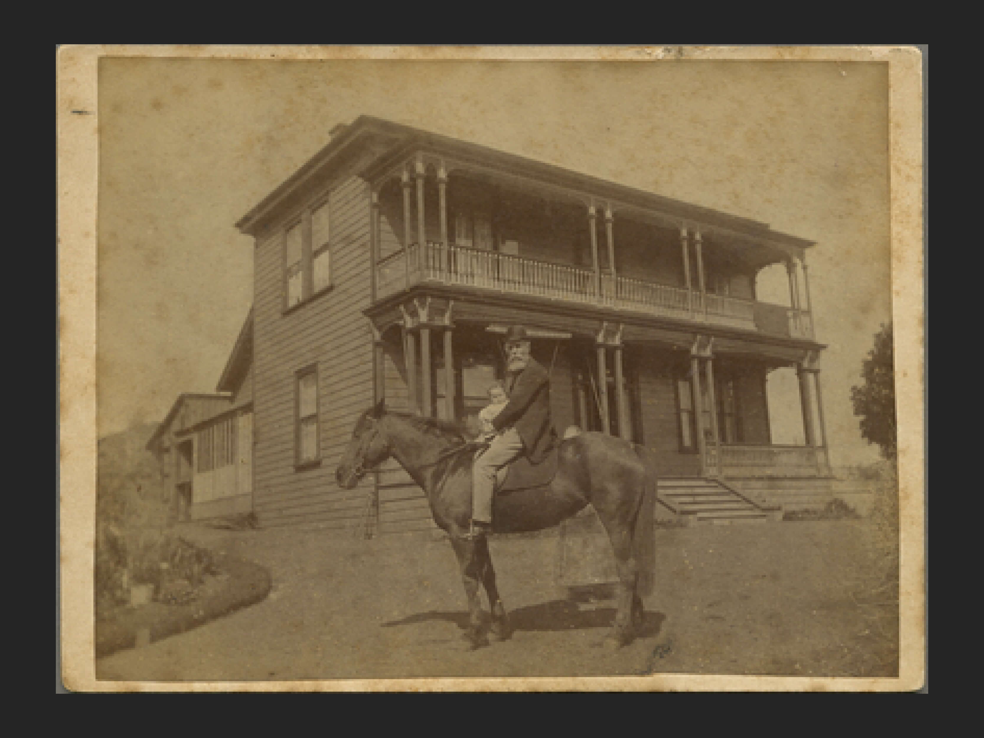
Thomas Cheeseman and daughter, Benson Road
This is Thomas Cheeseman and his granddaughter outside of his house at 20 Benson Road, just down from Little Rangitoto MaungaRahiri.
The house is reminiscent of the one in the pencil drawing and its location would be in keeping with what the artist depicted.
Auckland Libraries Kura Heritage Collection 4-7808
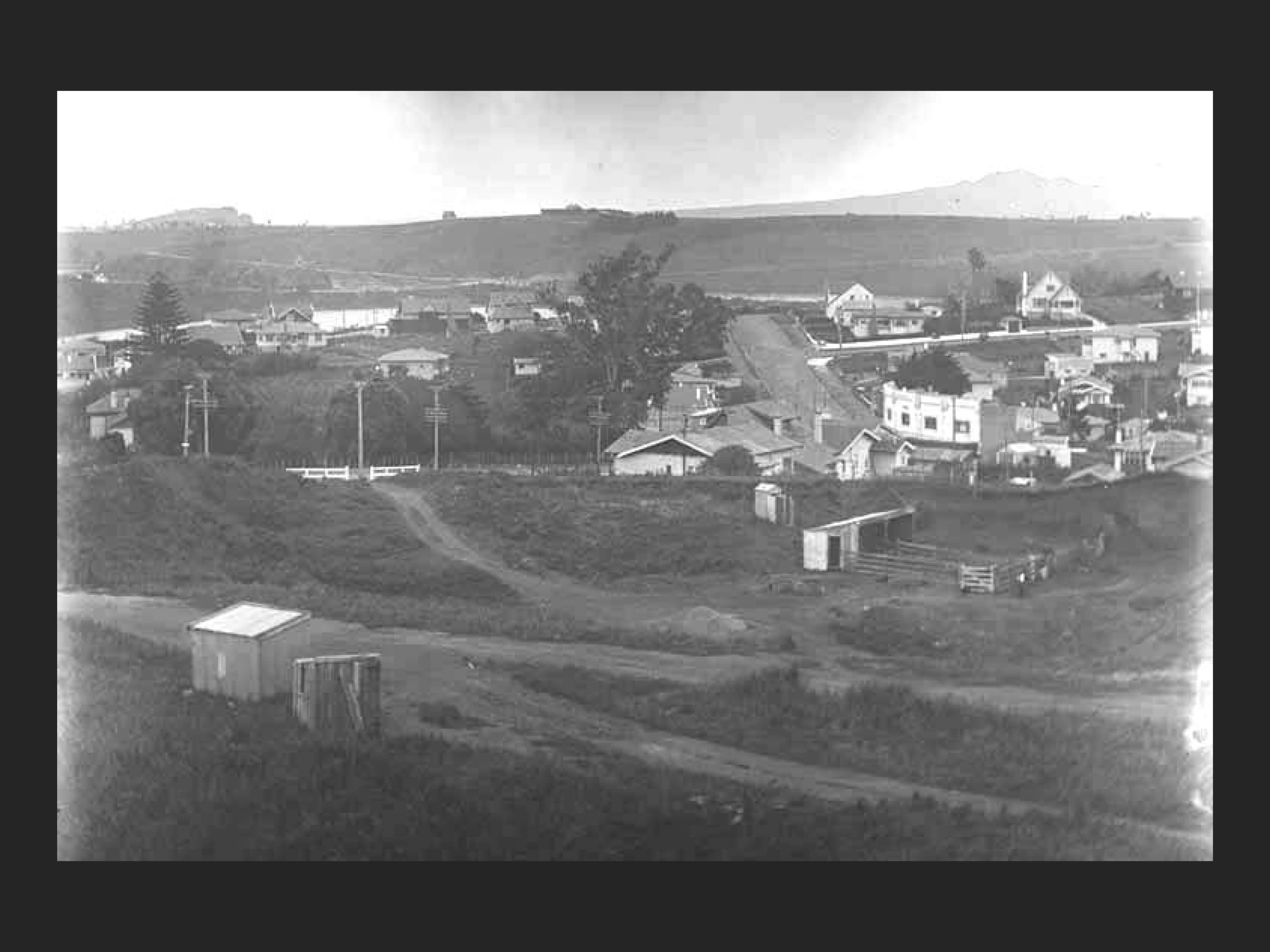
The site which Dr Hocken and Mr Allom identify as being where the feast took place lies on a sloping block of north facing land. This does not fit in with newspaper descriptions of a fertile plain. The image ( below ) of the area taken in the 1930s looking north from Little Rangitoto-Maunga Rahiri shows how the topography is probably unsuitable for the Great Feast and does not fit the 1844 Southern Cross description of the environs. The Benson Road shops can be seen in the mid right.
3D viewline using current LINZ 1m DEM data
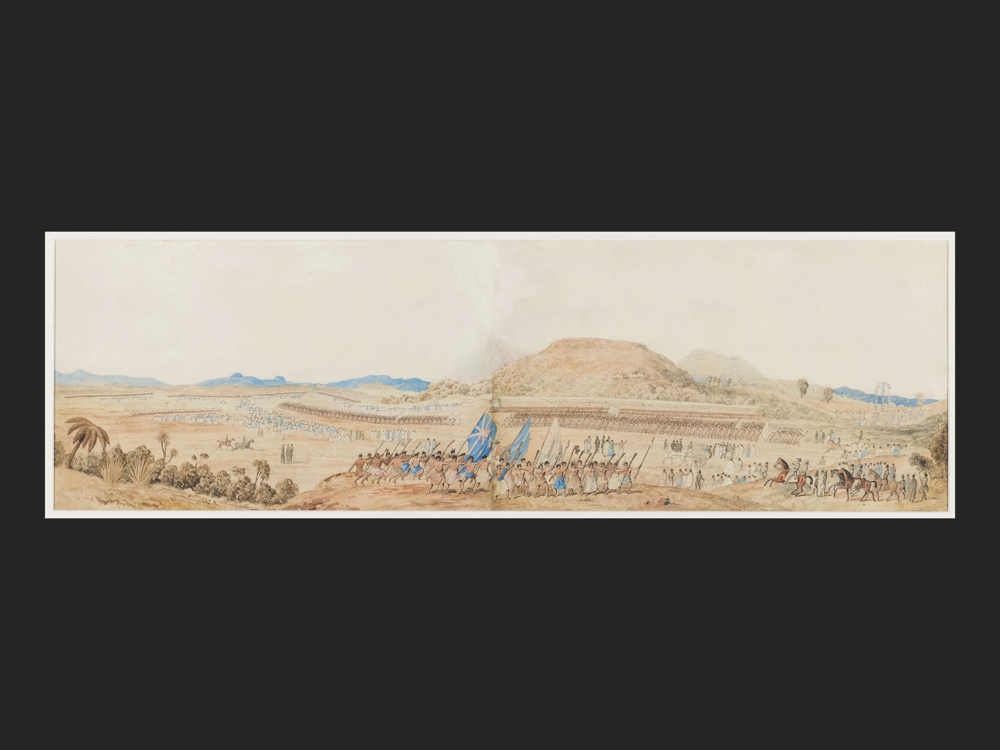
The Merrett painting of the Great Feast
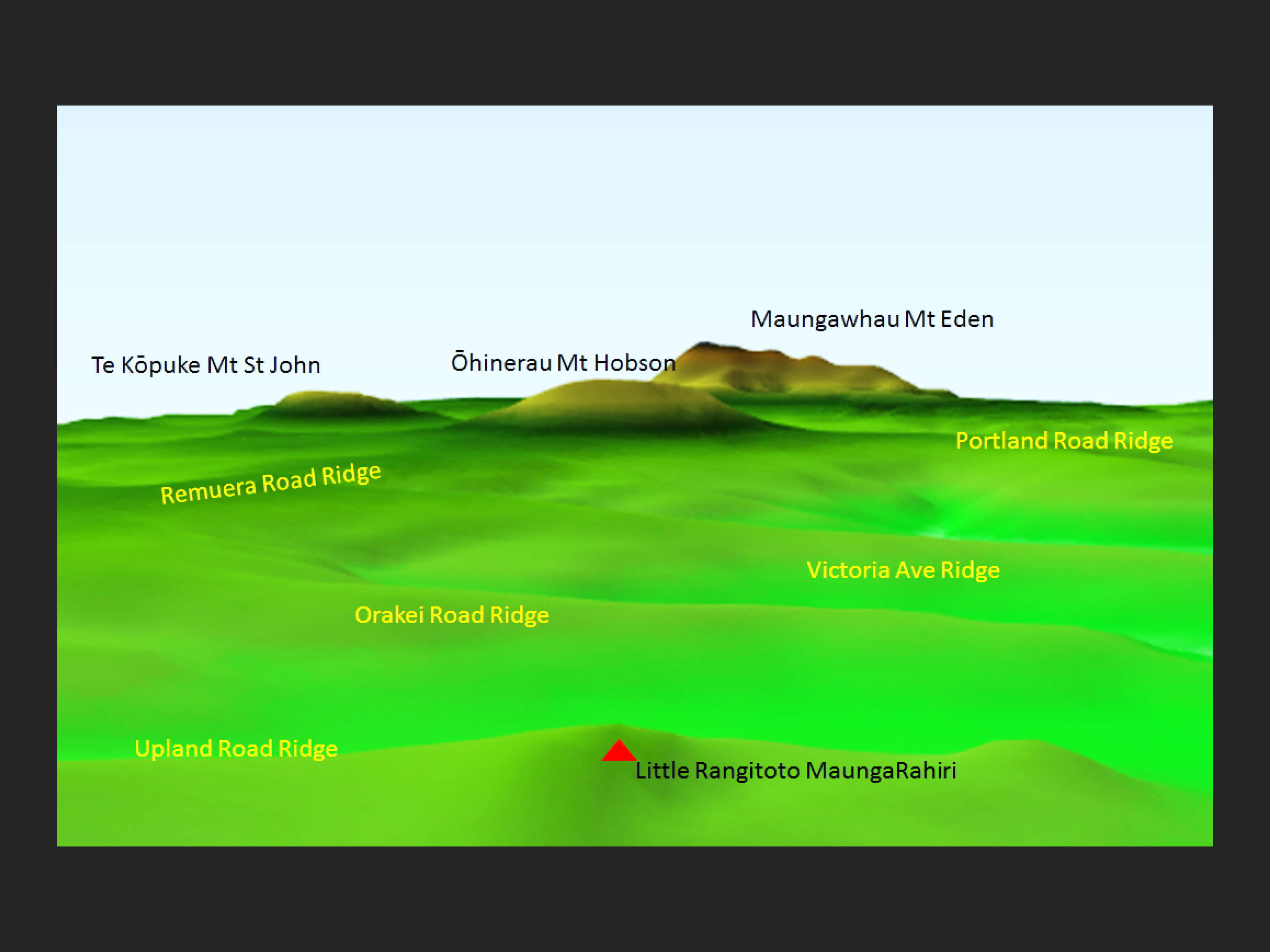
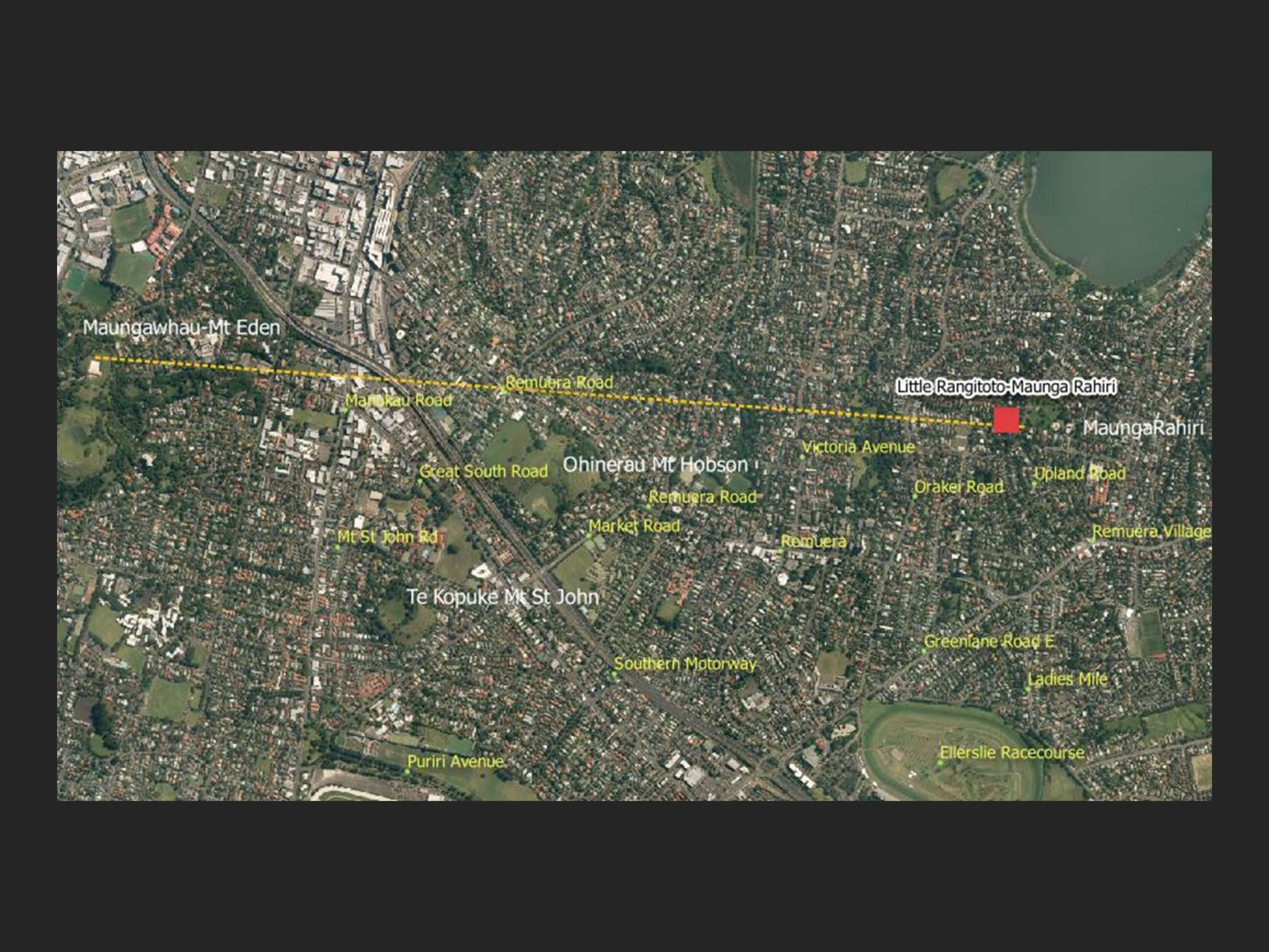
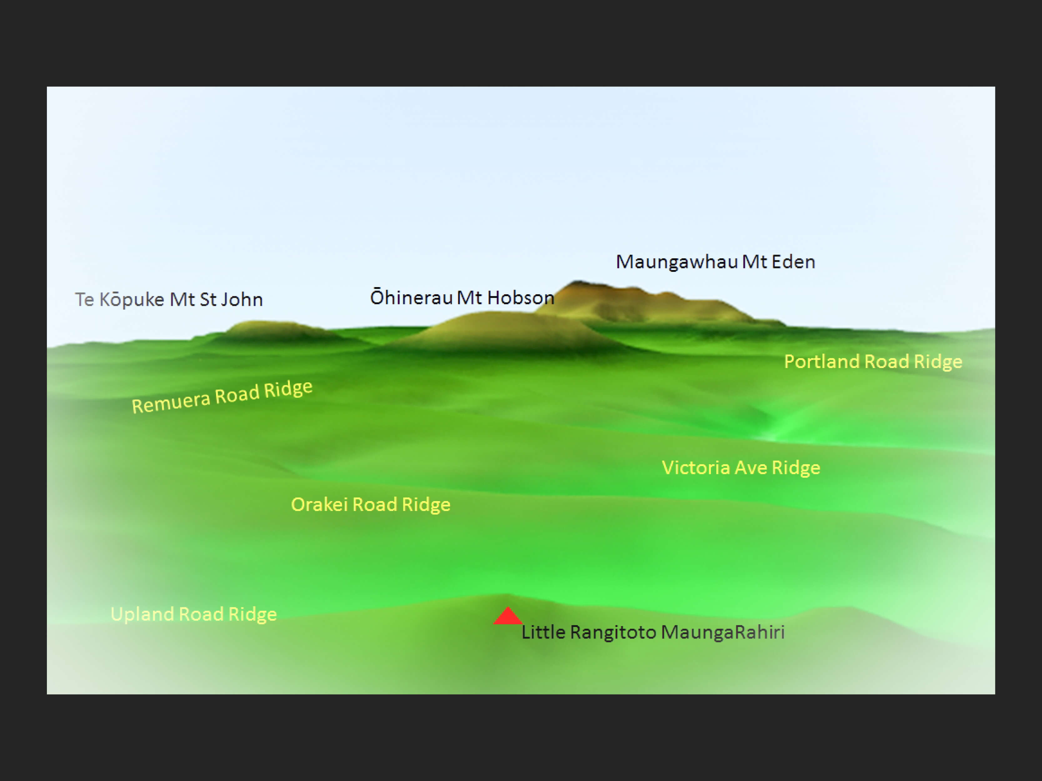
From the mountain, as it would have been pre-quarrying, a line of sight would take in both Ōhinerau Mt Hobson and Maungawhau Mt Eden. The mountain has been quarried and that is reflected in this 3D view. But you can see how Merrett might have had a line of vision that fits the litho descriptors.
The Merrett original does show the alignment of the mountains; but does the depiction fit the landscape?
and when you look at a 3D view of the landscape surrounding where the feast was judged to have taken place would you say that it fits the description in the newspaper articles?
So, is it hard to tell from the Merrett painting if Hocken and Allom are correct? The environs as we have shown comprises a steep ridge and valley terrain not fitting the description of an ampitheatre and a vast plain.
This raises the question of artistic licence. Was Merrett inspired to create his painting from around Little Rangitoto-MaungaRahiri thereby giving the mountains (Little Rangitoto-MaungaRahiri, Ōhinerau Mt Hobson and Maungawhau Mt Eden) a strong presence in his depiction of the feast but then continued to add the true terrain of the feast, its site layout and the participants around them at the true site? Quite possible.
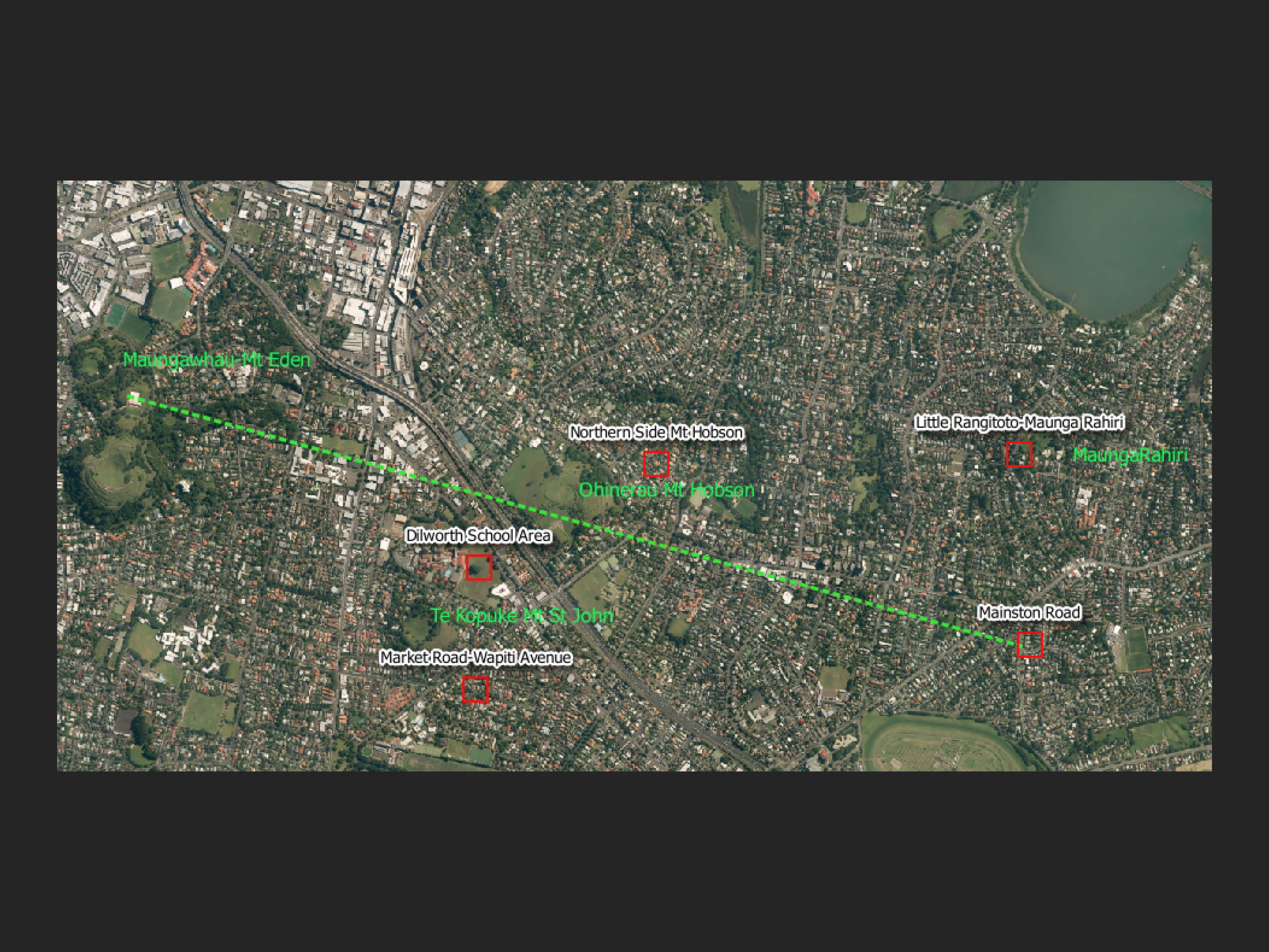
2 Mainston Road, Remuera
David Simmons (1930-2015), Ethnologist and former Assistant Director of Auckland Museum, said the nearest approximation of the vantage point for the painting is the upper verandah of the house, Mainston, on the corner of Remuera Road, Mainston Road and Tahora Avenue: it is only from this position that the hills seen line up but not quite as they are in the painting. The lineation is better from Little Rangtitoto-MaungaRahiri.
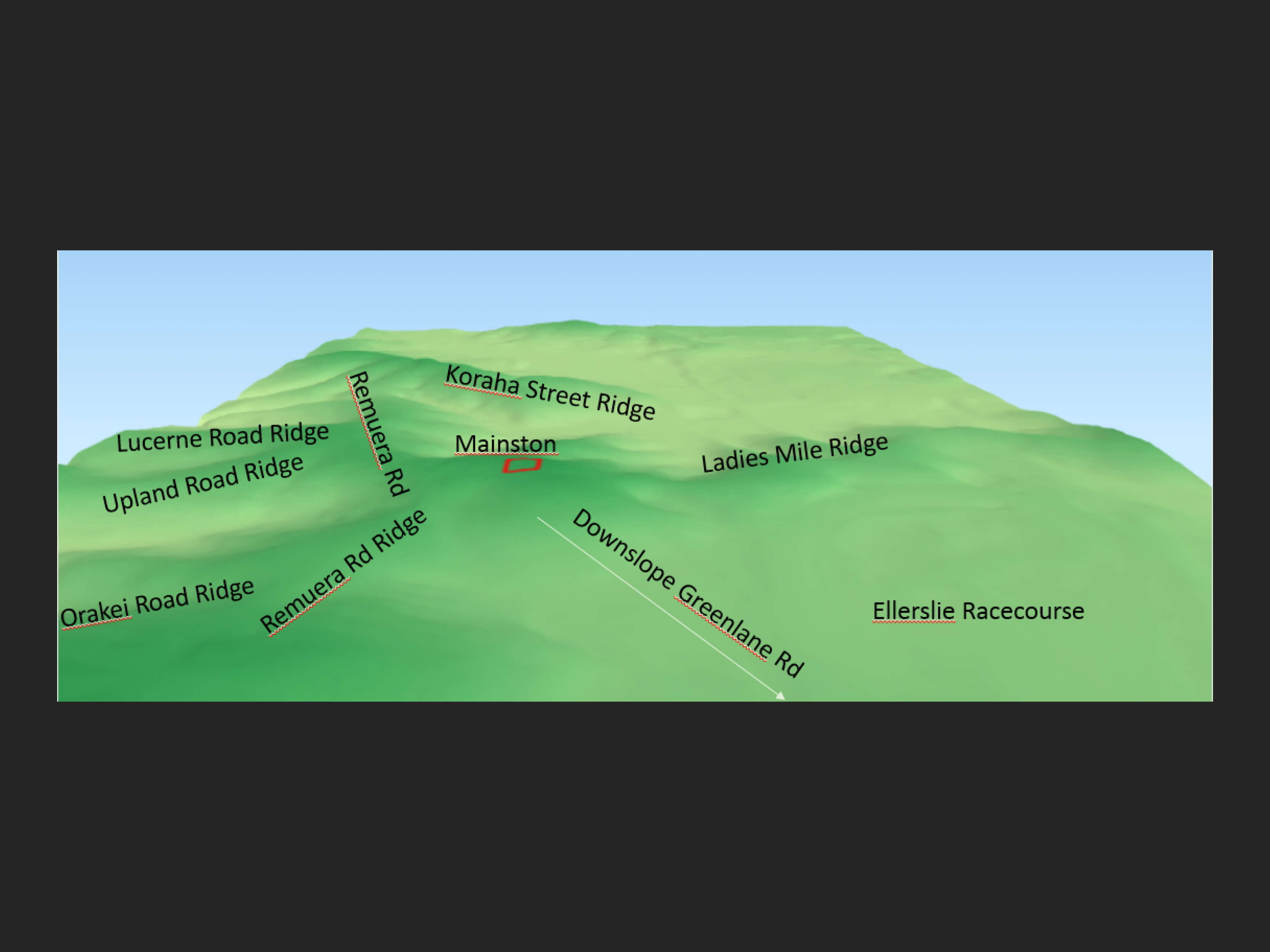
Also when you look at the terrain the environs of the old house does not provide the large plain described in newspaper clippings. The area of land, now part of Ellerslie Racecourse, is large and flattish but where are the hills mentioned. Mainston is bordered by a series of ridges from which emanate reasonably steep-sloped valleys.
So this as a site for the Great Feast also appears to have the same shortfalls as the previous one.
Papers Past, National Library, Wellington
Which brings us back to the point about artistic licence. We could leave it all here but there is another question which raises another possibility and it ties in with those reports in both the Auckland Star 1924 and the Wairarapa Daily Times 1936.
Mistaken Maunga?
Could it be possible that the mountain in the foreground is not ‘Mt Hobson’ as Day and Hague labelled it but rather Te Kōpuke Mt St John?
3 Remuera-Epsom
So could the lithograph which names these two mountains as ‘Mt Hobson’ ( foreground ) and ‘Mt Eden’ ( background ) be in error? And to get the two to line up as shown would the painting have had to been drawn from the Remuera Road side of Mt Hobson.
The mountains would line up as in the artwork but how do the other features fit? Te Wherowhero’s site with its flagpoles seems to be beside some rising flank of a mountain – could that be Ōhinerau Mt Hobson?
So maybe the mountain in the foreground is not Ohinerau Mt Hobson. And then there is the question of Captain Scott’s farm which may have been near Epsom Rd (now Manukau Rd ) where Inverary Ave now runs.
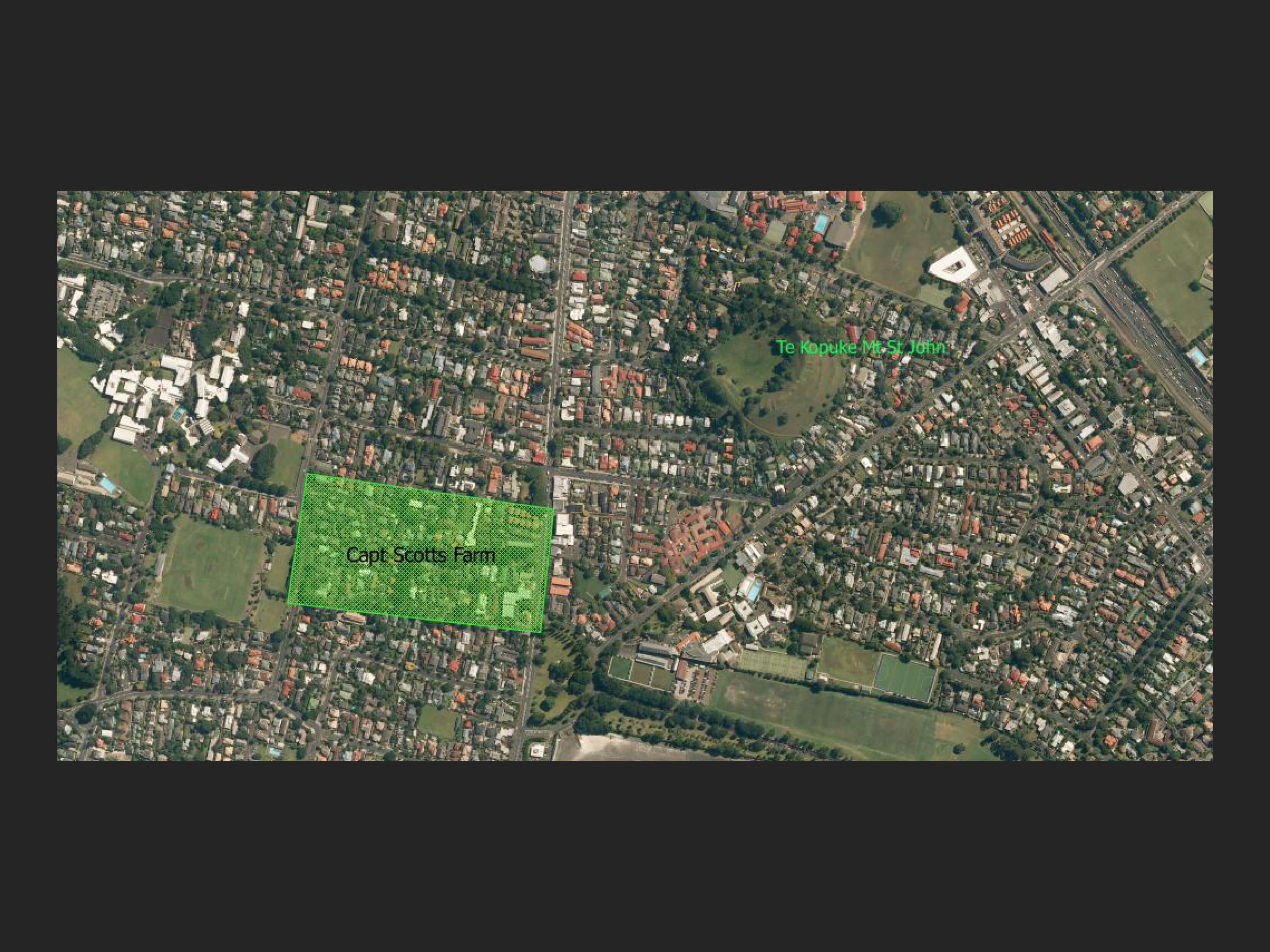
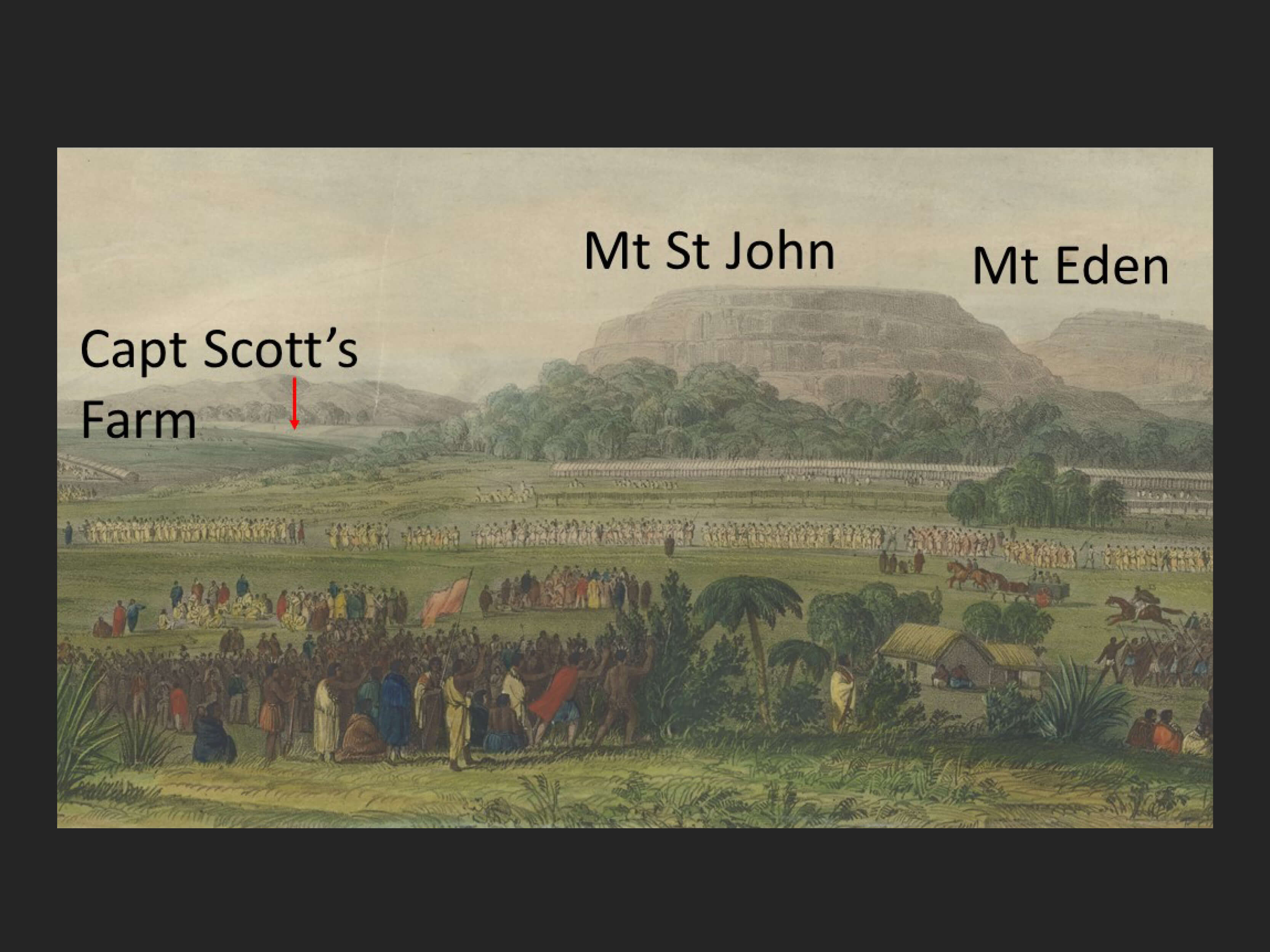
From works on the history of Epsom ( eg The History of Epsom ed Graham Bush, 2006), it appears that a Scott’s farm was located somewhere in this proximity. The lithograph shows the farm referenced to the south west of a mountain and it would add logic to it being Te Kōpuke Mt St John when you see its location in relation to the volcanic cone. Just was it Captain Scott who owned it? More research…..
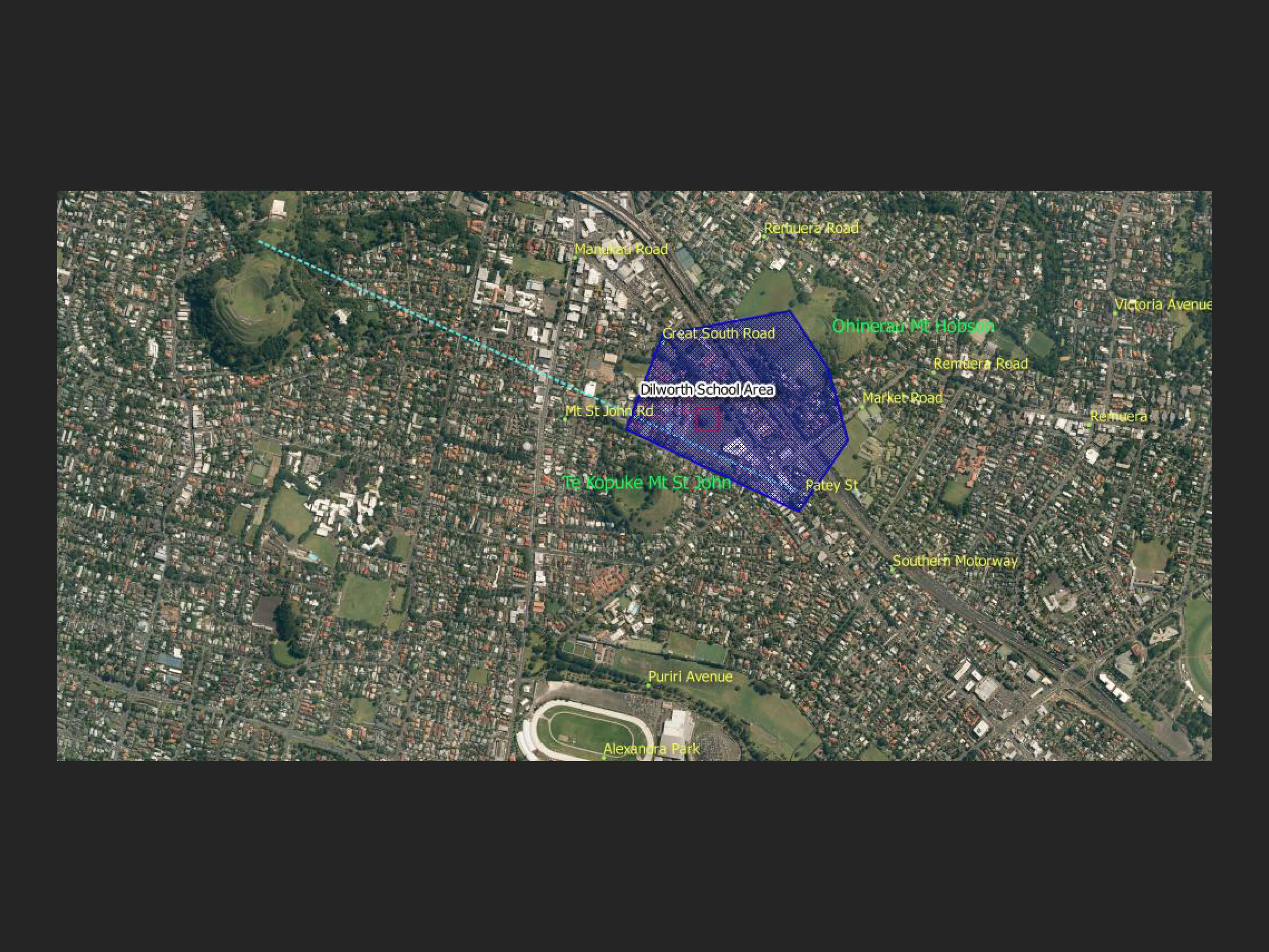
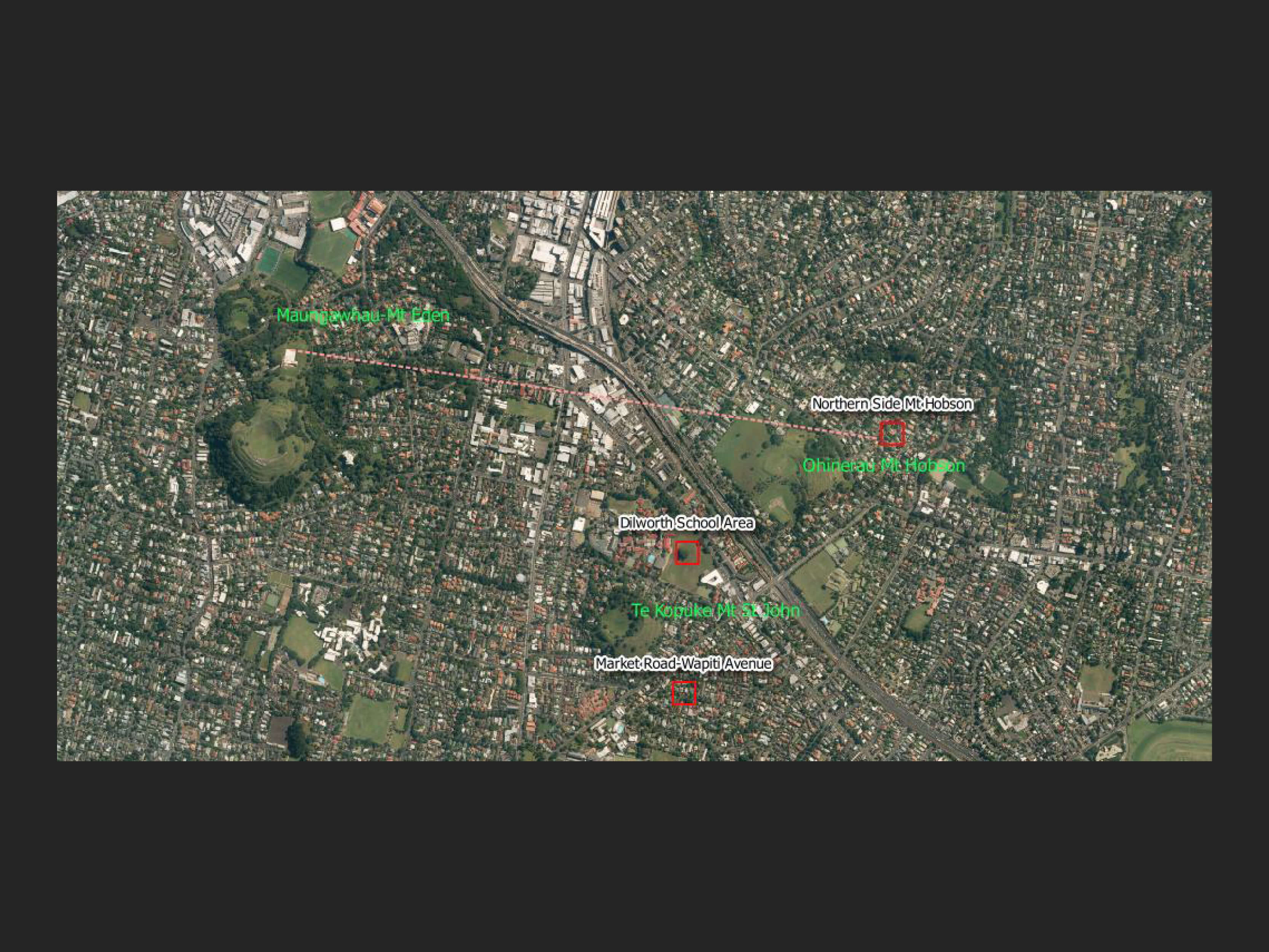
Dr Bruce Hayward, geologist and marine ecologist, believes the main mountain / maunga to be Te Kōpuke Mt St John. He says the feast was located close to Dilworth School grounds on Mt St John Road. And that the artworks are clearly painted from close to the intersection of Market Rd and Great South Rd or maybe a little up the hill nearer the Patey St intersection. He believes the site was closer to Market Rd to get the Three Kings peaks correct and the pool on the left was the wetland which existed just south of Market Road down towards the old ice cream factory. [5]
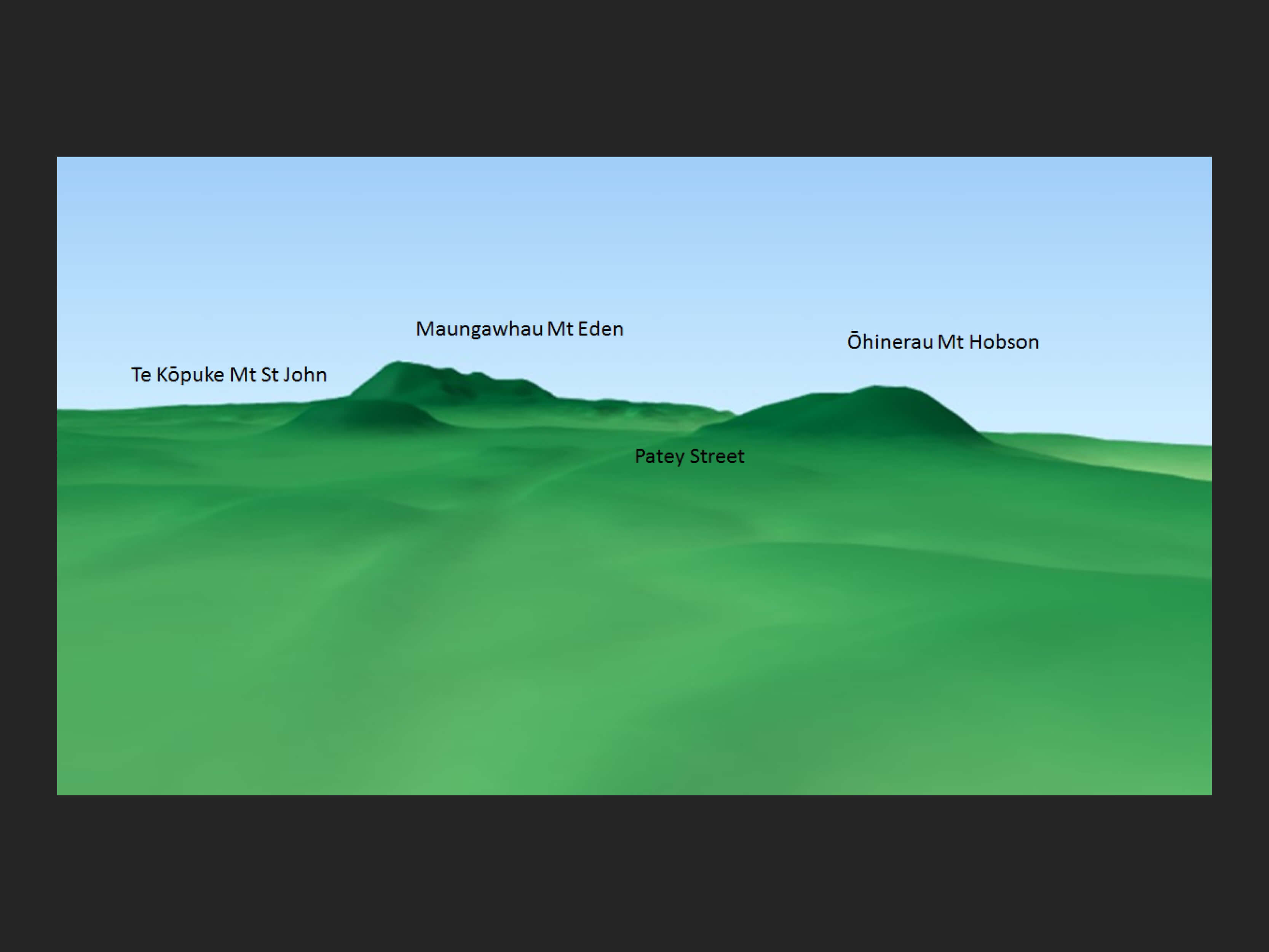
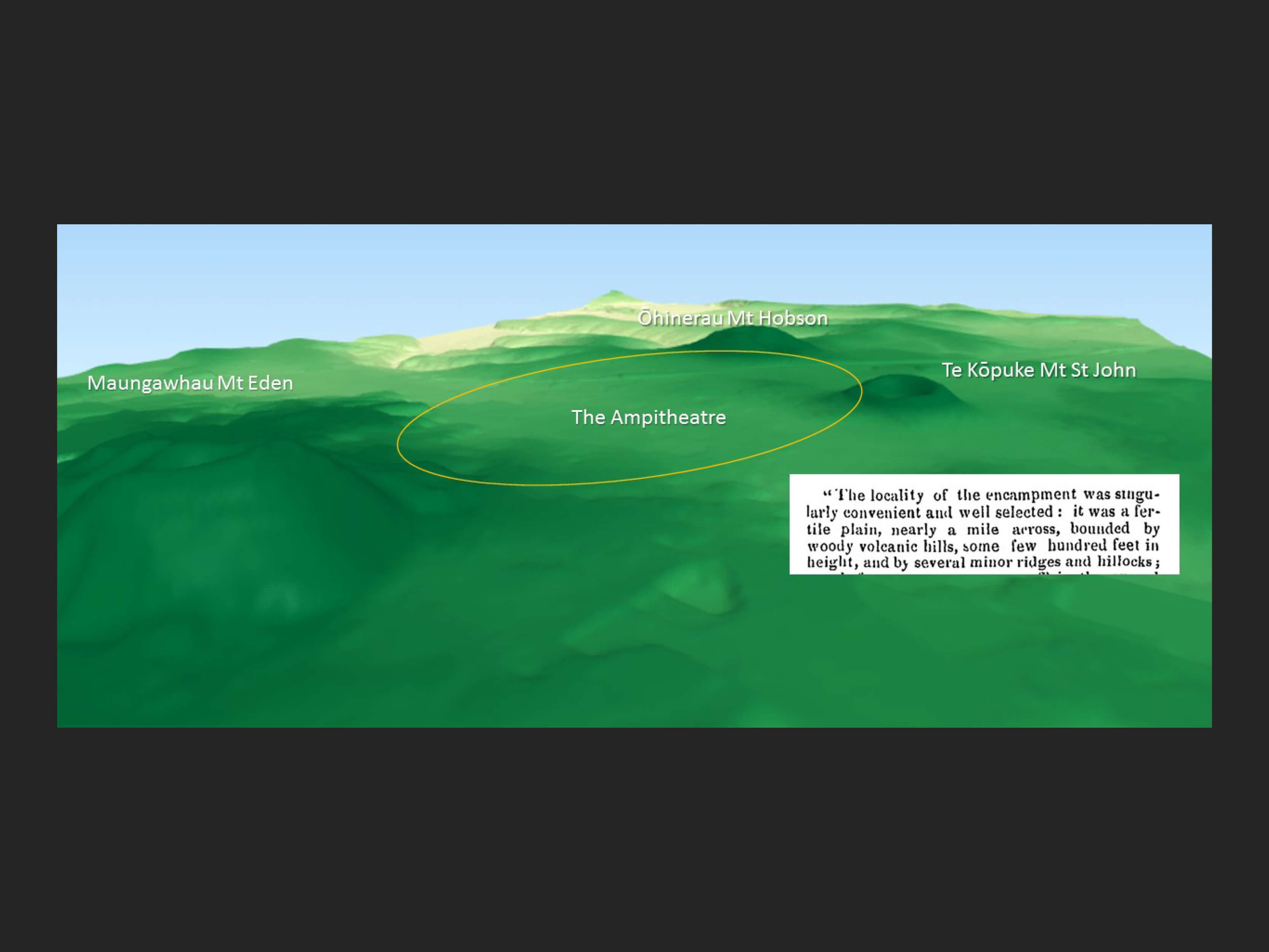
A 3D view from around Patey Street shows how this interpretation could be the most logical. And when you look for a space that could be described as an ampitheatre there is an area that fits that description.
But take another look at the Merrett painting. If the near mountain is Te Kopuke- Mt St John then on which hill are the warriors welcoming the guests standing on? And, therefore, is the feast site actually in the Wapiti Avenue area of Market Road? It’s all a confusion.
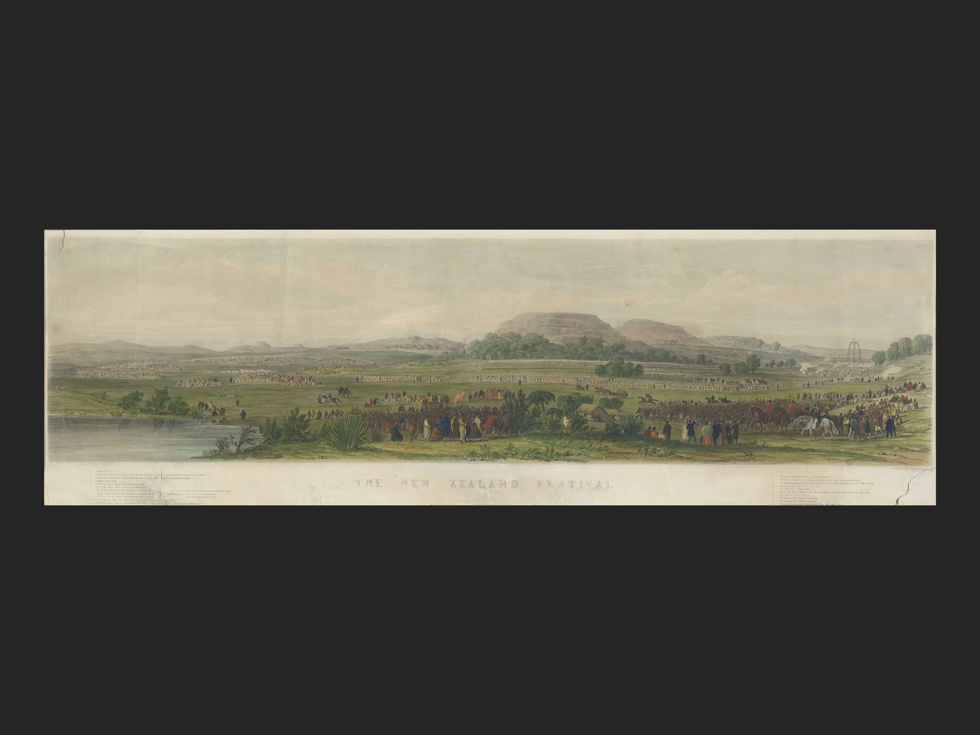
An interesting addition in the lithograph that is not in the Merrett original is the swamp in the bottom left. Ferdinand Von Hochstetter in his work Geology of New Zealand circa 1850 writes of “Mt St John, a small but very regular scoria cone….. At its foot, to the south-east, lie a small swamp, which fills the bed of a crater of a low tuff cone” (p196-197)
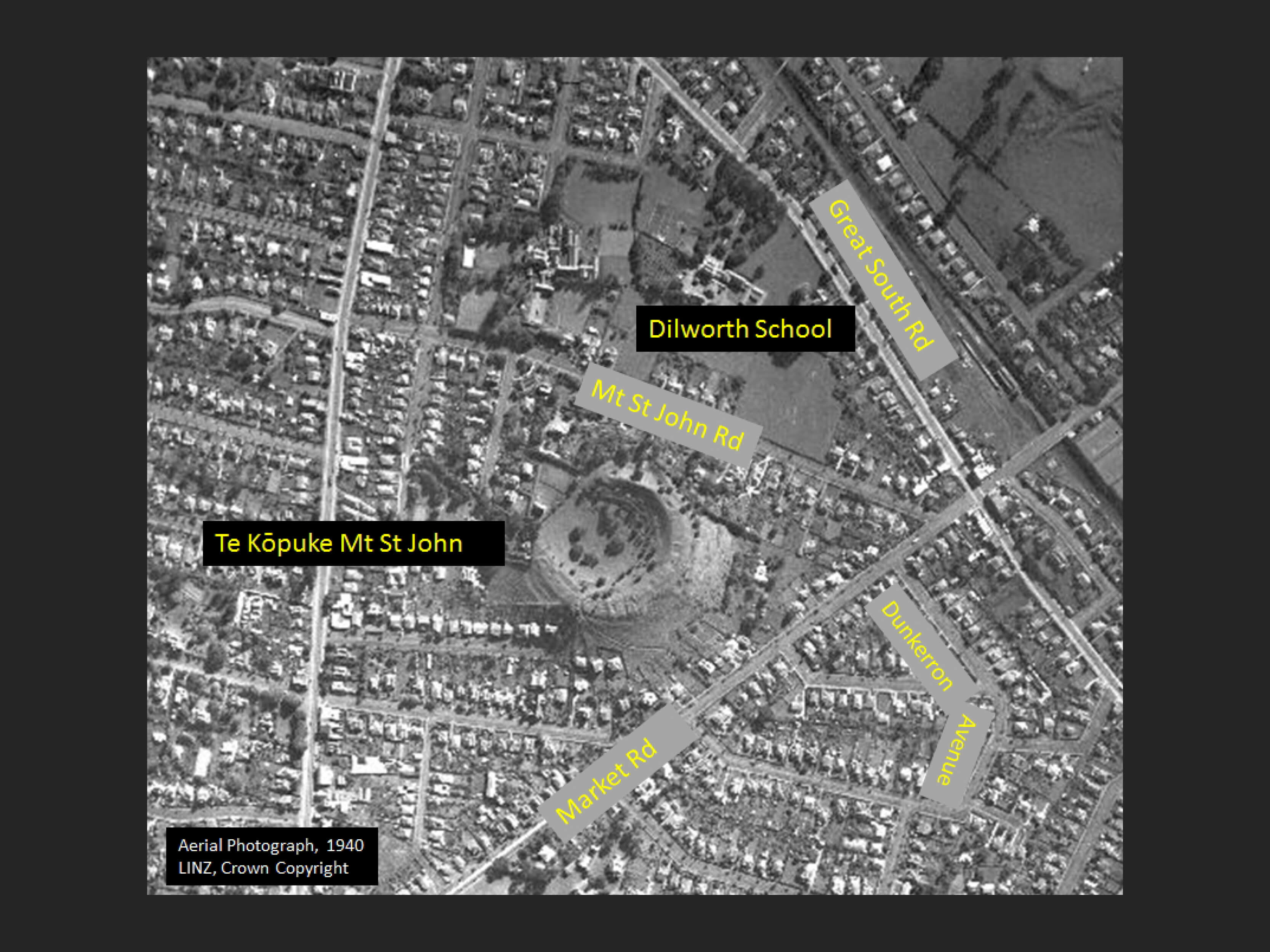
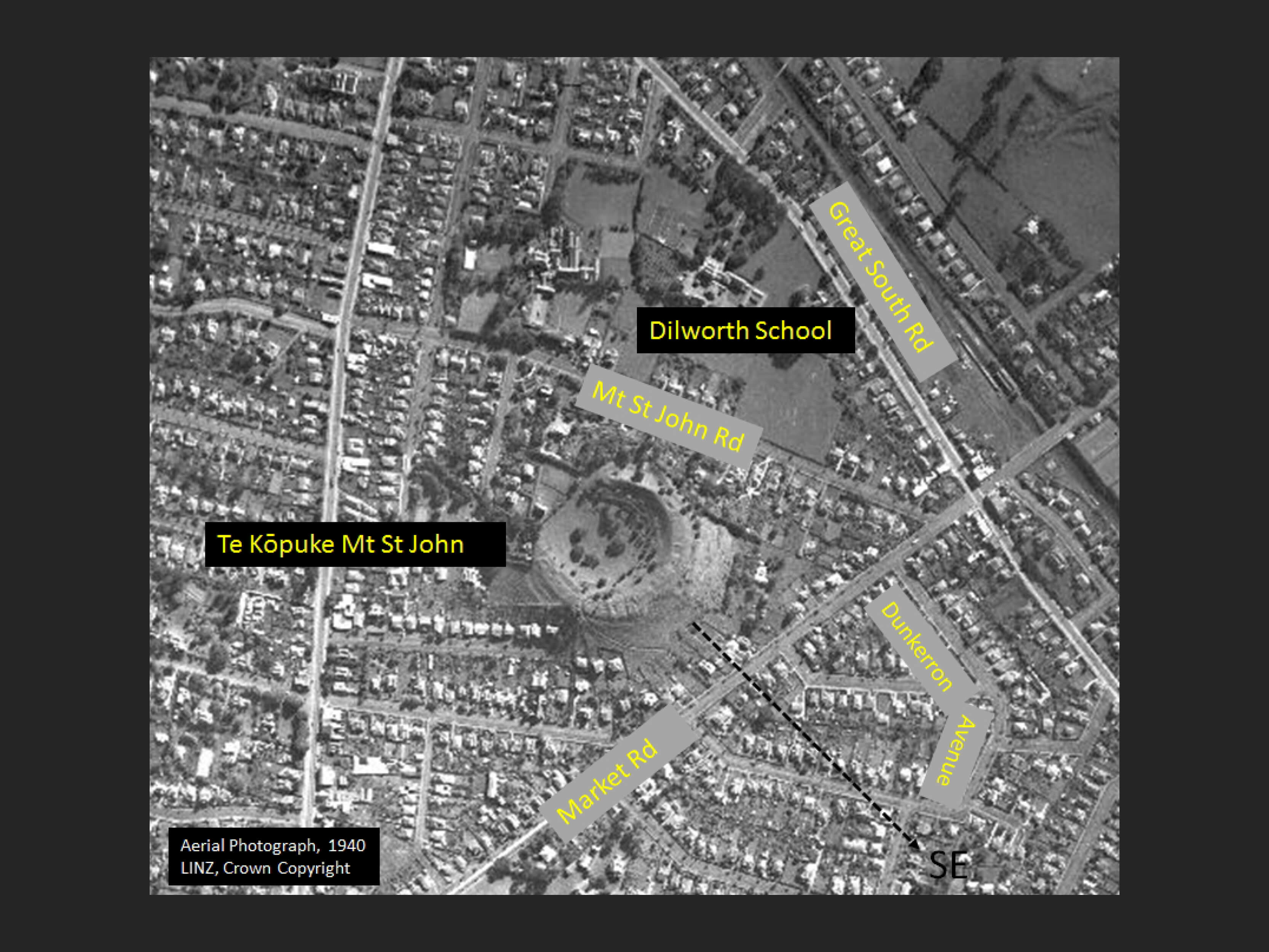
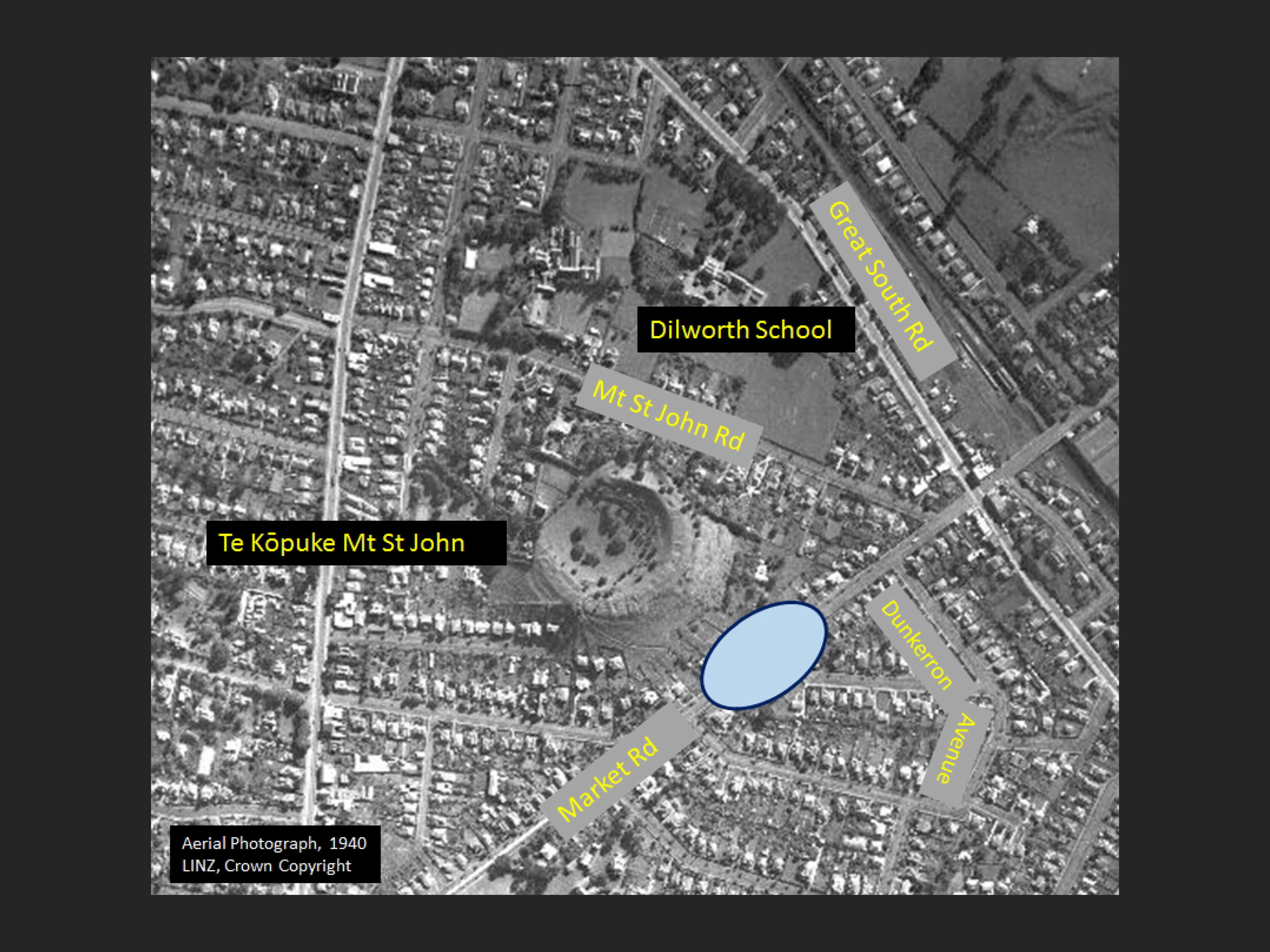
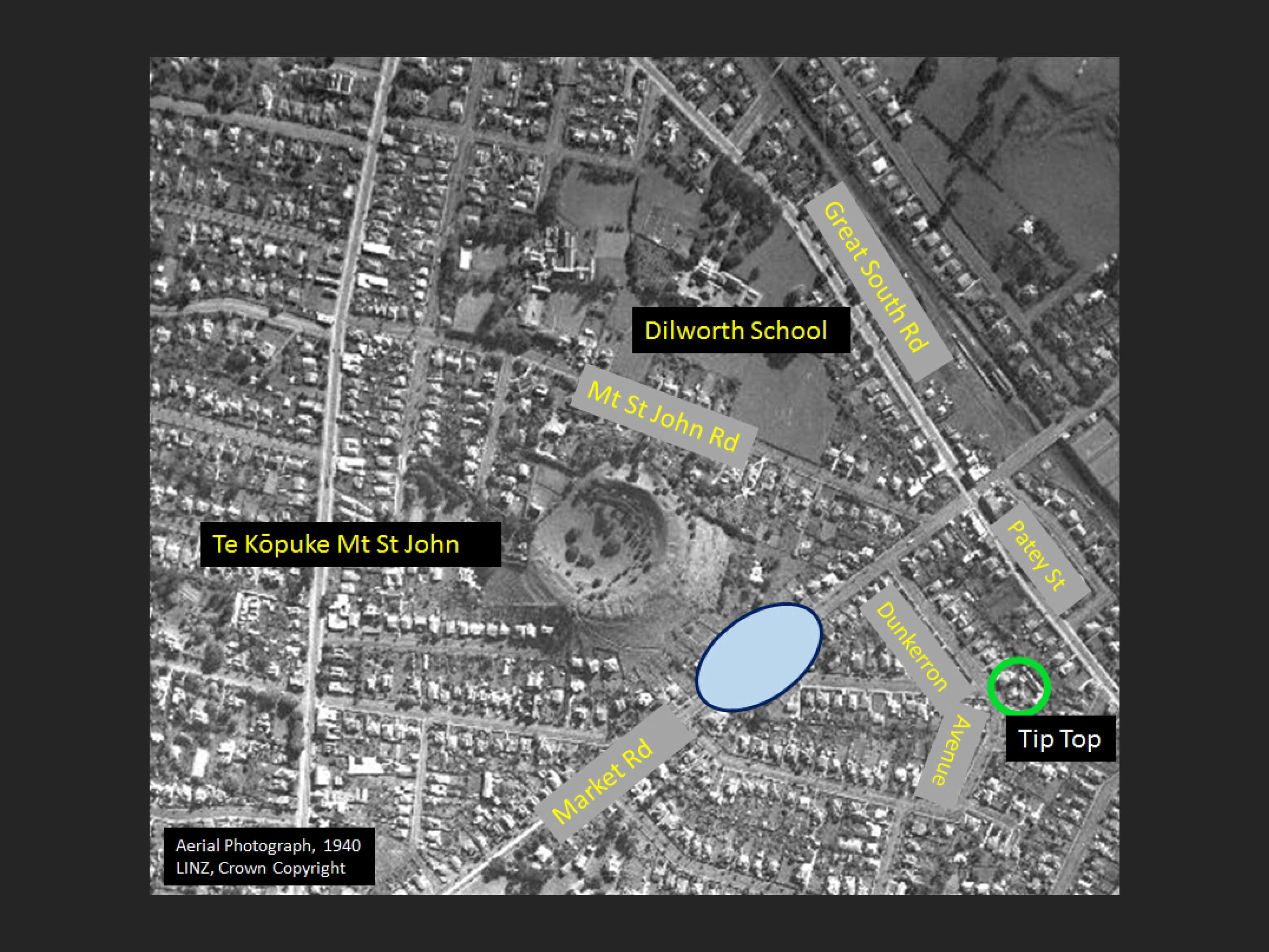
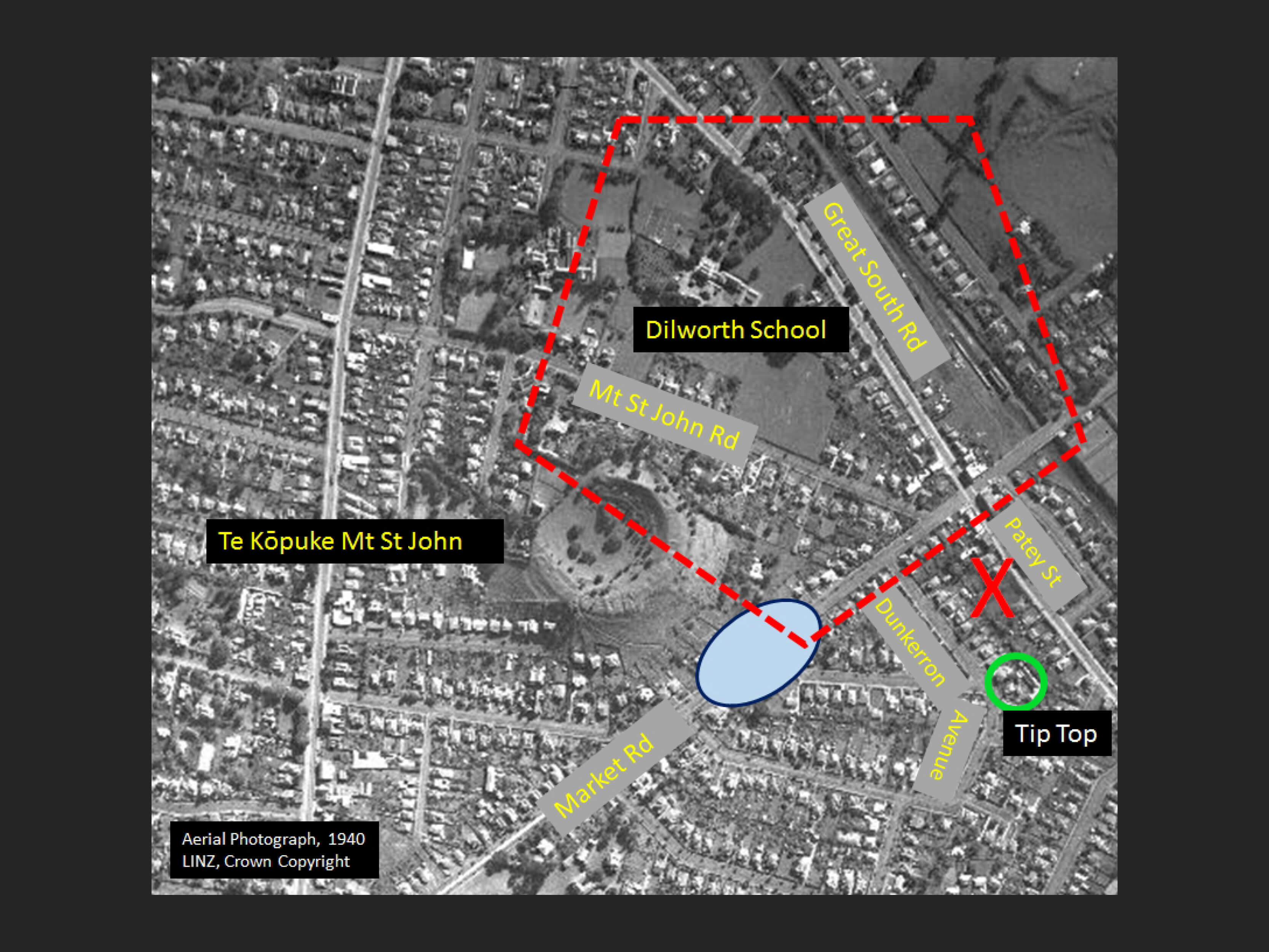
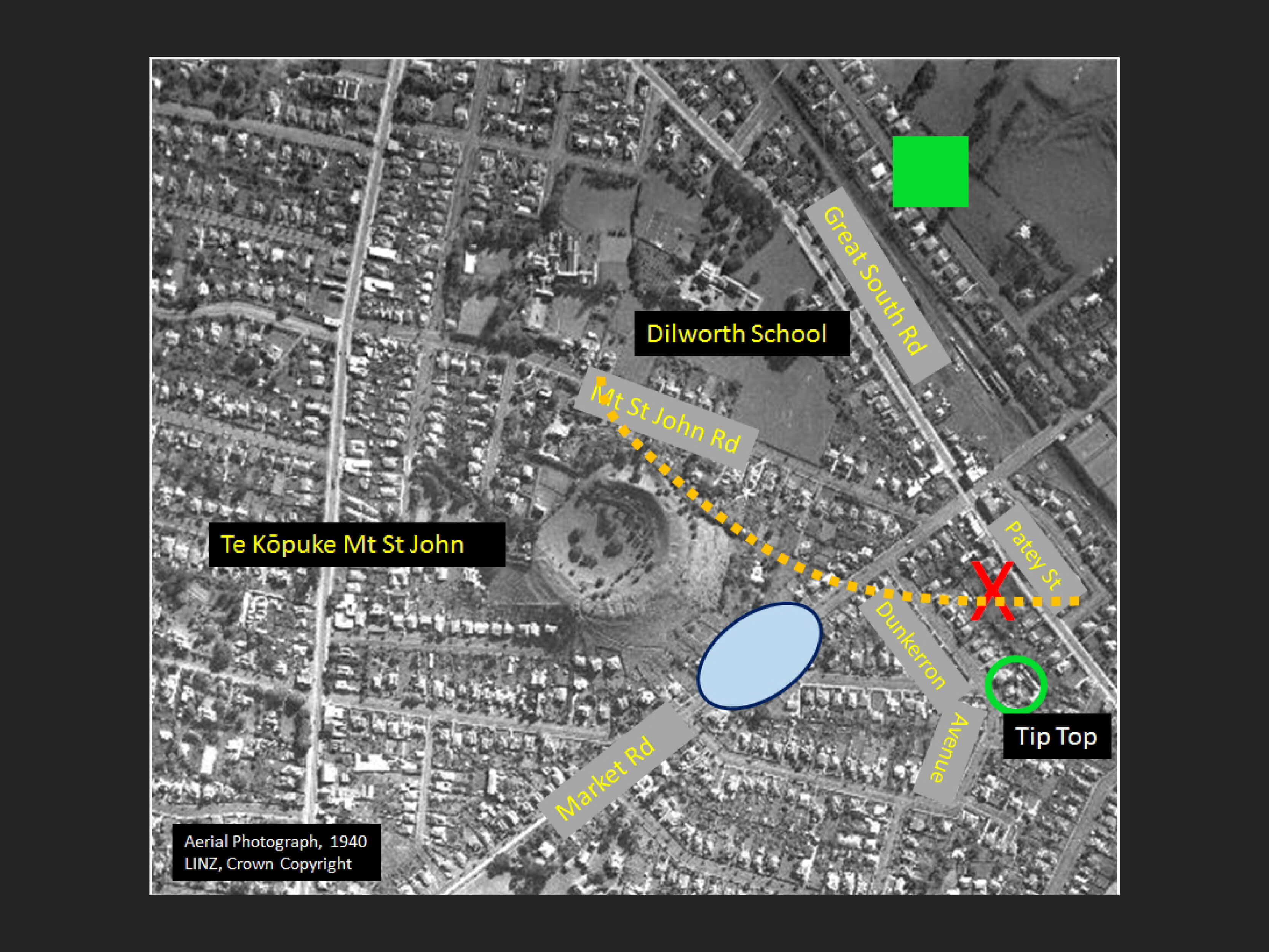
Hochstetter’s swamp fits in with the newspaper notion that the feast site was between Mt St John and Mt Hobson. This 1940 aerial image sets the scene for the area. The black arrow shows the direction of south east from the foot of the mountain as he describes. Which would place the swamp somewhere in the vicinity of the blue oval. And that is not far from the Tip Top factory built in Dunkerron Avenue in the 1930s.
And so, given some geographic adjustments in the interests of artistic licence, is this the vista that Merrett was painting? ( red polygon ) And from the point near X
…And, therefore, is the green square where Te WheroWhero’s camp was set up and the orange line the path that the guests took on arriving at the Great Feast.
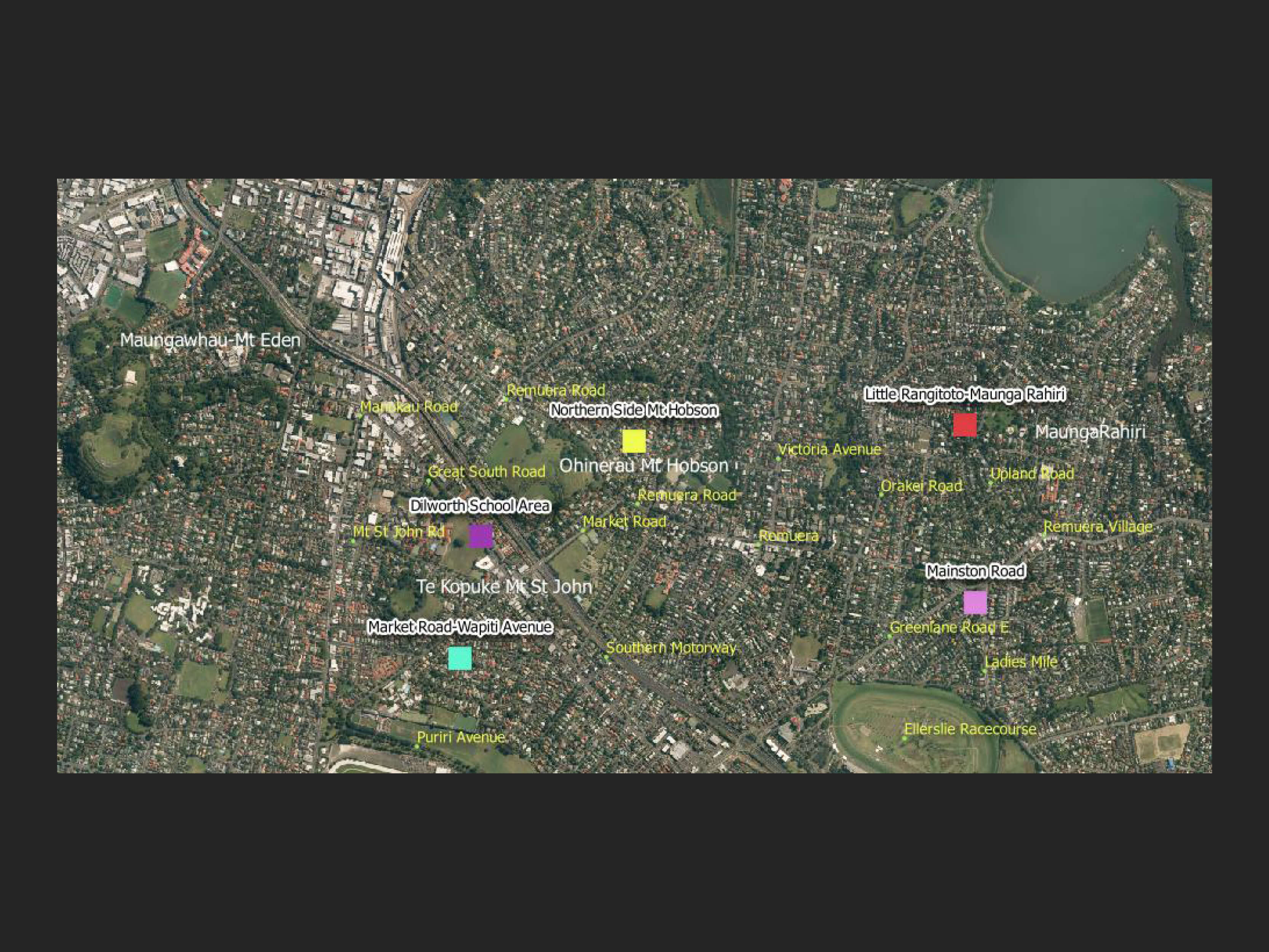
There is no conclusive answer but Bruce Hayward’s suggestion does have a good deal of merit. The name Remuera was given to the southern slopes of Ohinerau Mt Hobson, while the northern slopes of Ohinerau Mt Hobson were called Orakei. The amphitheatre was on the Dilworth estate which was divided by the railway line going through in 1873 and the southern motorway in the 1960s.
But maybe the question as to where the feast took place still challenges us.
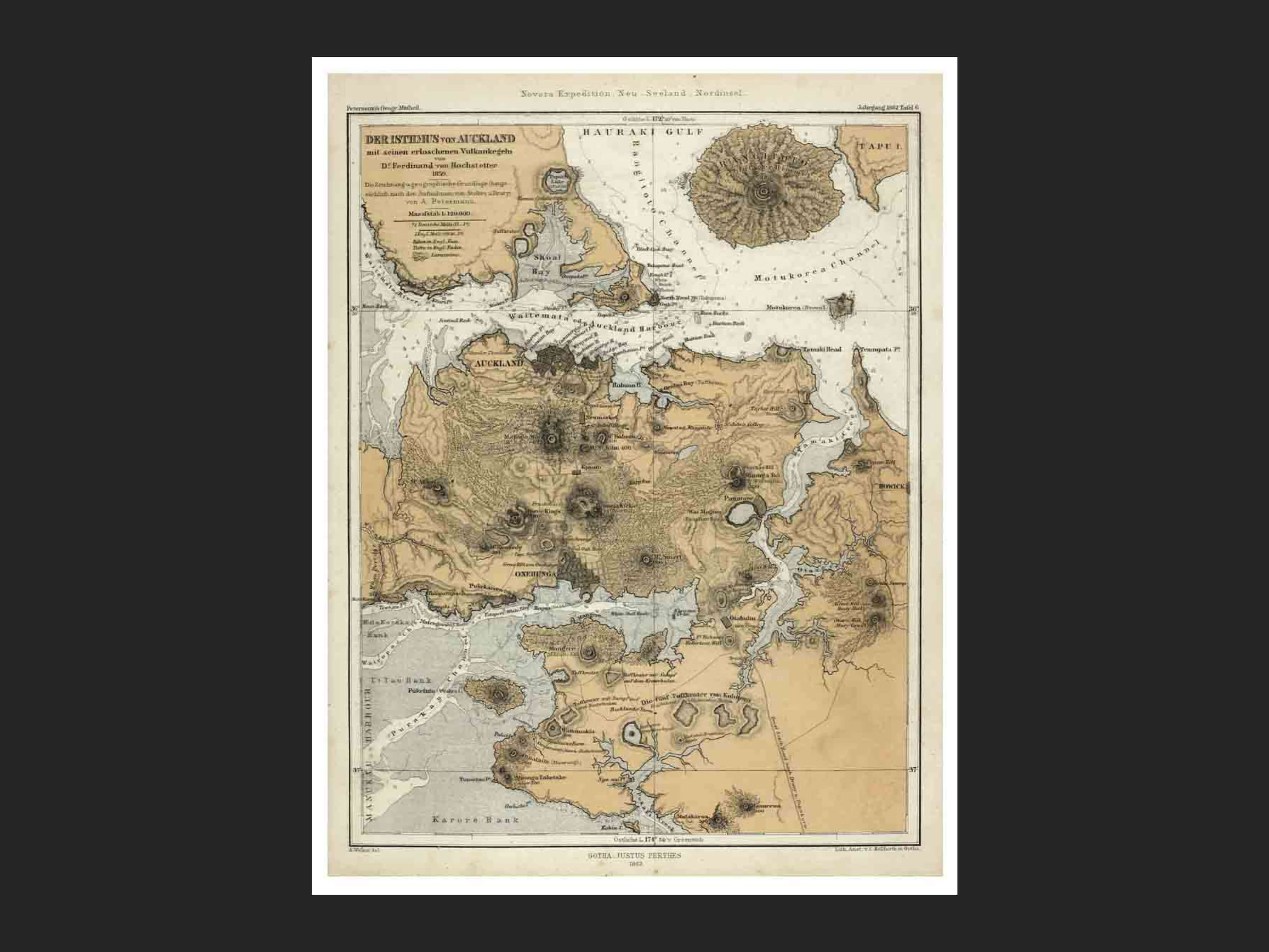
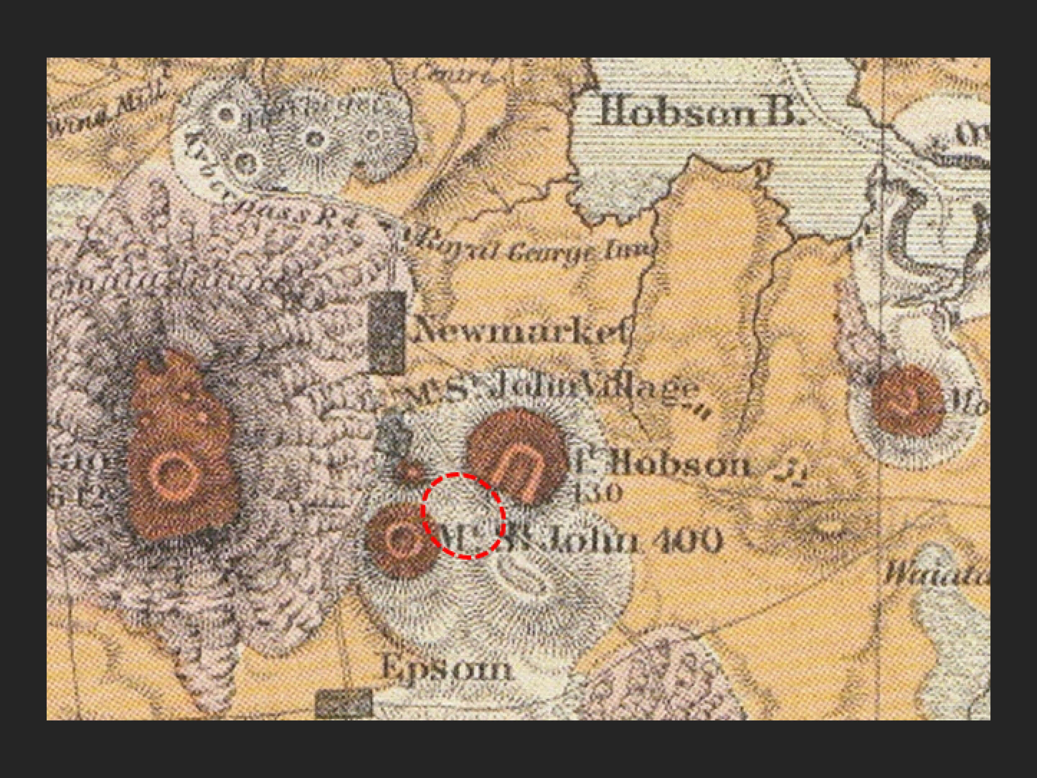
Hochstetter map of the isthmus of Auckland, published 1865, Justus Perthes and sourced from Auckland Libraries Kura collection, reference 1012-61
Footnote
Ferdinand Hochstetter was a young Austrian geologist who arrived in New Zealand in December 1858. He was asked by Sir George Grey, then Governor of the new colony, to map the volcanic area of the North Island.
He later mapped the Auckland volcanoes. Later other provincial councils requested him to map their local environs. New Zealand Its Physical Geography and Geology and Natural History was translated and published in 1867.
One of Hochstetter’s authoritative maps was of the isthmus of Auckland which extended into the North Shore and south to Manurewa.
Looking at it and his book you can see how meticulous he was in gathering information to produce this map.
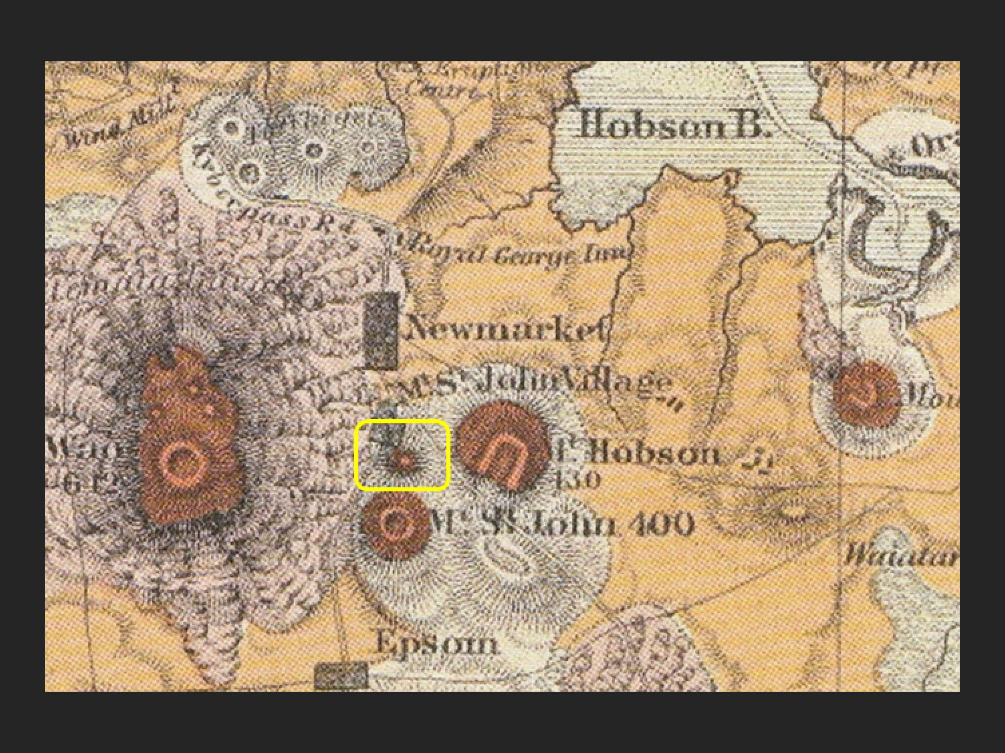
As for this project an interesting feature is drawn on this map. It is of a small volcanic cone that appears to have been in the Margot Street area of Epsom near where Diocesan School is today.
Professor Searle in City of Volcanoes, a geology of Auckland 1981 edition mentions that a lava flow from Mt Hobson joined with one from Mt Eden near the intersection of Manukau Rd, the Great South Rd and Broadway. This could be what Hochstetter has drawn on his map. It raises the question…
Is this the ampitheatre ( red oval ) referred to in the newpaper article shown earlier?
And does it further support the thesis that the Great Feast of 1844 did take place in this location.
More food for thought and your research.

 Share

 Email
Source Attributions: 3D Views and Aerial Imagery
Digital Terrain Models (3D) are derived from Lidar that was captured for Auckland Council by NZ Aerial Mapping & Aerial Surveying Limited. Data management and distribution external to Auckland Council is managed by Land Information New Zealand. Licensed for re-use under the Creative Commons Attribution 4.0 International licence.
Historical Aerial Imagery ( black and white images 1940s ) are now in the ownership of Land Information New Zealand (LINZ). Crown Copyright exists. Licensed for re-use under the Creative Commons Attribution 4.0 International licence.
Colour Aerial Imagery Copyright of aerial imagery for 2010-2012 and 2017 is owned by Auckland Council. Licensed for re-use under the Creative Commons Attribution 4.0 International licence. Sourced from LINZ.
Related Stories

RETURN TO TOP
