‘Orakei Bay Village’, 228 Orakei Road
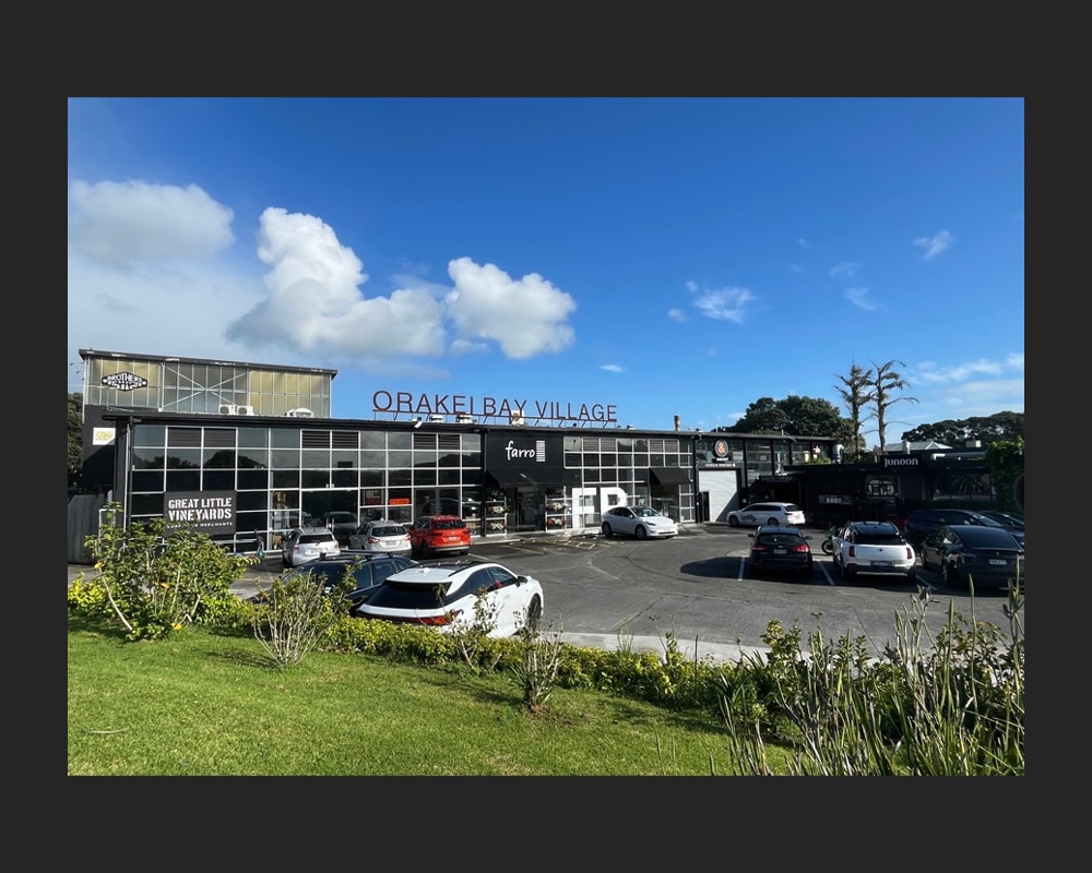
Figure 1: The east (front) elevation of the former factory and distillery building at 228 Orakei Road (C. O’Neil, October 2024).
Located between the Orakei Basin and Hobson Bay, ‘Orakei Bay Village’ occupies a mid-century building with an interesting history. Purpose-built as a factory for manufacturing and distributing radios in 1954, the building subsequently had a decades-long association with New Zealand’s liquour industry. Now a popular boutique shopping precinct, the substantial concrete, steel, and glazed structure still retains evidence of its industrial past.
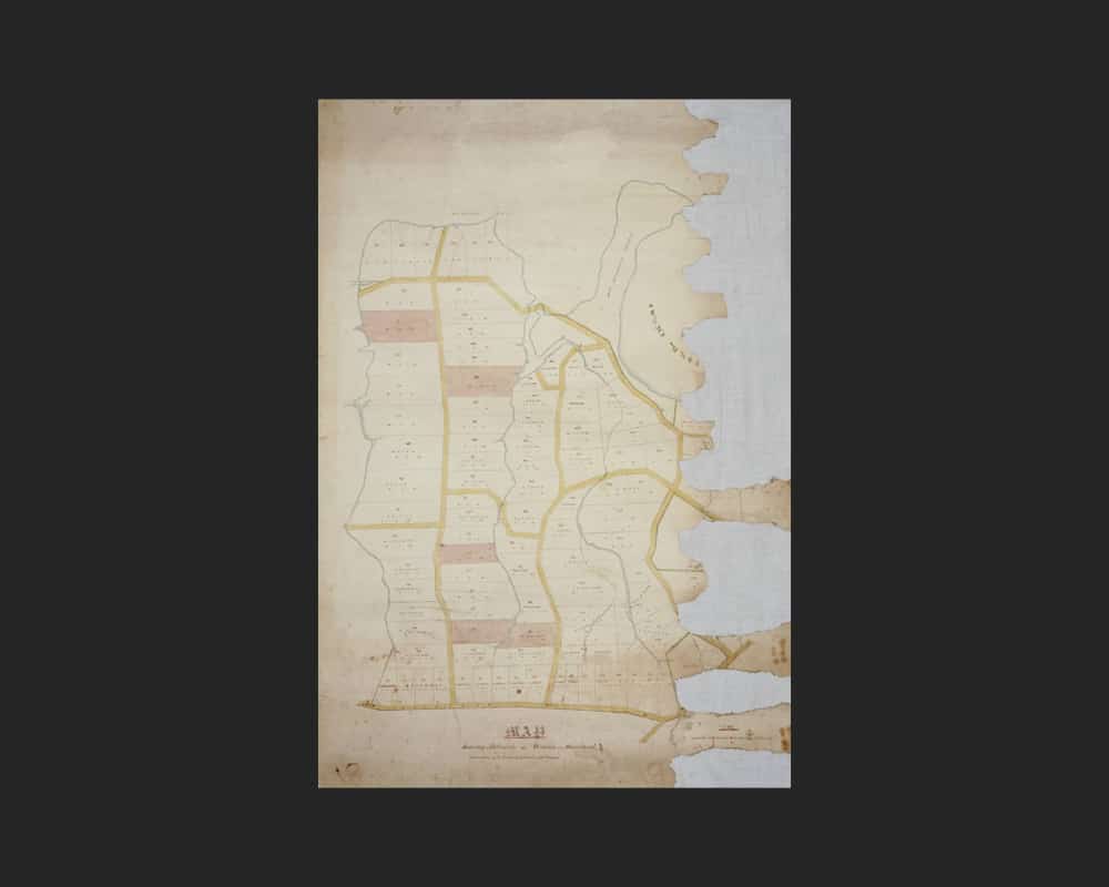
Figure 2a: Map showing allotments at Orakei, Section 16 Suburbs of Auckland, 1860 (Auckland Libraries Heritage Collections Map 4204).
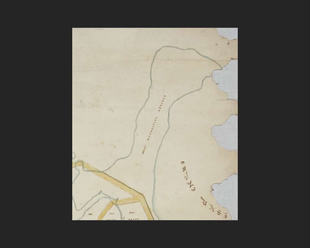
Figure 2b: Extract of Figure 2a showing the Orakei peninsula as a sheep quarantine reserve in 1860.
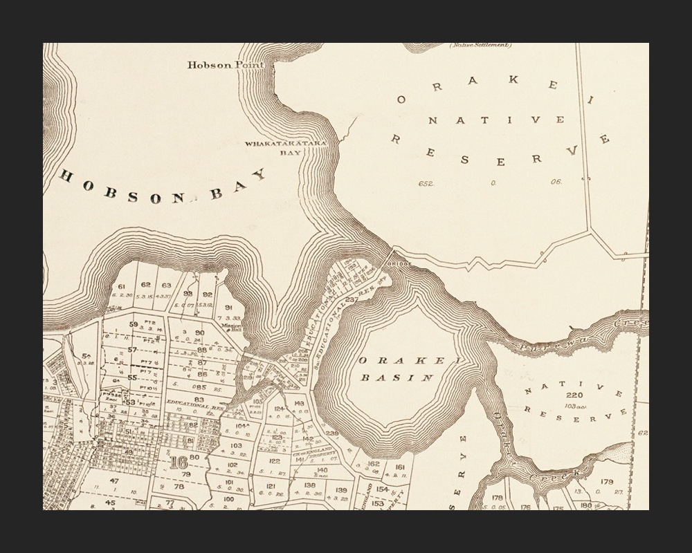
Figure 3: Extract of Sheet 4 of cadastral map of Eden County (Auckland City), 1892, showing the Orakei peninsula (centre) located between Hobson Bay and the Orakei Basin. At this time, the peninsula had been subdivided into lots and set aside as an Educational Reserve (Auckland Libraries Heritage Collections Map 4658).
Early European land use
‘Orakei Bay Village’ at present-day 228 Orakei Road occupies coastal land flanked by the Orakei Basin to the east and Hobson Bay to the west. Forming part of Ngāti Whātua land acquired by the Crown during the mid-nineteenth century, the peninsula is an important Māori pā site known as Ōrākei Pā.[1]
By 1862, the land had been set aside by the Government as a ‘Sheep Quarantine Reserve’ – a place where livestock were kept until they could be declared disease-free (Figures 2a and b).[2] By this time, much of the land around present-day Orakei, Upland, and Benson roads had been made available by the Crown at public auction, while the land to the north and east of the basin became ‘Native Reserves’.[3]
By 1862, a bridge had been built across the Pourewa Creek at the northern end of the peninsula – connecting Remuera with Orakei.[4] Ten years later, 12 acres of the peninsula was subdivided into allotments and granted to the Superintendent of the Province of Auckland for educational purposes (Figure 3).[5] At that time, the position of superintendent was held by Scottish-born lawyer and politician, Thomas Bannatyne Gillies (1828-1889), who had returned to politics in 1869 following his move from Dunedin to Auckland.[6] It is unclear what educational purposes the land was used for at that time, but, in 1878, it was leased by Joseph Byers (c.1839-1920), an Irish-born butcher from Thames who had set himself up as a farmer and stock dealer in Remuera.[7]
This was likely the same ‘Joe’ Byers who, according to Remuera Round, gained the distinction of being the first Remuera man to own a scow.[8] Byers, who lived on the hill near the landing place, would use his boat to transport cattle driven to the North Shore from North Auckland, and from nearby islands, to Orakei. His first sailing was witnessed by a large crowed who had gathered to watch the scow’s journey across the Waitemata Harbour.[9] One account documents the following startling scene:
“From Byer’s [sic] scows, cattle from Motutapu, Brown’s Island and elsewhere, were pushed into the sea near the present Orakei bridge to swim ashore. Without fresh water for days, an occasional beast would drink sea water, go mad on shore, spread alarm until it was shot.”[10]
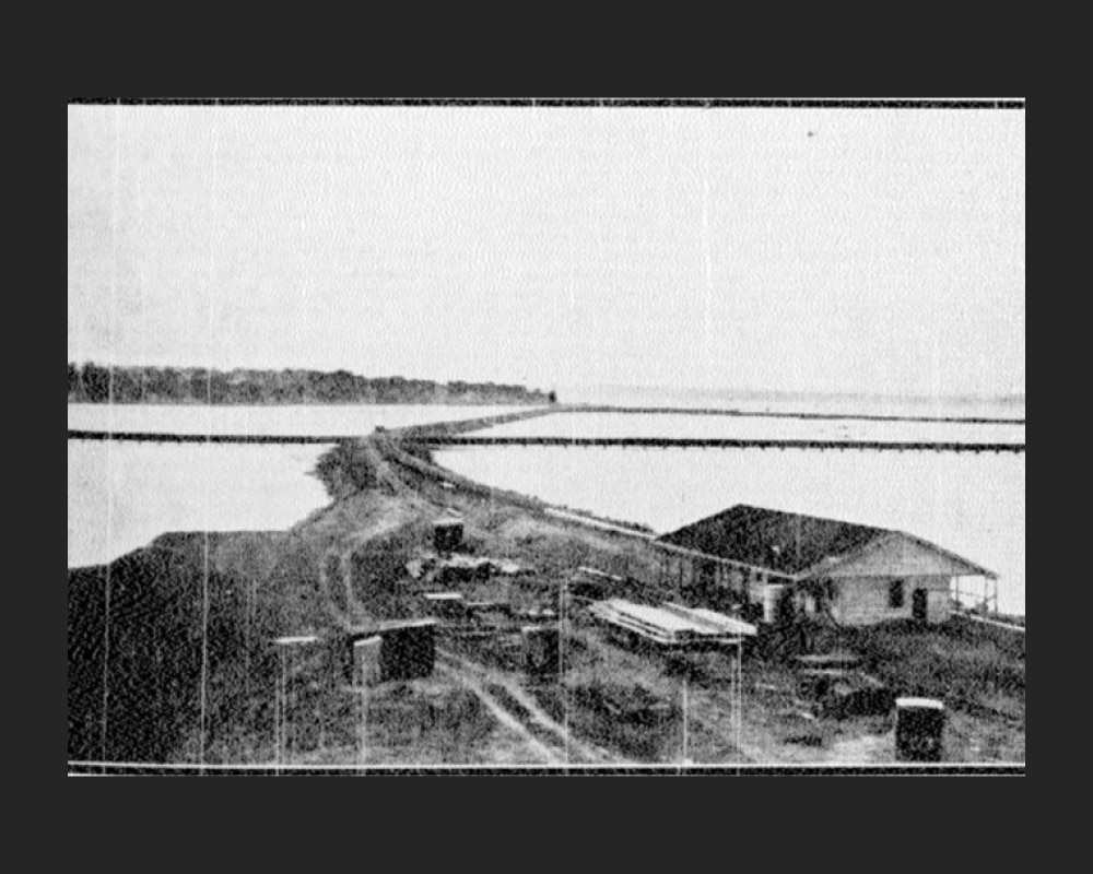
Figure 4: Orakei Station in the making, showing its waterfront site overlooking Hobson Bay and the harbour beyond. It became the gateway to the new garden suburb with which it shares a name (Sun (Auckland), Volume II, Issue 590, 16 February 1929, Papers Past).
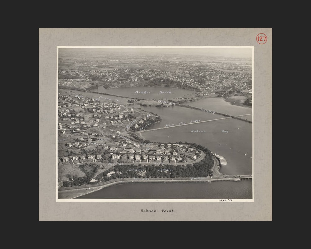
Figure 5: Aerial view taken in 1947, showing the Orakei peninsula, the Orakei Railway, and subject site (then vacant) (centre) (Auckland Libraries Heritage Collections 580-ALB22-127).
Orakei Railway Station
In 1923, much of the northern portion of the Orakei peninsula was taken by the Crown for railway purposes.[11] Around 300,000 cartloads of spoil were removed to level the land, and by 1925, the construction of a waterfront railway station was underway.[12]
The Orakei Railway Station was the first of six stations established as part of the Westfield Deviation (Eastern Line) (Figure 4).[13] In operation by 1929, the Westfield Deviation was built to divert the Auckland to Westfield section of the North Island Trunk line via an alternative route that was flatter and faster.[14] It also provided much-needed passenger services to the growing eastern suburbs, including Remuera and the prospective garden suburb of Orakei.[15] By 1931, improvements were also made to roading infrastructure in the area, including the construction of a new ferro-concrete bridge that replaced the old wooden bridge across the Pourewa Creek.[16]
By 1940, several residential houses had been built on the corner of Orakei and Upland roads at the southern end of the peninsula. The land around the railway station, however, remained largely vacant until 1953 (Figure 5). At this time, plans were underway for the construction of a new factory for radio manufacturing and distributing company, International Traders Limited.[17]
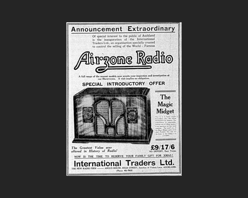
Figure 6: The ‘new radio firm’ International Traders Limited advertising Airzone Radio (Page 13 Advertisements Column 1, New Zealand Herald, Volume LXXI, Issue 21955, 12 November 1934, Papers Past).
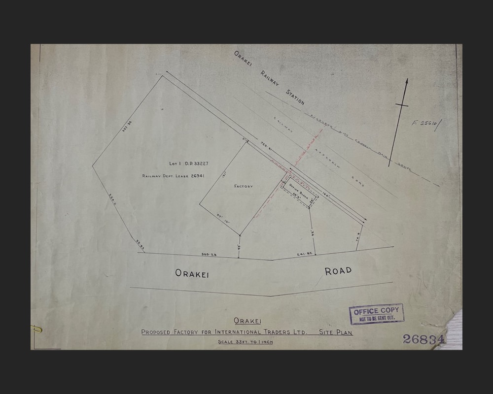
Figure 7: Site plan showing the proposed factory and office block for International Traders Limited, 1953 (Record No. 26834, 1953, Archives New Zealand).

Figure 8: Architectural/Engineering plans showing the proposed elevations, sections, and details of the factory for International Traders Limited, 1953 (Record No. 26496, 1956, Archives New Zealand).

Figure 9: The new factory building and office block (right) viewed from the east following their completion in 1954 (Auckland Libraries Heritage Collections 580-1609).
A new factory
International Traders Limited was established in November 1934 by Ernest Onslow Cox for the purpose of importing and distributing the “world-famous” Airzone radios from Australia (Figure 6).[18] With a showroom on Auckland’s High Street, the company was soon advertising a full range of radios.[19] By 1940, the business was operating out of a factory on nearby Anzac Avenue, manufacturing and/or distributing well-known radio brands such as Bush, EIL, and Motorola.[20]
In 1946, International Traders Limited leased just over two acres of railway land directly south of the Orakei Railway Station for a term of 21 years at £40 per annum.[21] It was another seven years, however, before the site was developed. In 1953, building permits were issued for a factory and associated office block, with an estimated building cost of £22,650.[22] Measuring around 150 by 95 feet (46 x 29 metres) and described as a building “of modern design with maximum natural lighting for interiors”[23], the commodious factory was constructed of concrete block panels; steel trusses, beams and pillars; a gabled fibrolite roof with skylights; and ample glazing (Figure 7 and 8).[24] The more modestly-scaled, yet similarly designed concrete office block was completed a year later (Figure 9).[25]
The International Traders Limited retained interest in the leasehold of the Orakei Road land until 1959, when a newly-formed company took over the lease and acquired the premises for its gin distilling business.[26]

Figure 10: Sir Ernest Davis, Sir Ernest Davis, 1962 (Press, Volume CI, Issue 29929, 17 September 1962, Papers Past).

Figure 11: Grainger Hannah at the Orakei Road offices, date unknown (Grainger Hannah, From Scotland to New Zealand, 2013, cover image).

Figure 12: The stillhouse at the Orakei Road premises (Remuera Heritage, Orakei Gin Distillery and from Grainger Hannah, From Scotland to New Zealand, 2013, 76).
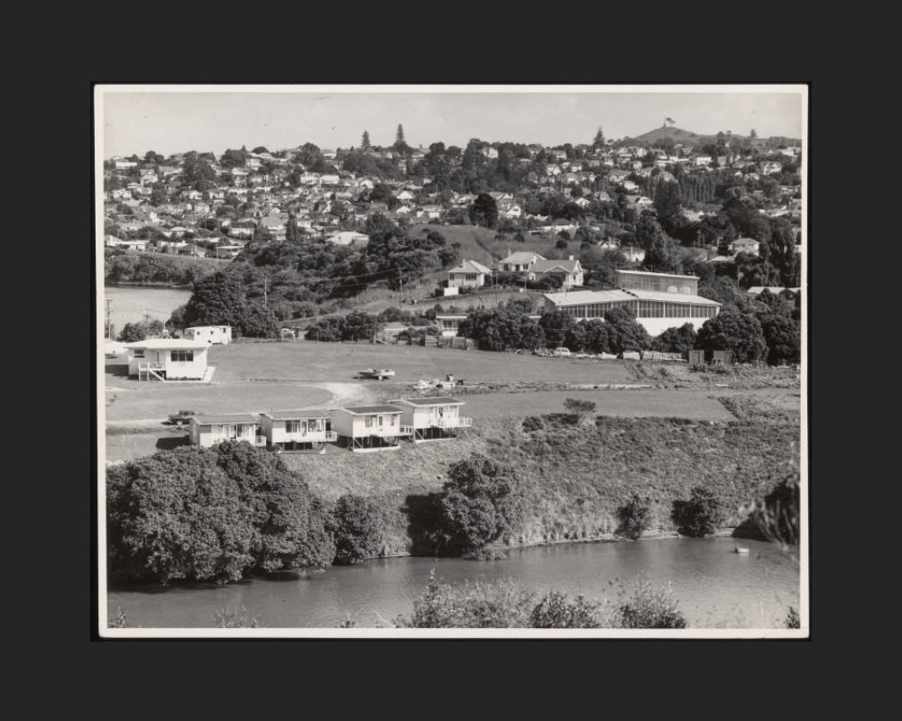
Figure 13: Showing the Orakei Road premises in c.1960s (centre right) when in use as a distilling, compounding and bottling plant. Note the glazed roof-top extension that had been added by this time. The Waterfront Motel is in the foreground (Auckland Libraries Heritage Collections 895-A70092).
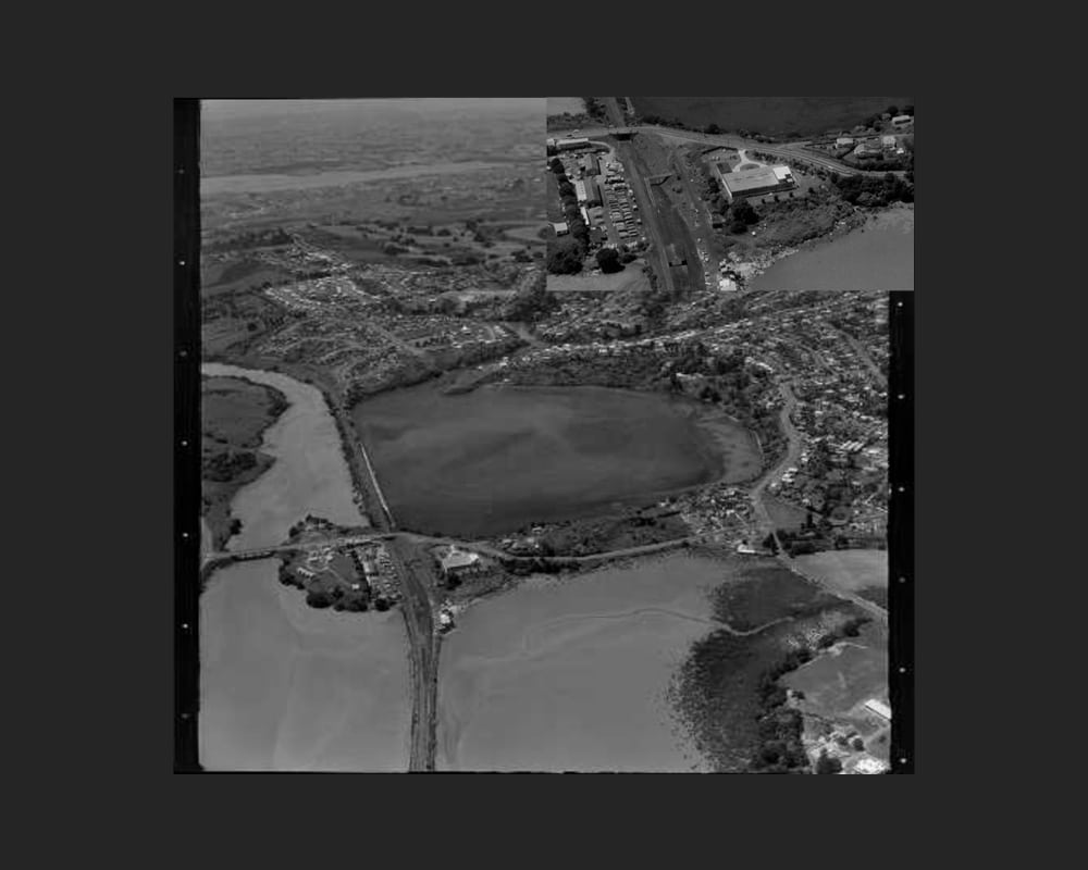
Figure 14: An aerial view (looking roughly east) showing the Orakei peninsula on 18 December 1961. By this time, the Waterfront Motel had been established on land to the north of the railway line, and a small numbers of houses had been built to the south of the distillery. Inset: A close-up of the Orakei Road premises (Orakei Basin, Auckland, WA-56553-F, Whites Aviation Collection, Alexander Turnbull Library).
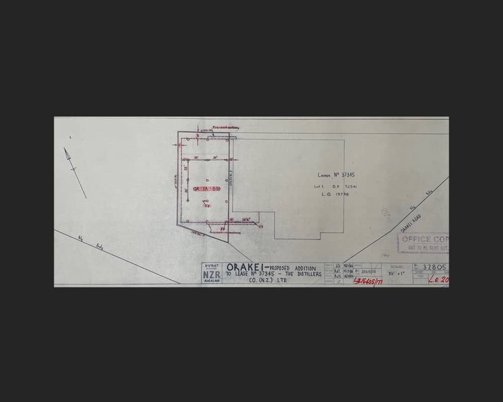
Figure 15: Showing the section of land to the west of the premises leased for the purpose of construction a further addition to the distillery (Record No. 32805, 1966, Archives New Zealand).
A gin distillery
Established in 1959, the Distillers Company (N.Z.) Limited was a subsidiary of the Distillers Company Limited in the UK and was formed for the purpose of importing bulk gin into the country and bottling it locally.[27] The company’s chairman of directors was brewery baron and two-time Mayor of Auckland, Sir Ernest H. Davis (1872-1962) (Figure 10), a successful and highly influential businessman who was regarded as the liquor trade’s “master tactician against the prohibition movement”.[28] The company’s director was Scottish-born, Grainger W. Hannah (c.1925-2018) (Figure 11), who had recently arrived in New Zealand with his family following a period in Australia.[29] Hannah had worked for Distillers Company Limited since 1946, when he joined their Glasgow-based Engineering Division.[30] He and his family settled in Remuera, and remained there for over 50 years.
Soon after its establishment, the Distillers Company (N.Z.) Limited acquired the Orakei Road premises as its headquarters and as a space for compounding, distilling, and bottling imported gin prior to distribution.[31] This included the well-known brands of Gordon’s Gin and Booth’s Gin. Works were subsequently carried out to the factory to accommodate its new use, including the installation of a stillhouse with several large copper sills, bottling machinery, and racking systems for handling casks (Figure 12).[32] Helicopters and cranes were utilised for transporting the large vessels and storage tanks onto the site and into the building.[33] Moulds were also created for the different bottle shapes required by individual brands, which then went into production on site.
In 1961, just two years after acquiring their Orakei Road premises, the Distillers Company opened a grain distillery on the corner of Mountain Road and Khyber Pass Road, the output of which was anticipated to be about 300,000 proof gallons of grain spirit a year. The distillery was also expected to consume around 40,000 sacks of barley a year and 10,000 sacks of malt, grown mostly on the Canterbury plains.[34] The grain distillery supplied alcohol to three rectifying, compounding and bottling plants, including Orakei Road, producing gin, vodka, and whisky.[35]
The enterprise proved a successful one, resulting in the expansion of the Orakei Road premises. During the early-to-mid-1960s, the building was extended to the south and west, which incorporated a roof-top addition (Figure 13).[36] During this time, further development had taken place on the peninsula with the introduction of The Waterfront Motel to the north of the railway line, and a number of residences to the south of the distillery (Figure 14).
By 1967, the company had leased another section of land to the west of the distillery for the purpose of constructing a further addition (Figure 15).[37] On completion of the works, the size of the original building had increased three-fold, providing space for purchasing, maintenance, distribution, and marketing departments. Employment at the plant also increased to 150 personnel during this time. Workers included a number of local Māori and Pakeha, in addition to those who lived further afield and used the conveniently located neighbouring train station to commute to and from work.[38]
It was around this time of growth and expansion that the Orakei Road factory featured in the national newspapers. At around 4:30pm on 29 August 1966, a .22 bullet hit the factory, smashing through a window and a door and narrowly missing four people. A police search ensued around the Orakei district, but without result. The perpetrator was not found.[39]
By the end of the 1970s, Distillers Company (N.Z.) Limited was New Zealand’s largest gin and vodka supplier and one of only five companies in the country to be issued a distilling licence by the Customs Department.[40] The Orakei Road factory continued operations until its closure in 1992.[41] By this time, the parent company, Distillers Company Limited, had been taken over by Guinness. The acquisition in 1986 was the largest in Britain’s history and made Guinness the chief producer of whisky in that country.[42] It also led to one of the most notorious stock market scandals in 1980s Britain. Known as the ‘Guinness Affair’, the share trading fraud involved four individuals who planned to raise the share price of Guinness in order to win the takeover bid of the Distillers Company.[43]
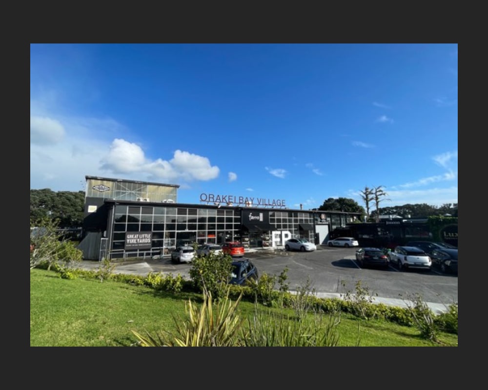
Figure 16: Showing the east (front) elevation of the former radio factory and gin distillery (C. O’Neil, October 2024).
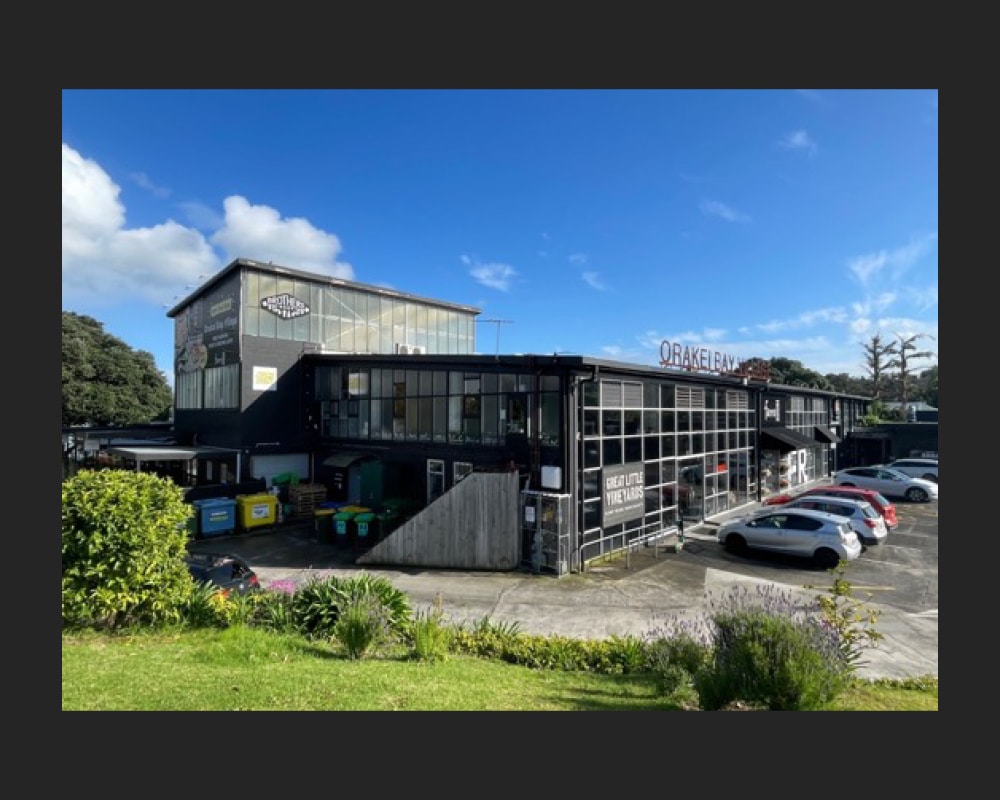
Figure 17: Showing parts of the east and south elevations, including the rooftop extension added by the early 1960s (C. O’Neil, October 2024).
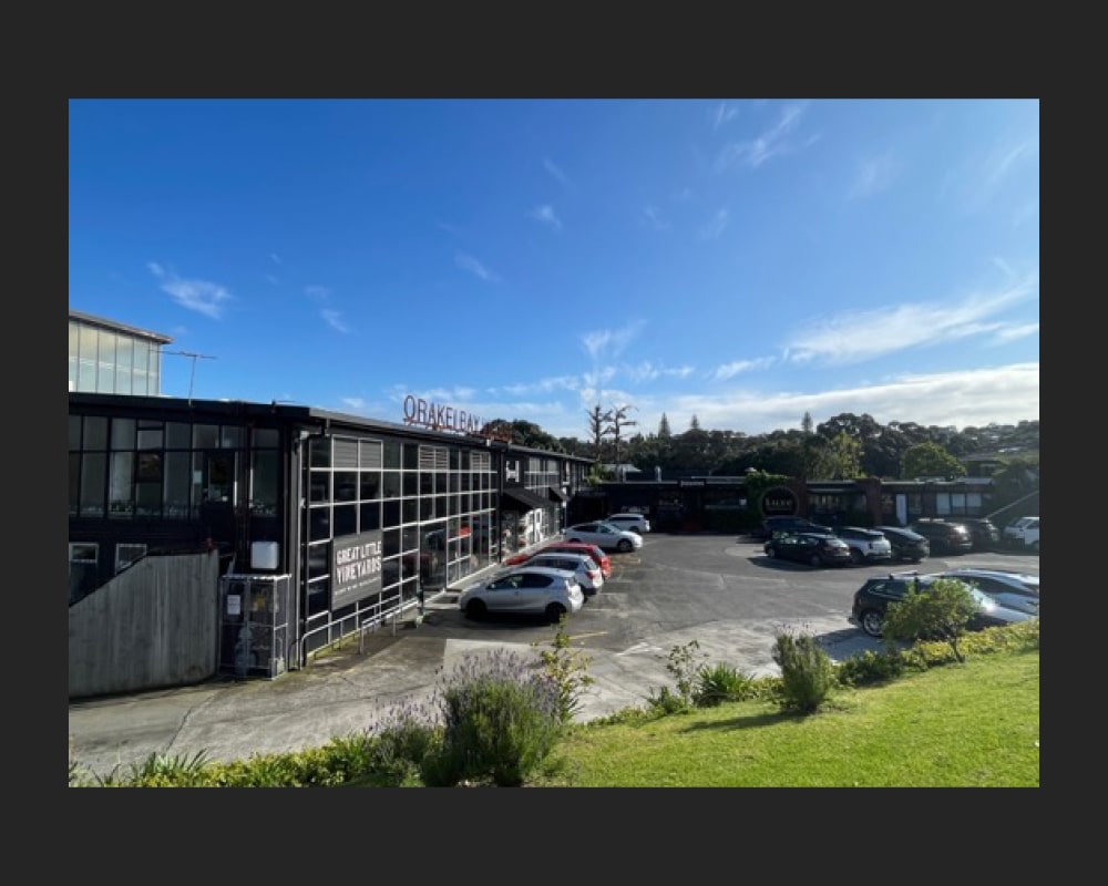
Figure 18: Showing part of the east (front) elevation and the former office block (centre) (C. O’Neil, October 2024).
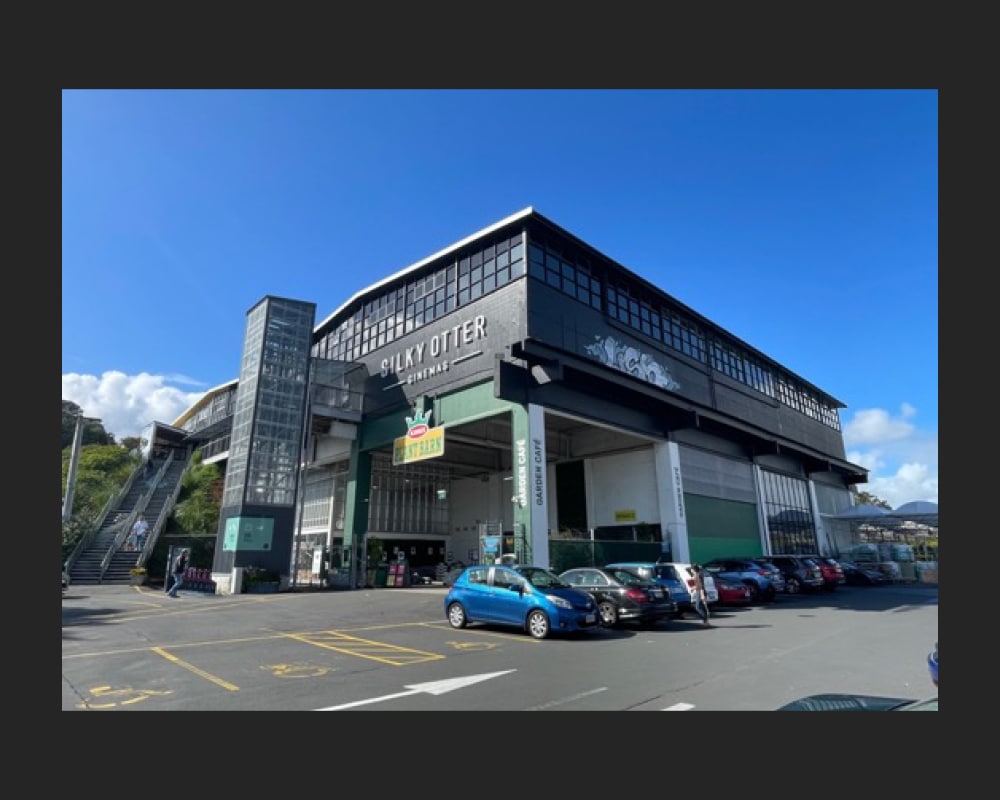
Figure 19: Showing parts of the north and west elevations. The two-storey portion of the building in the foreground was added to the distillery by around 1967 (C. O’Neil, October 2024).
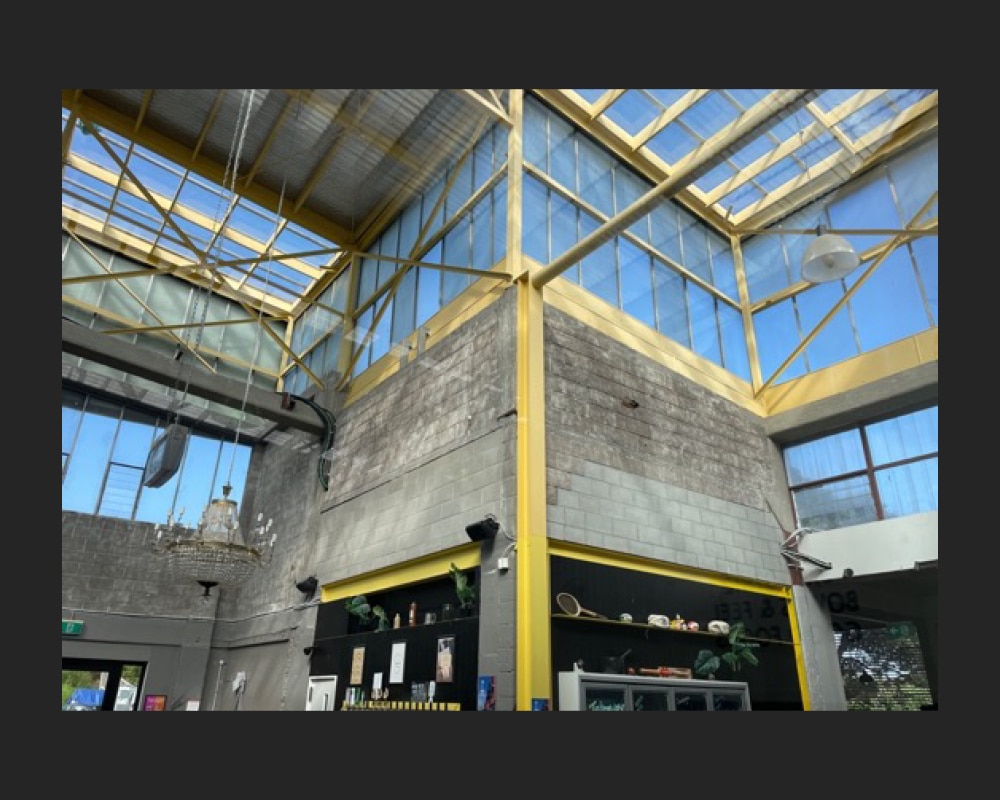
Figure 20: Showing part of the openplan interior with exposed structural elements and high levels of glazing (C. O’Neil, October 2024).
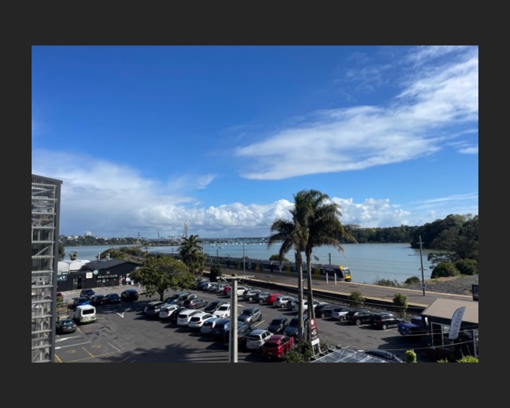
Figure 21: Showing the view from the building, overlooking the Orakei Railway Station to the north and Hobson Bay beyond (C. O’Neil, October 2024).
Subsequent uses
During the 2000s, the former distillery had various commercial uses. It was occupied for a time by Jacobsen, a New Zealand-owned family business established in 1962 that operated their flooring design showroom out of the premises.[44] Other uses included a kitchen showroom, finance and insurance offices, and a photography studio.[45]
From 2006, plans were underway by development company, Equinox Group for the construction of a large-scale residential and retail village complex on the northern portion of the peninsula.[46] This included the land occupied by both the former distillery and neighbouring railway. After almost a decade in the pipeline, the planned development was shelved following a series of delays, escalating construction costs, and resistance to the proposals.[47] A change in focus by the company resulted in the conversion of the former distillery building into a retail hub.[48] Named ‘Orakei Bay Village’, the 6,000
square metre development opened in 2016 and featured around 29 businesses and services, including a supermarket, cinema, craft beer bar, florist, design store, and eateries.[49]
Still in use as a boutique shopping precinct, the former factory and distillery building continues to reflect its mid-century industrial architecture and retains a high level of its traditional fabric and features (Figures 16 to 21).
Background
The Heritage Studio Limited has been commissioned by Remuera Heritage to undertake research and prepare a story that documents the history of the substantial industrial building that now forms part of ‘Orakei Bay Village’ on Orakei Road, Remuera.
Research involved viewing online repositories such as DigitalNZ, Papers Past and Auckland Libraries resources; sourcing available information at Auckland Council Archives and the National Library; and viewing records from Archives New Zealand and Land Information New Zealand. It is important to note that opportunities still exist to explore other avenues of research, which may yield more information.
The author would like to acknowledge the assistance of Lyn Davis and Guy King who shared helpful information about the place.
A site visit was carried out on 10 October 2024.
Subscribe to our newsletter to keep up to date.
[1] John and Sue La Roche, The Pourewa Valley Story, May 2022, https://www.pourewa.nz/wp-content/uploads/2022/10/Ch-1-The-Pourewa-Valley-Story.pdf (accessed 11 February 2025)
[2] Ibid.; Auckland Libraries Heritage Collections Map 4204; Eileen McSaveney, ‘Nearshore islands – Quarantine centres and prisons’, Te Ara – the Encyclopedia of New Zealand https://teara.govt.nz/en/nearshore-islands/page-4 (accessed 11 February 2025).
[3] Winifred Macdonald, Recollections 1850-1920: A Sketch History of Early Remuera, Milnes of Remuera, 1984, 30; Auckland Libraries Heritage Collections Map 4658.
[4] John and Sue La Roche, The Pourewa Valley Story, May 2022, https://www.pourewa.nz/wp-content/uploads/2022/10/Ch-1-The-Pourewa-Valley-Story.pdf (accessed 11 February 2025); House of Representatives., Daily Southern Cross, Volume XVII, Issue 1429, 23 August 1861, Papers Past.
[5] Certificate of title NA5/79, LINZ records.
[6] Hugh Rennie. ‘Gillies, Thomas Bannatyne’, Dictionary of New Zealand Biography, first published in 1990. Te Ara – the Encyclopedia of New Zealand, https://teara.govt.nz/en/biographies/1g9/gillies-thomas-bannatyne (accessed 10 February 2025).
[7] Certificate of title NA5/79, LINZ records.
[8] Remuera Round – Volume 2, Number 39, 1947-09-04, Record ID RR_19470904, Auckland Libraries Heritage Collections.
[9] Ibid.
[10] Old Remuera, ‘Feuds Among Families, Wife with Pitchfork ends an Argument’, No. 12, Remuera Round, n.p., cited in Jenny Carlyon and Diana Morrow, A Fine Prospect: A History of Remuera, Meadowbank and St Johns, 2011, Random House New Zealand, 69.
[11] Certificate of title NA5/79, LINZ records.
[12] Auckland’s Future, New Zealand Herald, Volume LXII, Issue 18977, 26 March 1925, Papers Past.
[13] Ibid; Salmond Reed Architects Limited, Auckland Metro Rail Network Electrification: Heritage Assessment, September 2009.
[14] Westfield Deviation, New Zealand Herald, Volume LXVI, Issue 20191, 27 February 1929, Papers Past.
[15] Auckland’s Future, New Zealand Herald, Volume LXII, Issue 18977, 26 March 1925, Papers Past; Salmond Reed Architects Limited, Auckland Metro Rail Network Electrification: Heritage Assessment, September 2009.
[16] Improved Outlets for Railway and Road Traffic from Auckland City to the East, New Zealand Herald, Volume LXVIII, Issue 20954, 18 August 1931, Papers Past.
[17] Orakei – Proposed factory for International Traders Limited – Site plan, Record No. 26834, 1953, Archives New Zealand.
[18] International Traders Limited, Record No. 43425, 1934-1965, Archives New Zealand; The N.Z. Vintage Radio Project, https://www.vintageradio.co.nz/manufacturer/international_traders (accessed 3 March 2025); Page 13 Advertisements Column 1, New Zealand Herald, Volume LXXI, Issue 21955, 12 November 1934, Papers Past.
[19] The N.Z. Vintage Radio Project, https://www.vintageradio.co.nz/manufacturer/international_traders (accessed 3 March 2025); Page 1 Advertisements Column 7, Auckland Star, Volume LXXI, Issue 37, 13 February 1940, Papers Past.
[20] Ibid.
[21] Certificate of title NA866/236, LINZ records; ACC 213, Orakei Road 6-236, Item No. 114b, Record ID: 328839, Auckland Council Archives.
[22] ACC 213, Orakei Road 6-236, Item No. 114b, Record ID: 328839, Auckland Council Archives.
[23] Orakei – Premises to be erected on Lease 26941 for International Traders, Record No. 26496, 1953, Archives New Zealand.
[24] ACC 213, Orakei Road 6-236, Item No. 114b, Record ID: 328839, Auckland Council Archives.
[25] Ibid.
[26] Certificate of title 866/236, LINZ records.
[27] Imports of Gin in Bulk, Press, Volume XCVIII, Issue 29019, 7 October 1959, Papers Past.
[28] Duty on N.Z. gin, Press, Volume XCIC, Issue 29169, 1 April 1960, Papers Past; Graham W. A. Bush. ‘Davis, Ernest Hyam’, Dictionary of New Zealand Biography, first published in 1998, updated October, 2001. Te Ara – the Encyclopedia of New Zealand, https://teara.govt.nz/en/biographies/4d7/davis-ernest-hyam (accessed 22 March 2025).
[29] Grainger Hannah, From Scotland to New Zealand, self-published, 2013, 62 and 73-74.
[30] Ibid., 19.
[31] Ibid., 73 and 75.
[32] Ibid., 76.
[33] Ibid., 80.
[34] First Spirit for Gin Manufacture, Press, Volume C, Issue 29670, 14 November 1961, Papers Past.
[35] Remuera Heritage, Orakei Gin Distillery, 2024, https://remueraheritage.org.nz/story/orakei-gin-distillery/ (accessed 28 March 2025).
[36] Orakei Basin, Auckland, WA-56553-F, 18 Dec 1961, Whites Aviation Collection, Alexander Turnbull Library; Orakei – Proposed addition to Lease No. 37345 – The Distillers Company (NZ) Limited, 1966, Record No. 32805, Archives New Zealand.
[37] Orakei – Proposed addition to Lease No. 37345 – The Distillers Company (NZ) Limited, 1966, Record No. 32805, Archives New Zealand; Orakei – Land to be leased to the Distillers Company (NZ) Limited, 1967, Record No. 33319, Archives New Zealand; Certificate of title NA866/236, LINZ records.
[38] Grainger Hannah, 2013, 76; Remuera Heritage, Orakei Gin Distillery, 2024, https://remueraheritage.org.nz/story/orakei-gin-distillery/ (accessed 28 March 2025); Orakei Community Group Facebook page, 16 September 2024, post and comments discussing Orakei Gin Distillery.
[39] Bullet Hits Factory, Press, Volume CVI, Issue 31151, 30 August 1966, Page 18, Papers Past.
[40] Small firm takes on brewery monopoly, Press, 1 November 1978, Papers Past; ‘Moonshine’ makes licit comeback, Press 21 November 1979, Papers Past.
[41] Remuera Heritage, Orakei Gin Distillery, 2024, https://remueraheritage.org.nz/story/orakei-gin-distillery/ (accessed 28 March 2025).
[42] Scandal prompts pressure, Press, 10 January 1987, Papers Past.
[43] Famous stock market scandals, The Telegraph, 2 February 2011, https://www.telegraph.co.uk/finance/newsbysector/banksandfinance/8296369/Famous-stock-market-scandals.html?image=3 (accessed 28 March 2025); All Answers ltd, ‘Guinness Share Trading Scandal’ (Lawteacher.net, March 2025) https://www.lawteacher.net/free-law-essays/company-law/guinness-share-scandal.php?vref=1 (accessed 29 March 2025).
[44] Google Street View, January 2008, November 2009, and February 2012; About Us, Jacobsen, https://jacobsen.co.nz/about/story/ (accessed 29 March 2025).
[45] Google Street View, January 2008, November 2009, and February 2012.
[46] Lauren Priestley for Stuff, Orakei development moves forward, 17 February 2015, https://www.stuff.co.nz/business/industries/66294367/orakei-development-moves-forward (accessed 29 March 2025); Alice Parminter for Stuff, Downsized Orakei Bay development back on the table, 16 May 2016, https://www.stuff.co.nz/business/79912842/downsized-orakei-bay-development-back-on-the-table (accessed 29 March 2025).
[47] Ibid.
[48] Alice Parminter for Stuff, Downsized Orakei Bay development back on the table, 16 May 2016, https://www.stuff.co.nz/business/79912842/downsized-orakei-bay-development-back-on-the-table (accessed 29 March 2025).
[49] Tom Carnegie for Stuff, Auckland’s Orakei Bay Village market open for business, 1 March 2017, https://www.stuff.co.nz/business/property/89939112/aucklands-orakei-bay-village-market-open-for-business (accessed 29 March 2025).
