21 Ridings Road, Remuera (Remuera’s Century-Old Homes Project)
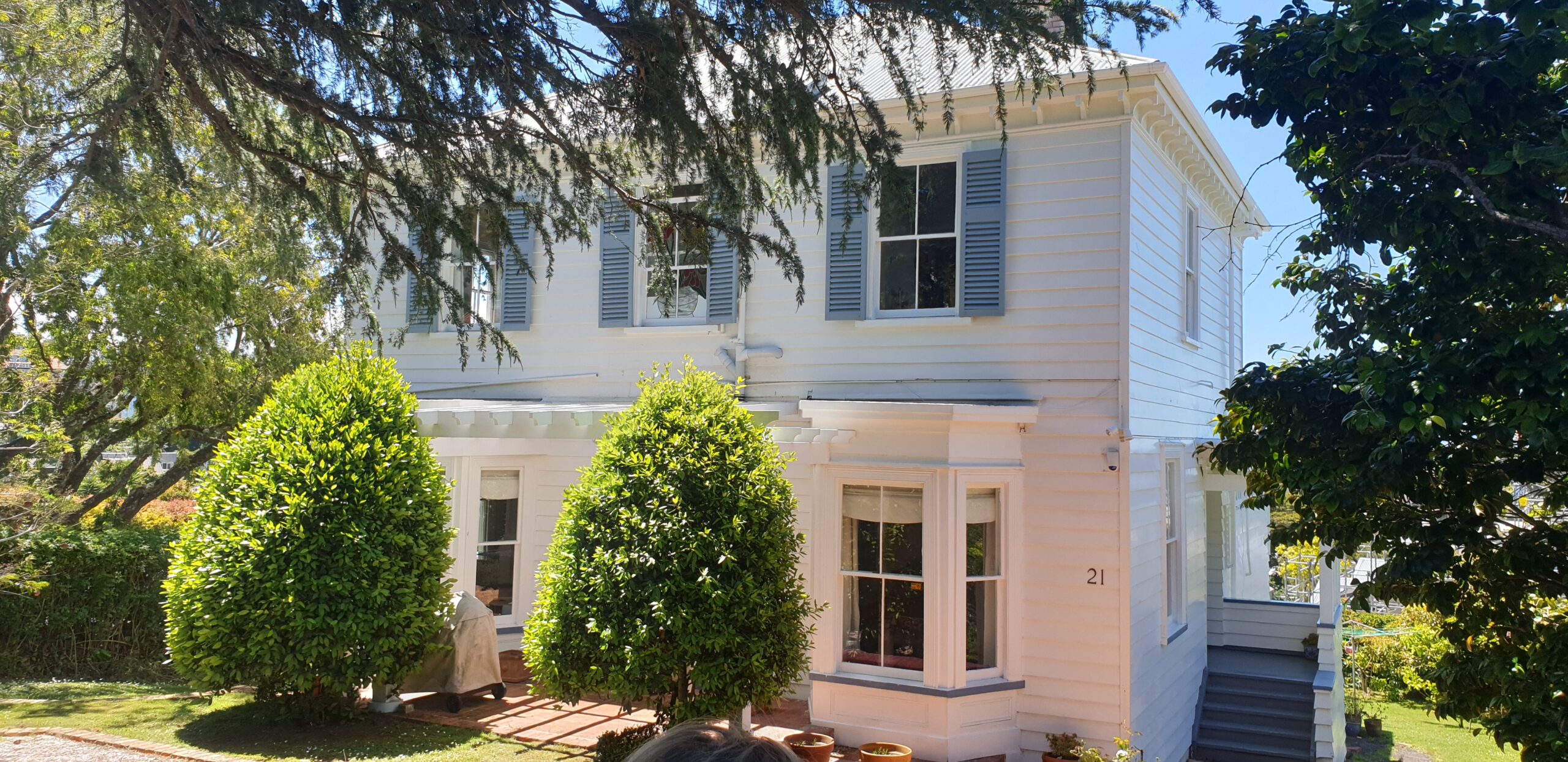
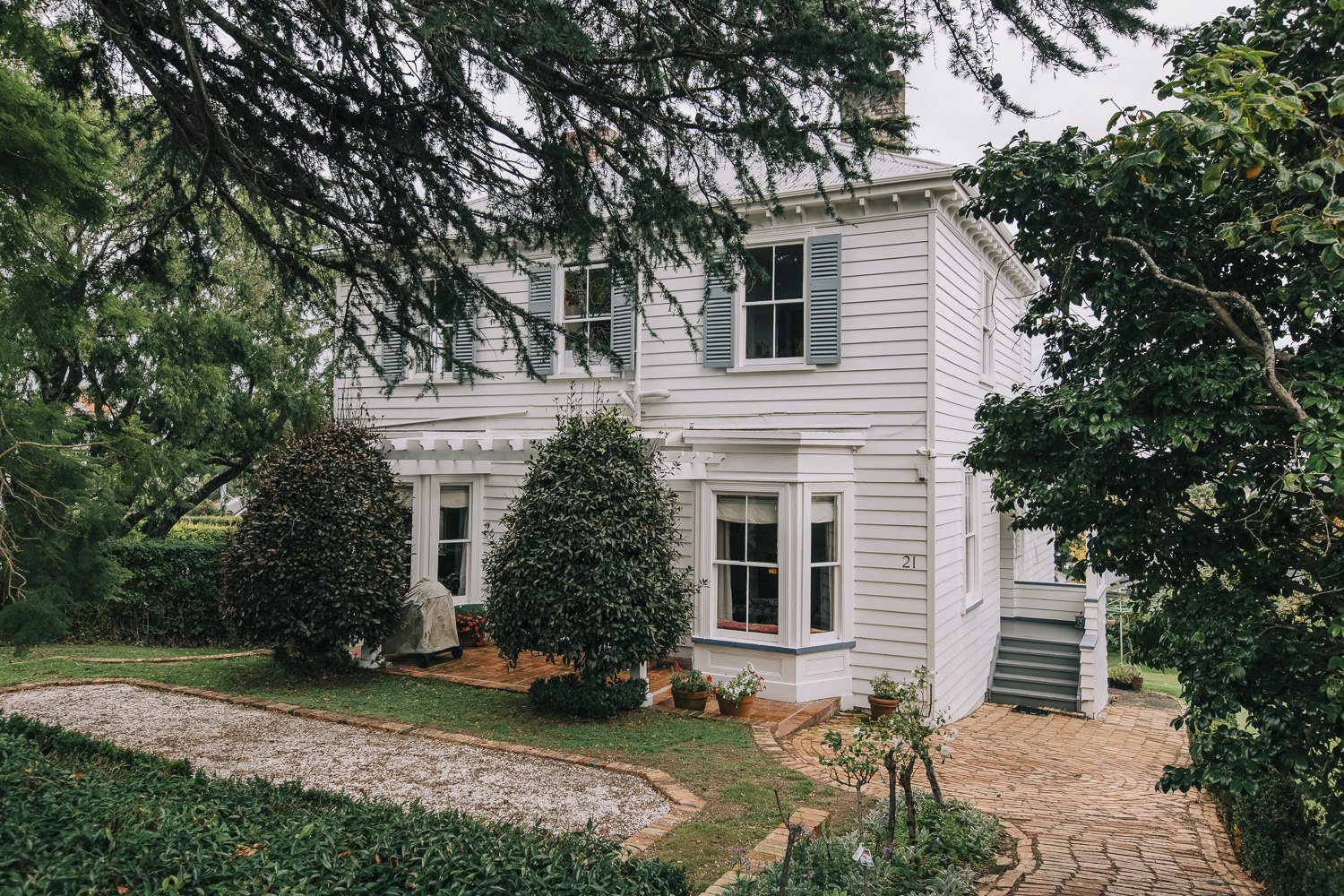
Figure 1: Partial view of the principal (south) elevation of 21 Ridings Road (C. O’Neil, November 2020).
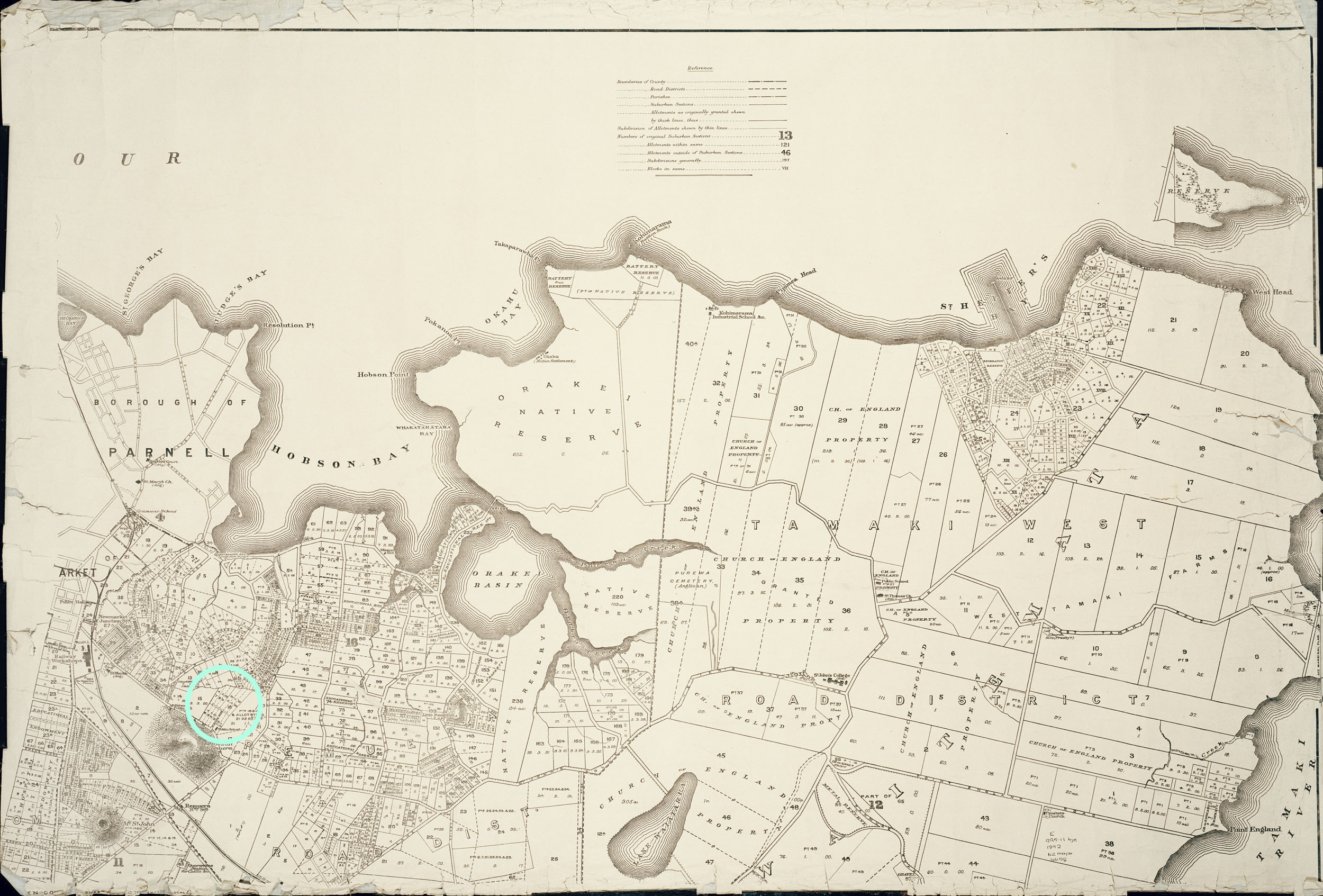
Figure 2a: An 1880s map showing the original allotments of the Suburbs of Auckland. Part of original Allotment 16, Section 16 is located in the area circled (close-up in Figure 2b) (Auckland Libraries Heritage Collections NZ Map 4658).
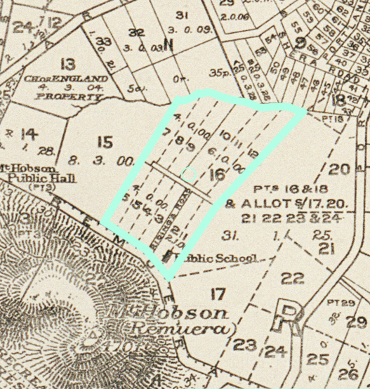
Figure 2b: Close-up of the 1880s map (Figure 2a) showing part of original Allotment 16 and its subdivision into 12 lots. 21 Ridings Road was built at the southern end of lot 10 (approximate location circled).
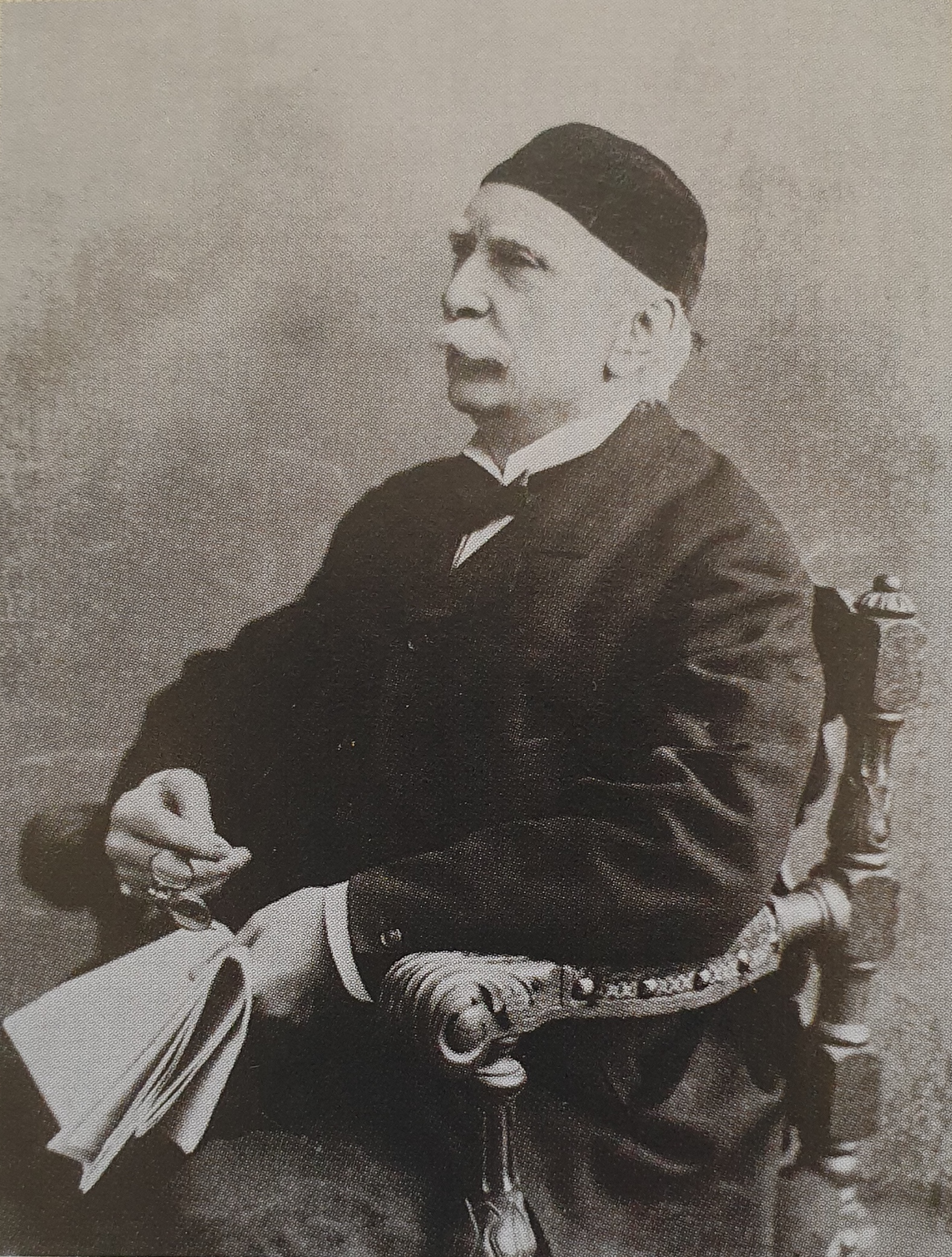
Figure 3: Crown grantee and prominent land investor, William Smellie (W. S.) Grahame, 1894 (Jenny Carlyon and Diana Morrow, 2011, 54).
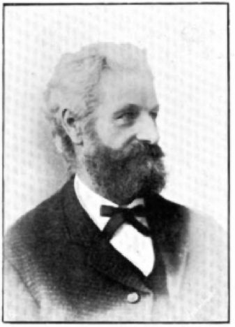
Figure 4: Charles Thomas (C. T.) Wren, date unknown (NZETC, The Cyclopedia of New Zealand [Auckland Provincial District], Mr. C. T. Wren).
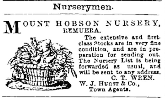
Figure 5: Newspaper article dated 1875 advertising C. T. Wren’s Mount Hobson Nursery (Page 8 Advertisements Column 6, New Zealand Herald, Volume XII, Issue 4259, 8 July 1875, Papers Past).
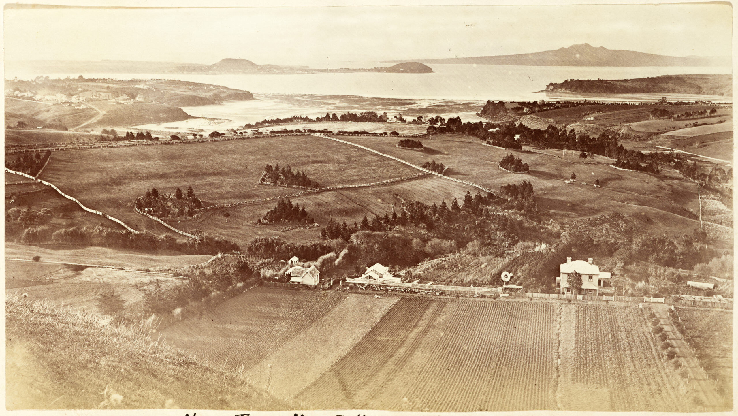
Figure 6a: A photograph dated 1877 looking north from Mount Hobson and showing the Mount Hobson Nursery in the fore-to-mid ground. Wren’s Lane (now Riding’s Road) is the tree-lined thoroughfare, visible in the bottom right corner of the image. Present-day 21 Ridings Road is visible in the eastern portion of the nursery (refer Figure 6b). The cottage at present-day 29 Ridings Road is visible left of centre (Auckland Libraries Heritage Collections 1342-Album-244-123-2).
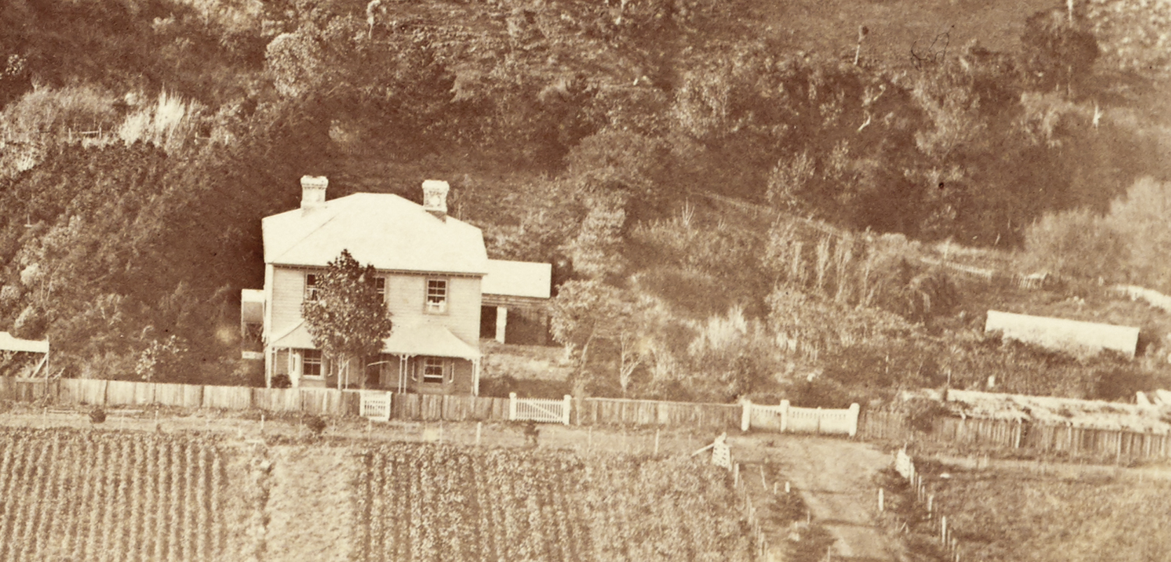
Figure 6b: Close-up of the 1877 image (Figure 6a) showing present-day 21 Ridings Road.
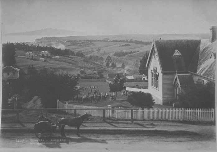
Figure 7: The Remuera District School (right) in c.1885, which was built on the corner of Remuera and Ridings roads. Present-day 21 Ridings Road is visible centre-left of the image (Auckland Libraries Heritage Collections 7-A7376).

Figure 7a: A photograph dated 1890s showing the Mount Hobson Nursery and associated buildings. Present-day 29 Ridings Road is visible at the western edge of the nursery and at the end of the access lane (close-up in Figure 7b) (Auckland Libraries Heritage Collections 4-3503).
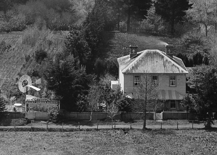
Figure 8b: Close-up of the 1890s image (Figure 8a) showing present-day 21 Ridings Road and the neighbouring nursery sign that reads ‘C. T. Wren Mount Hobson Nursery’.
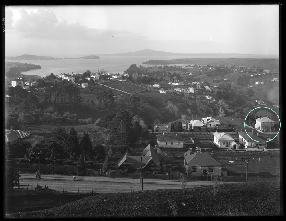
Figure 9: A photograph taken from Mount Hobson in 1911 showing the land formerly used by Wren for nursery and paddocks, and the construction of new dwellings on this land. Present-day 21 Ridings Road is circled (Auckland Libraries Heritage Collection 1-W1281).
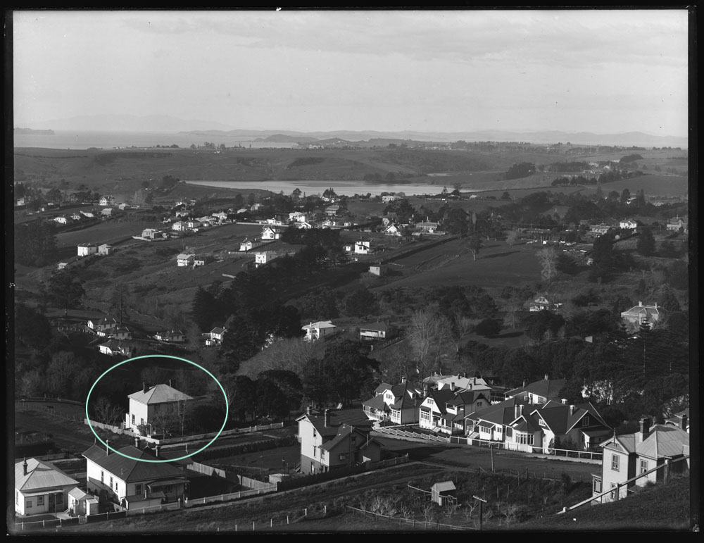
Figure 10: Another photograph taken from Mount Hobson in 1912 showing new dwellings constructed on the land formerly used as paddocks in front of Wren’s nursery and either side of Ridings Road. Present-day 21 Ridings Road is circled (Auckland Libraries Heritage Collection 1-W1276).
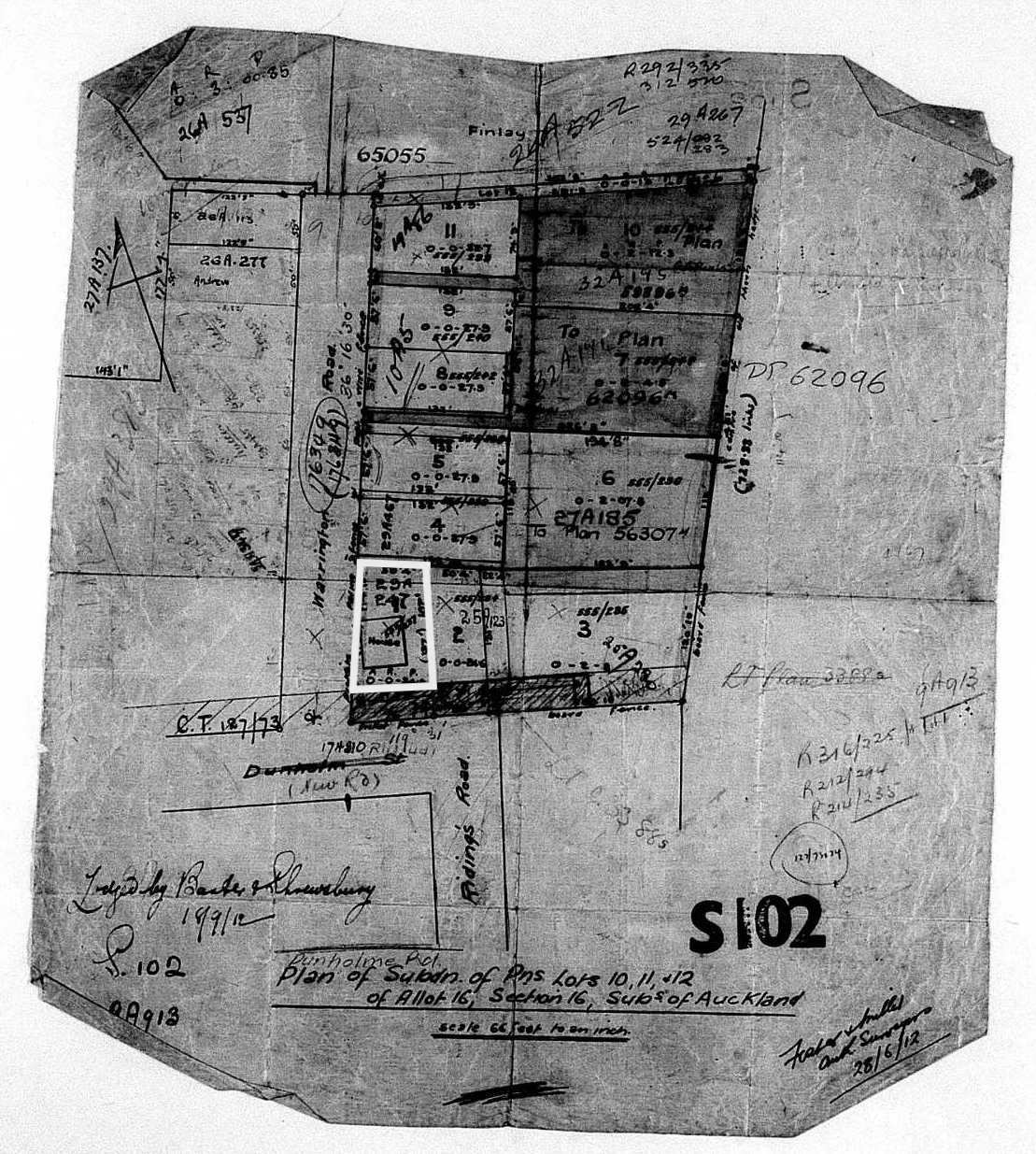
Figure 11: Deeds Plan S102, dated 1912, showing the subdivision of parts of lots 10, 11 and 12 into 11 sections. The house at present-day 21 Ridings occupied section 1 of the subdivision (outlined) (S102, LINZ records).

Figure 12a: City of Auckland Map c.1920, showing present-day 21 Ridings Road outlined and the footprint of the two-storey subject residence (ACC 001 City of Auckland Map 1908, Item no: 307, Record no: O17, Record ID: 706679, Auckland Council Archives).
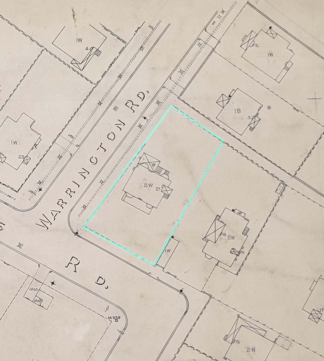
Figure 12b: Close-up of Figure 12a showing the footprint and recorded make-up of the residence, being a two-storey wooden structure with a one-storey wooden structure to the rear.
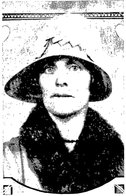
Figure 13: Emily Mary Axford, date unknown (Prominent Auckland Women, Auckland Star, Volume LXI, Issue 39, 15 February 1930, Papers Past).
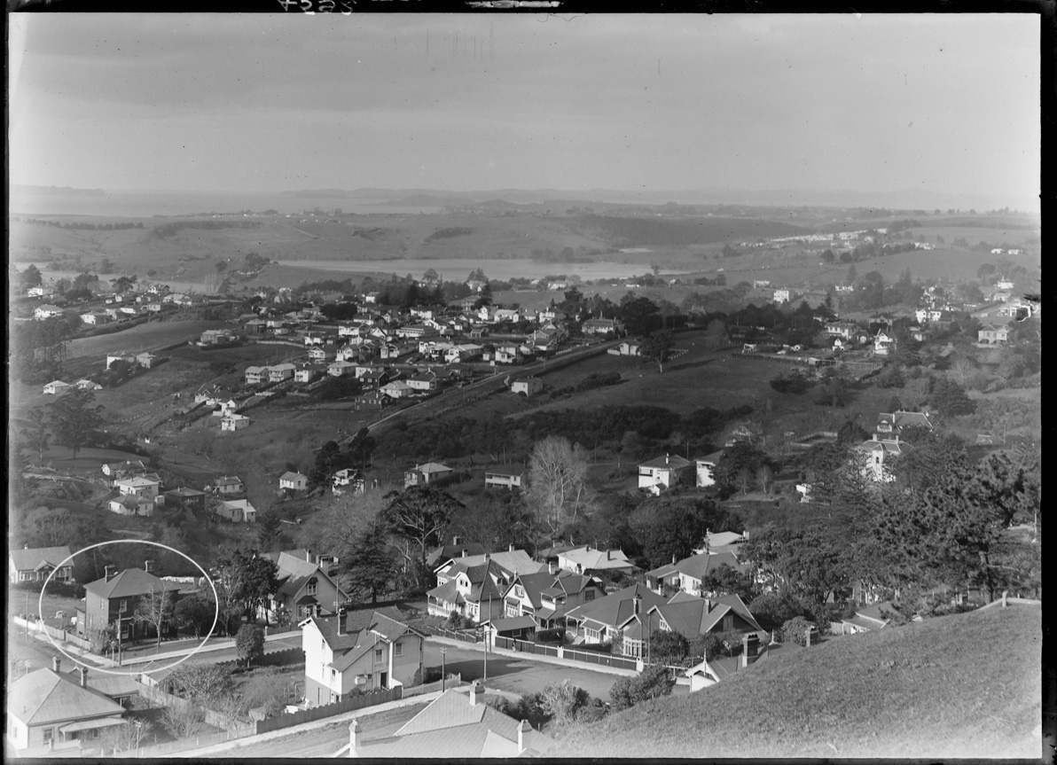
Figure 14: Photograph taken in 1921 showing the exterior of 21 Ridings Road (circled) painted a darker colour (Auckland Libraries Heritage Collection 4592).
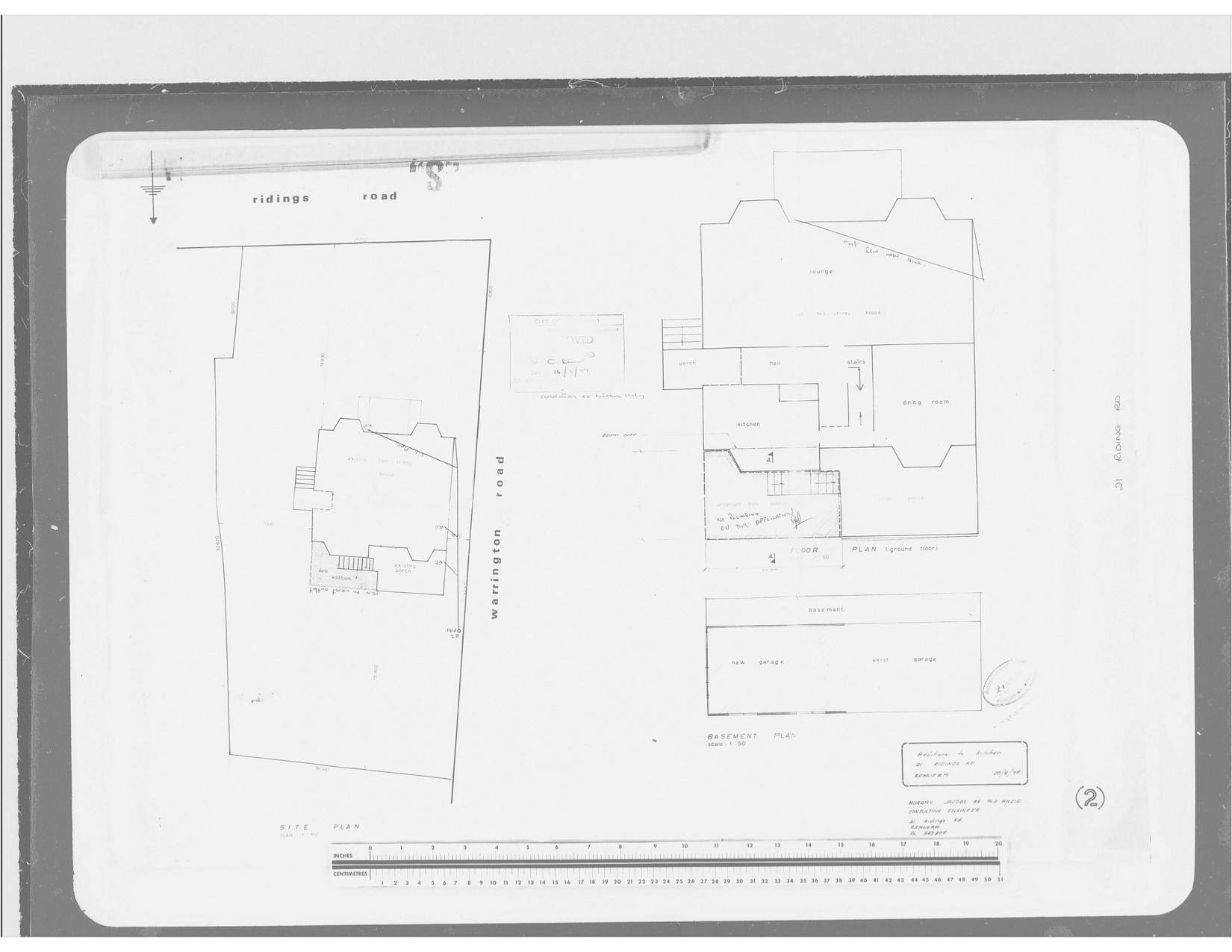
Figure 15: Architectural drawings for a small addition to the kitchen at 21 Ridings Road and the extension of the basement garage, which were prepared for Murray and Lauraine Jacobs in 1979 (AKC 339 Building Permit and Consents Aperture Cards 1908-1997, Record: Ridings Road, Record ID: 178655, Auckland Council Archives).
As one of only a small number of surviving mid-to-late nineteenth century dwellings in Remuera, 21 Ridings Road stands as a remnant of the suburb’s early colonial architecture and as an important physical reminder of its early residential development, social history and way of life.
Early European land ownership
The land upon which the dwelling at 21 Ridings Road was built once formed part of original Allotment 16 of Section 16 of the Suburbs of Auckland (figures 2a and 2b). The allotment originally formed part of the ‘Ōhinerau’ blocks, areas of land on Remuera’s northern slopes that were purchased from Ngāti Whātua by the Crown between 1851 and 1853 for £250.[1] Regarded as “some of the most valuable land in Remuera”[2], the land garnered great interest and fierce competition at public auction, resulting in high purchase prices and substantial profits for the Crown.[3]
One of the early purchasers of this land was Auckland merchant and land speculator, W. S. Grahame who, by 1854, had acquired over 63 acres of the ‘Ōhinerau’ blocks from the Crown for £1236.13.0.[4] Encompassing an area roughly bounded by present-day Remuera, Arney and Eastbourne roads, the substantial estate became known as ‘Grahame’s Farm’.[5]
Born in Glasgow, Scotland in 1813, William Smellie Grahame (1813-1894) (Figure 3) emigrated to New Zealand at the age of 22. In 1845, he married London-born Anne Roberts with whom he had 10 children.[6] Settling in Auckland, Grahame became a prominent and prosperous land investor, who, in 1856 was granted a total of 3,223 acres under the Land Claims Settlement.[7] Having made his fortune in the new colony, Grahame returned to Britain in 1857, settling in Surrey, England. Before his departure, however, he sold 15 acres of his estate (comprising part of original Allotment 16) (figure 2b) to an individual by the name of Wright.[8] By 1861, the land had been leased by C. T. Wren, a nurseryman and landscape gardener who would become one of New Zealand’s leading pioneer horticulturalists.[9]
C. T. Wren and the ‘Mount Hobson Nursery’
Born in Hertfordshire, England in 1833, Charles Thomas Wren (1833-1901) (Figure 4) began his career working as a gardener and foreman in a number of Britain’s country estates.[10] He immigrated to New Zealand in 1859 and promptly acquired the leasehold for 15 acres of land (part of Allotment 16) directly north of Mount Hobson.[11] Here, on the fertile slopes of the maunga, Wren established ‘Mount Hobson Nursery’ – an ornamental and seed nursery where he sold various plants, shrubs, seeds, fruits and flowers and provided professional services as a landscape gardener and horticultural architect (Figure 5). [12] The nursery gardens were accessed from Remuera Road via a thoroughfare aptly known as ‘Wren’s Lane’ (present-day Ridings Road) and adjoined neighbouring paddocks that Wren regularly advertised for grazing (figures 6a and 8a).[13]
Mount Hobson Nursery swiftly earned a first-class reputation as a source of nursery trees and plants, among them specimens from South Africa, South America and Australia.[14] It was one of two commercial gardens established in Remuera during the early 1860s. The other, ‘Montpellier Nursery’, was set up by nurseryman David Hay near present-day Shore Road.[15] During this time, Remuera’s rural landscape was dotted with a mixture of country cottages and an increasing number of grand houses in park-like setting, which were home to some of the most influential and prosperous individuals in the country – ideal clientele for both enterprises.
Throughout the 1860s and 1870s, Wren continued to lease the 15 acres of land upon which he had established Mount Hobson Nursery.[16] During this time, the ownership of part Allotment 16 had changed hands several times. In 1866, Wright, who had first purchased the land from W. S. Grahame nine years earlier, conveyed the property to Richard Ridings after whom Ridings Road was later named.[17]
Subdivision of the property
Ridings was a well-known early colonist who arrived in Auckland in 1845 and founded the successful auctioneer and commission agent business ‘Connell & Ridings’ with his brother-in-law, William Connell.[18] Before Ridings death in 1868, part of Allotment 16 was subdivided into 12 lots (Figure 2b), four acres of which (lots 7, 8 and 9) were on-sold to Wright.[19]
Lots 7, 8 and 9 continued to change hands over the following decade, being consecutively acquired by investors by the names of Middleton, Minetti, Moore and W. K. Graham, while the remaining 11 acres appear to have been in the ownership of Richard Ridings’ widow.[20] In 1878, Mrs Ridings conveyed two acres of land (lots 1 and 2) on the corner of Remuera and Wren’s Lane to the Board of Education for the purposes of establishing the much-needed Remuera District School (Figure 7).[21] That same year, Wren’s Lane was dedicated ‘Ridings Road’.[22]
After nearly two-decades of leasing 15 acres of Allotment 16 to establish and operate his nursery gardens, C. T. Wren eventually acquired the freehold to part of the estate.[23] By 1879, he had purchased lots 7, 8 and 9 from W. K. Graham and also owned lots 10, 11 and 12 – six acres of land that bordered the eastern edge of the nursery grounds.[24] It was upon the southernmost portion of lot 10 that the subject dwelling was built (Figure 2b).
The subject dwelling
The two-storey dwelling that stands at present-day 21 Ridings Road was built sometime before 1877.[25] Designed in the simplified Georgian style that characterised some of New Zealand’s earliest colonial buildings, it shares architectural similarities (albeit on a more modest scale) with other early Remuera residences such as ‘Ellerslie House’ (1853) and ‘Glenholm’ (1868). Located close to the entrance of Mount Hobson Nursery, it is possible that the dwelling was built for and occupied by C. T. Wren and his wife, Sarah (nee. Russell) during their early tenure of the land. Photographs dated 1877 and the 1890s reveal that it was one of several buildings on the estate at the time, including an early cottage (present-day 29 Ridings Road) and a number of outbuildings presumably associated with the operation of the nursery (figures 6a, 6b, 8a and 8b) .[26]
Built as timber-framed structure over a square plan, the dwelling was clad in plain timber weatherboards and featured a hipped roof covered in corrugated metal with two corbelled brick chimneys. Its front elevation, which appears to have changed little in over 140 years, comprised a verandah with concave roof, a central entrance and two bay windows on the ground floor, and three double-hung sash windows on the first floor. An outbuilding was located directly north of the dwelling, and to the east, another outbuilding and groups of mature plants or trees further suggests a connection with the nursery (Figure 6b).
In 1878, local resident Ralph Pickmere wrote to C. T. Wren seeking to purchase six acres of his Remuera property for £800.[27] The land comprised six acres, which most likely refers to lots 10 (including the subject dwelling), 11 and 12, and was offered on the understanding that Wren would remove the block of greenhouses, lower barn and nursery plants.[28] That same year, Pickmere also acquired lots 3, 4, 5 and 6 fronting Remuera Road from Mrs Ridings.[29]
Wren continued to run the Mount Hobson Nursery until 1898, when prolonged family sickness forced him to relinquish the business.[30] His wife of 36 years died later that year.[31] He purchased land on Pah Road, Mount Roskill where he continued a steady trade in addition to growing oranges for use in marmalade.[32] In 1901, after a protracted illness, Wren passed away at the age of 68 years.[33] He was later described as a man who possessed “a very kindly nature…a keen sense of humour…[and] was truly a member of the old school of nurserymen.”[34]
Pickmere’s ownership
Following his acquisition of the subject dwelling and surrounding six acres of land in 1878-9, Pickmere advertised the property for let. It was marketed as a ten-roomed villa near Mount Hobson with a wash-house, stable and other conveniences, including pasturage for one or more animals, at a cost of £80 per annum.[35] At the time, Pickmere also owned a property near the corner of Remuera and Bassett roads, on a site situated between St Luke’s Church and the grand residence that became known as ‘Linton’.[36]
After Pickmere’s death in 1901, his two sons, Arnold G. Pickmere and Arthur R. Pickmere, became trustees of his estate, which still comprised approximately 10 acres of original Allotment 16, including the subject dwelling on lot 10.[37] That same year, they sold the four acres of land fronting Remuera Road to an individual named Anderson.[38]
Towards the end of the first decade of the twentieth century, new dwellings were gradually appearing on the land formerly used by Wren for his nursery and paddocks (figures 9 and 10).[39] Further development occurred following the subdivision of parts of lots 10, 11 and 12 into 11 residential sections (Figure 11).[40] The dwelling at present-day 21 Ridings Road occupied section 1 of the subdivision, located on the corner of Ridings Road and the newly-formed Warrington Road (figures 12a and 12b).[41]
In 1919, the subject dwelling was advertised for sale by the trustees of the Pickmere estate. Auctioneers described it as a “two-storeyed house, containing 8 rooms and conveniences: drawing and dining rooms each 16ft by 13ft, register grate, tiled hearth, bay window, frieze and picture rail, breakfast room 13ft by 14ft…French windows opening on to back verandah; kitchen (match lined) 15ft by 14ft, Orb range, cupboards, etc; pantry and scullery. Upstairs: 4 bedrooms and bathroom califont, etc. Good land, view and pretty glimpse of harbour.”[42] It was purchased by widow, Emily M. Axford for £800.[43]
Subsequent owners and changes
Formerly of Te Aroha, where she lived with her husband Dr S. B. Axford, Emily Mary Axford (Figure 13) resided at 21 Ridings Road for nearly 30 years.[44] During this time, she became prominent in Auckland society serving as an early member of the Civic League and the Town Planning and Beautifying Committee, and as one of the original delegates to the National Council of Women and the New Zealand Howard League for Penal Reform. She also served on the Remuera School Committee for two years and did much work to obtain the memorial gates that still stand at the school entrance today.[45] Soon after acquiring the property, Axford completely renovated and modernised the dwelling at a cost of around £600, which may have included painting the exterior weatherboards in darker colour (Figure 14).[46] In 1929, she also commissioned the construction of a garage under the dwelling.[47]
In 1950, Axford sold the dwelling to Mavis Commons, following which time the property changed hands more frequently.[48] It was purchased by Muriel Leahy in 1955, then transferred to Marie Elizabeth Rayner in 1961, who was likely related to well-known broadcaster, John Rayner, who also lived at the property.[49] Three years later, the house was conveyed to surgeon, John Dreadon, who, in 1965 commissioned architect, D. G. Swan to prepare plans for alterations to the kitchen.[50]
The property remained in the possession of the Dreadon family until 1976 when John’s son, Graham Dreadon, master at King’s School, sold it to present owners, structural engineer Murray Jacobs and his wife, Lauraine Jacobs.[51] During the early years of the Jacobs’ ownership, further changes were made to the dwelling, which included the construction of a small rear addition to enlarge the kitchen and the extension of the existing basement garage (Figure 15).[52]
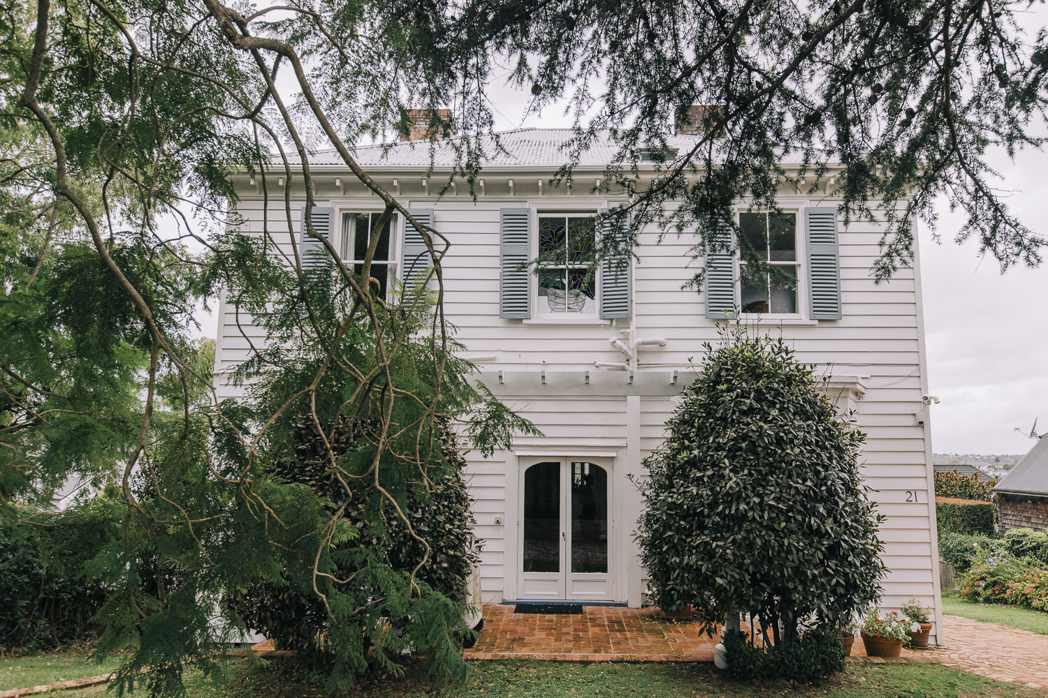
As of 2021, 21 Ridings Road stands as one of only a small number of mid-to-late nineteenth century residences remaining in Remuera. Despite some changes to its rear elevation, it appears to largely retain its original form and a significant proportion of its early architectural fabric, including two chimneys, board and batten ceilings and decorative staircase with turned balusters. After 45 years, it continues to be the family home of Murray Jacobs and award-winning food writer, Lauraine Jacobs.
Background
The Heritage Studio Limited was commissioned by Remuera Heritage to undertake high-level research to gain an understanding about the history of the residence at 21 Ridings Road, Remuera. The principal aim of the research was to assist in the preparation of a ‘story’ of the place for Remuera Heritage’s ‘Century-Old Homes’ campaign.
The subject place is an early two-story residence that occupies a site on the corner of Ridings and Warrington roads. The dwelling is orientated to face Ridings Road, and, to the rear, offers glimpsed views of the Waitemata Harbour.
High-level research involved viewing online repositories such as DigitalNZ, Papers Past and Auckland Libraries resources; sourcing available information at Auckland Council Archives and at Auckland Libraries Research Centre; and viewing early Deeds Indexes and Certificates of Title from Land Information New Zealand (LINZ). Research was undertaken to an extent that met the requirements of the brief, but was not necessarily exhaustive. It is important to note that opportunities still exist to explore other avenues of research, which may yield more detailed information.
Access onto the site and inside the property was made on 20 November 2020, courtesy of the current owner.
Carolyn O’Neil
Heritage Consultant
The Heritage Studio
March 2021
Front (south) elevation of 21 Ridings Road (Michelle Hyslop, 9 April 2021)
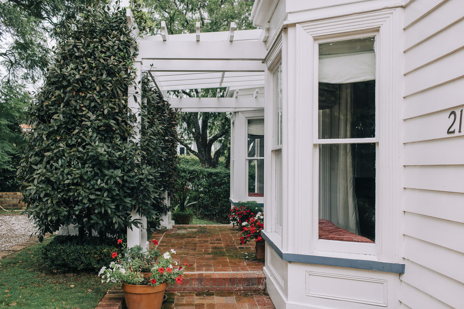
Front elevation viewed from the garden, showing the location of the original entrance (Michelle Hyslop, 9 April 2021)
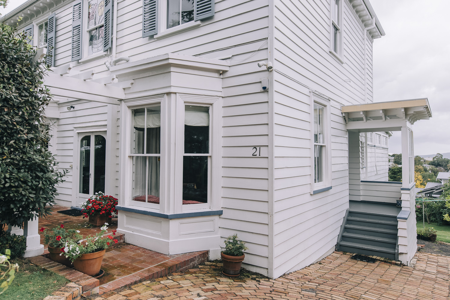
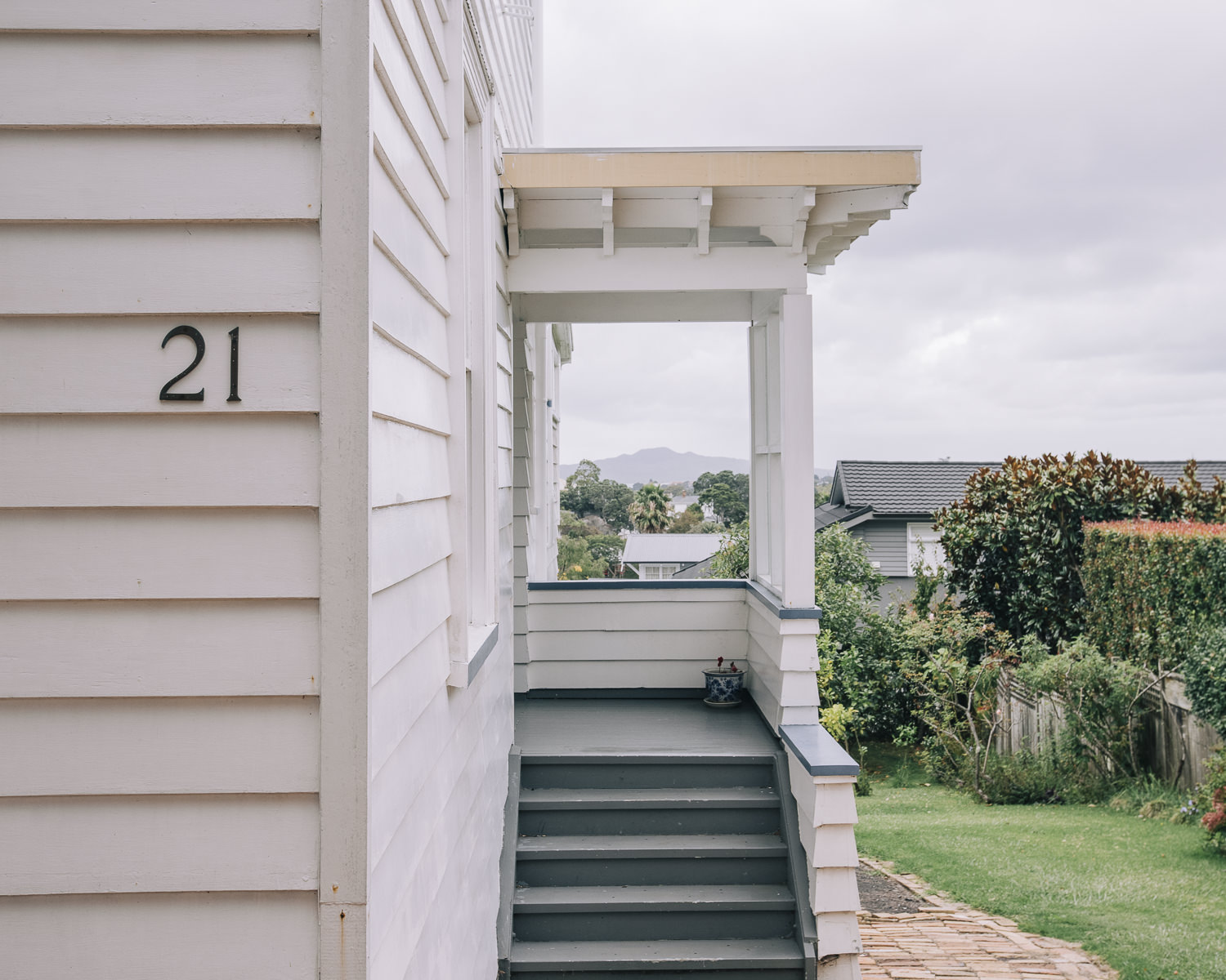
Part front and side (east) elevations (Michelle Hyslop, 9 April 2021)
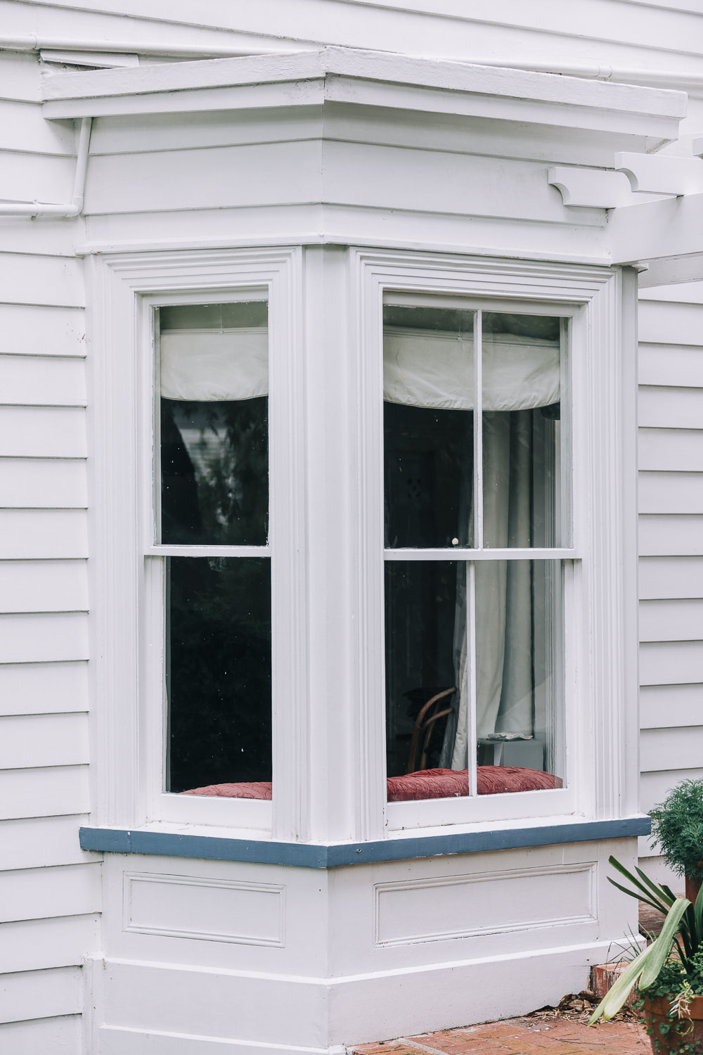
Ground floor facetted-bay window on the front elevation (Michelle Hyslop 9 April 2021)
Ground floor fenestration on the front elevation (Michelle Hyslop, 9 April 2021)
Current entrance on the side (east) elevation, added c.1920s (Michelle Hyslop, 9 April 2021)
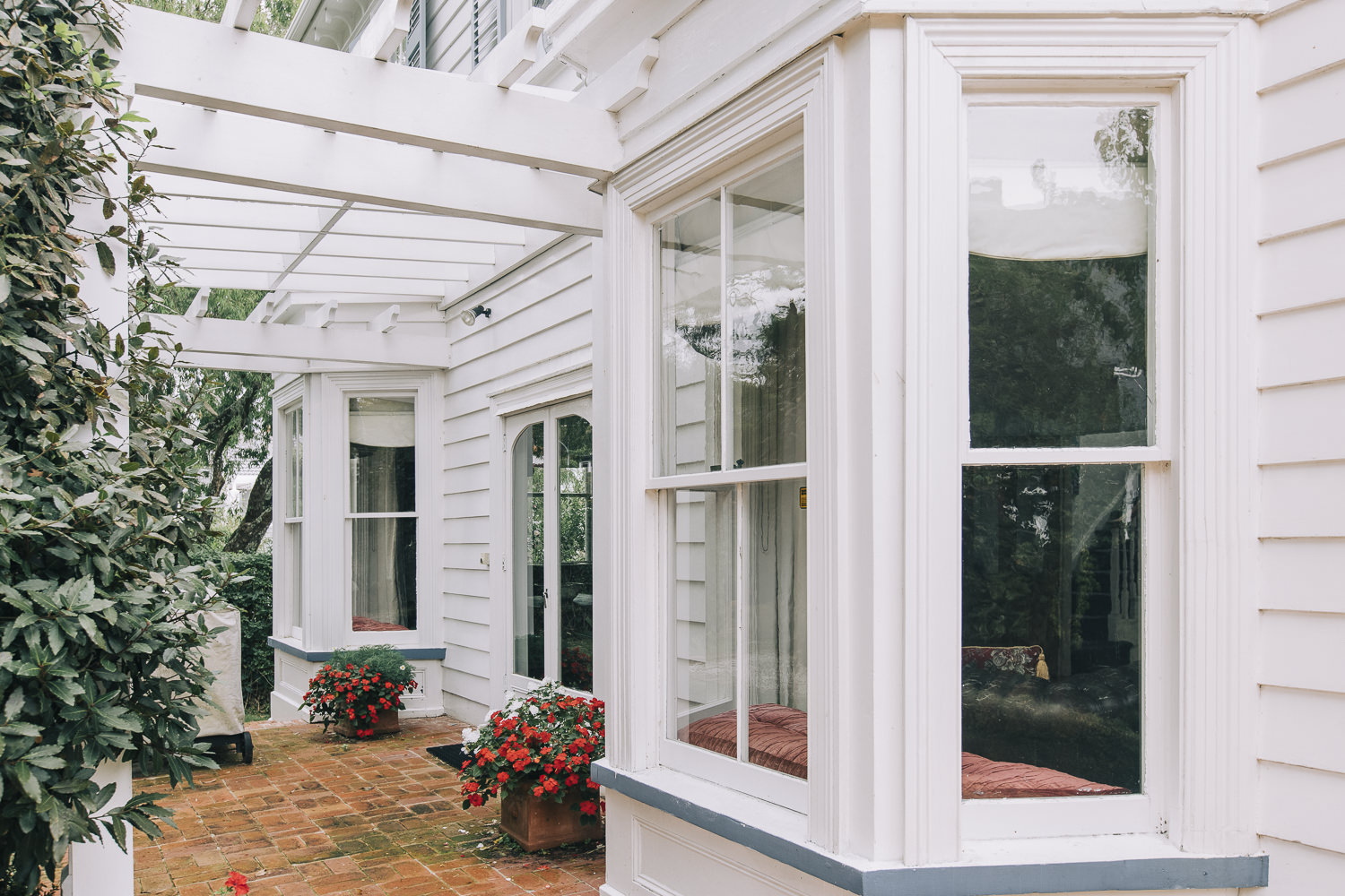
Timber pergola, a later addition. Note the original verandah has been removed (Michelle Hyslop, 9 April 2021)
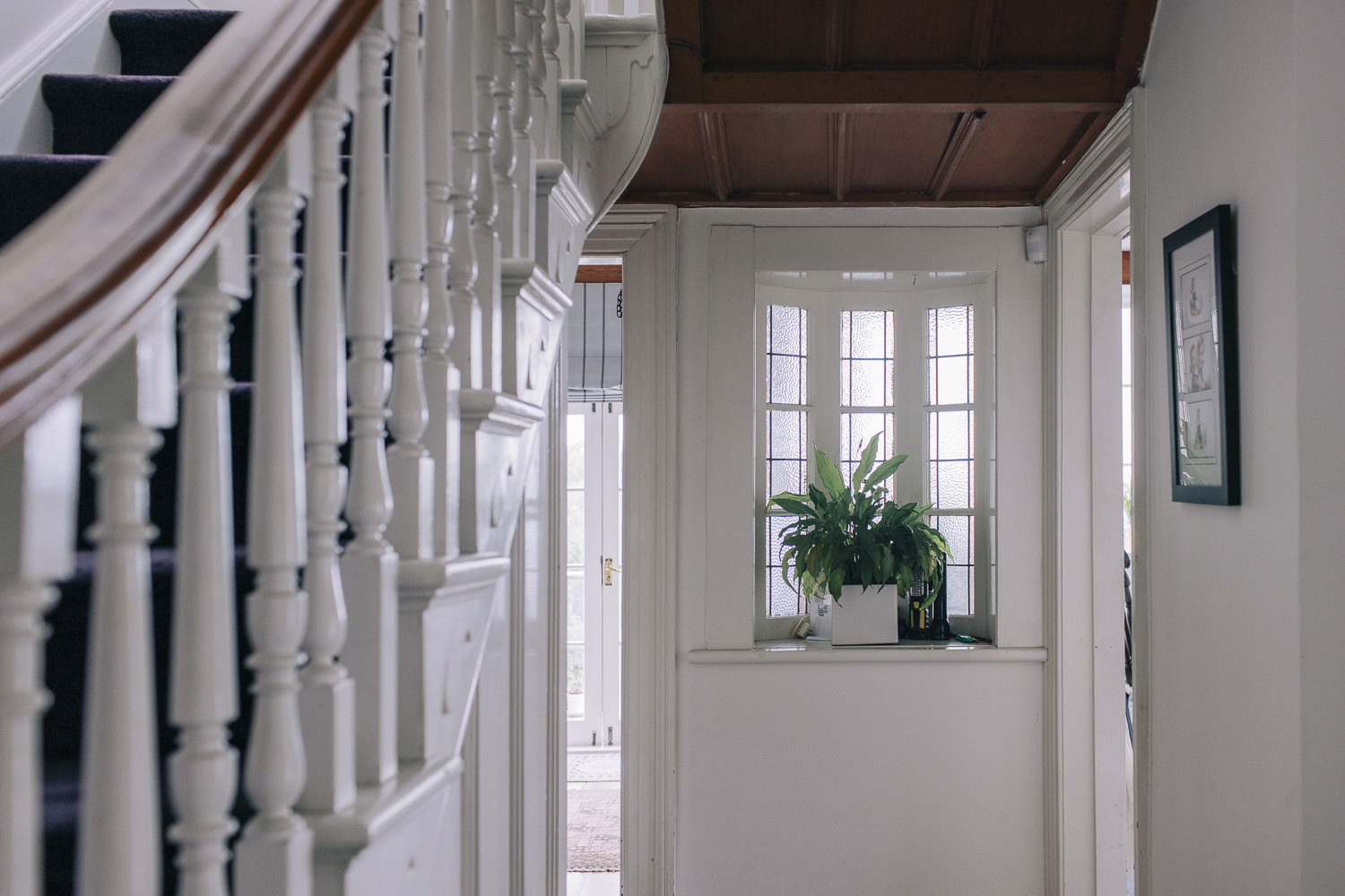
Internal hall looking towards the original rear wall (Michelle Hyslop, 9 April 2021)
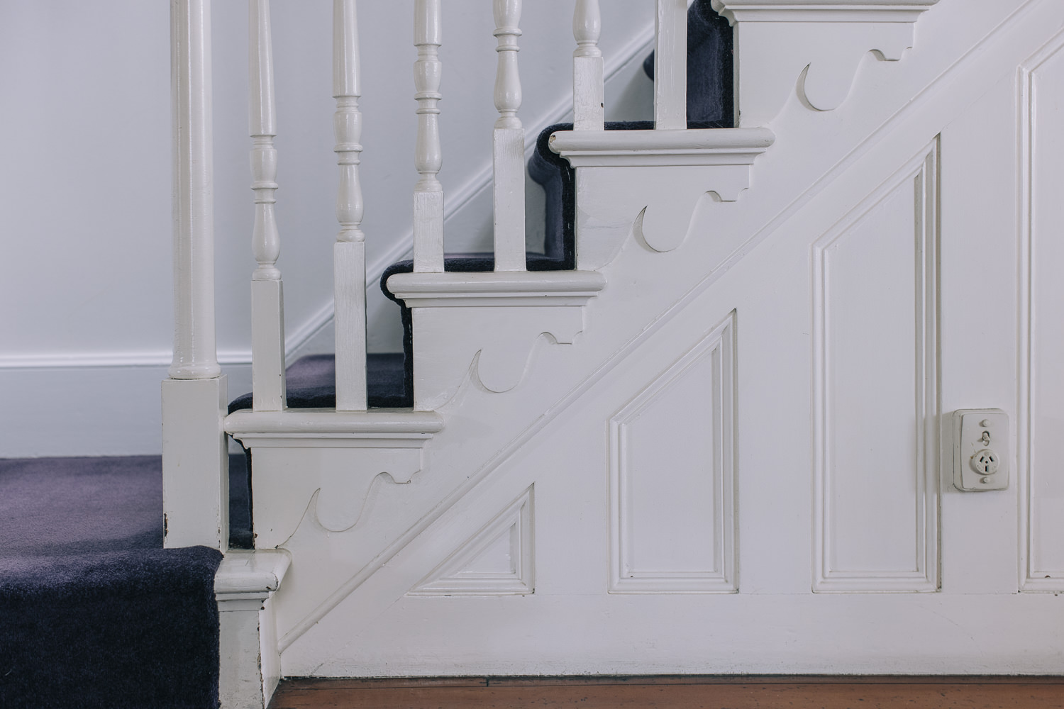
Timber staircase (Michelle Hyslop, 9 April 2021)
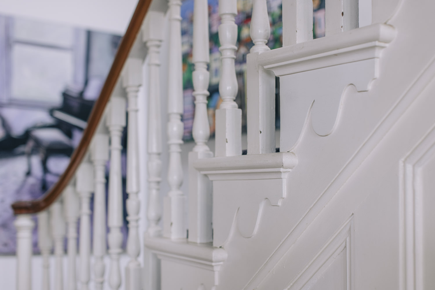
Staircase detailing, showing turned balusters, decorative string brackets and timber panelling (Michelle Hyslop, 9 April 2021)

Open-plan sitting room/parlour, formerly two rooms with a central hallway (Michelle Hyslop, 9 April 2021)

Sitting room/parlour, with original timber flooring and board and batten ceiling (Michelle Hyslop, 9 April 2021)
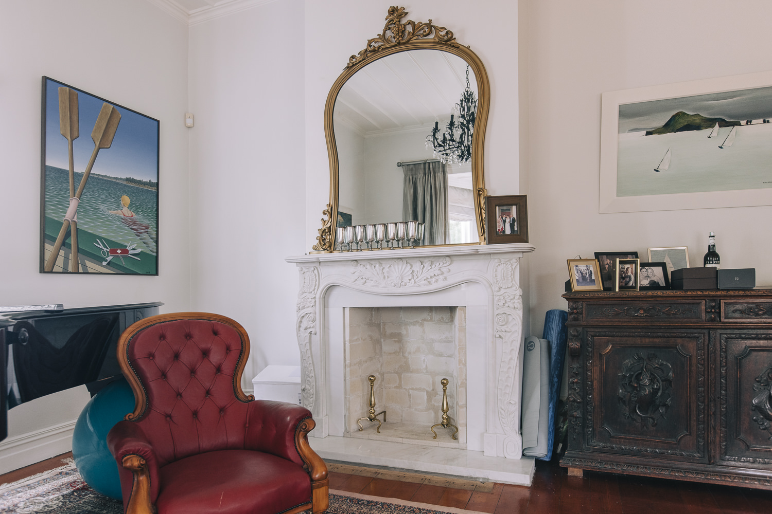
Fireplace in the sitting room/parlour with modern mantle, surround and hearth (Michelle Hyslop, 9 April 2021)
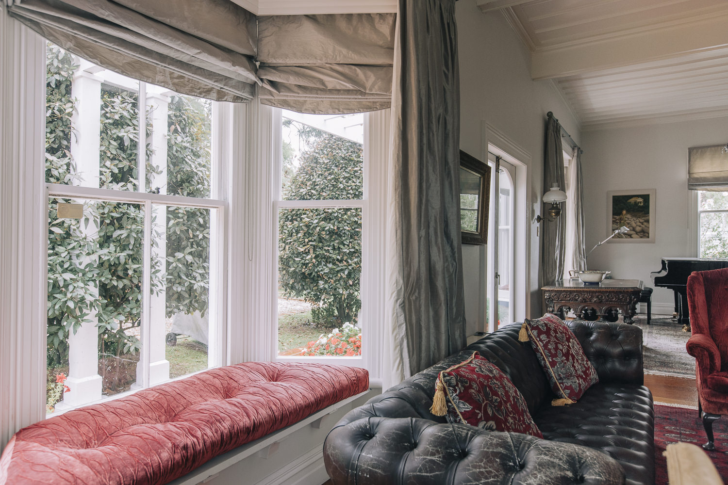
Internal view of front bay window (Michelle Hyslop, 9 April 2021)
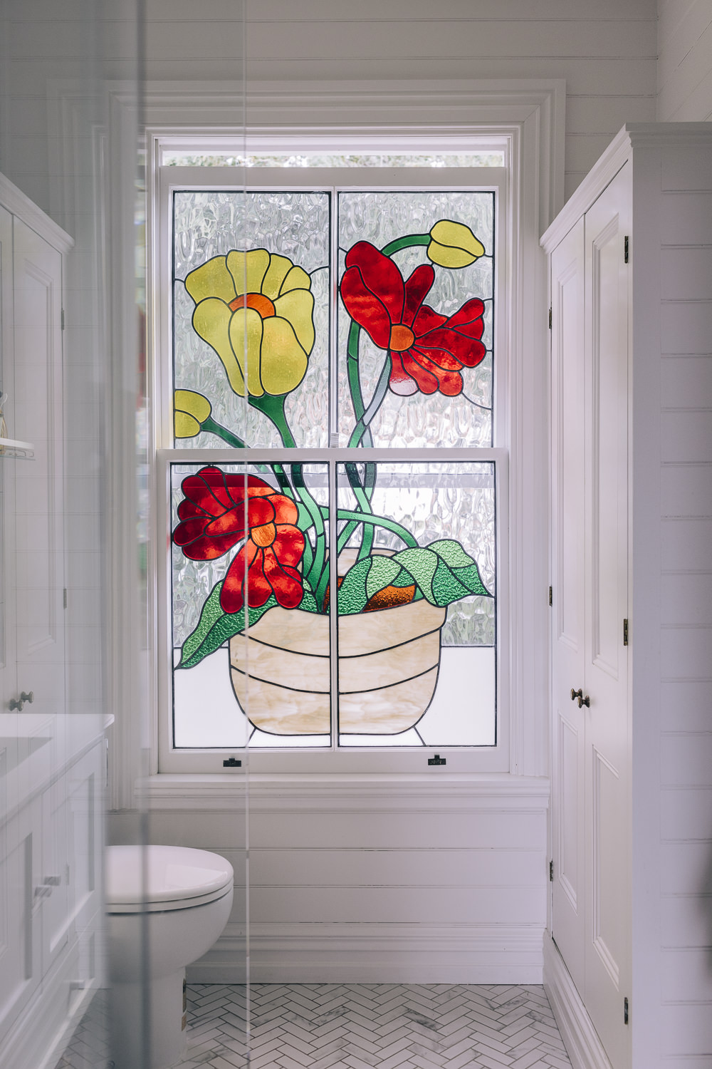
Modern stained glass window in first floor bathroom (Michelle Hyslop, 9 April 2021)
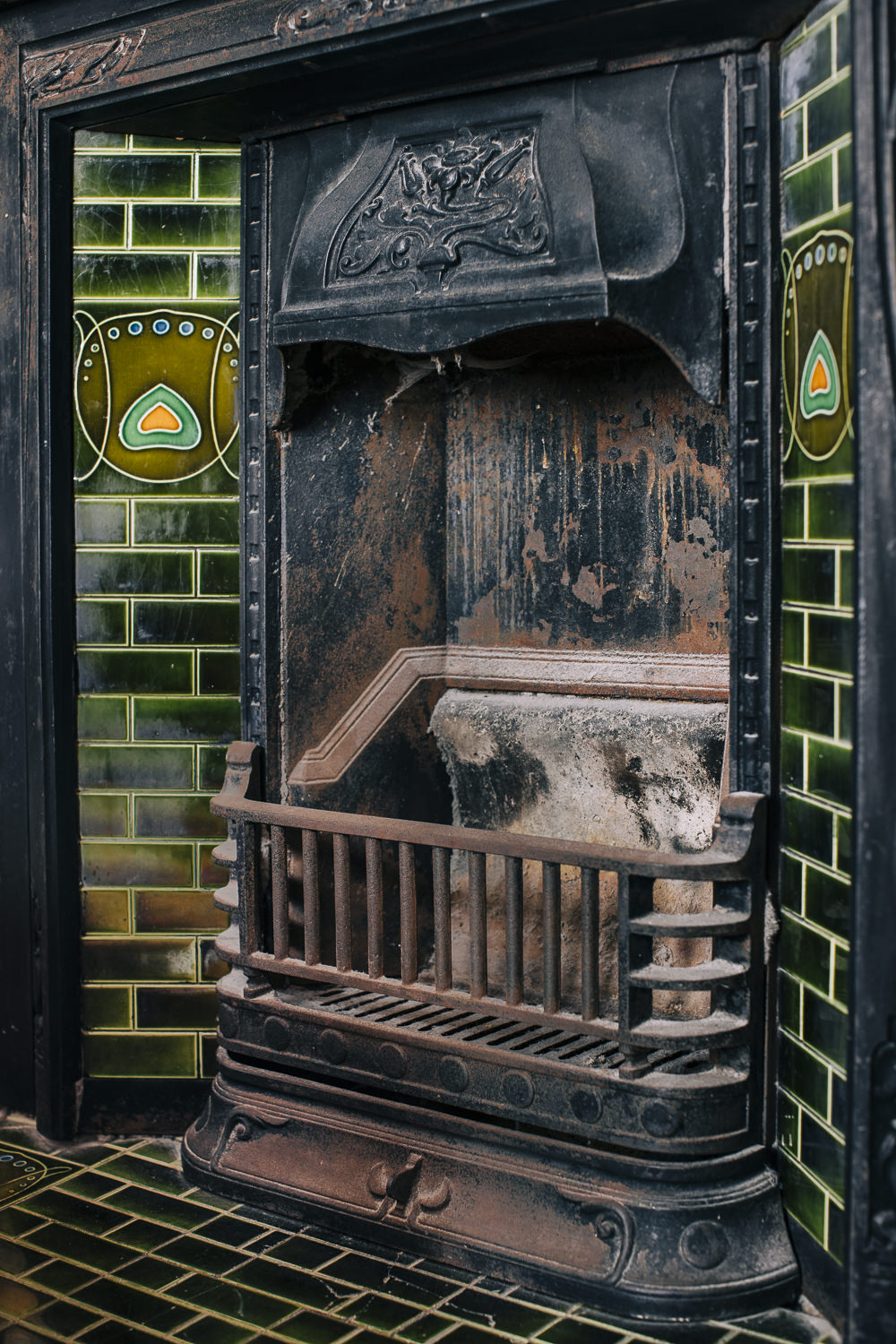
Decorative Art Nouveau-style cast iron fireplace with inset glazed tiles (Michelle Hyslop, 9 April 2021)
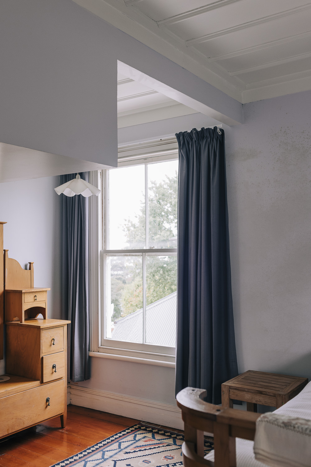
First floor bedroom with sash window and board and batten ceiling. Note modifications to the ceiling and wall to accommodate attic bedrooms (Michelle Hyslop, 9 April 2021)
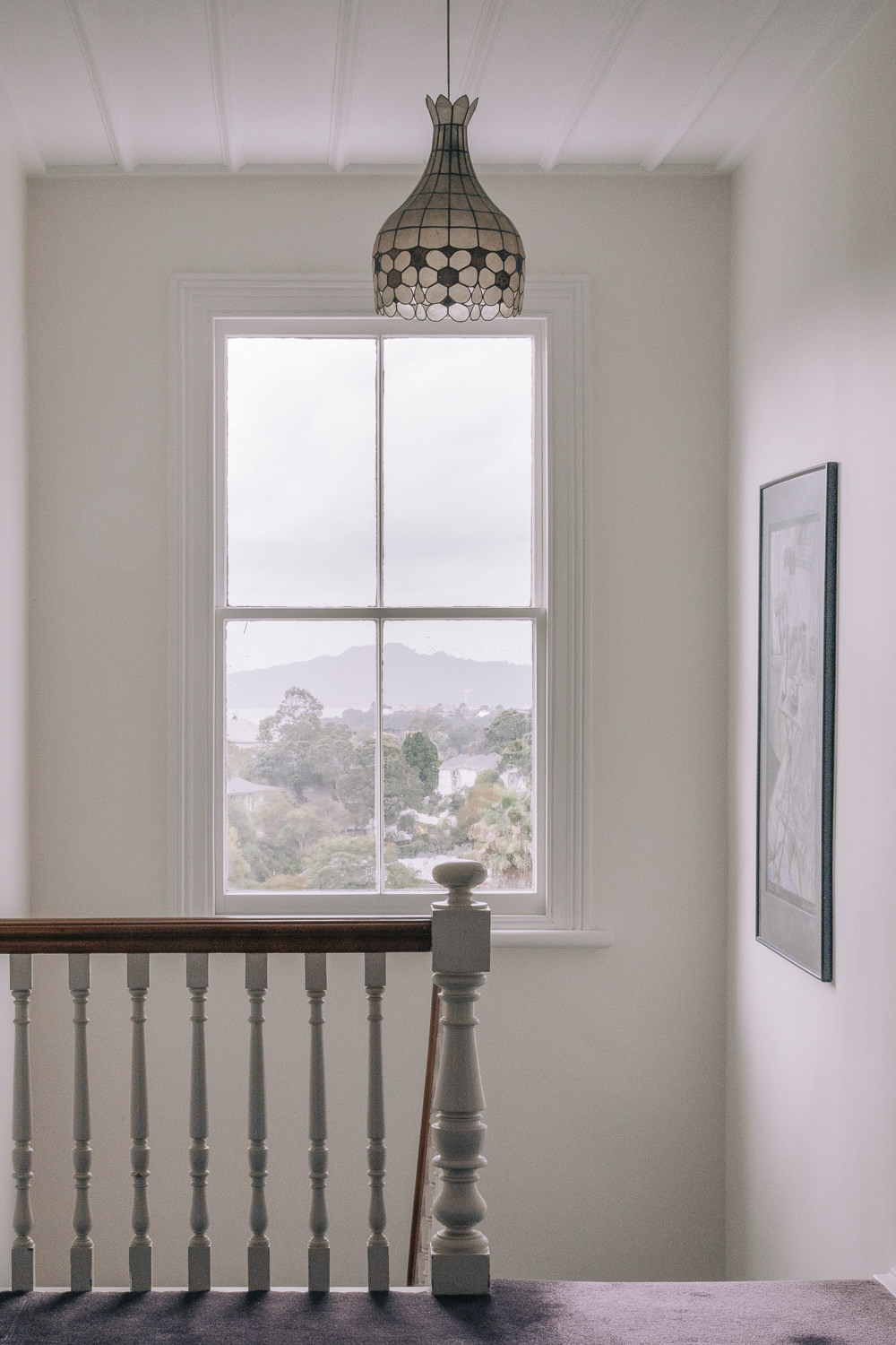
View towards Rangitoto from first floor stairwell window (Michelle Hyslop, April 2021)
A photo shoot to capture the traditional architectural features of 21 Ridings Road was undertaken by Michelle Hyslop of Michelle Hyslop Photography on 9 April 2021. Captions by Carolyn O’Neil.
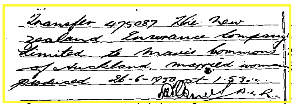
From Certificate of Title 21 Ridings Road - Mavis Commons, June 1950
Subscribe to our newsletter to keep up to date.
Endnotes
1. Jenny Carlyon and Diana Morrow, A Fine Prospect: A History of Remuera, Meadowbank and St Johns, Random House, 2011, 38.
2. Early Native Land Purchases, New Zealand Herald, Volume XXVI, Issue 9488, 5 October 1889, 1 (Supplement), Papers Past.
3. Jenny Carlyon and Diana Morrow, 2011, 38-9.
4. Ibid., 39 and 54.
5. Winifred Macdonald, ‘Recollections A Sketch History of Early Remuera 1850-1920’, 1984, 9; Jenny Carlyon and Diana Morrow, 2011, 54.
6. Ancestry Library, William Smellie Grahame, https://www.ancestrylibrary.com.au/family-tree/person/tree/43718541/person/27567663687/story
7. Ibid.
8. Deeds indexes 5A 401 and 8A 696; Jenny Carlyon and Diana Morrow, 2011, 54 and 378.
9. Page 2 Advertisements Column 4, New Zealander, Volume XVII, Issue 1616, 12 October 1861, Papers Past; Auckland Horticultural Society, Daily Southern Cross, Volume XVIII, Issue 1700, 31 December 1862, Papers Past; Jenny Carlyon and Diana Morrow, 2011, 309-311.
10. Allen Hale, Pioneer Nurserymen of New Zealand, Wellington, AH and AW Reed, 1955, 60; Jenny Carlyon and Diana Morrow, 2011, 309-311.
11. Allen Hale, 1955, 60; Auckland Horticultural Society, Daily Southern Cross, Volume XVIII, Issue 1700, 31 December 1862, Papers Past.
12. Page 6 Advertisements Column 4, Daily Southern Cross, Volume XX, Issue 2035, January 1864, Papers Past.
13. Page 2 Advertisements Column 4, New Zealander, Volume XVII, Issue 1616, 12 October 1861, Papers Past.
14. Allen Hale, 1955, 60; Jenny Carlyon and Diana Morrow, 2011, 311.
15. Jenny Carlyon and Diana Morrow, 2011, 309-310.
16. Franklin Electoral Rolls, dated 1871-2 and 1875-6, records Charles Thomas Wren as holding the leasehold of 15 acres of a portion of allotment 16, sec. 16, suburbs of Auckland.
17. Deeds index 8A 696, Archives New Zealand.
18. Death of Mr. Richard Ridings, Daily Southern Cross, Volume XXIV, Issue 3511, 16 October 1868, Papers Past.
19. NZ Map 4658, Auckland Libraries Heritage Collections; Deeds indexes 8A 696 and 13A 738, Archives New Zealand.
20. Deeds indexes 8A 696 and 13A 738, Archives New Zealand.
21. Deeds indexes 8A 696 and 9A 913, Archives New Zealand; Jenny Carlyon and Diana Morrow, 2011, 146.
22. Deeds index 8A 696, Archives New Zealand.
23. Deeds index 13A 738, Archives New Zealand; Eden Electoral Rolls, dated 1880-1.
24. Suspicion Ever Haunts, New Zealand Herald, Volume XVI, Issue 5573, 26 September 1879, Papers Past; Deeds indexes 8A 696 and 9A 913, Archives New Zealand.
25. 1342-Album-244-123, Auckland Libraries Heritage Collections.
26. Ibid.
27. Suspicion Ever Haunts, New Zealand Herald, Volume XVI, Issue 5573, 26 September 1879, Papers Past.
28. Ibid.
29. Deeds indexes 8A 696 and 9A 913, Archives New Zealand.
30. Untitled, New Zealand Herald, Volume XXXV, Issue 10851, 7 September 1898, Papers Past; Untitled, Auckland Star, Volume XXIX, Issue 206, 1 September 1898, Papers Past; Local and General News, New Zealand Herald, Volume XXXV, Issue 10781, 16 June 1898, Papers Past.
31. Deaths, New Zealand Herald, Volume XXXV, Issue 10915, 21 November 1898, Papers Past; Marriages, New Zealand Herald, Volume II, Issue 328, 30 November 1864, Papers Past.
32. Allen Hale, 1955, 60; Jenny Carlyon and Diana Morrow, 2011, 311.
33. Obituary, New Zealand Herald, Volume XXXVIII, Issue 11806, 8 November 1901, Papers Past.
34. Allen Hale, 1955, 60.
35. Page 1 Advertisements Column 4, New Zealand Herald, Volume XXII, Issue 7451, 6 October 1885, Papers Past; Page 1 Advertisements Column 5, New Zealand Herald, Volume XXIII, Issue 7679, 2 July 1886, Papers Past.
36. Page 1 Advertisements Column 5, New Zealand Herald, Volume XXIII, Issue 7679, 2 July 1886, Papers Past; Deposit Plan 2848A, LINZ records.
37. Deeds index 9A 913, Archives New Zealand; Remuera Road Board Valuation Rolls, RRB 003 Item No: 1 Page No: 13 and 14, Auckland Council Archives; Remuera Road Board Valuation Rolls, RRB 003 Item No: 2 Page No: 9, Auckland Council Archives.
38. Deeds index 9A 913, Archives New Zealand; Page 8 Advertisements Column 2, New Zealand Herald, Volume XXXVIII, Issue 11689, 26 June 1901, Papers Past.
39. 1-W1281 and 1-W1476, Auckland Libraries Heritage Collections.
40. Deed Plan S102, LINZ records; Deeds index 9A 913, Archives New Zealand.
41. Deed Plan S102, LINZ records.
42. Page 7 Advertisements Column 5, Auckland Star, Volume L, Issue 70, 22 March 1919, Papers Past.
43. Deeds indexes 9A 913 and 29A 247, Archives New Zealand; ACC 213 Valuation Field Sheets 1912-1997, Ridings Road (part was Dunholme Road), 1915-1954, Record no. 329128, Auckland Council Archives.
44. Page 4 Advertisements Column 2, Thames Star, Volume XLII, Issue 10332, 6 September 1912, Papers Past; ACC 213 Valuation Field Sheets 1912-1997, Ridings Road (part was Dunholme Road), 1915-1954, Record no. 329128, Auckland Council Archives.
45. Prominent Auckland Women, Auckland Star, Volume LXI, Issue 39, 15 February 1930, Papers Past.
46. ACC 213 Valuation Field Sheets 1912-1997, Ridings Road (part was Dunholme Road), 1915-1954, Record no. 329128, Auckland Council Archives.
47. ACC 443 Building Permit and Plan Cards First Sequent 1920-1959, Pr-R 1920-1959, Record no. 73869, Auckland Council Archives.
48. Ibid.; Certificate of Title NA555/237, LINZ records.
49. Ibid.; pers. comm. (via email) Lauraine Jacobs.
50. Certificate of Title NA555/237, LINZ records; AKC 339 Building Permit and Consents Aperture Cards 1908-1997, Ridings Road, Record no. 178655, Auckland Council Archives.
51. Certificate of Title NA555/237, LINZ records; pers. comm. (via email) Lauraine Jacobs.
52. AKC 339 Building Permit and Consents Aperture Cards 1908-1997, Ridings Road, Record no. 178655, Auckland Council Archives.
